Spring Lake Park is a city in Anoka and Ramsey counties in the state of Minnesota. The population was 6,412 at the 2010 census. The city is located mainly within Anoka County. Minnesota State Highways 47 and 65 and County Highway 10 are three of the main routes in the city.
| Name: | Spring Lake Park city |
|---|---|
| LSAD Code: | 25 |
| LSAD Description: | city (suffix) |
| State: | Minnesota |
| County: | Anoka County, Ramsey County |
| Elevation: | 912 ft (278 m) |
| Total Area: | 2.09 sq mi (5.41 km²) |
| Land Area: | 2.00 sq mi (5.17 km²) |
| Water Area: | 0.09 sq mi (0.24 km²) |
| Total Population: | 7,188 |
| Population Density: | 3,603.01/sq mi (1,391.35/km²) |
| ZIP code: | 55432 |
| Area code: | 763 |
| FIPS code: | 2761996 |
| GNISfeature ID: | 2395934 |
Online Interactive Map
Click on ![]() to view map in "full screen" mode.
to view map in "full screen" mode.
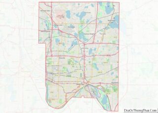
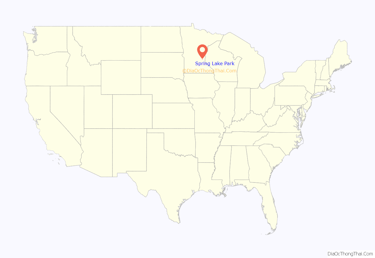
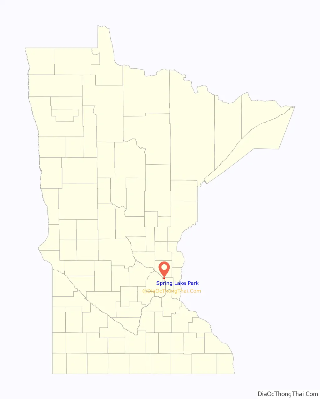
Spring Lake Park location map. Where is Spring Lake Park city?
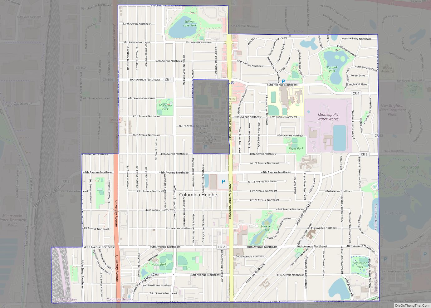
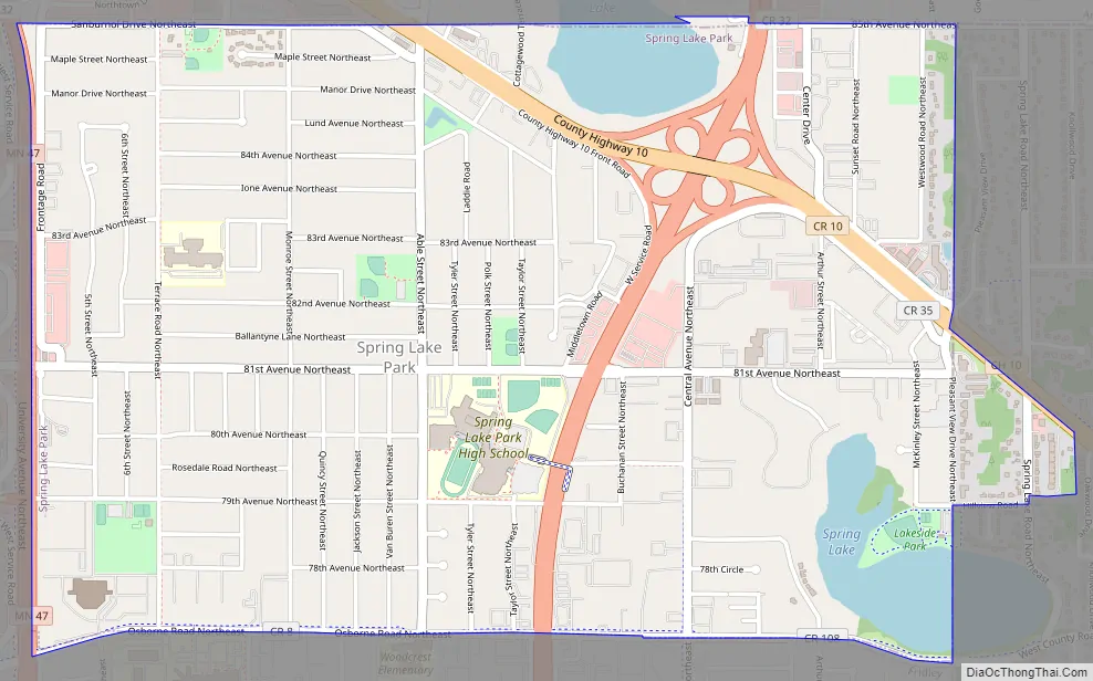
Spring Lake Park Road Map
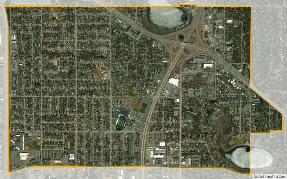
Spring Lake Park city Satellite Map
Geography
According to the United States Census Bureau, the city has a total area of 2.07 square miles (5.36 km), of which 1.98 square miles (5.13 km) is land and 0.09 square miles (0.23 km) is water.
Highway 65–Central Avenue NE runs north–south through the middle of Spring Lake Park. County Highway 10 passes through the northeast portion of the city.
Highway 47–University Avenue NE runs north–south along Spring Lake Park’s western boundary line with adjacent city of Fridley.
Osborne Road runs east–west along Spring Lake Park’s southern boundary line with adjacent city of Fridley.
Sanburnol Drive–85th Avenue NE runs east–west along Spring Lake Park’s northern boundary line with adjacent city of Blaine.
Nearby places include Blaine, Mounds View, Fridley, and Coon Rapids.
See also
Map of Minnesota State and its subdivision:- Aitkin
- Anoka
- Becker
- Beltrami
- Benton
- Big Stone
- Blue Earth
- Brown
- Carlton
- Carver
- Cass
- Chippewa
- Chisago
- Clay
- Clearwater
- Cook
- Cottonwood
- Crow Wing
- Dakota
- Dodge
- Douglas
- Faribault
- Fillmore
- Freeborn
- Goodhue
- Grant
- Hennepin
- Houston
- Hubbard
- Isanti
- Itasca
- Jackson
- Kanabec
- Kandiyohi
- Kittson
- Koochiching
- Lac qui Parle
- Lake
- Lake of the Woods
- Lake Superior
- Le Sueur
- Lincoln
- Lyon
- Mahnomen
- Marshall
- Martin
- McLeod
- Meeker
- Mille Lacs
- Morrison
- Mower
- Murray
- Nicollet
- Nobles
- Norman
- Olmsted
- Otter Tail
- Pennington
- Pine
- Pipestone
- Polk
- Pope
- Ramsey
- Red Lake
- Redwood
- Renville
- Rice
- Rock
- Roseau
- Saint Louis
- Scott
- Sherburne
- Sibley
- Stearns
- Steele
- Stevens
- Swift
- Todd
- Traverse
- Wabasha
- Wadena
- Waseca
- Washington
- Watonwan
- Wilkin
- Winona
- Wright
- Yellow Medicine
- Alabama
- Alaska
- Arizona
- Arkansas
- California
- Colorado
- Connecticut
- Delaware
- District of Columbia
- Florida
- Georgia
- Hawaii
- Idaho
- Illinois
- Indiana
- Iowa
- Kansas
- Kentucky
- Louisiana
- Maine
- Maryland
- Massachusetts
- Michigan
- Minnesota
- Mississippi
- Missouri
- Montana
- Nebraska
- Nevada
- New Hampshire
- New Jersey
- New Mexico
- New York
- North Carolina
- North Dakota
- Ohio
- Oklahoma
- Oregon
- Pennsylvania
- Rhode Island
- South Carolina
- South Dakota
- Tennessee
- Texas
- Utah
- Vermont
- Virginia
- Washington
- West Virginia
- Wisconsin
- Wyoming