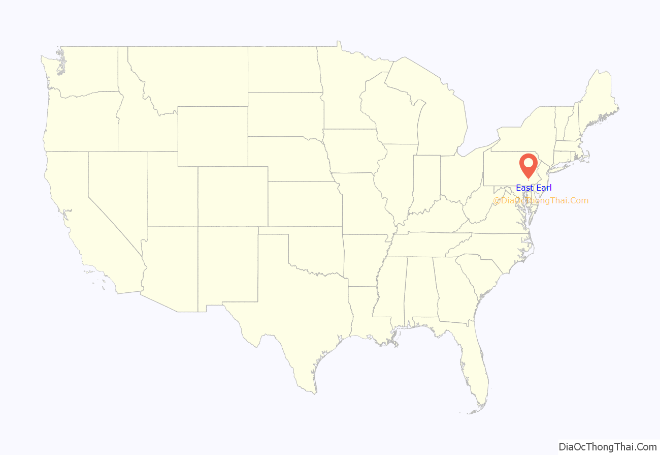
East Earl is an unincorporated community and census-designated place (CDP) in East Earl Township, Lancaster County, Pennsylvania, United States. As of the 2010 census, it had a population of 1,144.
| Name: | East Earl CDP |
|---|---|
| LSAD Code: | 57 |
| LSAD Description: | CDP (suffix) |
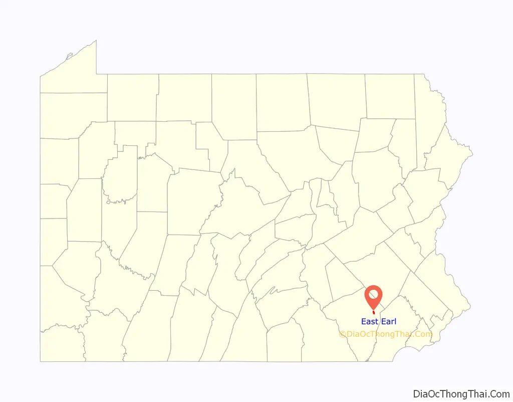
| State: | Pennsylvania |
| County: | Lancaster County |
| Elevation: | 512 ft (156 m) |
| Total Area: | 0.94 sq mi (2.44 km²) |
| Land Area: | 0.94 sq mi (2.44 km²) |
| Water Area: | 0.00 sq mi (0.01 km²) |
| Total Population: | 1,113 |
| Population Density: | 1,184.04/sq mi (457.00/km²) |
| ZIP code: | 17519 |
| Area code: | 717 |
| FIPS code: | 4221064 |
| GNISfeature ID: | 1173799 |
Online Interactive Map
Click on ![]() to view map in "full screen" mode.
to view map in "full screen" mode.
East Earl location map. Where is East Earl CDP?
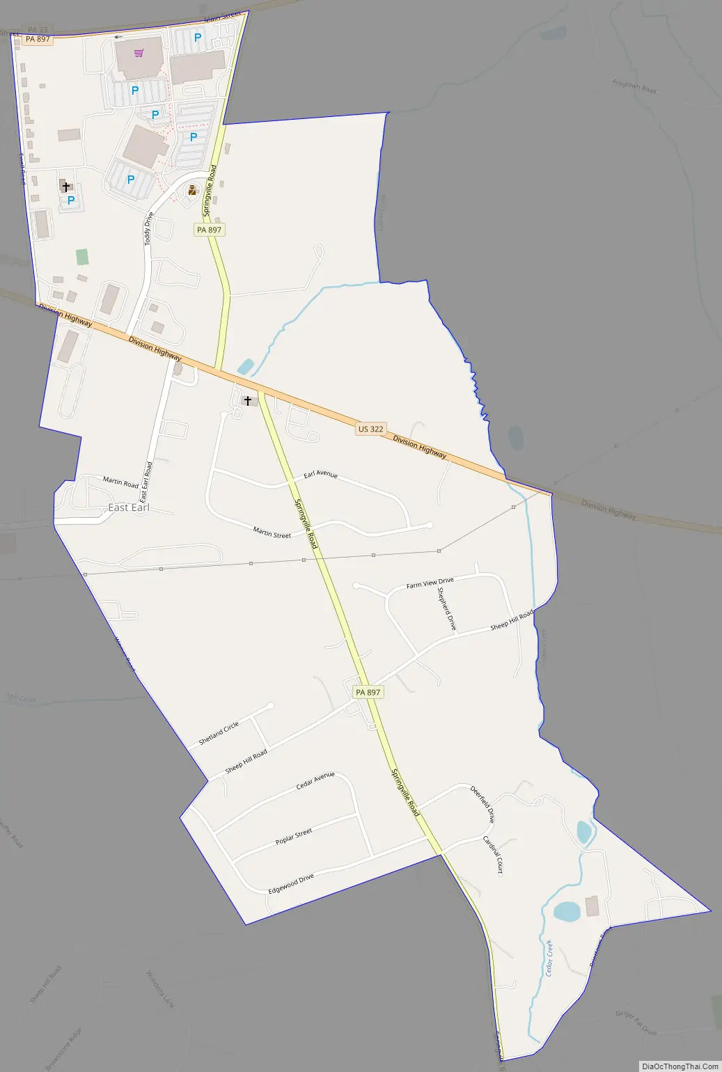
East Earl Road Map
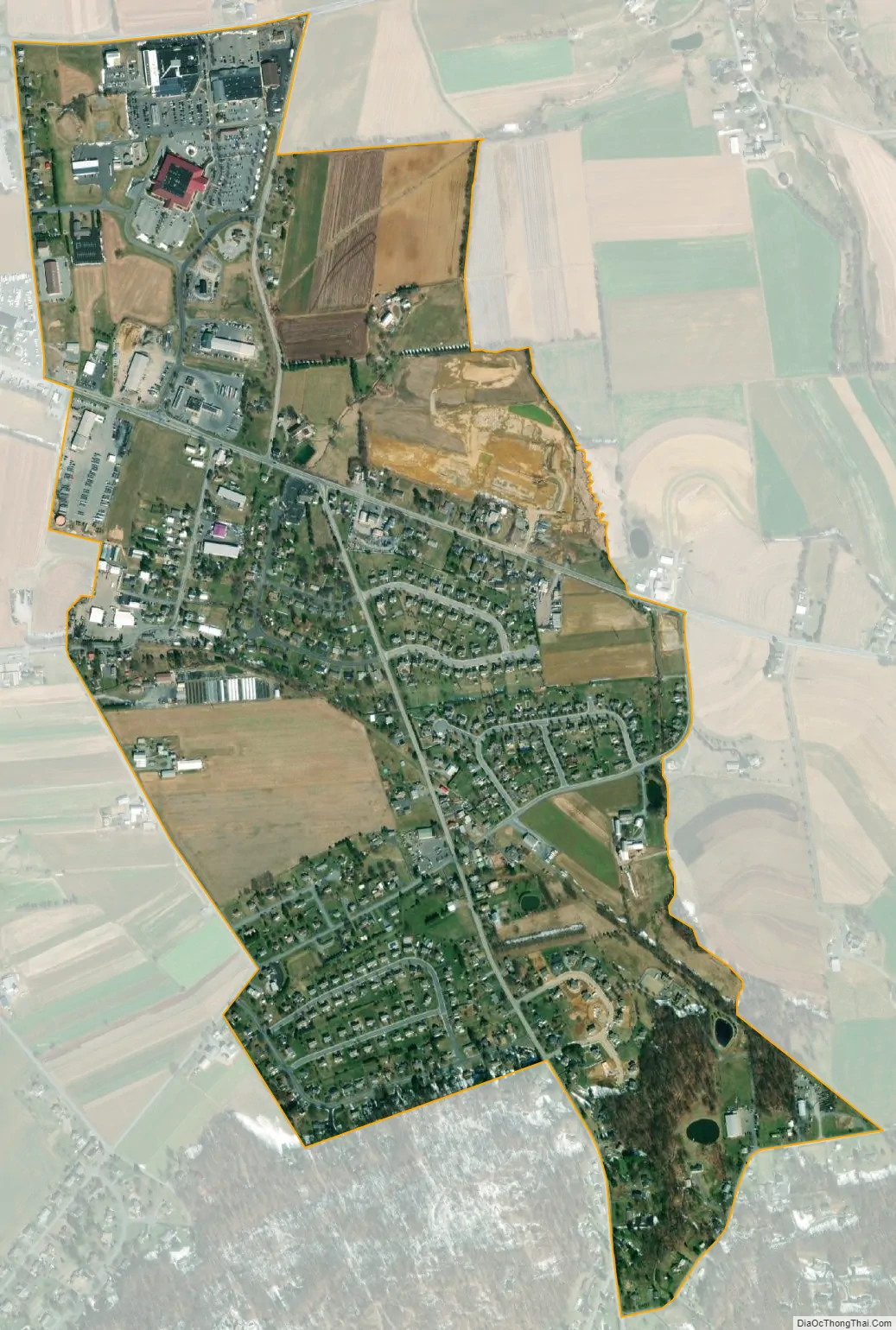
East Earl city Satellite Map
Geography
East Earl is in northeastern Lancaster County, in the south-central part of East Earl Township. It is bordered to the northwest by Blue Ball. U.S. Route 322 (Division Highway) passes through East Earl, leading northwest 9 miles (14 km) to Ephrata and southeast 20 miles (32 km) to Downingtown. Pennsylvania Route 897 (Springville Road) leads south 11 miles (18 km) to Gap and north 10 miles (16 km) to Swartzville. Lancaster, the county seat, is 16 miles (26 km) to the southwest.
According to the U.S. Census Bureau, the East Earl CDP has a total area of 0.93 square miles (2.4 km), of which 1.6 acres (6,524 m), or 0.27%, are water. The community drains northeast and northwest to the Conestoga River and southwest to Mill Creek, a tributary of the Conestoga.
See also
Map of Pennsylvania State and its subdivision:- Adams
- Allegheny
- Armstrong
- Beaver
- Bedford
- Berks
- Blair
- Bradford
- Bucks
- Butler
- Cambria
- Cameron
- Carbon
- Centre
- Chester
- Clarion
- Clearfield
- Clinton
- Columbia
- Crawford
- Cumberland
- Dauphin
- Delaware
- Elk
- Erie
- Fayette
- Forest
- Franklin
- Fulton
- Greene
- Huntingdon
- Indiana
- Jefferson
- Juniata
- Lackawanna
- Lancaster
- Lawrence
- Lebanon
- Lehigh
- Luzerne
- Lycoming
- Mc Kean
- Mercer
- Mifflin
- Monroe
- Montgomery
- Montour
- Northampton
- Northumberland
- Perry
- Philadelphia
- Pike
- Potter
- Schuylkill
- Snyder
- Somerset
- Sullivan
- Susquehanna
- Tioga
- Union
- Venango
- Warren
- Washington
- Wayne
- Westmoreland
- Wyoming
- York
- Alabama
- Alaska
- Arizona
- Arkansas
- California
- Colorado
- Connecticut
- Delaware
- District of Columbia
- Florida
- Georgia
- Hawaii
- Idaho
- Illinois
- Indiana
- Iowa
- Kansas
- Kentucky
- Louisiana
- Maine
- Maryland
- Massachusetts
- Michigan
- Minnesota
- Mississippi
- Missouri
- Montana
- Nebraska
- Nevada
- New Hampshire
- New Jersey
- New Mexico
- New York
- North Carolina
- North Dakota
- Ohio
- Oklahoma
- Oregon
- Pennsylvania
- Rhode Island
- South Carolina
- South Dakota
- Tennessee
- Texas
- Utah
- Vermont
- Virginia
- Washington
- West Virginia
- Wisconsin
- Wyoming


