Manheim is a borough in Lancaster County, Pennsylvania, United States. The population was 5,064 at the 2020 census. The borough was named after Kerpen-Manheim, Germany.
| Name: | Manheim borough |
|---|---|
| LSAD Code: | 21 |
| LSAD Description: | borough (suffix) |
| State: | Pennsylvania |
| County: | Lancaster County |
| Elevation: | 407 ft (124 m) |
| Total Area: | 1.40 sq mi (3.63 km²) |
| Land Area: | 1.38 sq mi (3.58 km²) |
| Water Area: | 0.02 sq mi (0.04 km²) |
| Total Population: | 5,046 |
| Population Density: | 3,651.23/sq mi (1,409.45/km²) |
| ZIP code: | 17545 |
| FIPS code: | 4246888 |
| Website: | manheimboro.org |
Online Interactive Map
Click on ![]() to view map in "full screen" mode.
to view map in "full screen" mode.
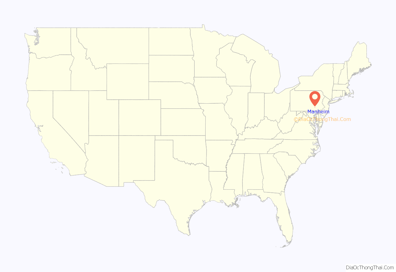
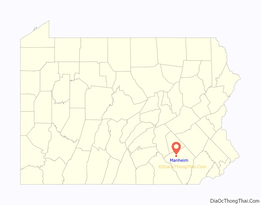
Manheim location map. Where is Manheim borough?
History
Manheim was laid out by Henry William Stiegel in 1762 on a land tract in Rapho Township, though it was only incorporated in 1838. He set out to build an industrial empire and founded the Manheim Glassworks. After financial failure, he was forced to sell the development in 1775. After several failed attempts at resurrecting the glassworks, it closed in 1780.
The first railroad train came into Manheim on January 1, 1862, with the completion of the first division of the Columbia and Reading Railroad. In 1884, another forward step was the laying of water pipes and the beginning of service by the Manheim Electric Company, which set up a plant in Bomberger’s Mill at the end of Mill Street.
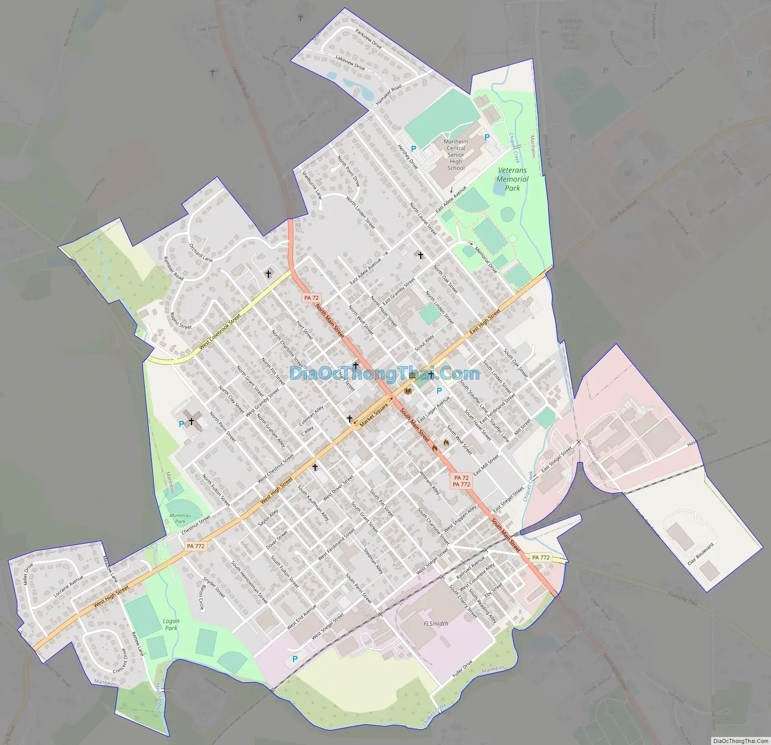
Manheim Road Map
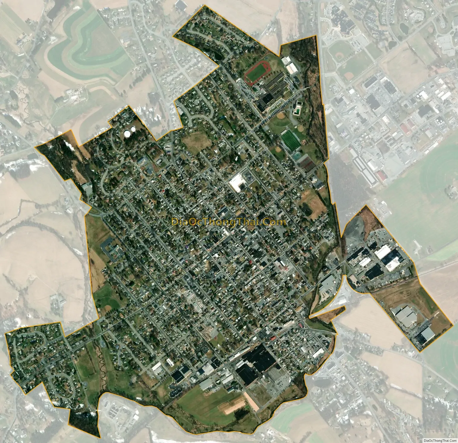
Manheim city Satellite Map
Geography
Manheim is in northern Lancaster County, along Pennsylvania Route 72 (Main Street), 11 miles (18 km) northwest of Lancaster, the county seat, and 13 miles (21 km) south of Lebanon. Pennsylvania Route 772 also passes through the borough, leading east 5 miles (8 km) to Lititz and southwest 7 miles (11 km) to Mount Joy. Manheim is bordered to the west by Rapho Township and to the east by Penn Township.
According to the United States Census Bureau, the borough has a total area of 1.4 square miles (3.6 km), of which 0.02 square miles (0.04 km), or 1.24%, are water. Chiques Creek, a southwest-flowing tributary of the Susquehanna River, forms the eastern boundary of the borough.
Manheim has a hot-summer humid continental climate (Dfa) and average monthly temperatures range from 30.2 °F in January to 74.9 °F in July. The local hardiness zone is 6b.
See also
Map of Pennsylvania State and its subdivision:- Adams
- Allegheny
- Armstrong
- Beaver
- Bedford
- Berks
- Blair
- Bradford
- Bucks
- Butler
- Cambria
- Cameron
- Carbon
- Centre
- Chester
- Clarion
- Clearfield
- Clinton
- Columbia
- Crawford
- Cumberland
- Dauphin
- Delaware
- Elk
- Erie
- Fayette
- Forest
- Franklin
- Fulton
- Greene
- Huntingdon
- Indiana
- Jefferson
- Juniata
- Lackawanna
- Lancaster
- Lawrence
- Lebanon
- Lehigh
- Luzerne
- Lycoming
- Mc Kean
- Mercer
- Mifflin
- Monroe
- Montgomery
- Montour
- Northampton
- Northumberland
- Perry
- Philadelphia
- Pike
- Potter
- Schuylkill
- Snyder
- Somerset
- Sullivan
- Susquehanna
- Tioga
- Union
- Venango
- Warren
- Washington
- Wayne
- Westmoreland
- Wyoming
- York
- Alabama
- Alaska
- Arizona
- Arkansas
- California
- Colorado
- Connecticut
- Delaware
- District of Columbia
- Florida
- Georgia
- Hawaii
- Idaho
- Illinois
- Indiana
- Iowa
- Kansas
- Kentucky
- Louisiana
- Maine
- Maryland
- Massachusetts
- Michigan
- Minnesota
- Mississippi
- Missouri
- Montana
- Nebraska
- Nevada
- New Hampshire
- New Jersey
- New Mexico
- New York
- North Carolina
- North Dakota
- Ohio
- Oklahoma
- Oregon
- Pennsylvania
- Rhode Island
- South Carolina
- South Dakota
- Tennessee
- Texas
- Utah
- Vermont
- Virginia
- Washington
- West Virginia
- Wisconsin
- Wyoming


