Reamstown (Pennsylvania Dutch: Riemeschteddel) is an unincorporated community and census-designated place (CDP) in Lancaster County, Pennsylvania, United States. The population was 3,361 at the 2010 census.
| Name: | Reamstown CDP |
|---|---|
| LSAD Code: | 57 |
| LSAD Description: | CDP (suffix) |
| State: | Pennsylvania |
| County: | Lancaster County |
| Elevation: | 392 ft (119 m) |
| Total Area: | 2.27 sq mi (5.88 km²) |
| Land Area: | 2.26 sq mi (5.85 km²) |
| Water Area: | 0.02 sq mi (0.04 km²) |
| Total Population: | 3,361 |
| Population Density: | 1,489/sq mi (574.9/km²) |
| ZIP code: | 17567 |
| Area code: | 717 |
| FIPS code: | 4263664 |
| GNISfeature ID: | 1184739 |
Online Interactive Map
Click on ![]() to view map in "full screen" mode.
to view map in "full screen" mode.
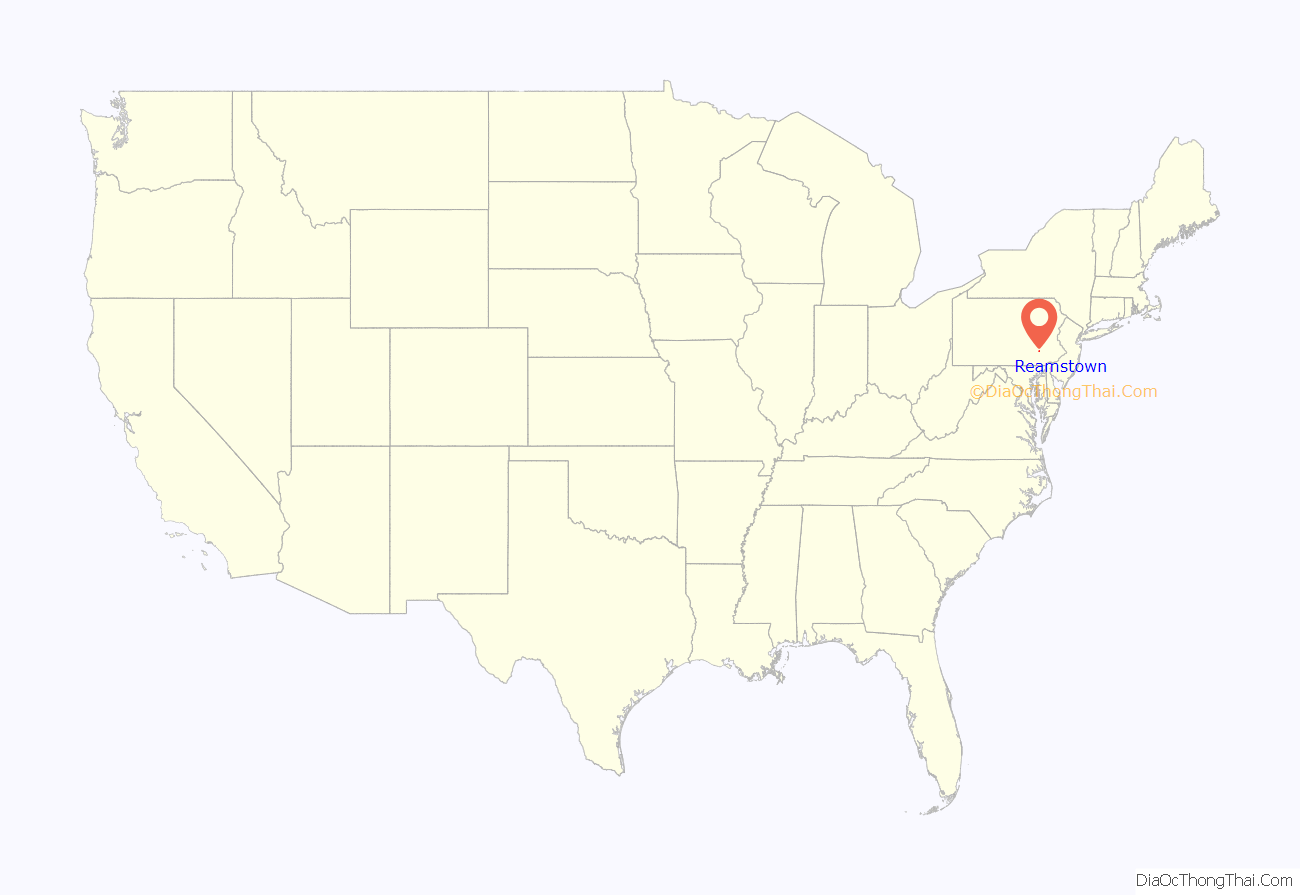
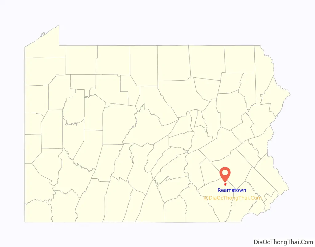
Reamstown location map. Where is Reamstown CDP?
History
The town was named after Eberhard Ream (Johann Eberhardt Riehm 1687–1779), whose son, Tobias Ream, founded it in the 1740s. It was originally known as “Zohar.”
During the American Revolution, Reamstown served as one of a number of field hospitals for the wounded following the Battle of Brandywine on September 11, 1777. A dozen or more of these troops died here and are buried in unmarked graves in the Salem Evangelical Cemetery. The cemetery is also home to a large boulder that once served as a mortar and pestle by the native people who lived on nearby Ephrata Mountain to the south. It was transported to Reamstown by Pierce Lesher, and today a plaque on the stone details both the Native American and military history.
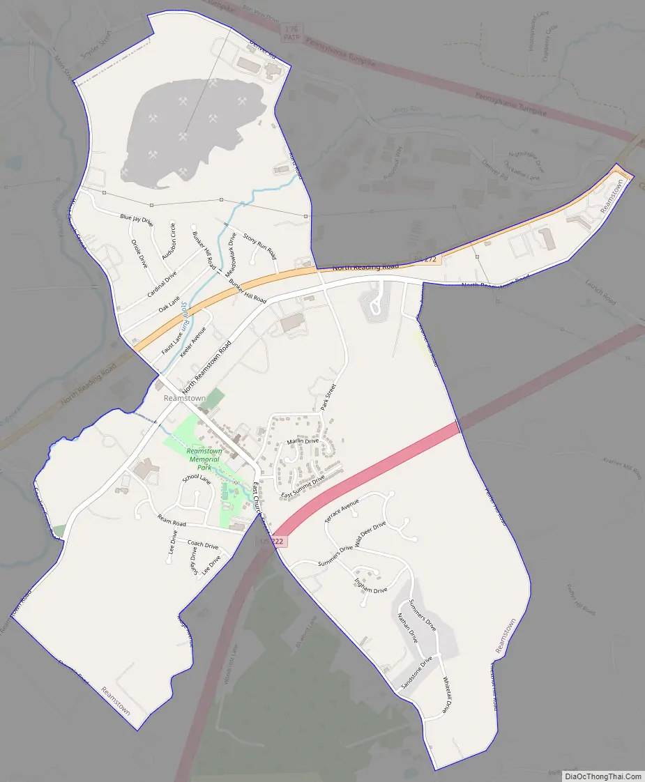
Reamstown Road Map
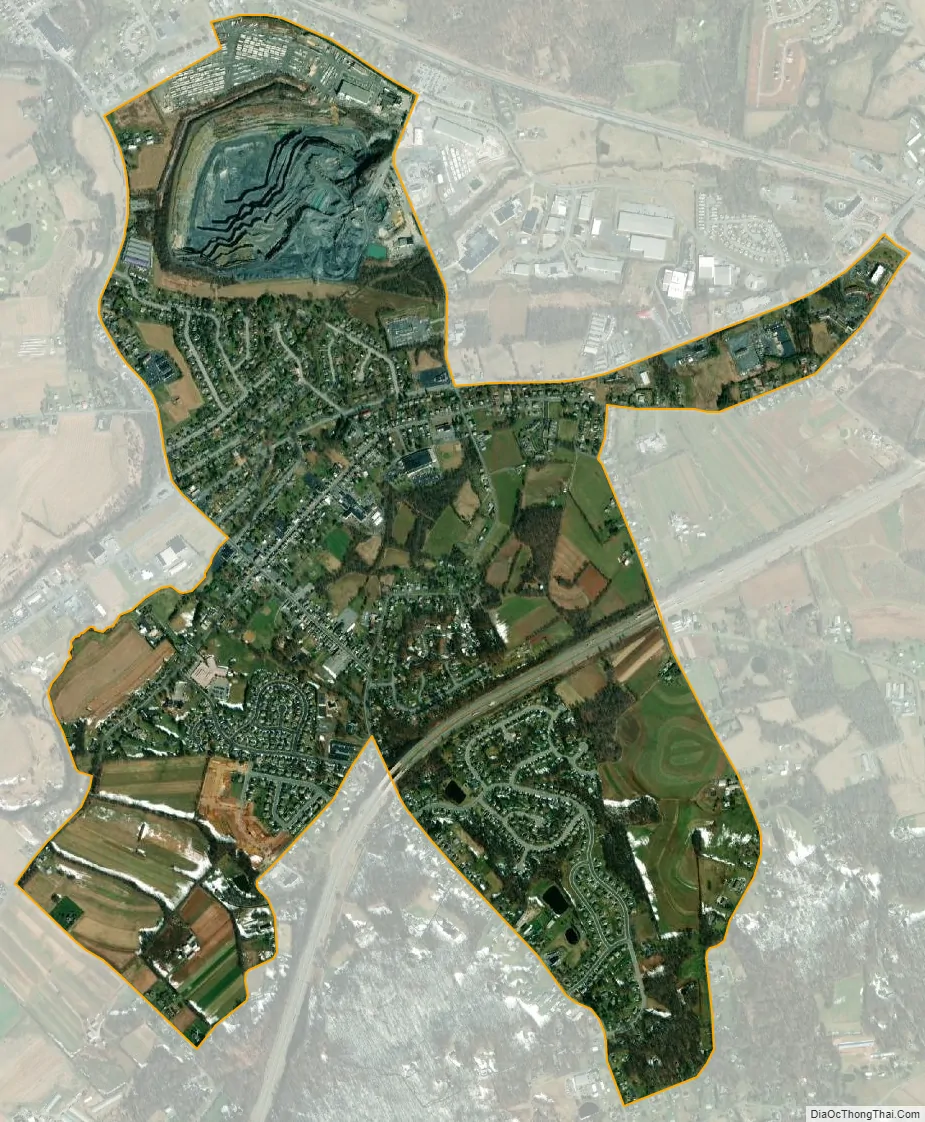
Reamstown city Satellite Map
Geography
Reamstown is located in northeastern Lancaster County at 40°12′43″N 76°7′3″W / 40.21194°N 76.11750°W / 40.21194; -76.11750 (40.212046, -76.117587), in the southern part of East Cocalico Township. It is bordered to the northwest by the borough of Denver.
Pennsylvania Route 272 passes through the community north of the downtown section. PA 272 leads northeast 4 miles (6 km) to Adamstown and southwest the same distance to Ephrata. U.S. Route 222, a four-lane expressway, passes through the south side of the Reamstown CDP, but the closest access is 2 miles (3 km) to the northeast, from Colonel Howard Boulevard, which also provides access to the Pennsylvania Turnpike. Reading is 15 miles (24 km) northeast of Reamstown, Lancaster is 17 miles (27 km) to the southwest, and Philadelphia is 62 miles (100 km) to the southeast.
According to the United States Census Bureau, the CDP has a total area of 2.3 square miles (5.9 km), of 0.02 square miles (0.04 km), or 0.63%, are water. Cocalico Creek runs along the northwestern edge of the CDP, flowing southwest to the Conestoga River, which continues southwest to the Susquehanna.
See also
Map of Pennsylvania State and its subdivision:- Adams
- Allegheny
- Armstrong
- Beaver
- Bedford
- Berks
- Blair
- Bradford
- Bucks
- Butler
- Cambria
- Cameron
- Carbon
- Centre
- Chester
- Clarion
- Clearfield
- Clinton
- Columbia
- Crawford
- Cumberland
- Dauphin
- Delaware
- Elk
- Erie
- Fayette
- Forest
- Franklin
- Fulton
- Greene
- Huntingdon
- Indiana
- Jefferson
- Juniata
- Lackawanna
- Lancaster
- Lawrence
- Lebanon
- Lehigh
- Luzerne
- Lycoming
- Mc Kean
- Mercer
- Mifflin
- Monroe
- Montgomery
- Montour
- Northampton
- Northumberland
- Perry
- Philadelphia
- Pike
- Potter
- Schuylkill
- Snyder
- Somerset
- Sullivan
- Susquehanna
- Tioga
- Union
- Venango
- Warren
- Washington
- Wayne
- Westmoreland
- Wyoming
- York
- Alabama
- Alaska
- Arizona
- Arkansas
- California
- Colorado
- Connecticut
- Delaware
- District of Columbia
- Florida
- Georgia
- Hawaii
- Idaho
- Illinois
- Indiana
- Iowa
- Kansas
- Kentucky
- Louisiana
- Maine
- Maryland
- Massachusetts
- Michigan
- Minnesota
- Mississippi
- Missouri
- Montana
- Nebraska
- Nevada
- New Hampshire
- New Jersey
- New Mexico
- New York
- North Carolina
- North Dakota
- Ohio
- Oklahoma
- Oregon
- Pennsylvania
- Rhode Island
- South Carolina
- South Dakota
- Tennessee
- Texas
- Utah
- Vermont
- Virginia
- Washington
- West Virginia
- Wisconsin
- Wyoming


