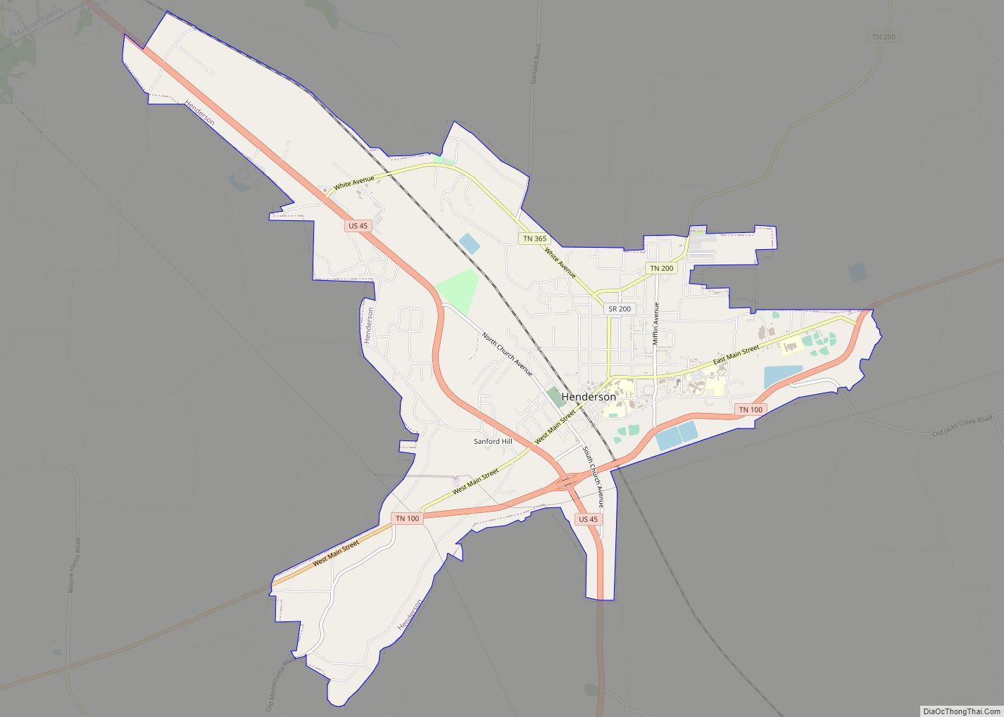
Henderson is a city in and the county seat of Chester County, Tennessee, United States. The population was 6,309 at the 2010 census, up from 5,670 at the 2000 census.
| Name: | Henderson city |
|---|---|
| LSAD Code: | 25 |
| LSAD Description: | city (suffix) |
| State: | Tennessee |
| County: | Chester County |
| Elevation: | 446 ft (136 m) |
| Total Area: | 7.83 sq mi (20.29 km²) |
| Land Area: | 7.80 sq mi (20.22 km²) |
| Water Area: | 0.03 sq mi (0.07 km²) |
| Total Population: | 6,308 |
| Population Density: | 808.20/sq mi (312.04/km²) |
| ZIP code: | 38340 |
| Area code: | 731 |
| FIPS code: | 4733260 |
| GNISfeature ID: | 1287374 |
| Website: | hendersontn.org |
Online Interactive Map
Click on ![]() to view map in "full screen" mode.
to view map in "full screen" mode.
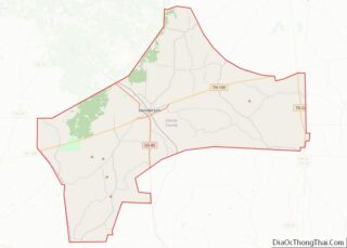
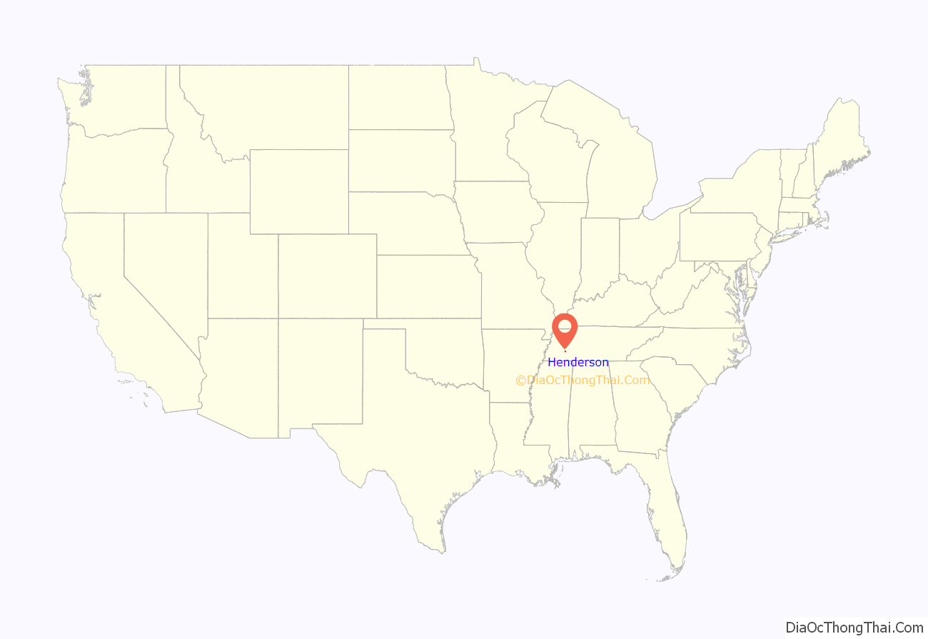
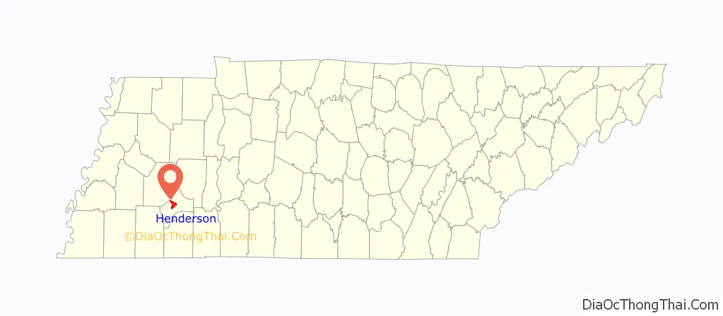
Henderson location map. Where is Henderson city?
History
Henderson was platted in 1857, when the railroad was extended to that point. The city takes its name from Henderson County, Tennessee. Henderson was called Dayton during the Civil War, then was known as Henderson Station and, finally, Henderson.
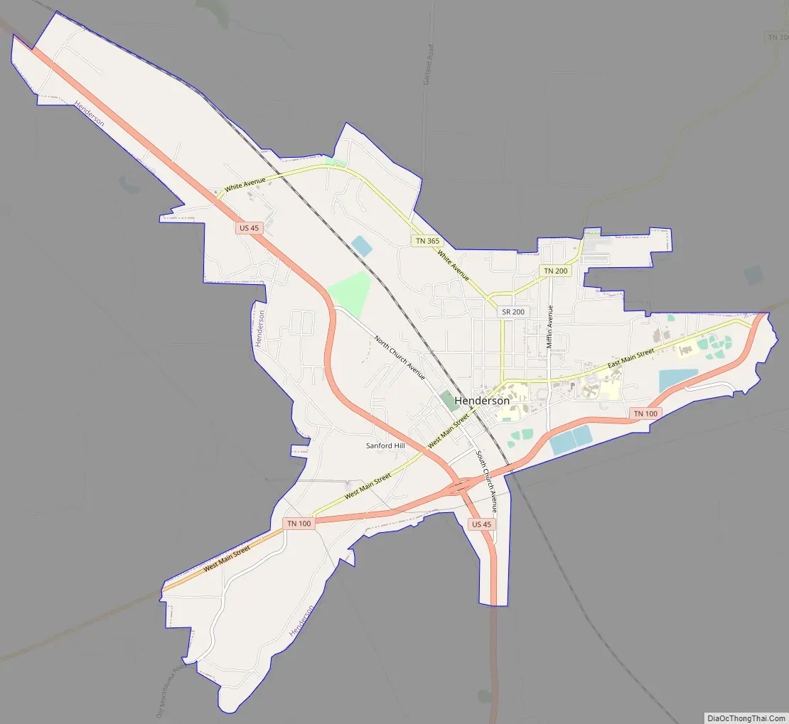
Henderson Road Map
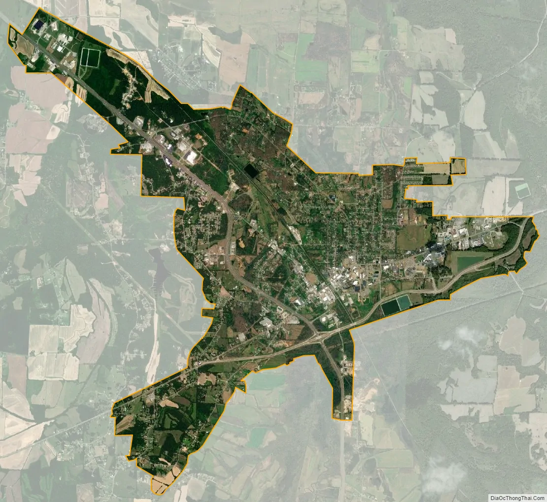
Henderson city Satellite Map
Geography
Henderson is located near the center of Chester County at 35°26′35″N 88°38′40″W / 35.44306°N 88.64444°W / 35.44306; -88.64444 (35.443025, -88.644345), to the west of the South Fork Forked Deer River. U.S. Route 45 passes through the city, leading northwest 17 miles (27 km) to Jackson and south 20 miles (32 km) to Selmer. Tennessee State Route 100 passes south of the city center, leading east 32 miles (51 km) to Decaturville and west 30 miles (48 km) to Whiteville.
According to the United States Census Bureau, the city has a total area of 7.9 square miles (20.4 km), of which 0.03 square miles (0.07 km), or 0.35%, is water.
See also
Map of Tennessee State and its subdivision:- Anderson
- Bedford
- Benton
- Bledsoe
- Blount
- Bradley
- Campbell
- Cannon
- Carroll
- Carter
- Cheatham
- Chester
- Claiborne
- Clay
- Cocke
- Coffee
- Crockett
- Cumberland
- Davidson
- Decatur
- DeKalb
- Dickson
- Dyer
- Fayette
- Fentress
- Franklin
- Gibson
- Giles
- Grainger
- Greene
- Grundy
- Hamblen
- Hamilton
- Hancock
- Hardeman
- Hardin
- Hawkins
- Haywood
- Henderson
- Henry
- Hickman
- Houston
- Humphreys
- Jackson
- Jefferson
- Johnson
- Knox
- Lake
- Lauderdale
- Lawrence
- Lewis
- Lincoln
- Loudon
- Macon
- Madison
- Marion
- Marshall
- Maury
- McMinn
- McNairy
- Meigs
- Monroe
- Montgomery
- Moore
- Morgan
- Obion
- Overton
- Perry
- Pickett
- Polk
- Putnam
- Rhea
- Roane
- Robertson
- Rutherford
- Scott
- Sequatchie
- Sevier
- Shelby
- Smith
- Stewart
- Sullivan
- Sumner
- Tipton
- Trousdale
- Unicoi
- Union
- Van Buren
- Warren
- Washington
- Wayne
- Weakley
- White
- Williamson
- Wilson
- Alabama
- Alaska
- Arizona
- Arkansas
- California
- Colorado
- Connecticut
- Delaware
- District of Columbia
- Florida
- Georgia
- Hawaii
- Idaho
- Illinois
- Indiana
- Iowa
- Kansas
- Kentucky
- Louisiana
- Maine
- Maryland
- Massachusetts
- Michigan
- Minnesota
- Mississippi
- Missouri
- Montana
- Nebraska
- Nevada
- New Hampshire
- New Jersey
- New Mexico
- New York
- North Carolina
- North Dakota
- Ohio
- Oklahoma
- Oregon
- Pennsylvania
- Rhode Island
- South Carolina
- South Dakota
- Tennessee
- Texas
- Utah
- Vermont
- Virginia
- Washington
- West Virginia
- Wisconsin
- Wyoming