Minor Hill is a city in Giles County, Tennessee, United States. The population was 537 at the 2010 census.
| Name: | Minor Hill city |
|---|---|
| LSAD Code: | 25 |
| LSAD Description: | city (suffix) |
| State: | Tennessee |
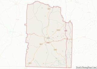
| County: | Giles County |
| Incorporated: | 1870 |
| Elevation: | 886 ft (270 m) |
| Total Area: | 1.86 sq mi (4.82 km²) |
| Land Area: | 1.86 sq mi (4.82 km²) |
| Water Area: | 0.00 sq mi (0.00 km²) |
| Total Population: | 504 |
| Population Density: | 270.82/sq mi (104.57/km²) |
| ZIP code: | 38473 |
| Area code: | 931 |
| FIPS code: | 4749360 |
| GNISfeature ID: | 1294062 |
| Website: | www.minorhilltn.com |
Online Interactive Map
Click on ![]() to view map in "full screen" mode.
to view map in "full screen" mode.
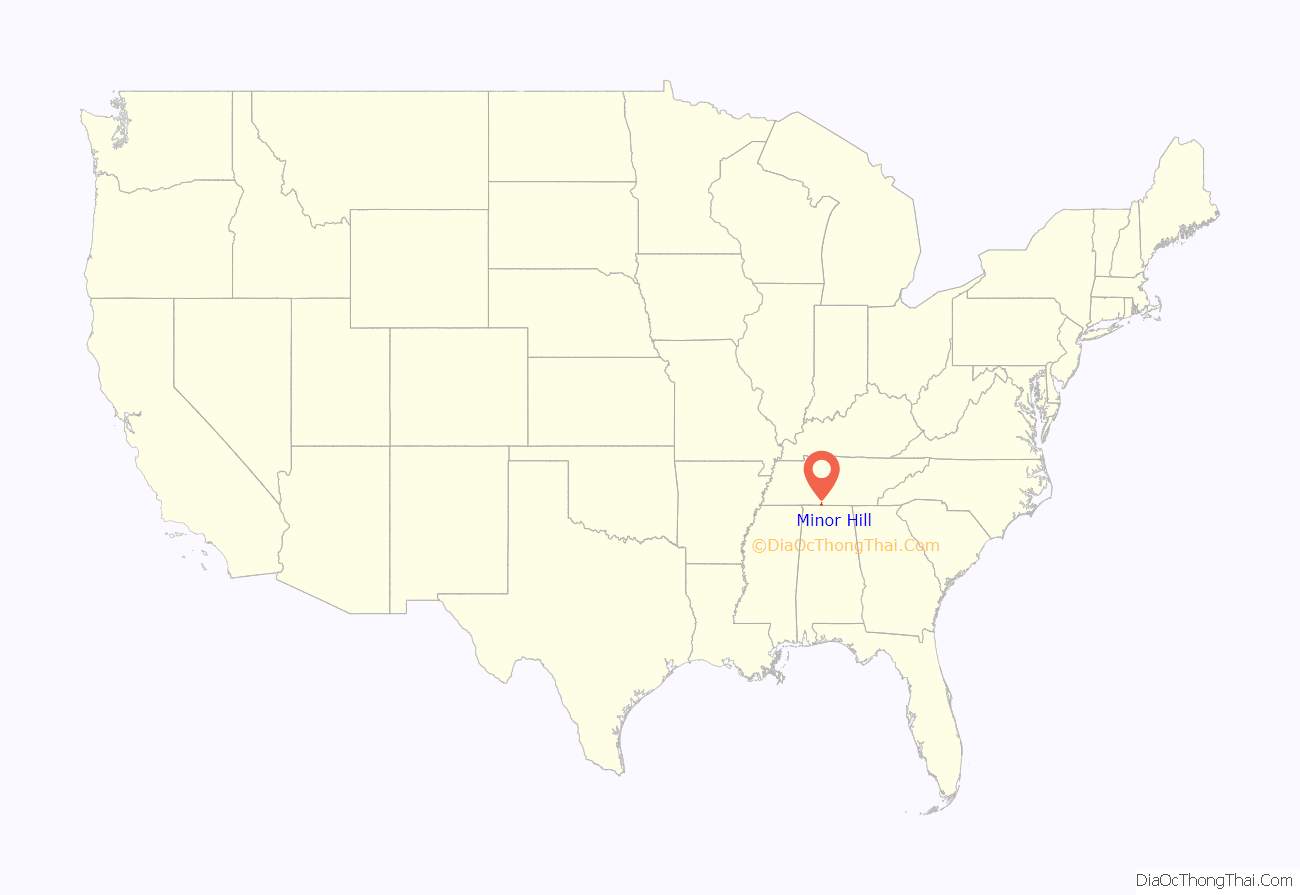
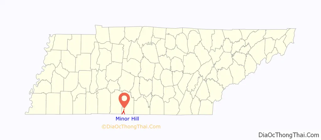
Minor Hill location map. Where is Minor Hill city?
History
Minor Hill is named for Joseph Minor, an early settler in the area. A later owner of the Minor tract donated part of it for the establishment of a school, church, and cemetery in the mid-19th century. A post office was established in 1870, and the city incorporated that same year.
On November 19, 1863, during the Civil War, Confederate scout Sam Davis was captured at Minor Hill. He was taken to Pulaski, where he was executed eight days later. A monument to Davis now stands in Minor Hill at the site where he was captured.
Noted gospel song book publisher James David Vaughan published his first song book in Minor Hill in 1900. Vaughan and three of his brothers performed as a gospel quartet throughout the region.
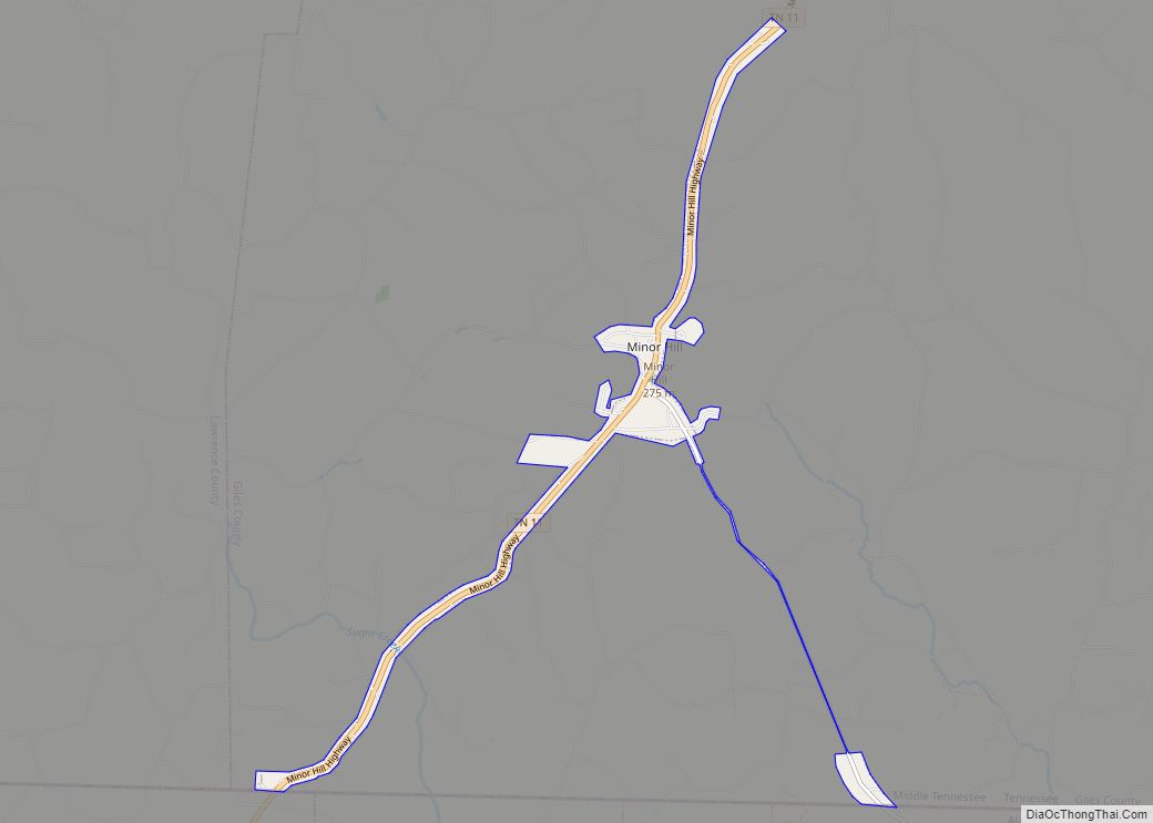
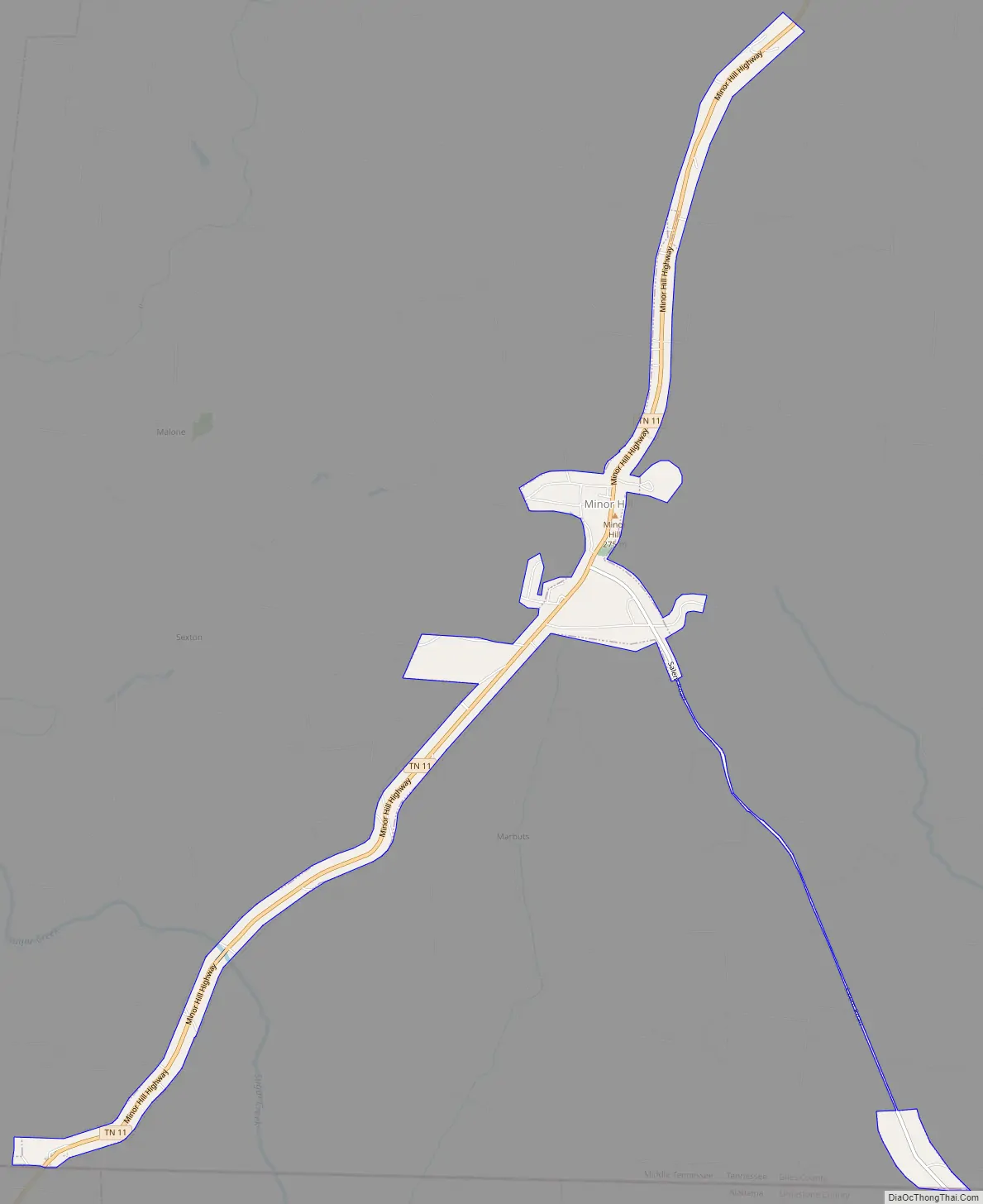
Minor Hill Road Map
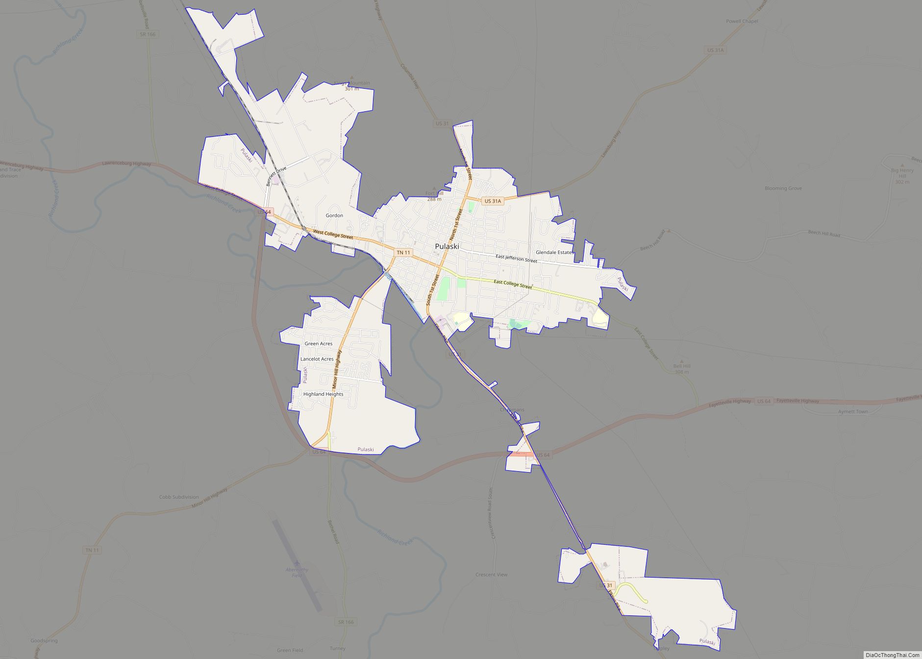
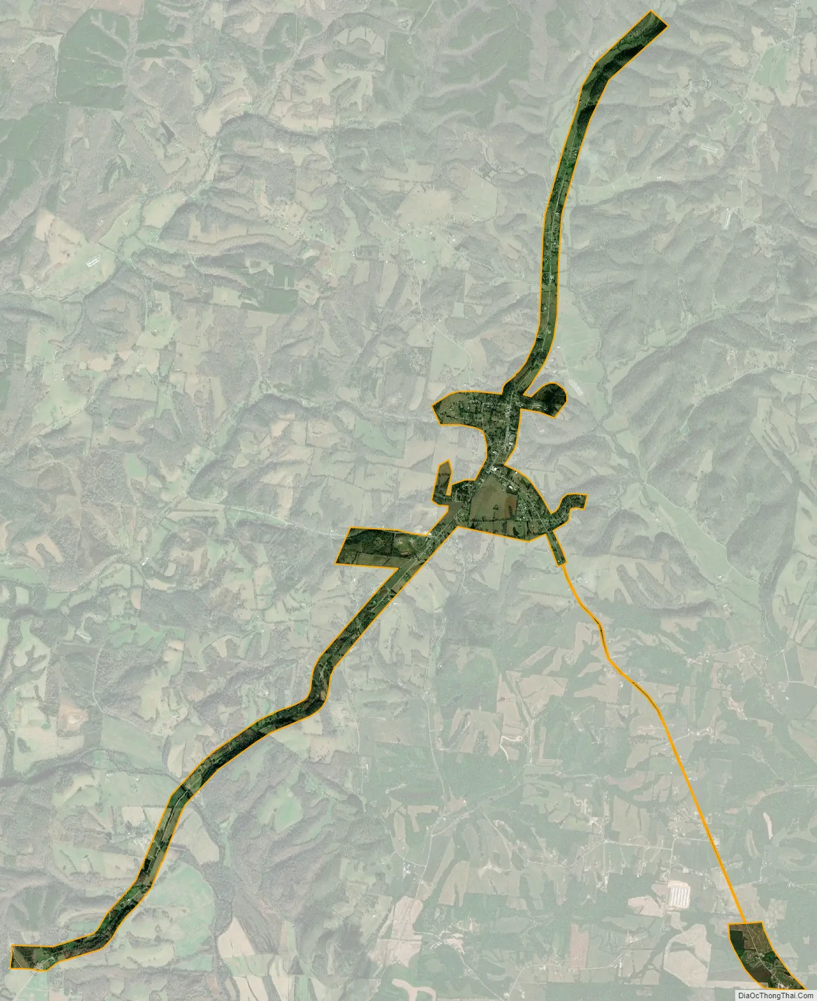
Minor Hill city Satellite Map
Geography
Minor Hill is located at 35°2′18″N 87°10′16″W / 35.03833°N 87.17111°W / 35.03833; -87.17111 (35.038466, -87.171135). The city is situated atop a hill that rises nearly 200 feet (61 m) above the West Fork Shoal Creek Valley, which passes just to the east, in southwestern Giles County. State Route 11 passes through the city, connecting it to Pulaski to the northeast and Lauderdale County, Alabama, to the southwest (the road becomes Alabama State Route 207 at the state line).
According to the United States Census Bureau, the city has a total area of 1.6 square miles (4.1 km), all land.
See also
Map of Tennessee State and its subdivision:- Anderson
- Bedford
- Benton
- Bledsoe
- Blount
- Bradley
- Campbell
- Cannon
- Carroll
- Carter
- Cheatham
- Chester
- Claiborne
- Clay
- Cocke
- Coffee
- Crockett
- Cumberland
- Davidson
- Decatur
- DeKalb
- Dickson
- Dyer
- Fayette
- Fentress
- Franklin
- Gibson
- Giles
- Grainger
- Greene
- Grundy
- Hamblen
- Hamilton
- Hancock
- Hardeman
- Hardin
- Hawkins
- Haywood
- Henderson
- Henry
- Hickman
- Houston
- Humphreys
- Jackson
- Jefferson
- Johnson
- Knox
- Lake
- Lauderdale
- Lawrence
- Lewis
- Lincoln
- Loudon
- Macon
- Madison
- Marion
- Marshall
- Maury
- McMinn
- McNairy
- Meigs
- Monroe
- Montgomery
- Moore
- Morgan
- Obion
- Overton
- Perry
- Pickett
- Polk
- Putnam
- Rhea
- Roane
- Robertson
- Rutherford
- Scott
- Sequatchie
- Sevier
- Shelby
- Smith
- Stewart
- Sullivan
- Sumner
- Tipton
- Trousdale
- Unicoi
- Union
- Van Buren
- Warren
- Washington
- Wayne
- Weakley
- White
- Williamson
- Wilson
- Alabama
- Alaska
- Arizona
- Arkansas
- California
- Colorado
- Connecticut
- Delaware
- District of Columbia
- Florida
- Georgia
- Hawaii
- Idaho
- Illinois
- Indiana
- Iowa
- Kansas
- Kentucky
- Louisiana
- Maine
- Maryland
- Massachusetts
- Michigan
- Minnesota
- Mississippi
- Missouri
- Montana
- Nebraska
- Nevada
- New Hampshire
- New Jersey
- New Mexico
- New York
- North Carolina
- North Dakota
- Ohio
- Oklahoma
- Oregon
- Pennsylvania
- Rhode Island
- South Carolina
- South Dakota
- Tennessee
- Texas
- Utah
- Vermont
- Virginia
- Washington
- West Virginia
- Wisconsin
- Wyoming