Bristol is a city in Sullivan County, Tennessee, United States. The population was 27,147 at the 2020 census. It is the twin city of Bristol, Virginia, which lies directly across the state line between Tennessee and Virginia. The boundary between the two cities is also the state line, which runs along State Street in their common downtown district. It is a principal city in the Kingsport–Bristol metropolitan area, which had a population of 307,614 in 2020. The metro area is a component of the larger Tri-Cities region of Tennessee and Virginia, with a population of 508,260 in 2020.
Bristol is known for being the site of some of the earliest commercial recordings of country music, showcasing Jimmie Rodgers and the Carter Family, and later a favorite venue of mountain musician Uncle Charlie Osborne. The U.S. Congress recognized Bristol as the “Birthplace of Country Music” in 1998, and the Birthplace of Country Music Museum is located in Bristol. It also is the birthplace of Tennessee Ernie Ford.
Bristol is the site of Bristol Motor Speedway, a NASCAR short track. The world’s fifth-largest coal producer, Contura Energy, is based in Bristol.
| Name: | Bristol city |
|---|---|
| LSAD Code: | 25 |
| LSAD Description: | city (suffix) |
| State: | Tennessee |
| County: | Sullivan County |
| Incorporated: | 1856 |
| Elevation: | 1,676 ft (511 m) |
| Total Area: | 32.83 sq mi (85.03 km²) |
| Land Area: | 32.68 sq mi (84.63 km²) |
| Water Area: | 0.15 sq mi (0.40 km²) |
| Total Population: | 27,147 |
| Population Density: | 830.79/sq mi (320.77/km²) |
| Area code: | 423 |
| FIPS code: | 4708540 |
| GNISfeature ID: | 1327702 |
| Website: | www.bristoltn.org |
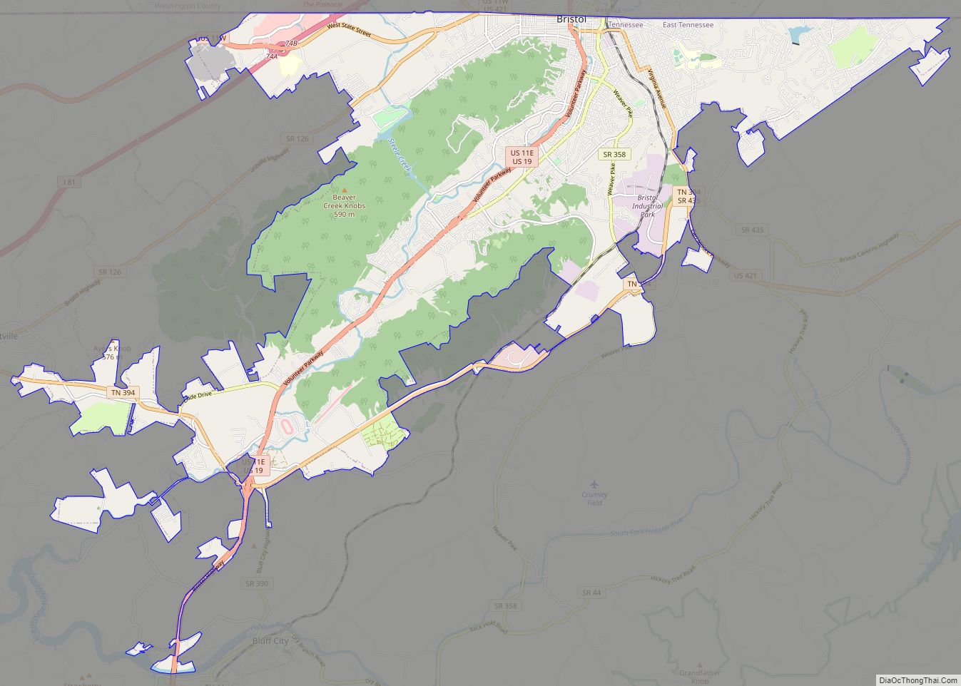
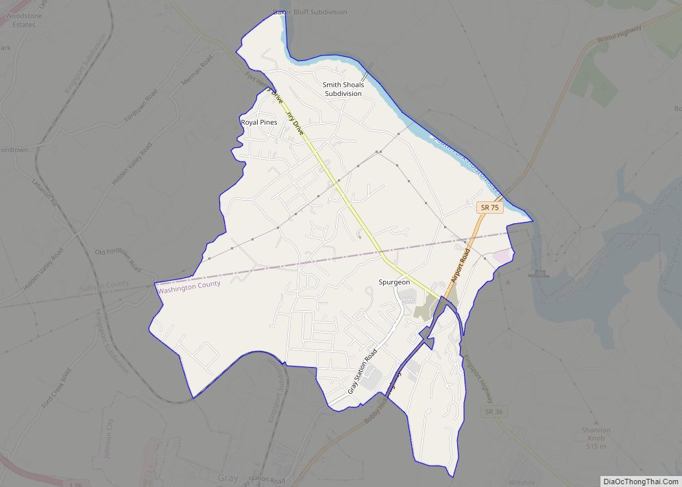
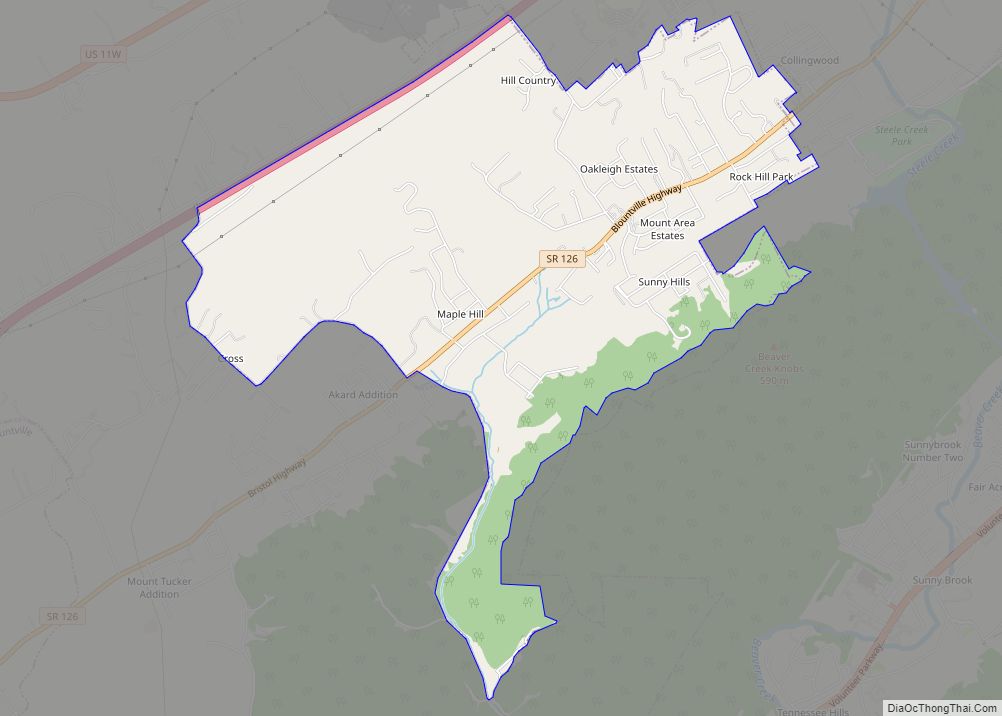
Online Interactive Map
Click on ![]() to view map in "full screen" mode.
to view map in "full screen" mode.
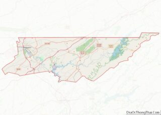
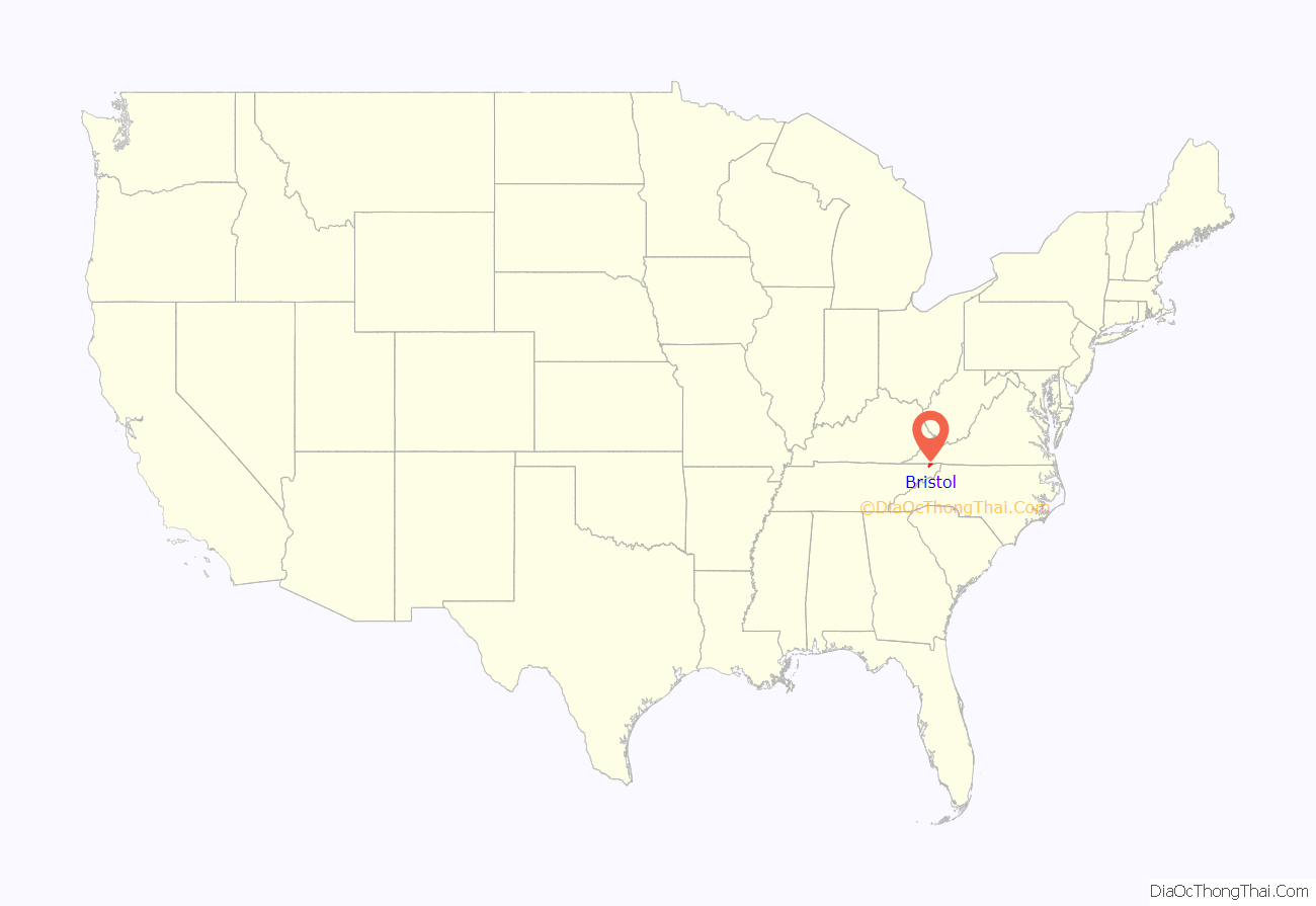
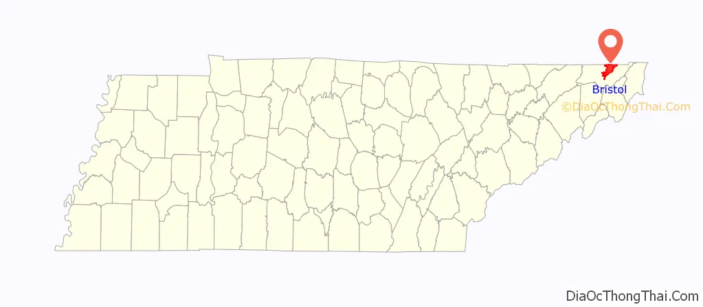
Bristol location map. Where is Bristol city?
History
Before 1852, Bristol was owned by Reverend James King. His son-in-law, Mr. Joseph R. Anderson, bought 100 acres of the plantation, and named it Bristol The G.W. Blackley House, one of the oldest houses in Bristol, was constructed in 1869.
“Birthplace of Country Music”
The U.S. Congress declared Bristol to be the “Birthplace of Country Music”, according to a resolution passed in 1998, recognizing its contributions to early country music recordings and influence, and the Birthplace of Country Music Museum is located in Bristol.
In 1927, record producer Ralph Peer of Victor Records began recording local musicians in Bristol, to attempt to capture the local sound of traditional “folk” music of the region. One of these local sounds was created by the Carter Family, who got their start on July 31, 1927, when A.P. Carter and his family journeyed from Maces Spring, Virginia, to Bristol to audition for Ralph Peer, who was seeking new talent for the relatively embryonic recording industry. They received $50 for each song they recorded. That same visit by Peer to Bristol also resulted in the first recordings by Jimmie Rodgers.
Since 1994, the Birthplace of Country Music Alliance has promoted the city as a destination to learn about country music and the city’s role in the creation of an entire music genre. The alliance is organizing the building of a new Cultural Heritage Center to help educate the public about the history of country music in the region. On August 1, 2014, the Birthplace of Country Music Museum opened in Bristol, Virginia to commemorate the historical significance of the Bristol sessions. The museum features a 24,000-ft building that houses core exhibits, space for special exhibits, a performance theater, and a radio station.
Every year, during the third weekend in September, a music festival called the Bristol Rhythm & Roots Reunion takes place. The festival is held downtown, where Tennessee and Virginia meet, and it celebrates Bristol’s heritage as the birthplace of country music.
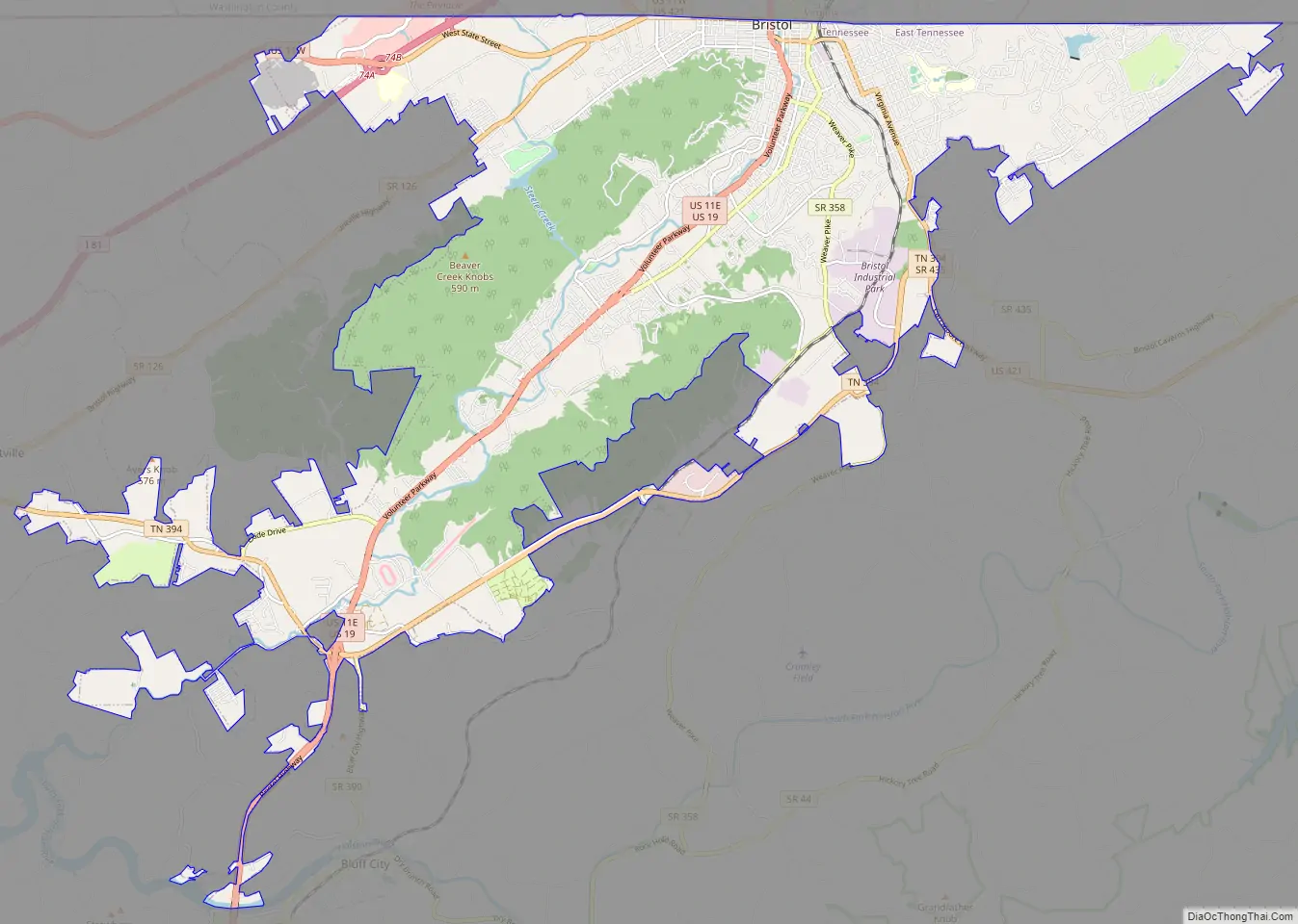
Bristol Road Map
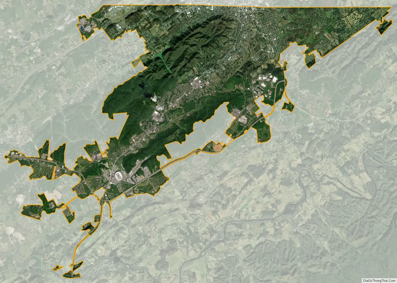
Bristol city Satellite Map
Geography
Bristol is located in the northeast corner of Tennessee, at 36°34′9″N 82°11′51″W / 36.56917°N 82.19750°W / 36.56917; -82.19750 (36.569135, −82.197489).
Bristol is located 20.95 miles east of Kingsport, Tennessee, 21.51 miles northeast of Johnson City, Tennessee, 38.74 miles northwest of Boone, North Carolina, 105.96 miles northeast of Knoxville, Tennessee, and 132.61 miles southwest of Roanoke, Virginia.
According to the United States Census Bureau, the city has a total area of 29.5 square miles (76.4 km), of which 29.4 square miles (76.1 km) are land and 0.1 square miles (0.3 km) (0.44%) is covered by water.
Climate
Like much of the rest of the state, Bristol has a humid subtropical climate (Köppen climate classification: Cfa), although with significantly cooler temperatures, especially in the summer, due to elevation; it is part of USDA hardiness zone 6b, with areas to the southwest falling in zone 7a. The normal monthly mean temperature ranges from 35.2 °F (1.8 °C) in January to 74.6 °F (23.7 °C) in July, while, on average, 8.8 days have temperatures at or below freezing and 17 days with highs at or above 90 °F (32 °C) per year. The all-time record low is −21 °F (−29 °C), set on January 21, 1985, while the all-time record high is 103 °F (39 °C), set on June 30, 2012.
Precipitation is low compared to much of East Tennessee, averaging 41.0 inches (1,040 mm) annually, and reaches a low during autumn. The rainiest calendar day on record is October 16, 1964, when 3.65 inches (93 mm) of rain fell; monthly precipitation has ranged from 0.02 inches (0.51 mm) in October 2002 to 12.70 inches (323 mm) in July 2012. Bristol’s normal (1981–2010) winter snowfall stands at 13.3 inches (34 cm), significantly more than what most of Tennessee receives. The most snow in one calendar day was 16.2 inches (41 cm) on November 21, 1952, while the most in one month is 27.9 inches (71 cm) during March 1960, which contributed to the winter of 1959–60, with a total of 51.0 inches (130 cm), finishing as the snowiest on record.
- ^ Mean monthly maxima and minima (i.e. the highest and lowest temperature readings during an entire month or year) calculated based on data at said location from 1991 to 2020.
See also
Map of Tennessee State and its subdivision:- Anderson
- Bedford
- Benton
- Bledsoe
- Blount
- Bradley
- Campbell
- Cannon
- Carroll
- Carter
- Cheatham
- Chester
- Claiborne
- Clay
- Cocke
- Coffee
- Crockett
- Cumberland
- Davidson
- Decatur
- DeKalb
- Dickson
- Dyer
- Fayette
- Fentress
- Franklin
- Gibson
- Giles
- Grainger
- Greene
- Grundy
- Hamblen
- Hamilton
- Hancock
- Hardeman
- Hardin
- Hawkins
- Haywood
- Henderson
- Henry
- Hickman
- Houston
- Humphreys
- Jackson
- Jefferson
- Johnson
- Knox
- Lake
- Lauderdale
- Lawrence
- Lewis
- Lincoln
- Loudon
- Macon
- Madison
- Marion
- Marshall
- Maury
- McMinn
- McNairy
- Meigs
- Monroe
- Montgomery
- Moore
- Morgan
- Obion
- Overton
- Perry
- Pickett
- Polk
- Putnam
- Rhea
- Roane
- Robertson
- Rutherford
- Scott
- Sequatchie
- Sevier
- Shelby
- Smith
- Stewart
- Sullivan
- Sumner
- Tipton
- Trousdale
- Unicoi
- Union
- Van Buren
- Warren
- Washington
- Wayne
- Weakley
- White
- Williamson
- Wilson
- Alabama
- Alaska
- Arizona
- Arkansas
- California
- Colorado
- Connecticut
- Delaware
- District of Columbia
- Florida
- Georgia
- Hawaii
- Idaho
- Illinois
- Indiana
- Iowa
- Kansas
- Kentucky
- Louisiana
- Maine
- Maryland
- Massachusetts
- Michigan
- Minnesota
- Mississippi
- Missouri
- Montana
- Nebraska
- Nevada
- New Hampshire
- New Jersey
- New Mexico
- New York
- North Carolina
- North Dakota
- Ohio
- Oklahoma
- Oregon
- Pennsylvania
- Rhode Island
- South Carolina
- South Dakota
- Tennessee
- Texas
- Utah
- Vermont
- Virginia
- Washington
- West Virginia
- Wisconsin
- Wyoming