Piperton is a city in Fayette County, Tennessee, United States. The population was 2,263 at the 2020 census. In 2007 USA Today cited the National Motorist Association when it listed Piperton as one of the worst cities for speeding tickets across the USA.
| Name: | Piperton city |
|---|---|
| LSAD Code: | 25 |
| LSAD Description: | city (suffix) |
| State: | Tennessee |
| County: | Fayette County |
| Incorporated: | 1974 |
| Elevation: | 361 ft (110 m) |
| Total Area: | 27.32 sq mi (70.77 km²) |
| Land Area: | 27.20 sq mi (70.43 km²) |
| Water Area: | 0.13 sq mi (0.33 km²) |
| Total Population: | 2,263 |
| Population Density: | 83.21/sq mi (32.13/km²) |
| ZIP code: | 38017 |
| Area code: | 901 |
| FIPS code: | 4758840 |
| GNISfeature ID: | 1297695 |
| Website: | www.pipertontn.com |
Online Interactive Map
Click on ![]() to view map in "full screen" mode.
to view map in "full screen" mode.
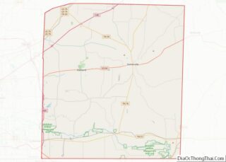
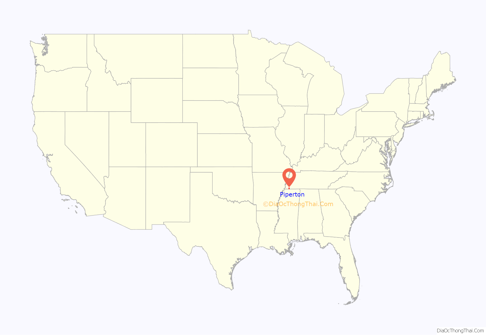
Piperton location map. Where is Piperton city?

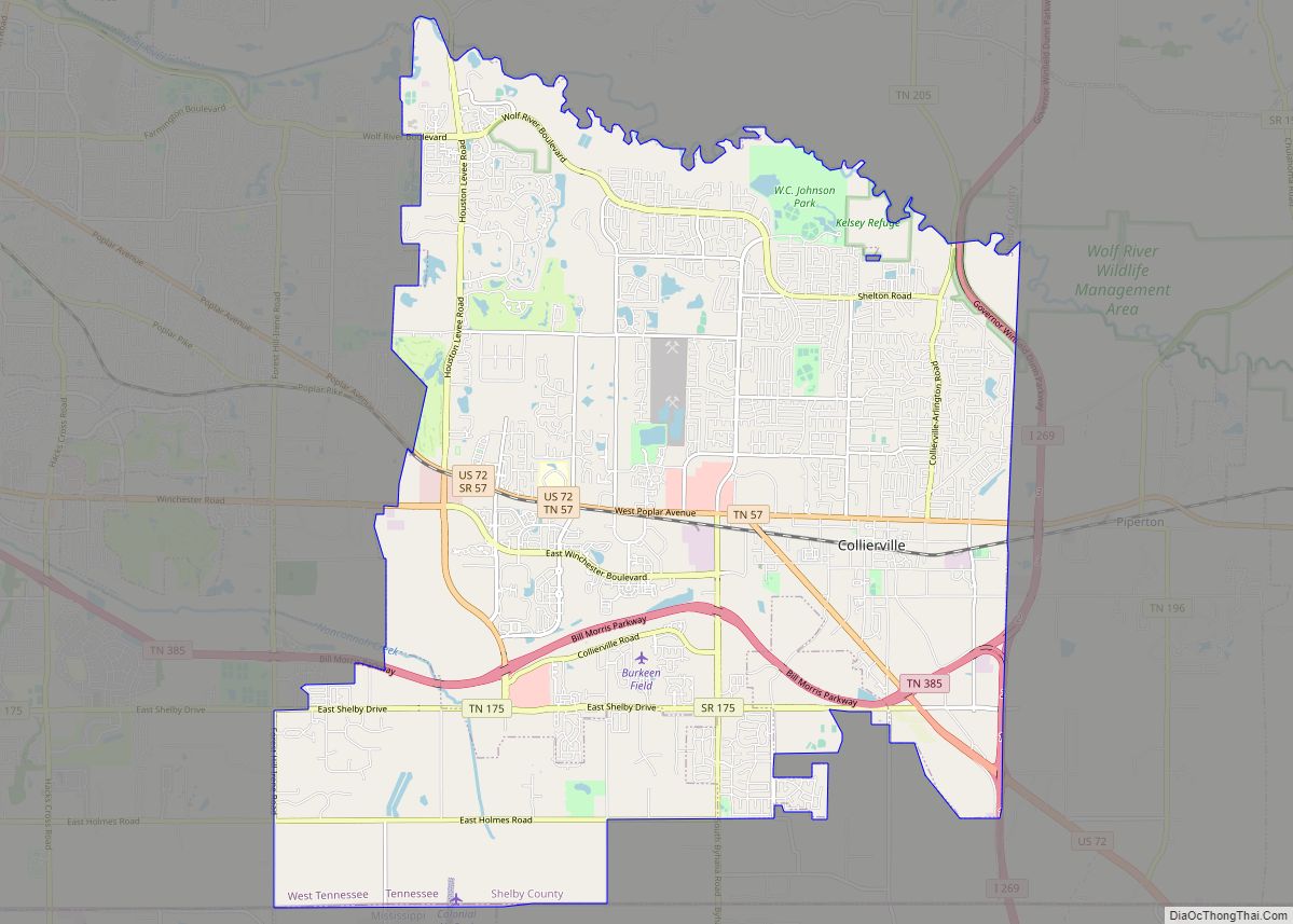
Piperton Road Map
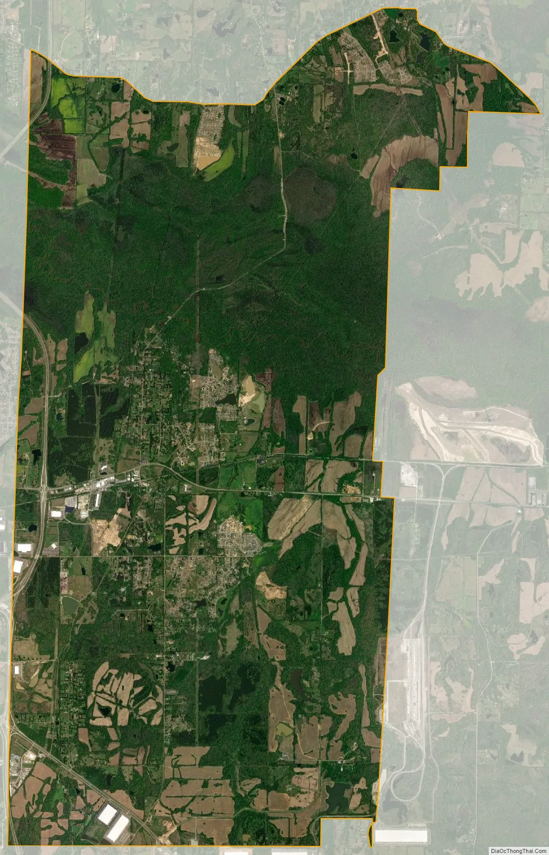
Piperton city Satellite Map
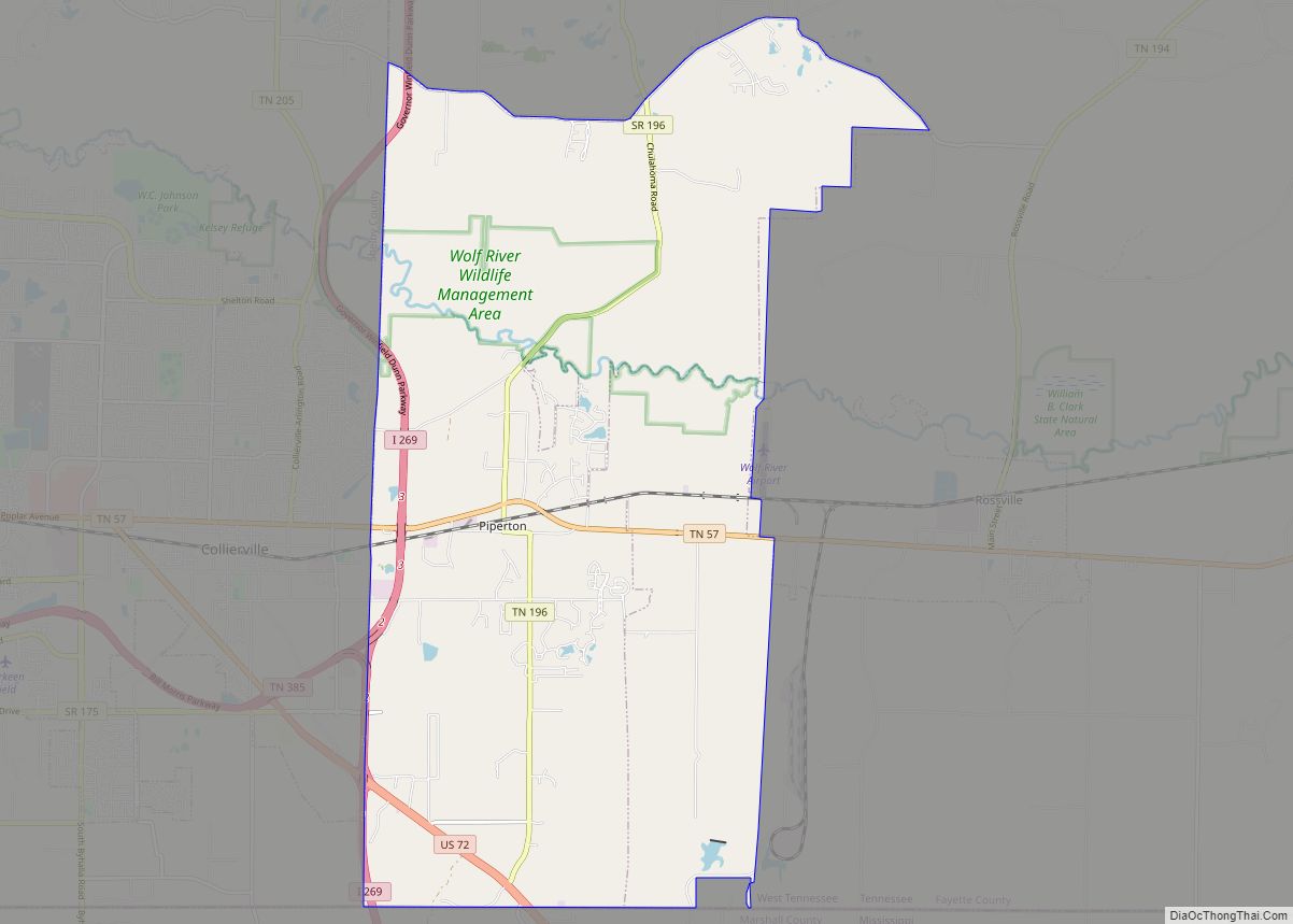
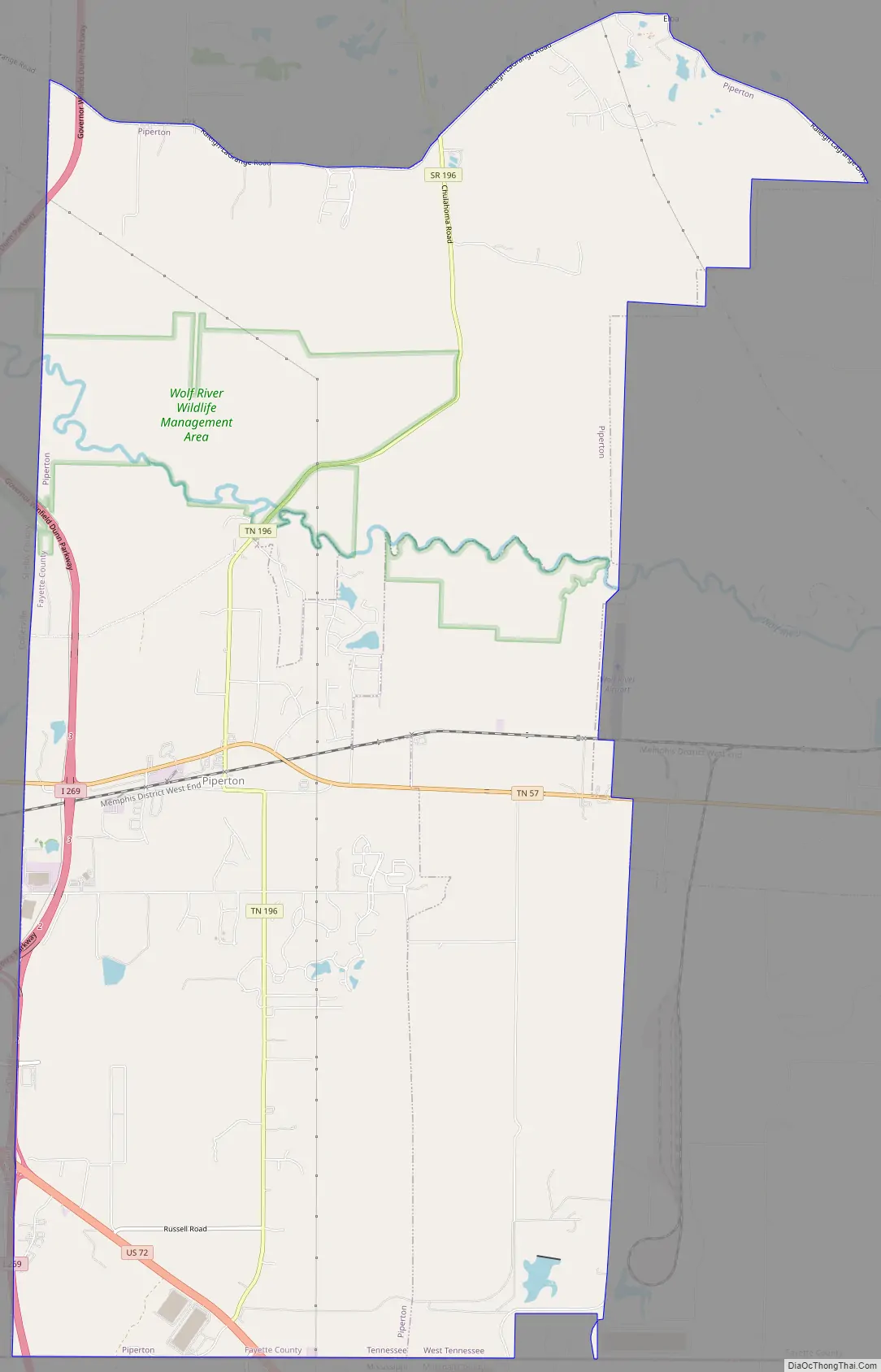
Geography
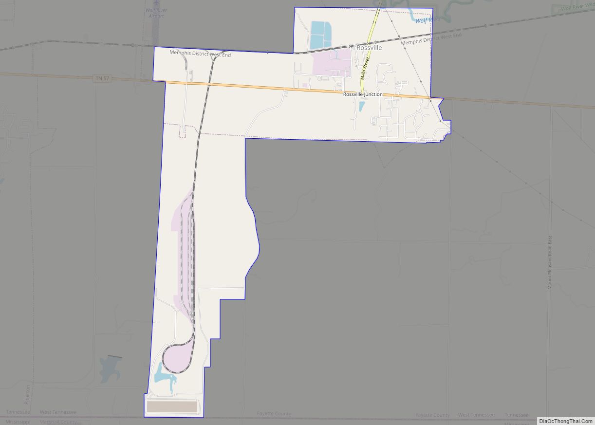
Piperton is located in the southwest corner of Fayette County at 35°2′42″N 89°37′24″W / 35.04500°N 89.62333°W / 35.04500; -89.62333 (35.045003, -89.623451). It is bordered to the west by Collierville in Shelby County, to the east by Rossville, and to the south by Marshall County, Mississippi.
According to the United States Census Bureau, the city has a total area of 27.3 square miles (70.7 km), of which 27.2 square miles (70.4 km) is land and 0.1 square miles (0.3 km), or 0.45%, is water. The city’s area nearly tripled between 2000 and 2010, from an area in 2000 of 9.8 square miles (25 km).
Major thoroughfares
- U.S. Route 72 crosses the southern part of the city, leading northwest into Collierville and 26 miles (42 km) to downtown Memphis. To the southeast, US 72 crosses into Mississippi and leads 64 miles (103 km) to Corinth.
- State Route 57 passes through central Piperton, leading west into Collierville and east 25 miles (40 km) to Grand Junction.
- State Route 196 crosses TN 57 at the center of Piperton and leads north 21 miles (34 km) to Gallaway. The southern terminus of TN 196 is at US 72 just north of the Mississippi border in southern Piperton.
- State Route 385 (Nonconnah/Bill Morris Parkway), the Memphis outer beltway, passes through the western part of Piperton, with access from TN 57.
- Interstate 269 has an interchange with TN 385 at the Piperton/Collierville border. To the north of the interchange, I-269 is the new numbering for the beltway, while to the south, I-269 leads into Mississippi, with one exit in Piperton at US 72.
See also
Map of Tennessee State and its subdivision:- Anderson
- Bedford
- Benton
- Bledsoe
- Blount
- Bradley
- Campbell
- Cannon
- Carroll
- Carter
- Cheatham
- Chester
- Claiborne
- Clay
- Cocke
- Coffee
- Crockett
- Cumberland
- Davidson
- Decatur
- DeKalb
- Dickson
- Dyer
- Fayette
- Fentress
- Franklin
- Gibson
- Giles
- Grainger
- Greene
- Grundy
- Hamblen
- Hamilton
- Hancock
- Hardeman
- Hardin
- Hawkins
- Haywood
- Henderson
- Henry
- Hickman
- Houston
- Humphreys
- Jackson
- Jefferson
- Johnson
- Knox
- Lake
- Lauderdale
- Lawrence
- Lewis
- Lincoln
- Loudon
- Macon
- Madison
- Marion
- Marshall
- Maury
- McMinn
- McNairy
- Meigs
- Monroe
- Montgomery
- Moore
- Morgan
- Obion
- Overton
- Perry
- Pickett
- Polk
- Putnam
- Rhea
- Roane
- Robertson
- Rutherford
- Scott
- Sequatchie
- Sevier
- Shelby
- Smith
- Stewart
- Sullivan
- Sumner
- Tipton
- Trousdale
- Unicoi
- Union
- Van Buren
- Warren
- Washington
- Wayne
- Weakley
- White
- Williamson
- Wilson
- Alabama
- Alaska
- Arizona
- Arkansas
- California
- Colorado
- Connecticut
- Delaware
- District of Columbia
- Florida
- Georgia
- Hawaii
- Idaho
- Illinois
- Indiana
- Iowa
- Kansas
- Kentucky
- Louisiana
- Maine
- Maryland
- Massachusetts
- Michigan
- Minnesota
- Mississippi
- Missouri
- Montana
- Nebraska
- Nevada
- New Hampshire
- New Jersey
- New Mexico
- New York
- North Carolina
- North Dakota
- Ohio
- Oklahoma
- Oregon
- Pennsylvania
- Rhode Island
- South Carolina
- South Dakota
- Tennessee
- Texas
- Utah
- Vermont
- Virginia
- Washington
- West Virginia
- Wisconsin
- Wyoming