Waverly is a city in and the county seat of Humphreys County, Tennessee, United States. The population was 4,297 at the 2020 census.
| Name: | Waverly city |
|---|---|
| LSAD Code: | 25 |
| LSAD Description: | city (suffix) |
| State: | Tennessee |
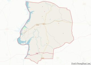
| County: | Humphreys County |
| Incorporated: | 1838 |
| Elevation: | 535 ft (163 m) |
| Total Area: | 8.71 sq mi (22.57 km²) |
| Land Area: | 8.71 sq mi (22.57 km²) |
| Water Area: | 0.00 sq mi (0.00 km²) |
| Total Population: | 4,297 |
| Population Density: | 493.11/sq mi (190.40/km²) |
| ZIP code: | 37185 |
| Area code: | 931 |
| FIPS code: | 4778560 |
| GNISfeature ID: | 1273950 |
| Website: | waverlytn.org |
Online Interactive Map
Click on ![]() to view map in "full screen" mode.
to view map in "full screen" mode.
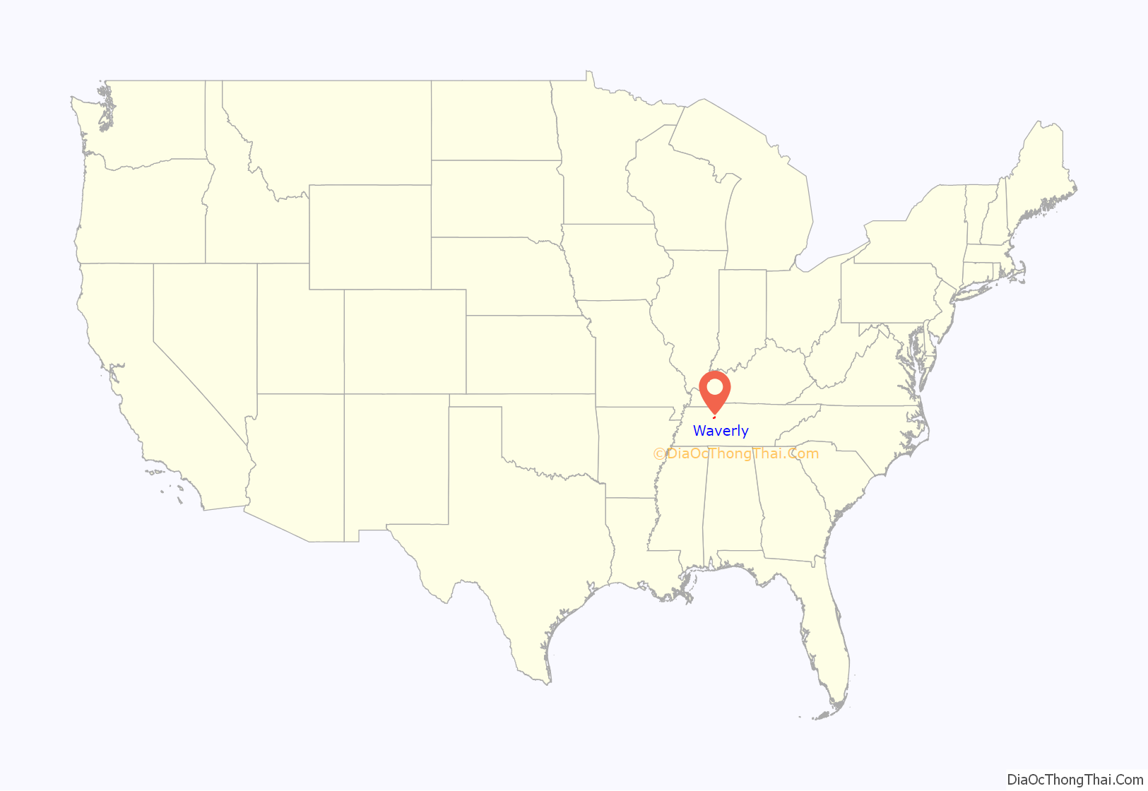
Waverly location map. Where is Waverly city?

History
Waverly was established by Steven Pavatt as a stop along the stagecoach road between Nashville and Memphis in the early 19th century. Pavatt was a fan of the author Sir Walter Scott, and named the community after Scott’s Waverley Novels. When Humphreys County was created in 1803, Reynoldsburg, located northwest of Waverly along the Tennessee River, was chosen as the county seat. However, when county lands on the west bank of the Tennessee split off to become part of the newly created Benton County in 1835, the Humphreys County seat was moved to Waverly, which had become the more central location in the county. A courthouse was built in 1836, and the town was officially incorporated in 1838.
Like most of Middle and West Tennessee, Waverly was staunchly pro-Confederacy during the American Civil War. Humphreys County voted unanimously in favor of secession in 1861. Union troops occupied the town in 1863 to guard the railroad between White Bluff and Johnsonville (now Old Johnsonville), the latter being a Federal supply depot and transfer station. The Union troops managed to build a fort at the courthouse square, although they were constantly harassed by Confederate guerillas. On November 4, 1864, Confederate troops under Nathan Bedford Forrest attacked and destroyed the Federal depot in what became known as the Battle of Johnsonville. The battle occurred approximately 10 miles (16 km) west of Waverly at the mouth of Trace Creek.
Hurricane Mills, located a few miles south of Waverly along TN-13, was the site of a substantial mill and carding factory in the late 19th and early 20th centuries. A Mississippian-era prehistoric village (known as the Duck River Temple Mounds or Link Farm Site) and a farm owned by Jesse James were both located near the Link farm site in the vicinity of Hurricane Mills.
On February 24, 1978, a propane tank car explosion occurred in downtown Waverly after an L&N train derailed. The explosion, which killed 16 people, led to an overhaul of the methods used by the Tennessee Emergency Management Agency when responding to hazardous material spills. It also led to various strengthened standards and regulations (e.g., for design and construction of rail cars) by the National Transportation Safety Board.
During the morning of August 21, 2021, very heavy rainfall and totals of over 17 inches (43 cm) caused Trace Creek to overflow in the middle of town, leading to catastrophic flooding in Waverly. Floodwaters impacted many homes and businesses, electric, telephone, and water services, churches, and Waverly Elementary School. Many structures were flooded with up to 4 feet (1.2 m) of water, with numerous homes washed completely off their foundations. All roads in and out of town were made impassable, and 20 people were killed in Humphreys County.
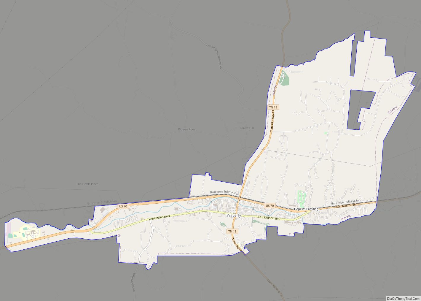
Waverly Road Map

Waverly city Satellite Map

Geography
Waverly is located at 36°5′9″N 87°47′13″W / 36.08583°N 87.78694°W / 36.08583; -87.78694 (36.085847, −87.786917). The city is situated in the Trace Creek Valley, just over 10 miles (16 km) east of the creek’s confluence with the Kentucky Lake impoundment of the Tennessee River. The low ridges that “wall in” Waverly to the north and south represent the fringe of the western section of the Highland Rim.
Waverly is centered on the junction of U.S. Route 70, which connects the city to Nashville to the east and Memphis to the west, and State Route 13, which connects the city to Hurricane Mills and Interstate 40 to the south and the rural areas around Erin to the north.
According to the United States Census Bureau, the city has a total area of 8.1 square miles (21 km), all of it land.
See also
Map of Tennessee State and its subdivision:- Anderson
- Bedford
- Benton
- Bledsoe
- Blount
- Bradley
- Campbell
- Cannon
- Carroll
- Carter
- Cheatham
- Chester
- Claiborne
- Clay
- Cocke
- Coffee
- Crockett
- Cumberland
- Davidson
- Decatur
- DeKalb
- Dickson
- Dyer
- Fayette
- Fentress
- Franklin
- Gibson
- Giles
- Grainger
- Greene
- Grundy
- Hamblen
- Hamilton
- Hancock
- Hardeman
- Hardin
- Hawkins
- Haywood
- Henderson
- Henry
- Hickman
- Houston
- Humphreys
- Jackson
- Jefferson
- Johnson
- Knox
- Lake
- Lauderdale
- Lawrence
- Lewis
- Lincoln
- Loudon
- Macon
- Madison
- Marion
- Marshall
- Maury
- McMinn
- McNairy
- Meigs
- Monroe
- Montgomery
- Moore
- Morgan
- Obion
- Overton
- Perry
- Pickett
- Polk
- Putnam
- Rhea
- Roane
- Robertson
- Rutherford
- Scott
- Sequatchie
- Sevier
- Shelby
- Smith
- Stewart
- Sullivan
- Sumner
- Tipton
- Trousdale
- Unicoi
- Union
- Van Buren
- Warren
- Washington
- Wayne
- Weakley
- White
- Williamson
- Wilson
- Alabama
- Alaska
- Arizona
- Arkansas
- California
- Colorado
- Connecticut
- Delaware
- District of Columbia
- Florida
- Georgia
- Hawaii
- Idaho
- Illinois
- Indiana
- Iowa
- Kansas
- Kentucky
- Louisiana
- Maine
- Maryland
- Massachusetts
- Michigan
- Minnesota
- Mississippi
- Missouri
- Montana
- Nebraska
- Nevada
- New Hampshire
- New Jersey
- New Mexico
- New York
- North Carolina
- North Dakota
- Ohio
- Oklahoma
- Oregon
- Pennsylvania
- Rhode Island
- South Carolina
- South Dakota
- Tennessee
- Texas
- Utah
- Vermont
- Virginia
- Washington
- West Virginia
- Wisconsin
- Wyoming