Pleasant Hill is a city in Polk County, Iowa, United States. The population was 10,147 at the time of the 2020 census. It is part of the Des Moines metropolitan area. As of July 2005, Pleasant Hill was assigned a ZIP code, 50327.
| Name: | Pleasant Hill city |
|---|---|
| LSAD Code: | 25 |
| LSAD Description: | city (suffix) |
| State: | Iowa |
| County: | Polk County |
| Elevation: | 876 ft (267 m) |
| Total Area: | 10.85 sq mi (28.09 km²) |
| Land Area: | 10.48 sq mi (27.13 km²) |
| Water Area: | 0.37 sq mi (0.96 km²) |
| Total Population: | 10,147 |
| Population Density: | 968.59/sq mi (373.98/km²) |
| ZIP code: | 50317, 50327 |
| Area code: | 515 |
| FIPS code: | 1963525 |
| GNISfeature ID: | 0460234 |
| Website: | www.pleasanthilliowa.org |
Online Interactive Map
Click on ![]() to view map in "full screen" mode.
to view map in "full screen" mode.
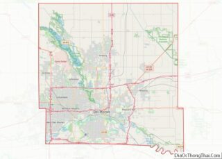
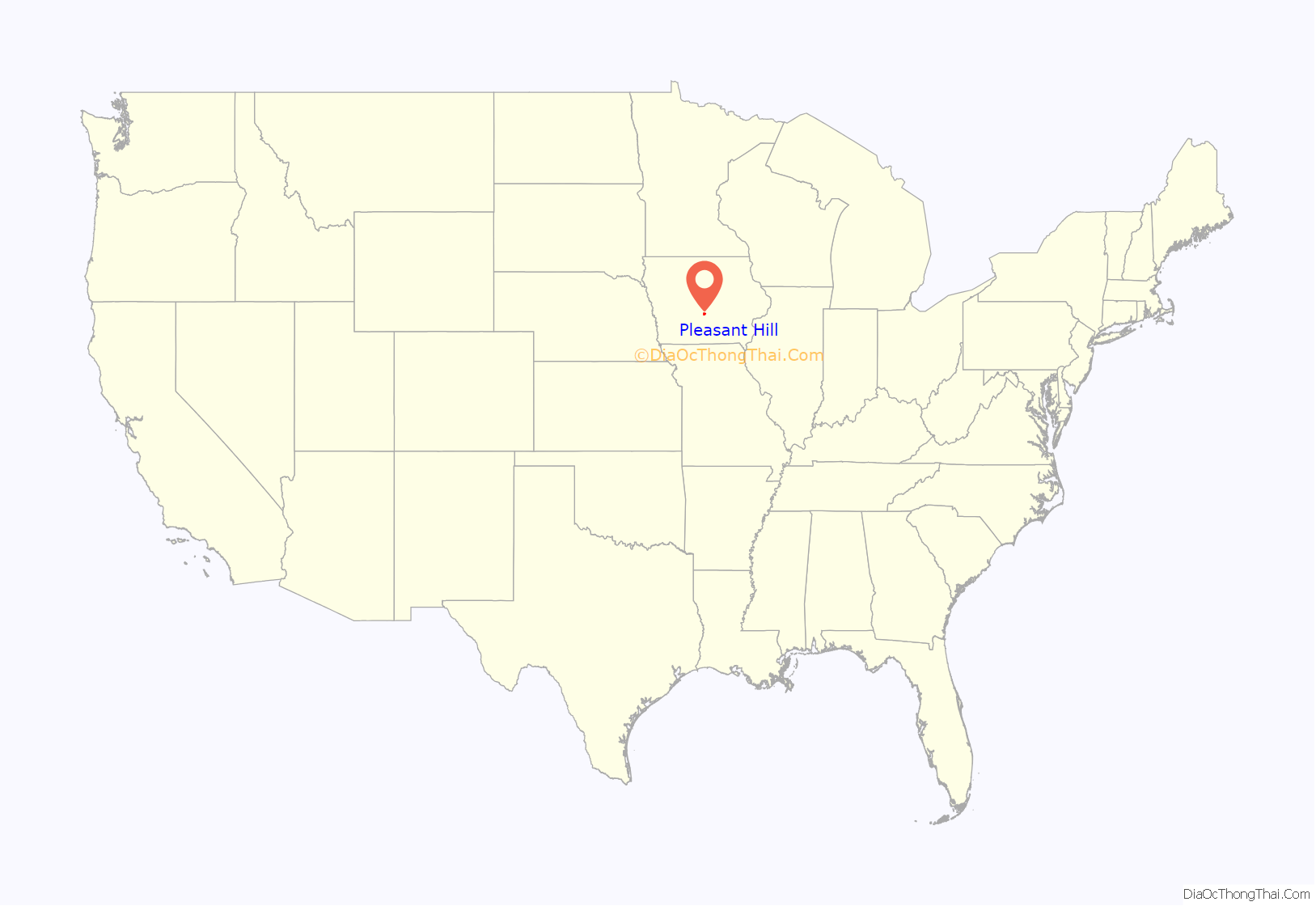
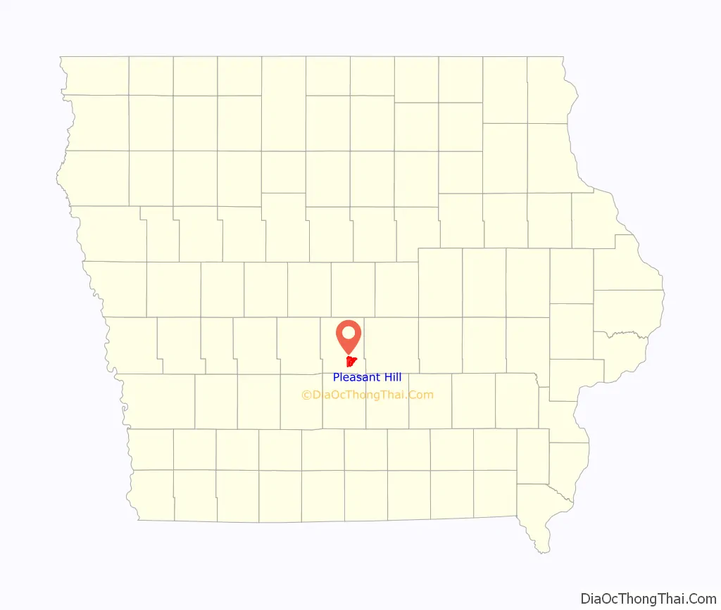
Pleasant Hill location map. Where is Pleasant Hill city?
History
Pleasant Hill incorporated as a city on May 12, 1956.
1983 explosion
On November 20, 1983, an explosion of an explosives storage bunker just south of Pleasant Hill occurred. Reports were that two teenagers were hunting around the area. One of the teenagers may have shot a bullet from a hill which penetrated the bunker ceiling, which was deemed the probable cause of the explosion. The two teenagers were killed in the explosion, leaving only small pieces of shirts. The explosion was felt 45 miles away from the site. At least 25 homes within a one-mile radius of the explosion suffered damage, doors and windows were blown out, ceilings fell and houses were knocked off their foundations, police said. One house, 300 yards directly up the valley from the shack, suffered an inch-wide crack the entire width of its basement wall.
Pleasant Hill Road Map
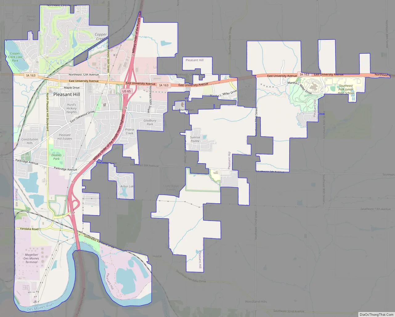
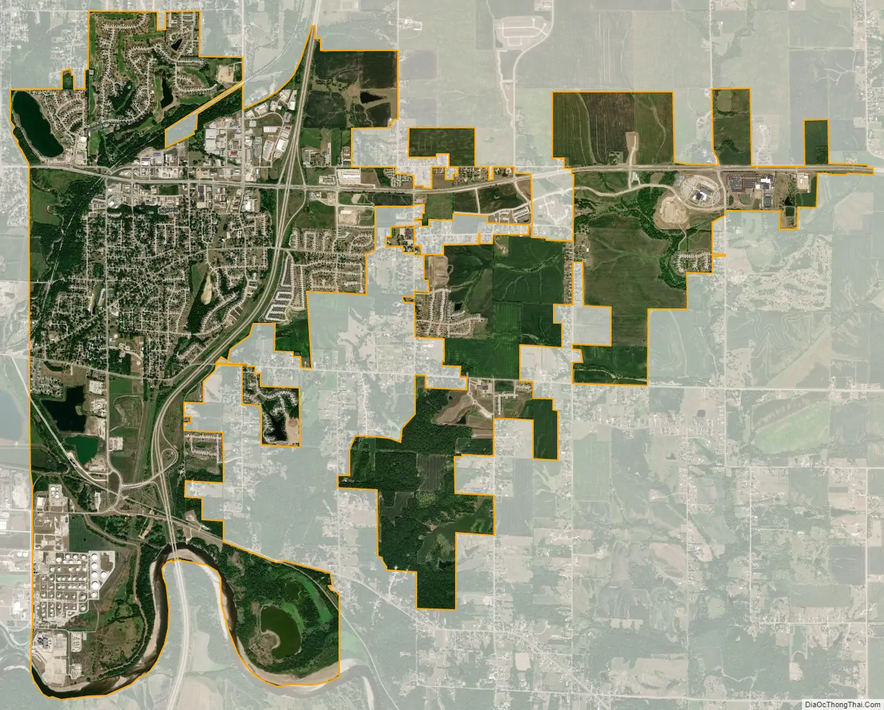
Pleasant Hill city Satellite Map
Geography
According to the United States Census Bureau, the city has a total area of 9.29 square miles (24.06 km), of which 9.15 square miles (23.70 km) is land and 0.14 square miles (0.36 km) is water.
See also
Map of Iowa State and its subdivision:- Adair
- Adams
- Allamakee
- Appanoose
- Audubon
- Benton
- Black Hawk
- Boone
- Bremer
- Buchanan
- Buena Vista
- Butler
- Calhoun
- Carroll
- Cass
- Cedar
- Cerro Gordo
- Cherokee
- Chickasaw
- Clarke
- Clay
- Clayton
- Clinton
- Crawford
- Dallas
- Davis
- Decatur
- Delaware
- Des Moines
- Dickinson
- Dubuque
- Emmet
- Fayette
- Floyd
- Franklin
- Fremont
- Greene
- Grundy
- Guthrie
- Hamilton
- Hancock
- Hardin
- Harrison
- Henry
- Howard
- Humboldt
- Ida
- Iowa
- Jackson
- Jasper
- Jefferson
- Johnson
- Jones
- Keokuk
- Kossuth
- Lee
- Linn
- Louisa
- Lucas
- Lyon
- Madison
- Mahaska
- Marion
- Marshall
- Mills
- Mitchell
- Monona
- Monroe
- Montgomery
- Muscatine
- O'Brien
- Osceola
- Page
- Palo Alto
- Plymouth
- Pocahontas
- Polk
- Pottawattamie
- Poweshiek
- Ringgold
- Sac
- Scott
- Shelby
- Sioux
- Story
- Tama
- Taylor
- Union
- Van Buren
- Wapello
- Warren
- Washington
- Wayne
- Webster
- Winnebago
- Winneshiek
- Woodbury
- Worth
- Wright
- Alabama
- Alaska
- Arizona
- Arkansas
- California
- Colorado
- Connecticut
- Delaware
- District of Columbia
- Florida
- Georgia
- Hawaii
- Idaho
- Illinois
- Indiana
- Iowa
- Kansas
- Kentucky
- Louisiana
- Maine
- Maryland
- Massachusetts
- Michigan
- Minnesota
- Mississippi
- Missouri
- Montana
- Nebraska
- Nevada
- New Hampshire
- New Jersey
- New Mexico
- New York
- North Carolina
- North Dakota
- Ohio
- Oklahoma
- Oregon
- Pennsylvania
- Rhode Island
- South Carolina
- South Dakota
- Tennessee
- Texas
- Utah
- Vermont
- Virginia
- Washington
- West Virginia
- Wisconsin
- Wyoming