Alsip is a village in Cook County, Illinois, United States. The population was 19,063 at the 2020 census. It is part of the Chicago metropolitan area.
Alsip was settled in the 1830s by German and Dutch farmers. The village is named after Frank Alsip, the owner of a brickyard that opened there in 1885. The village began to grow after the Tri-State Tollway was built there in 1959.
| Name: | Alsip village |
|---|---|
| LSAD Code: | 47 |
| LSAD Description: | village (suffix) |
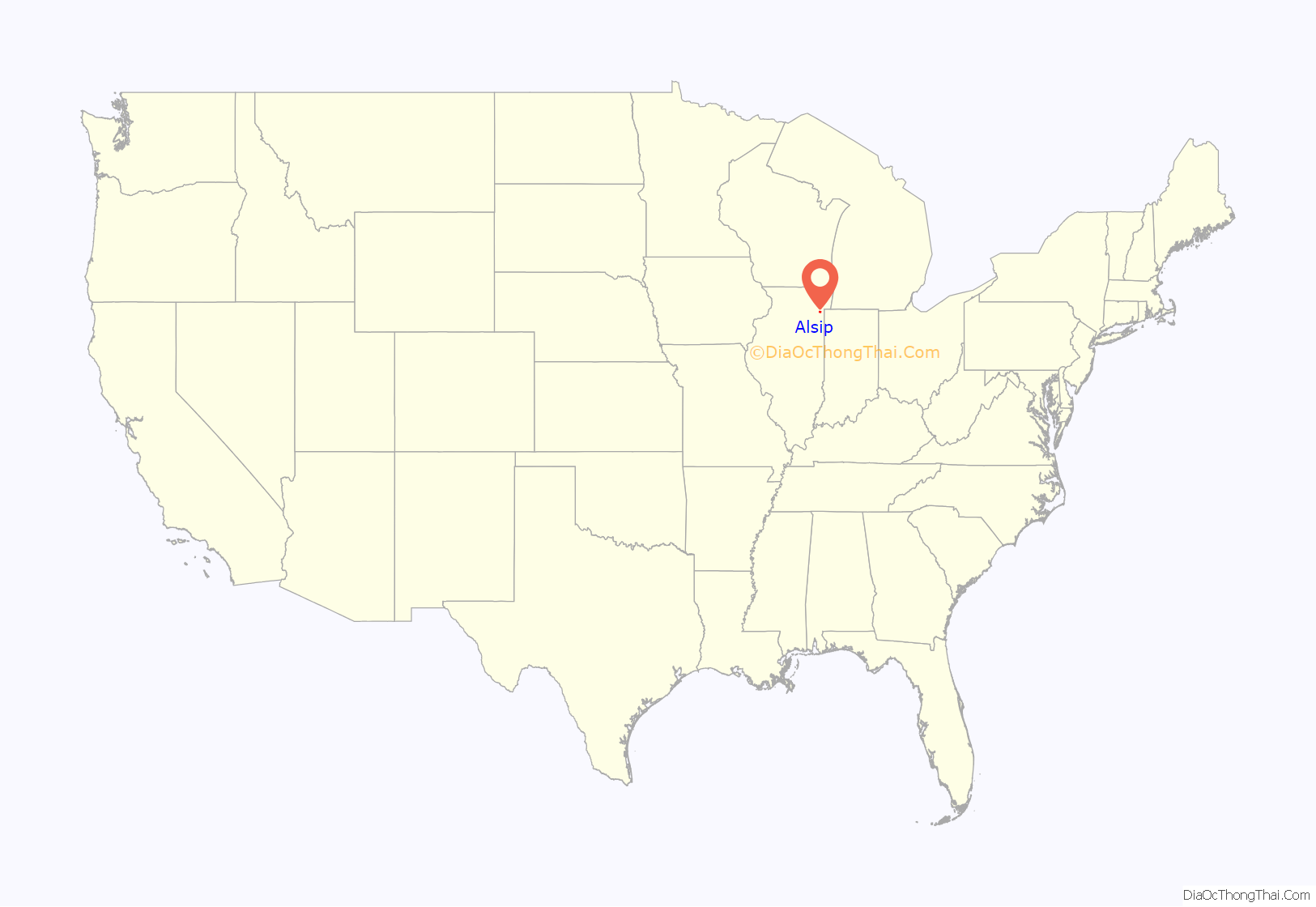
| State: | Illinois |
| County: | Cook County |
| Incorporated: | 1840 |
| Total Area: | 6.63 sq mi (17.16 km²) |
| Land Area: | 6.53 sq mi (16.90 km²) |
| Water Area: | 0.10 sq mi (0.26 km²) 1.54% |
| Total Population: | 19,063 |
| Population Density: | 2,921.53/sq mi (1,127.97/km²) |
| Area code: | 708/464 |
| FIPS code: | 1701010 |
| Website: | villageofalsip.org |
Online Interactive Map
Click on ![]() to view map in "full screen" mode.
to view map in "full screen" mode.
Alsip location map. Where is Alsip village?
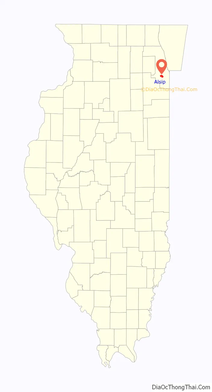
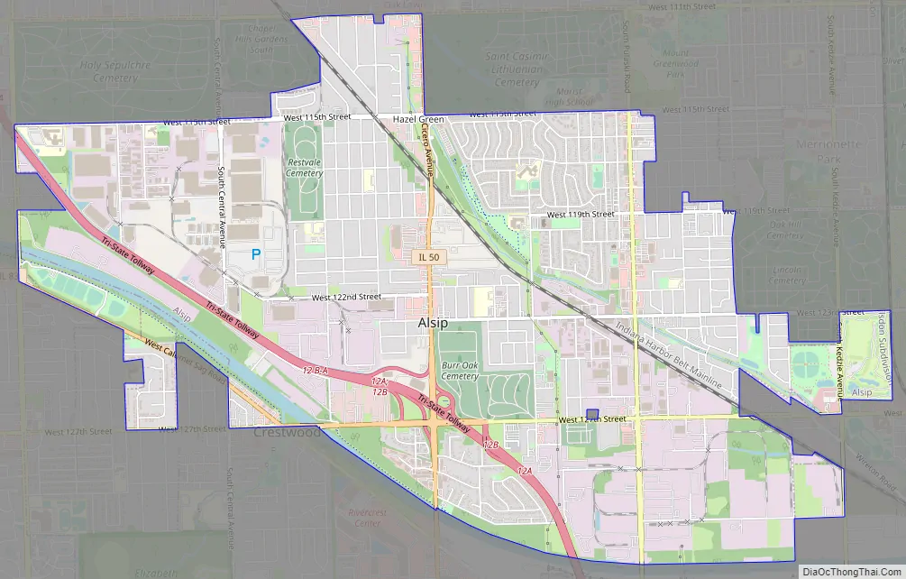
Alsip Road Map
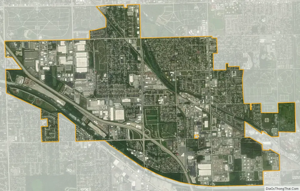
Alsip city Satellite Map
Geography
Alsip is located at 41°40′14″N 87°43′56″W / 41.67056°N 87.73222°W / 41.67056; -87.73222 (41.670433, -87.732199).
According to the 2021 census gazetteer files, Alsip has a total area of 6.63 square miles (17.17 km), of which 6.53 square miles (16.91 km) (or 98.49%) is land and 0.10 square miles (0.26 km) (or 1.51%) is water.
Alsip is bordered to the west by the villages of Worth and Palos Heights. To the south is Crestwood. Oak Lawn lies to the north. Merrionette Park, Blue Island, and Robbins lie to the east (north-south, respectively). The Mount Greenwood neighborhood of Chicago lies to the north and east.
Most of the town lies to the north of the Cal-Sag Channel. However, Chippewa Ridge subdivision, which was built upon the former Alsip Nursery, lies southwest of the Cal-Sag. In conjunction with the Illinois Department of Natural Resources and the Water Reclamation District of Chicago, the village operates a boat launch on the canal, permitting inland access to Lake Michigan.
The Alsip area is home to two predominantly African-American cemeteries, Burr Oak and Restvale cemeteries, which are the resting places of many Chicago blues musicians (including Muddy Waters, Willie Dixon and Dinah Washington), athletes (Jimmie Crutchfield), and other celebrities. Emmett Till, whose murder in Mississippi at age 14 in 1955 was an important moment in the Civil Rights Movement, is buried at Burr Oak. In 2004, that cemetery was covered in the national media when the murder investigation was re-opened, and Till’s body was exhumed.
Six years later, on July 9, 2010, Cook County Sheriff Tom Dart alleged that four workers at Burr Oak cemetery dug up more than 200 graves, dumped the bodies into unmarked mass graves, and resold the plots to unsuspecting members of the public. The three men and one woman were charged and convicted with one count each of dismembering a human body.
See also
Map of Illinois State and its subdivision:- Adams
- Alexander
- Bond
- Boone
- Brown
- Bureau
- Calhoun
- Carroll
- Cass
- Champaign
- Christian
- Clark
- Clay
- Clinton
- Coles
- Cook
- Crawford
- Cumberland
- De Kalb
- De Witt
- Douglas
- Dupage
- Edgar
- Edwards
- Effingham
- Fayette
- Ford
- Franklin
- Fulton
- Gallatin
- Greene
- Grundy
- Hamilton
- Hancock
- Hardin
- Henderson
- Henry
- Iroquois
- Jackson
- Jasper
- Jefferson
- Jersey
- Jo Daviess
- Johnson
- Kane
- Kankakee
- Kendall
- Knox
- La Salle
- Lake
- Lake Michigan
- Lawrence
- Lee
- Livingston
- Logan
- Macon
- Macoupin
- Madison
- Marion
- Marshall
- Mason
- Massac
- McDonough
- McHenry
- McLean
- Menard
- Mercer
- Monroe
- Montgomery
- Morgan
- Moultrie
- Ogle
- Peoria
- Perry
- Piatt
- Pike
- Pope
- Pulaski
- Putnam
- Randolph
- Richland
- Rock Island
- Saint Clair
- Saline
- Sangamon
- Schuyler
- Scott
- Shelby
- Stark
- Stephenson
- Tazewell
- Union
- Vermilion
- Wabash
- Warren
- Washington
- Wayne
- White
- Whiteside
- Will
- Williamson
- Winnebago
- Woodford
- Alabama
- Alaska
- Arizona
- Arkansas
- California
- Colorado
- Connecticut
- Delaware
- District of Columbia
- Florida
- Georgia
- Hawaii
- Idaho
- Illinois
- Indiana
- Iowa
- Kansas
- Kentucky
- Louisiana
- Maine
- Maryland
- Massachusetts
- Michigan
- Minnesota
- Mississippi
- Missouri
- Montana
- Nebraska
- Nevada
- New Hampshire
- New Jersey
- New Mexico
- New York
- North Carolina
- North Dakota
- Ohio
- Oklahoma
- Oregon
- Pennsylvania
- Rhode Island
- South Carolina
- South Dakota
- Tennessee
- Texas
- Utah
- Vermont
- Virginia
- Washington
- West Virginia
- Wisconsin
- Wyoming


