Athens /ˈeɪθənz/ AY-thənz is a city in Menard County, Illinois, United States. The population was 1,977 at the 2020 census. It is part of the Springfield, Illinois Metropolitan Statistical Area.
| Name: | Athens city |
|---|---|
| LSAD Code: | 25 |
| LSAD Description: | city (suffix) |
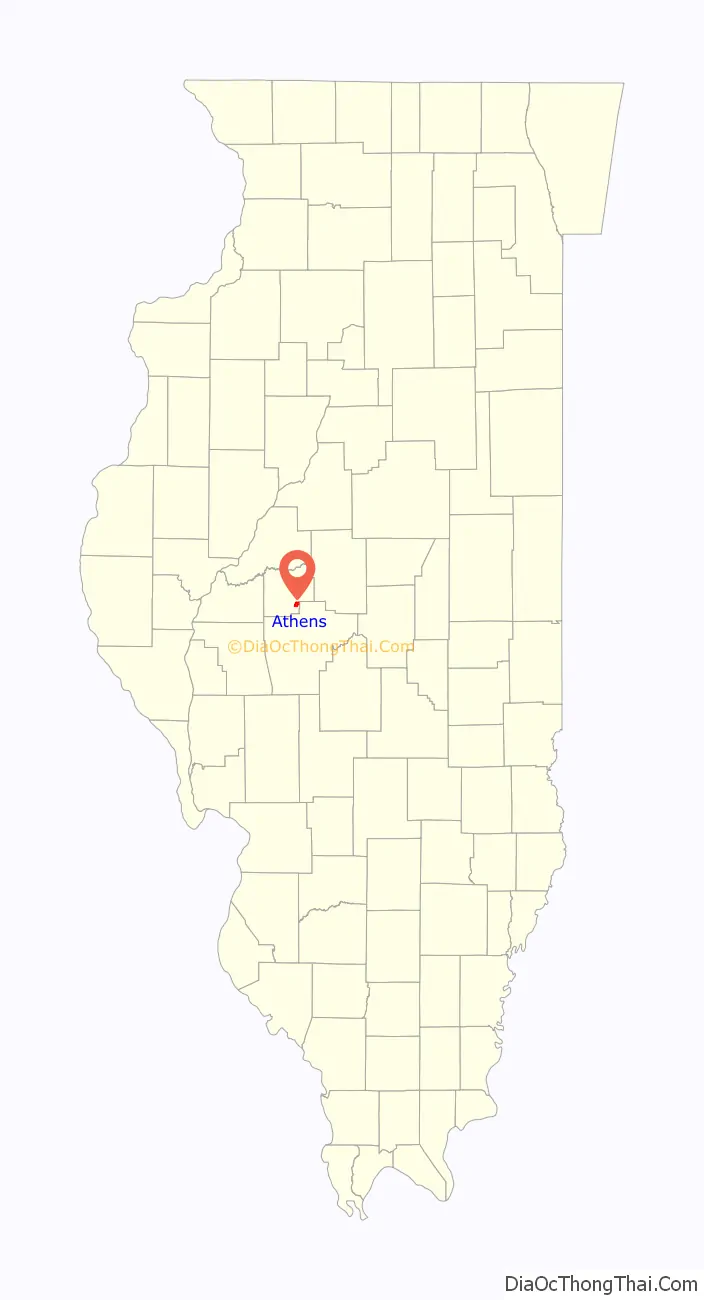
| State: | Illinois |
| County: | Menard County |
| Elevation: | 604 ft (184 m) |
| Total Area: | 1.68 sq mi (4.36 km²) |
| Land Area: | 1.68 sq mi (4.36 km²) |
| Water Area: | 0.00 sq mi (0.00 km²) |
| Total Population: | 1,977 |
| Population Density: | 1,173.99/sq mi (453.27/km²) |
| ZIP code: | 62613 |
| Area code: | 217 |
| FIPS code: | 1702674 |
| GNISfeature ID: | 2394010 |
| Website: | www.athensil.com |
Online Interactive Map
Click on ![]() to view map in "full screen" mode.
to view map in "full screen" mode.
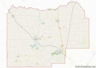
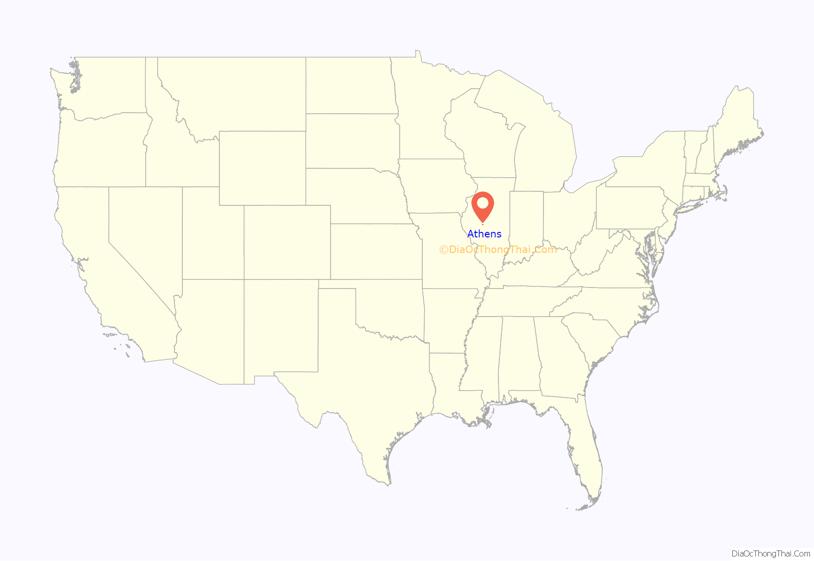
Athens location map. Where is Athens city?
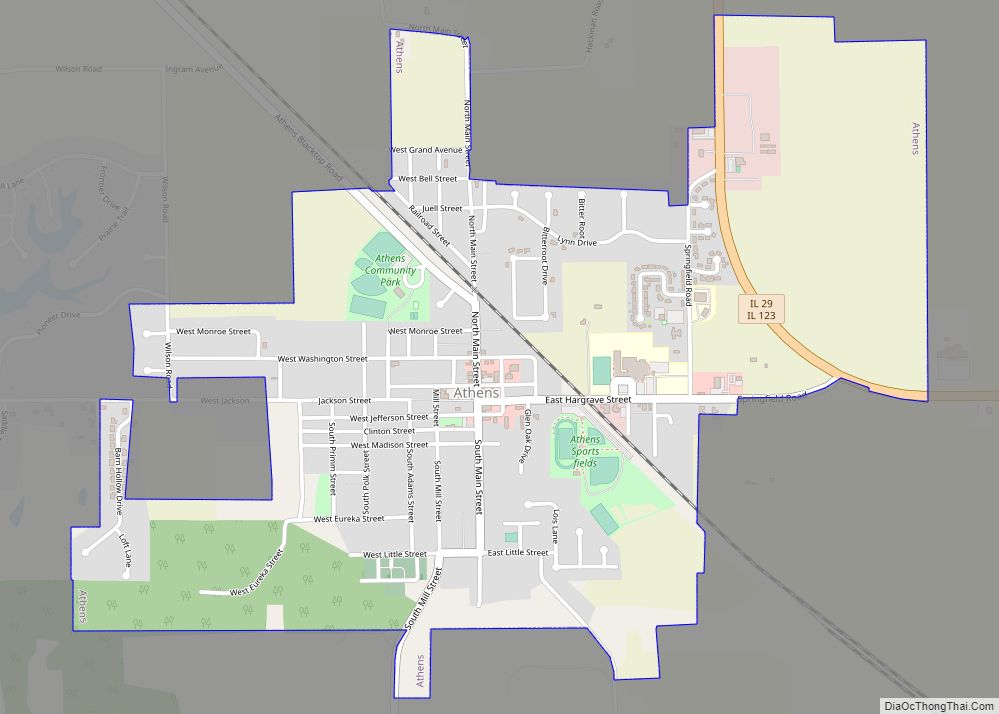
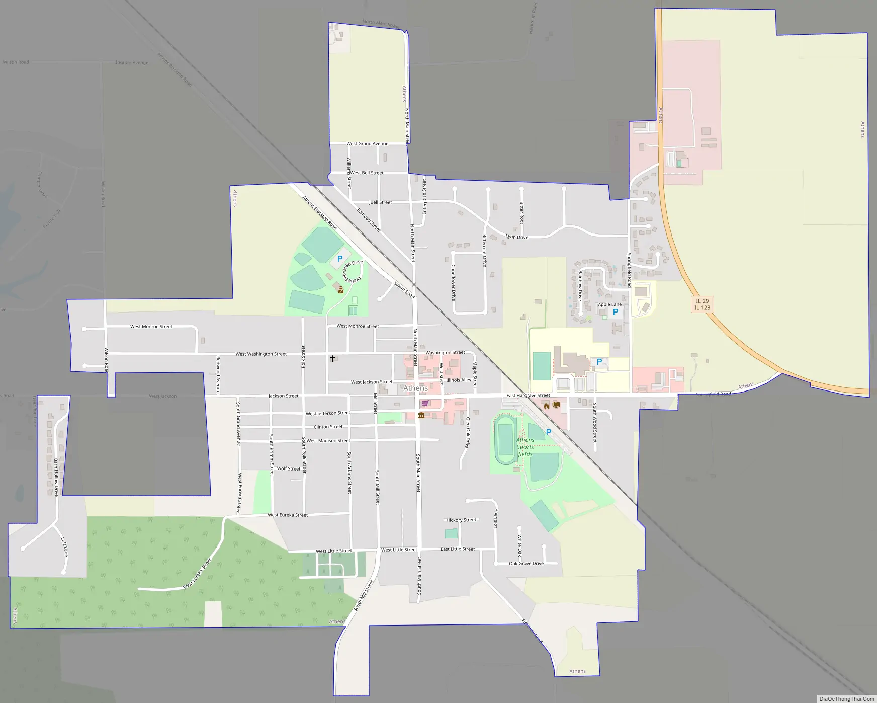
Athens Road Map
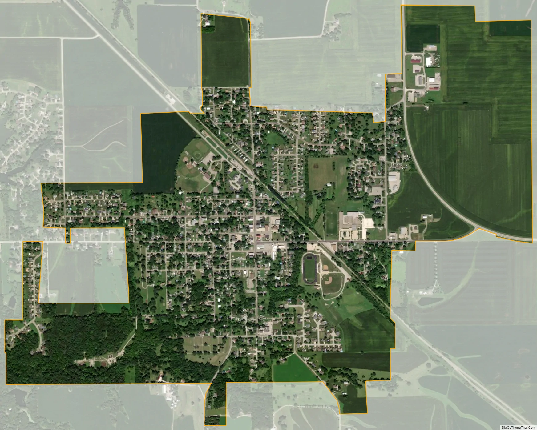
Athens city Satellite Map
Geography
Athens is in southeastern Menard County, 9 miles (14 km) southeast of Petersburg, the county seat. Illinois Routes 29 and 123 pass together through the northeast side of the city. IL 29 leads south 14 miles (23 km) to Springfield, the state capital, and north 18 miles (29 km) to Mason City, while IL 123 leads east 8 miles (13 km) to Williamsville and northwest to Petersburg.
According to the U.S. Census Bureau, the city of Athens has an area of 1.68 square miles (4.4 km), all land. Town Branch flows westward across the southwest corner of the city, leading 2 miles (3 km) to the Sangamon River, part of the Illinois River watershed.
See also
Map of Illinois State and its subdivision:- Adams
- Alexander
- Bond
- Boone
- Brown
- Bureau
- Calhoun
- Carroll
- Cass
- Champaign
- Christian
- Clark
- Clay
- Clinton
- Coles
- Cook
- Crawford
- Cumberland
- De Kalb
- De Witt
- Douglas
- Dupage
- Edgar
- Edwards
- Effingham
- Fayette
- Ford
- Franklin
- Fulton
- Gallatin
- Greene
- Grundy
- Hamilton
- Hancock
- Hardin
- Henderson
- Henry
- Iroquois
- Jackson
- Jasper
- Jefferson
- Jersey
- Jo Daviess
- Johnson
- Kane
- Kankakee
- Kendall
- Knox
- La Salle
- Lake
- Lake Michigan
- Lawrence
- Lee
- Livingston
- Logan
- Macon
- Macoupin
- Madison
- Marion
- Marshall
- Mason
- Massac
- McDonough
- McHenry
- McLean
- Menard
- Mercer
- Monroe
- Montgomery
- Morgan
- Moultrie
- Ogle
- Peoria
- Perry
- Piatt
- Pike
- Pope
- Pulaski
- Putnam
- Randolph
- Richland
- Rock Island
- Saint Clair
- Saline
- Sangamon
- Schuyler
- Scott
- Shelby
- Stark
- Stephenson
- Tazewell
- Union
- Vermilion
- Wabash
- Warren
- Washington
- Wayne
- White
- Whiteside
- Will
- Williamson
- Winnebago
- Woodford
- Alabama
- Alaska
- Arizona
- Arkansas
- California
- Colorado
- Connecticut
- Delaware
- District of Columbia
- Florida
- Georgia
- Hawaii
- Idaho
- Illinois
- Indiana
- Iowa
- Kansas
- Kentucky
- Louisiana
- Maine
- Maryland
- Massachusetts
- Michigan
- Minnesota
- Mississippi
- Missouri
- Montana
- Nebraska
- Nevada
- New Hampshire
- New Jersey
- New Mexico
- New York
- North Carolina
- North Dakota
- Ohio
- Oklahoma
- Oregon
- Pennsylvania
- Rhode Island
- South Carolina
- South Dakota
- Tennessee
- Texas
- Utah
- Vermont
- Virginia
- Washington
- West Virginia
- Wisconsin
- Wyoming