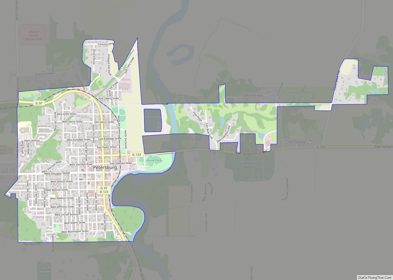
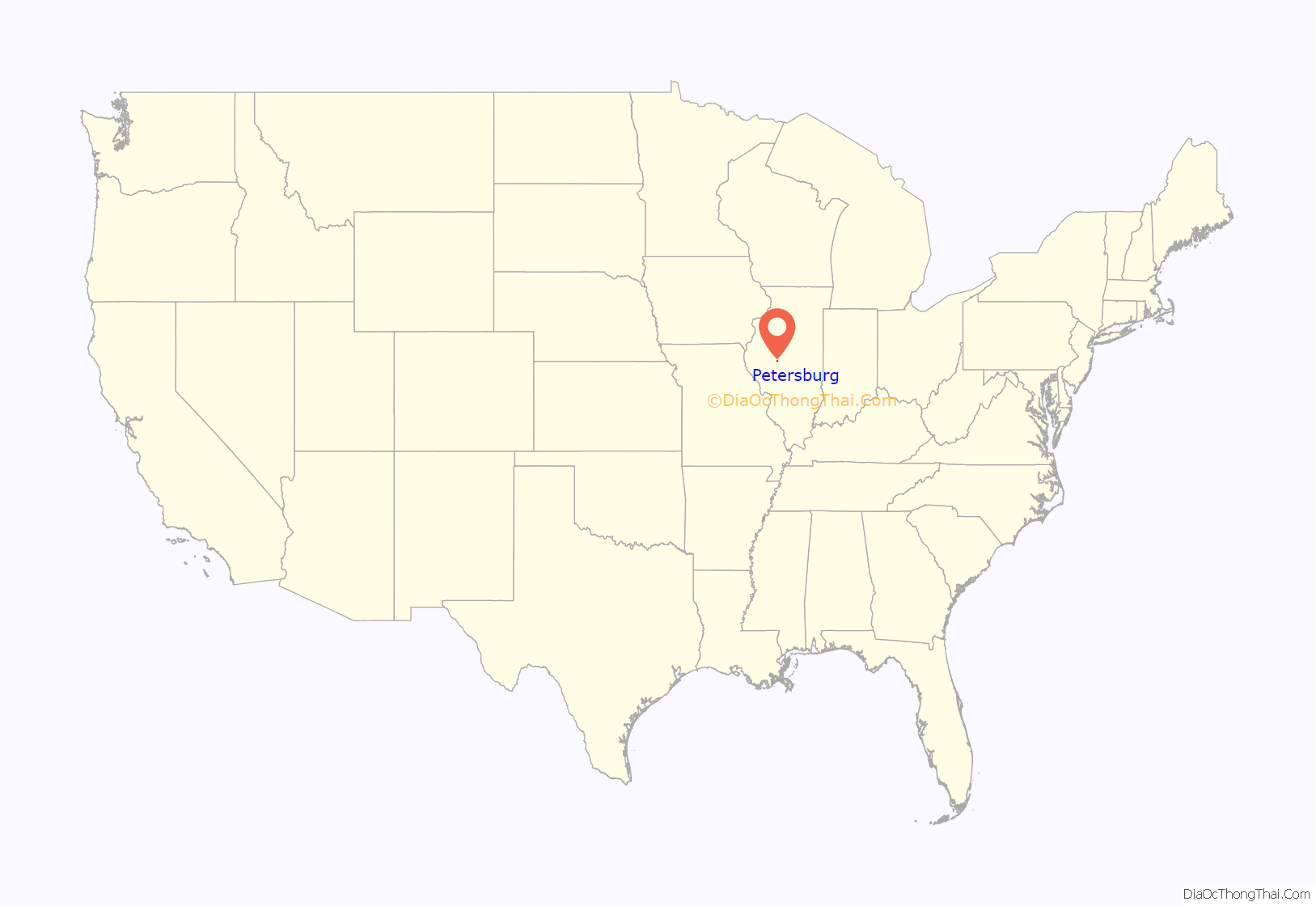
Petersburg is a city in and the county seat of Menard County, Illinois, United States, on the bluffs and part of the floodplain overlooking the Sangamon River. It is part of the Springfield, Illinois Metropolitan Statistical Area. The population was 2,258 at the 2020 census, nearly unchanged from 2010. Petersburg is located approximately 2 miles (3 km) north of New Salem, the original location where Abraham Lincoln first settled, as he started his career.
| Name: | Petersburg city |
|---|---|
| LSAD Code: | 25 |
| LSAD Description: | city (suffix) |
| State: | Illinois |
| County: | Menard County |
| Founded: | 1833 |
| Elevation: | 502 ft (153 m) |
| Total Area: | 1.56 sq mi (4.05 km²) |
| Land Area: | 1.56 sq mi (4.05 km²) |
| Water Area: | 0.00 sq mi (0.00 km²) |
| Total Population: | 2,258 |
| Population Density: | 1,445.58/sq mi (558.08/km²) |
| ZIP code: | 62675 |
| Area code: | 217 |
| FIPS code: | 1759312 |
| GNISfeature ID: | 2396193 |
| Website: | www.petersburgil.org |
Online Interactive Map
Click on ![]() to view map in "full screen" mode.
to view map in "full screen" mode.
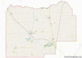
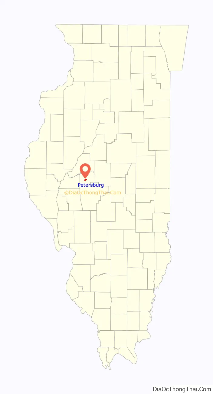
Petersburg location map. Where is Petersburg city?
History
The town began as a planned community organized by real estate speculators Peter Lukins (for whom the town is named) and George Warburton. Abraham Lincoln worked as the surveyor who first mapped, measured and help to divide lots on the land. Petersburg quickly grew, due to an advantageous placement on the river, becoming the county seat in the 1830s and eventually drawing off the population of New Salem, which was abandoned in 1840.
Many of the lush Victorian-era homes built by early wealthy inhabitants still stand on the bluffs of Petersburg. The town itself takes great pride in these structures, which has even preserved some of the original cobblestone streets to complement the classical architecture.
Local legend has it that the town’s name came about when Peter Lukins and George Warburton, two notorious sots, argued over what to call it. The matter was allegedly settled over a game of cards, which Lukins is credited as winning. Most versions of the tale claim that Warburton had it in mind to name the village “Georgetown.” This story, though often told in the area, has not been historically verified.
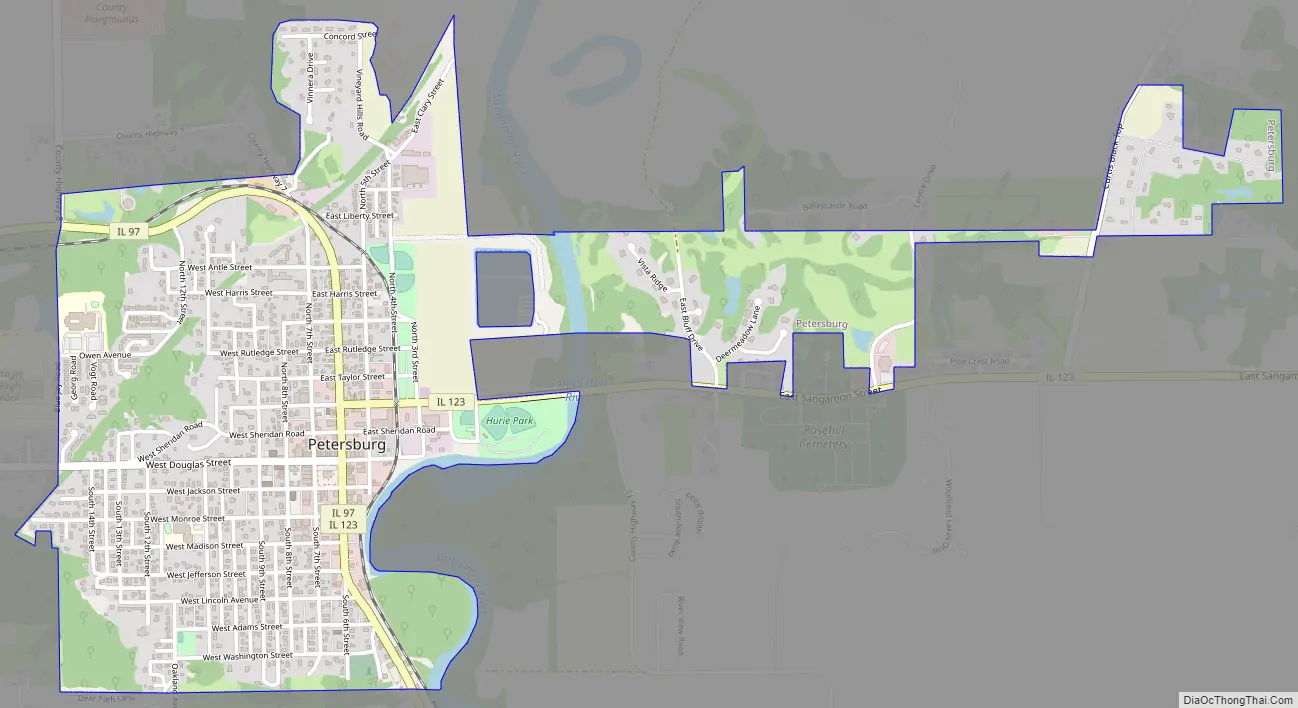
Petersburg Road Map
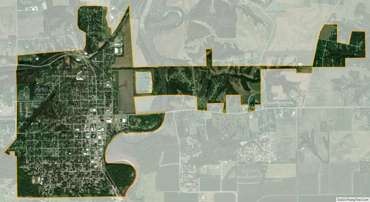
Petersburg city Satellite Map
Geography
Petersburg is located in central Menard County and Illinois Route 97 passes through the city on Sixth Street, leading northwest 25 miles (40 km) to Havana and southeast 23 miles (37 km) to Springfield, the state capital. Illinois Route 123 enters Petersburg from the south with IL 97 but leaves to the east on East Sangamon Street. IL 123 leads east and south 11 miles (18 km) to Athens, and southwest 14 miles (23 km) to Illinois Route 125 near Pleasant Plains.
According to the U.S. Census Bureau, Petersburg has a total area of 1.56 square miles (4.04 km), all land.
The bulk of Petersburg lies on the bluffs overlooking the Sangamon River, though a portion of it, including the downtown/courthouse square area, is technically on the floodplain of the river. The Sangamon flows north, then west to the Illinois River at Beardstown.
The town itself is moderately forested, a stark contrast to the flat plains around it. The trees are mostly deciduous maples and oaks, and New Salem State Park is home to a sizable stand of old-growth forest.
See also
Map of Illinois State and its subdivision:- Adams
- Alexander
- Bond
- Boone
- Brown
- Bureau
- Calhoun
- Carroll
- Cass
- Champaign
- Christian
- Clark
- Clay
- Clinton
- Coles
- Cook
- Crawford
- Cumberland
- De Kalb
- De Witt
- Douglas
- Dupage
- Edgar
- Edwards
- Effingham
- Fayette
- Ford
- Franklin
- Fulton
- Gallatin
- Greene
- Grundy
- Hamilton
- Hancock
- Hardin
- Henderson
- Henry
- Iroquois
- Jackson
- Jasper
- Jefferson
- Jersey
- Jo Daviess
- Johnson
- Kane
- Kankakee
- Kendall
- Knox
- La Salle
- Lake
- Lake Michigan
- Lawrence
- Lee
- Livingston
- Logan
- Macon
- Macoupin
- Madison
- Marion
- Marshall
- Mason
- Massac
- McDonough
- McHenry
- McLean
- Menard
- Mercer
- Monroe
- Montgomery
- Morgan
- Moultrie
- Ogle
- Peoria
- Perry
- Piatt
- Pike
- Pope
- Pulaski
- Putnam
- Randolph
- Richland
- Rock Island
- Saint Clair
- Saline
- Sangamon
- Schuyler
- Scott
- Shelby
- Stark
- Stephenson
- Tazewell
- Union
- Vermilion
- Wabash
- Warren
- Washington
- Wayne
- White
- Whiteside
- Will
- Williamson
- Winnebago
- Woodford
- Alabama
- Alaska
- Arizona
- Arkansas
- California
- Colorado
- Connecticut
- Delaware
- District of Columbia
- Florida
- Georgia
- Hawaii
- Idaho
- Illinois
- Indiana
- Iowa
- Kansas
- Kentucky
- Louisiana
- Maine
- Maryland
- Massachusetts
- Michigan
- Minnesota
- Mississippi
- Missouri
- Montana
- Nebraska
- Nevada
- New Hampshire
- New Jersey
- New Mexico
- New York
- North Carolina
- North Dakota
- Ohio
- Oklahoma
- Oregon
- Pennsylvania
- Rhode Island
- South Carolina
- South Dakota
- Tennessee
- Texas
- Utah
- Vermont
- Virginia
- Washington
- West Virginia
- Wisconsin
- Wyoming