Augusta is a village in southeast Hancock County, Illinois, United States. The population was 587 at the 2010 census, down from 657 at the 2000 census. It is located near Weinberg-King State Park.
| Name: | Augusta village |
|---|---|
| LSAD Code: | 47 |
| LSAD Description: | village (suffix) |
| State: | Illinois |
| County: | Hancock County |
| Elevation: | 666 ft (203 m) |
| Total Area: | 0.69 sq mi (1.79 km²) |
| Land Area: | 0.69 sq mi (1.79 km²) |
| Water Area: | 0.00 sq mi (0.00 km²) |
| Total Population: | 553 |
| Population Density: | 800.29/sq mi (308.91/km²) |
| Area code: | 217 |
| FIPS code: | 1702986 |
| GNISfeature ID: | 2398008 |
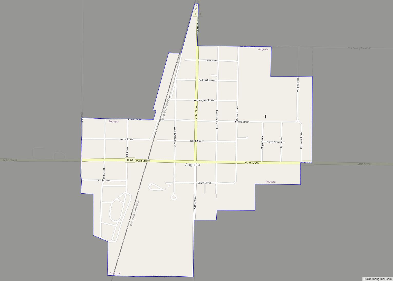
Online Interactive Map
Click on ![]() to view map in "full screen" mode.
to view map in "full screen" mode.
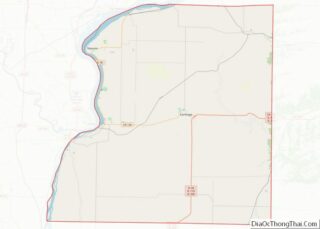
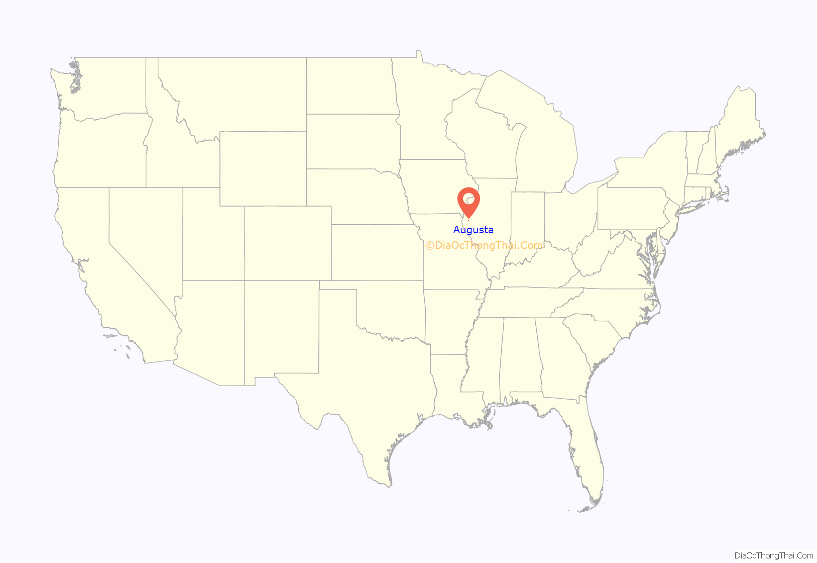
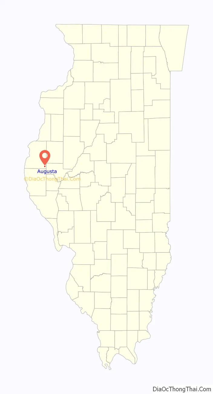
Augusta location map. Where is Augusta village?
History
Augusta was founded in 1832 by Joel Catlin and W.D. Abernathy, who was the village’s first postmaster. Catlin named Augusta after having a memorable visit to Augusta, Georgia.
On September 18, 1858, soon-to-be President Abraham Lincoln visited Augusta, where he gave a speech and stayed at the home of Elder James Stark. Previously, Lincoln’s opponent in the historic Lincoln–Douglas debates, Stephen A. Douglas, had spoken in Augusta. In 1864, Congressman James Garfield (the future president) spoke in Augusta on behalf of Lincoln. Other notable visitors include William McKinley and Theodore Roosevelt in the fall of 1900. Only Roosevelt gave a short speech on his trip through Augusta during the campaign.
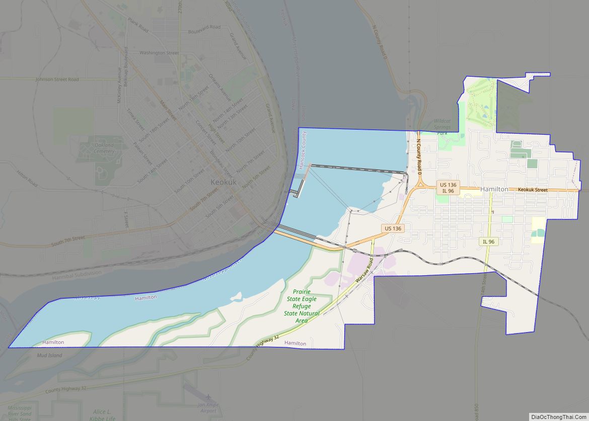
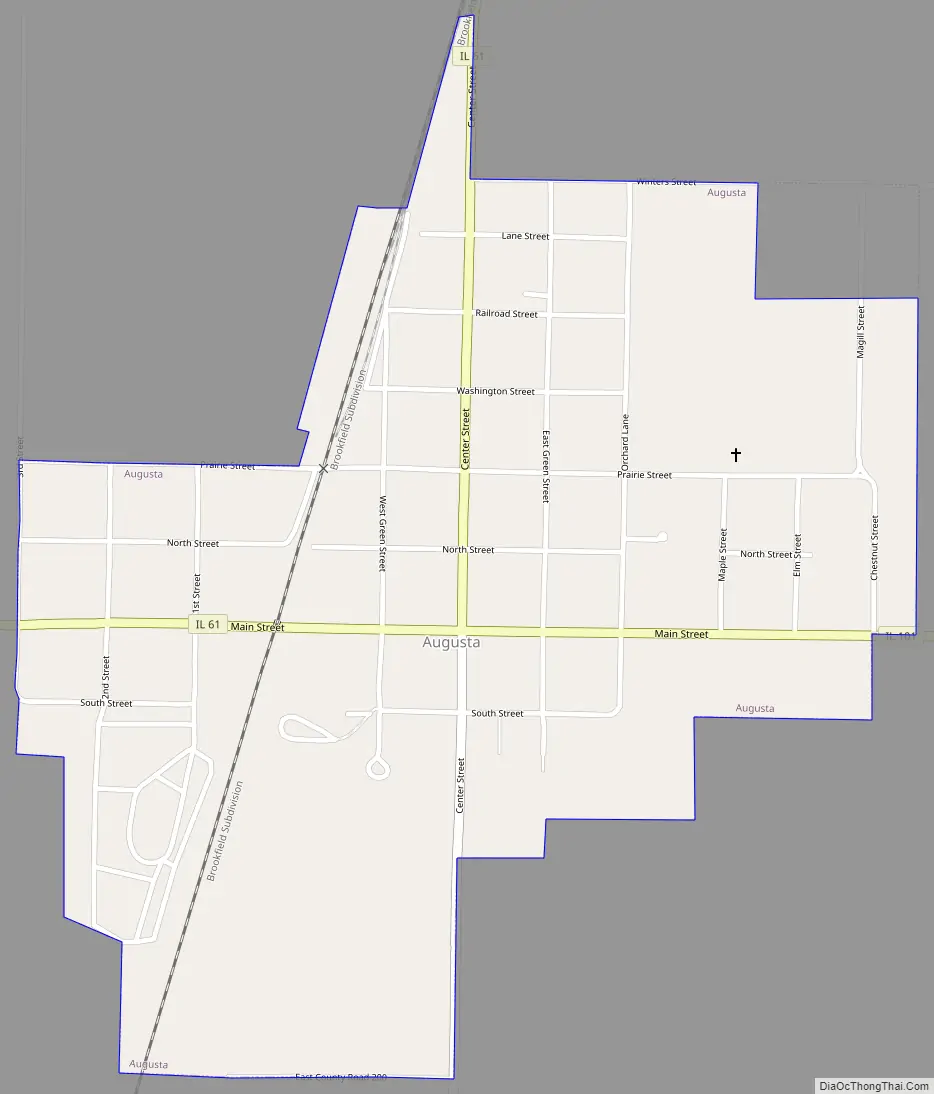
Augusta Road Map
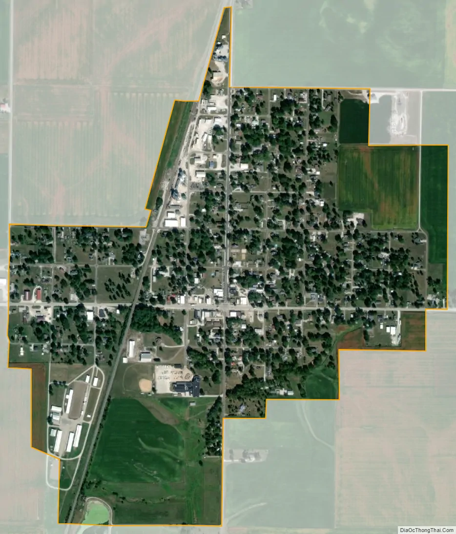
Augusta city Satellite Map
Geography
Augusta is located in southeastern Hancock County at 40°13′51″N 90°57′3″W / 40.23083°N 90.95083°W / 40.23083; -90.95083 (40.230946, -90.950741). Illinois Route 61 passes through the village, leaving to the west as Main Street and to the north as Center Street; Bowen is 6 miles (10 km) to the west, and Plymouth is 5 miles (8 km) to the north. Augusta’s Main Street continues east from the center of town as Illinois Route 101, leading 3 miles (5 km) to Weinberg-King State Park and 15 miles (24 km) to Littleton.
According to the 2010 census, Augusta has a total area of 0.72 square miles (1.86 km), all land.
See also
Map of Illinois State and its subdivision:- Adams
- Alexander
- Bond
- Boone
- Brown
- Bureau
- Calhoun
- Carroll
- Cass
- Champaign
- Christian
- Clark
- Clay
- Clinton
- Coles
- Cook
- Crawford
- Cumberland
- De Kalb
- De Witt
- Douglas
- Dupage
- Edgar
- Edwards
- Effingham
- Fayette
- Ford
- Franklin
- Fulton
- Gallatin
- Greene
- Grundy
- Hamilton
- Hancock
- Hardin
- Henderson
- Henry
- Iroquois
- Jackson
- Jasper
- Jefferson
- Jersey
- Jo Daviess
- Johnson
- Kane
- Kankakee
- Kendall
- Knox
- La Salle
- Lake
- Lake Michigan
- Lawrence
- Lee
- Livingston
- Logan
- Macon
- Macoupin
- Madison
- Marion
- Marshall
- Mason
- Massac
- McDonough
- McHenry
- McLean
- Menard
- Mercer
- Monroe
- Montgomery
- Morgan
- Moultrie
- Ogle
- Peoria
- Perry
- Piatt
- Pike
- Pope
- Pulaski
- Putnam
- Randolph
- Richland
- Rock Island
- Saint Clair
- Saline
- Sangamon
- Schuyler
- Scott
- Shelby
- Stark
- Stephenson
- Tazewell
- Union
- Vermilion
- Wabash
- Warren
- Washington
- Wayne
- White
- Whiteside
- Will
- Williamson
- Winnebago
- Woodford
- Alabama
- Alaska
- Arizona
- Arkansas
- California
- Colorado
- Connecticut
- Delaware
- District of Columbia
- Florida
- Georgia
- Hawaii
- Idaho
- Illinois
- Indiana
- Iowa
- Kansas
- Kentucky
- Louisiana
- Maine
- Maryland
- Massachusetts
- Michigan
- Minnesota
- Mississippi
- Missouri
- Montana
- Nebraska
- Nevada
- New Hampshire
- New Jersey
- New Mexico
- New York
- North Carolina
- North Dakota
- Ohio
- Oklahoma
- Oregon
- Pennsylvania
- Rhode Island
- South Carolina
- South Dakota
- Tennessee
- Texas
- Utah
- Vermont
- Virginia
- Washington
- West Virginia
- Wisconsin
- Wyoming