Bellwood is a village in Proviso Township, Cook County, Illinois, United States. Located 13 miles (21 km) west of Chicago’s downtown Loop, the Village of Bellwood is bounded by the Eisenhower Expressway (south), the Proviso yards of the former Chicago & Northwestern, now Union Pacific Railroad (north), and the suburbs of Maywood (east) and Hillside and Berkeley (west). The population was 18,789 at the 2020 census.
| Name: | Bellwood village |
|---|---|
| LSAD Code: | 47 |
| LSAD Description: | village (suffix) |
| State: | Illinois |
| County: | Cook County |
| Incorporated: | 1900 |
| Total Area: | 2.40 sq mi (6.21 km²) |
| Land Area: | 2.40 sq mi (6.21 km²) |
| Water Area: | 0.00 sq mi (0.00 km²) |
| Total Population: | 18,789 |
| Population Density: | 7,835.28/sq mi (3,025.05/km²) |
| FIPS code: | 1704975 |
| Website: | www.vil.bellwood.il.us |
Online Interactive Map
Click on ![]() to view map in "full screen" mode.
to view map in "full screen" mode.
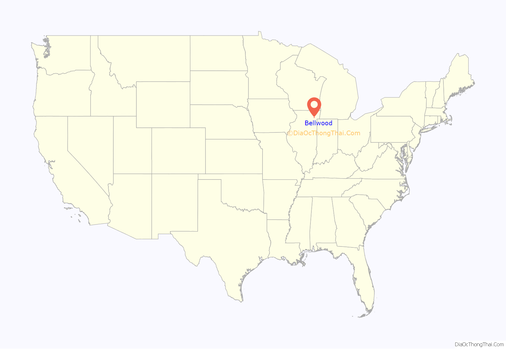
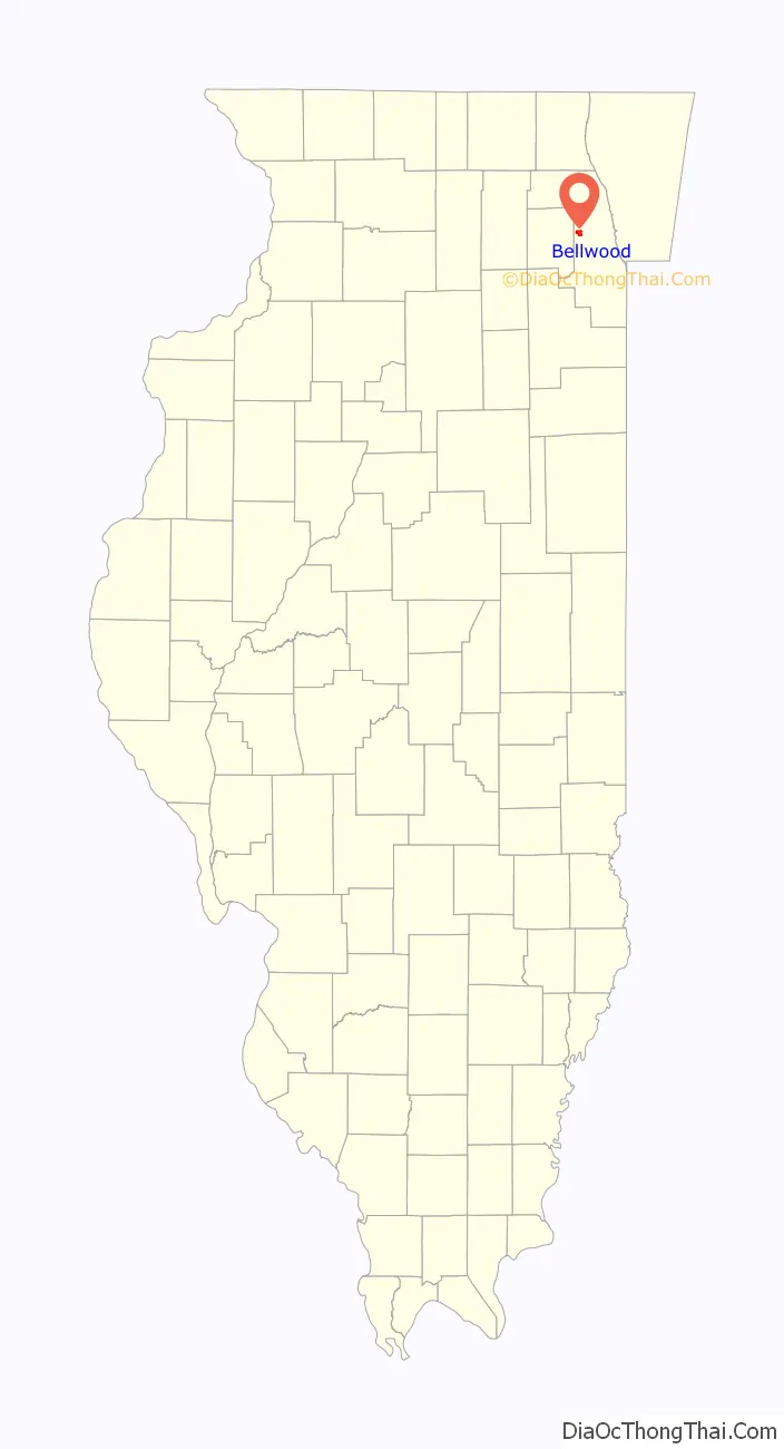
Bellwood location map. Where is Bellwood village?
History
Bellwood was incorporated on May 21, 1900. The municipality took its name from one of the village’s early subdivisions, “Bellewood“. However, in later years, the final “e” was dropped. The region, which was mostly flat grassland, was initially mostly farmland. A few businesses, including a few taverns, were drawn to the initial subdivision. In reaction to dry Maywood‘s effort to annex the area, businesses that served alcohol petitioned for incorporation. Between 1900 and 1930, Bellwood’s population numbers increased steadily. By 1920, the village’s population of 943 had more than quadrupled, with many German and Russian immigrants. The increase to 4,991 persons in 1930 is due to the annexation of territory west of Mannheim Road in 1926, as well as ongoing migration.
The Chicago, Aurora and Elgin Railway and the Chicago & North Western Railway provided rail passenger service, which promoted residential growth in neighboring portions of Bellwood. The 1970s saw racial upheaval and inclusion in a Supreme Court case in the United States. Bellwood sued a local real estate company in 1975, alleging racial discrimination. Four years later, the Supreme Court issued a historic decision allowing governments to utilize testers and sue when discrimination occurs. The black population of Bellwood jumped from 1.1 percent in 1970 to 35 percent in 1980 and 70 percent in 1990.
A few major firms exist in Bellwood today, but the collapse of many other large sectors has resulted in a decrease in employment and tax revenue. Despite these contributions, the community saw some new development as a result of various minor industrial and commercial organizations.
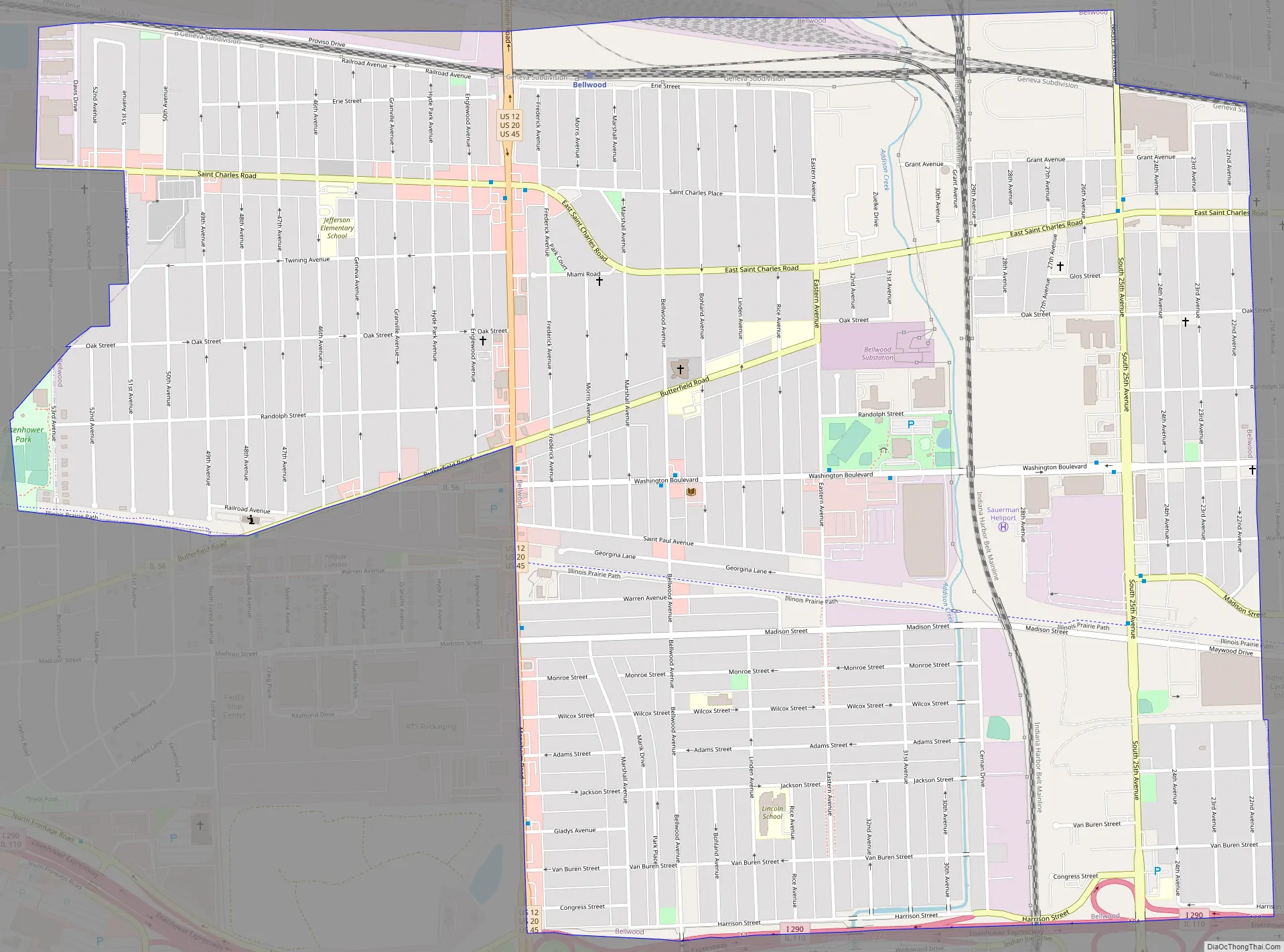
Bellwood Road Map
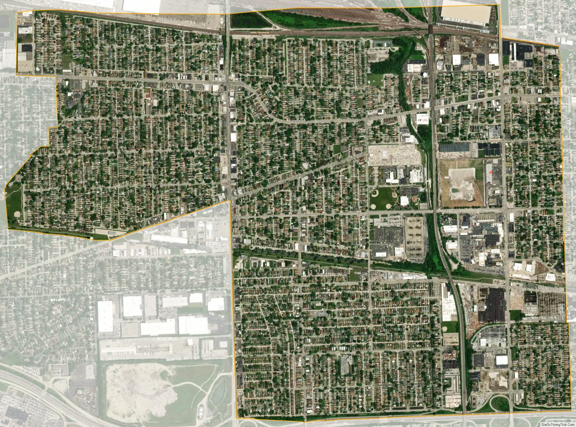
Bellwood city Satellite Map
Geography
According to the 2021 census gazetteer files, Bellwood has a total area of 2.40 square miles (6.22 km), all land.
See also
Map of Illinois State and its subdivision:- Adams
- Alexander
- Bond
- Boone
- Brown
- Bureau
- Calhoun
- Carroll
- Cass
- Champaign
- Christian
- Clark
- Clay
- Clinton
- Coles
- Cook
- Crawford
- Cumberland
- De Kalb
- De Witt
- Douglas
- Dupage
- Edgar
- Edwards
- Effingham
- Fayette
- Ford
- Franklin
- Fulton
- Gallatin
- Greene
- Grundy
- Hamilton
- Hancock
- Hardin
- Henderson
- Henry
- Iroquois
- Jackson
- Jasper
- Jefferson
- Jersey
- Jo Daviess
- Johnson
- Kane
- Kankakee
- Kendall
- Knox
- La Salle
- Lake
- Lake Michigan
- Lawrence
- Lee
- Livingston
- Logan
- Macon
- Macoupin
- Madison
- Marion
- Marshall
- Mason
- Massac
- McDonough
- McHenry
- McLean
- Menard
- Mercer
- Monroe
- Montgomery
- Morgan
- Moultrie
- Ogle
- Peoria
- Perry
- Piatt
- Pike
- Pope
- Pulaski
- Putnam
- Randolph
- Richland
- Rock Island
- Saint Clair
- Saline
- Sangamon
- Schuyler
- Scott
- Shelby
- Stark
- Stephenson
- Tazewell
- Union
- Vermilion
- Wabash
- Warren
- Washington
- Wayne
- White
- Whiteside
- Will
- Williamson
- Winnebago
- Woodford
- Alabama
- Alaska
- Arizona
- Arkansas
- California
- Colorado
- Connecticut
- Delaware
- District of Columbia
- Florida
- Georgia
- Hawaii
- Idaho
- Illinois
- Indiana
- Iowa
- Kansas
- Kentucky
- Louisiana
- Maine
- Maryland
- Massachusetts
- Michigan
- Minnesota
- Mississippi
- Missouri
- Montana
- Nebraska
- Nevada
- New Hampshire
- New Jersey
- New Mexico
- New York
- North Carolina
- North Dakota
- Ohio
- Oklahoma
- Oregon
- Pennsylvania
- Rhode Island
- South Carolina
- South Dakota
- Tennessee
- Texas
- Utah
- Vermont
- Virginia
- Washington
- West Virginia
- Wisconsin
- Wyoming


