Braidwood is a city in Will County, Illinois, United States, approximately 53 miles (85 km) southwest of Chicago and 18 miles (29 km) south of Joliet. The population was 6,191 at the 2010 census.
The Braidwood Nuclear Generating Station, a nuclear power plant currently owned by Exelon Corporation, is also located in the area (although the plant’s address is actually in the nearby town of Braceville). The station is one of the major employers in the area and provides a significant portion of the electricity used in the Chicago area. The plant has been the subject of controversy concerning a series of leaks since 2007
Reed-Custer Community Unit School District 255 educates students from in and around Braidwood, Custer Park, Essex, and Godley. The district has 3 schools: Reed-Custer Elementary School (Grades PreK-5), Reed-Custer Middle School (Grades 6-8), and Reed-Custer High School (Grades 9-12). The district level administrators are: Mark Mitchell (Superintendent), Christine Nelson (Assistant Superintendent), and Jim King (Director of Operations). Reed-Custer High School is located at 249 Comet Drive in Braidwood, IL 60408, and is part of the Reed-Custer School District known as 255U.
| Name: | Braidwood city |
|---|---|
| LSAD Code: | 25 |
| LSAD Description: | city (suffix) |
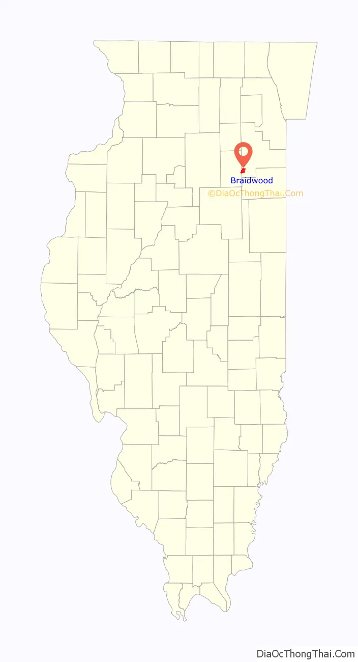
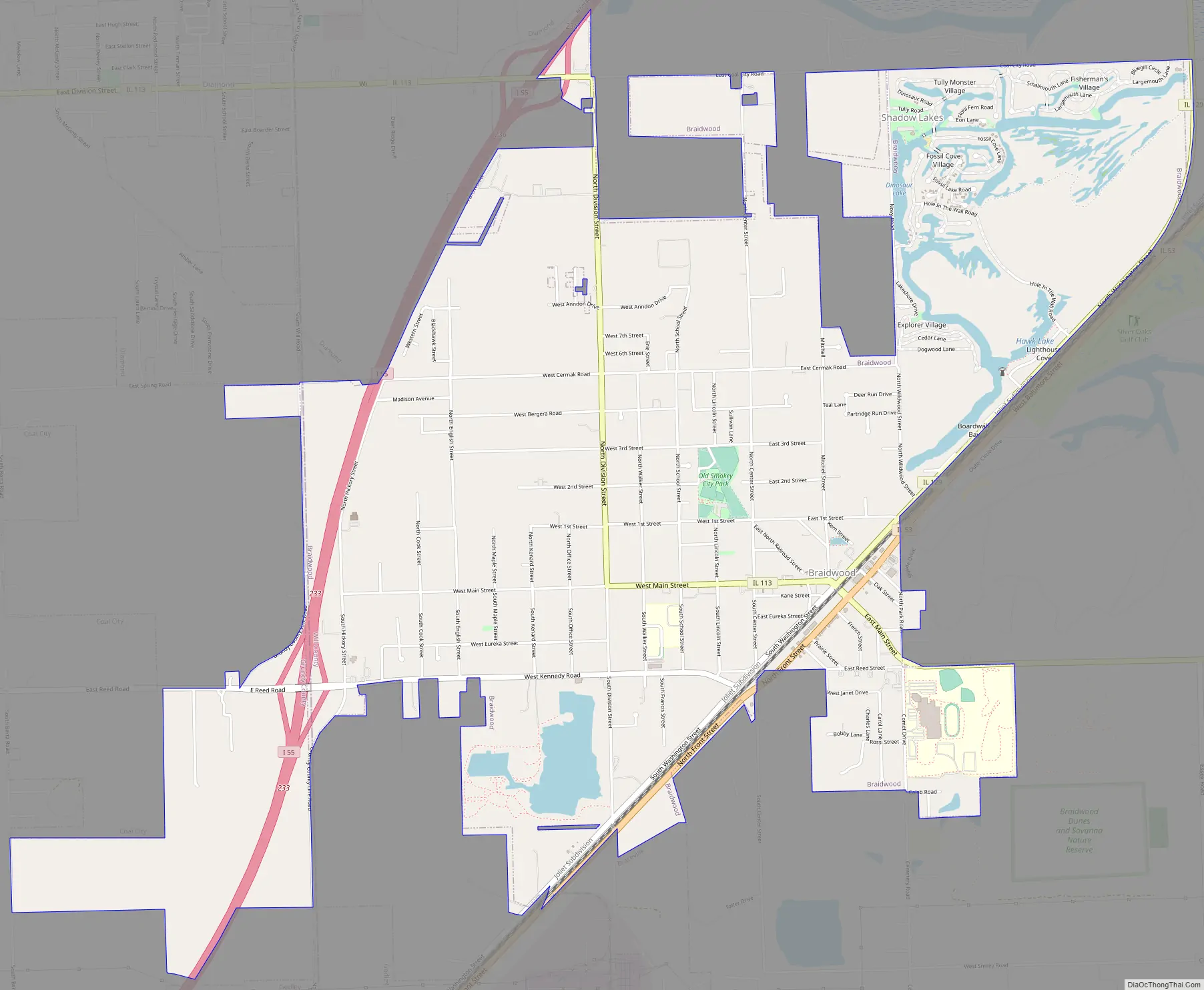
| State: | Illinois |
| County: | Will County |
| Elevation: | 568 ft (173 m) |
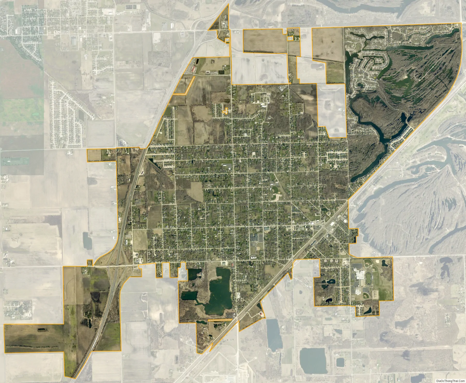
| Total Area: | 5.47 sq mi (14.17 km²) |
| Land Area: | 5.30 sq mi (13.72 km²) |
| Water Area: | 0.18 sq mi (0.46 km²) |
| Total Population: | 6,194 |
| Population Density: | 1,169.56/sq mi (451.61/km²) |
| ZIP code: | 60408 |
| Area code: | 815/779 |
| FIPS code: | 1707770 |
| GNISfeature ID: | 2394237 |
| Website: | braidwood.us |
Online Interactive Map
Click on ![]() to view map in "full screen" mode.
to view map in "full screen" mode.
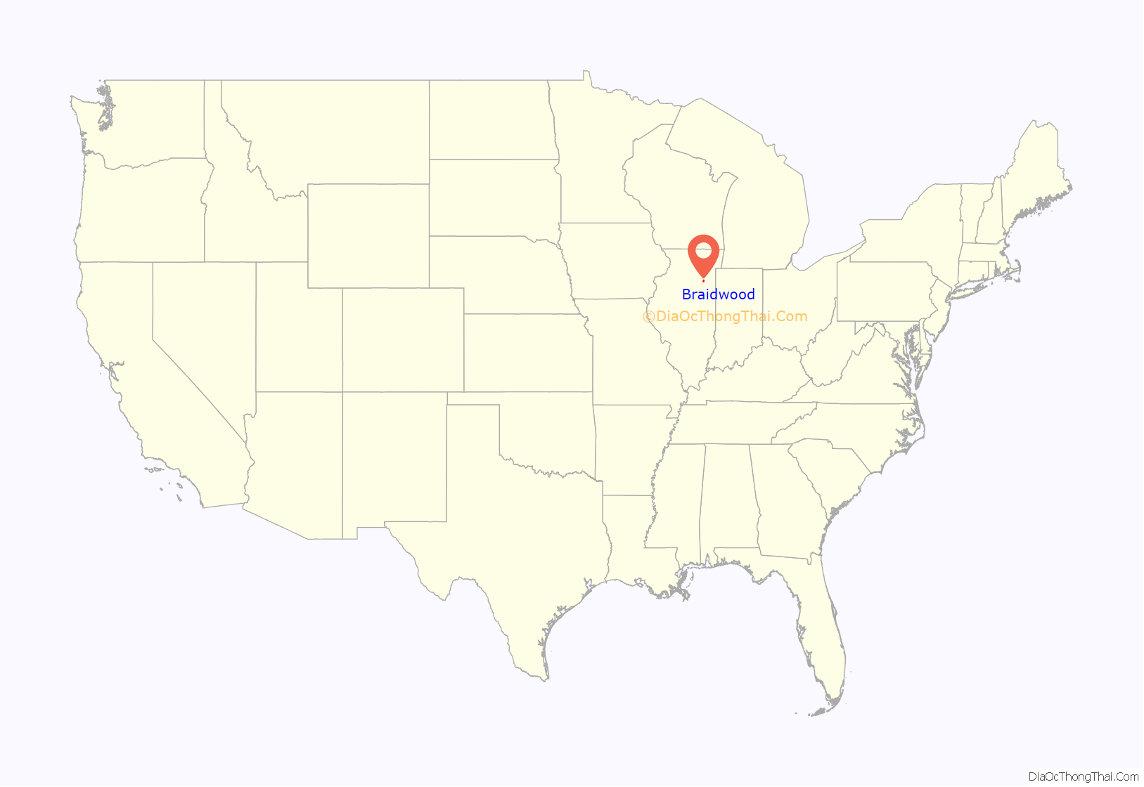
Braidwood location map. Where is Braidwood city?
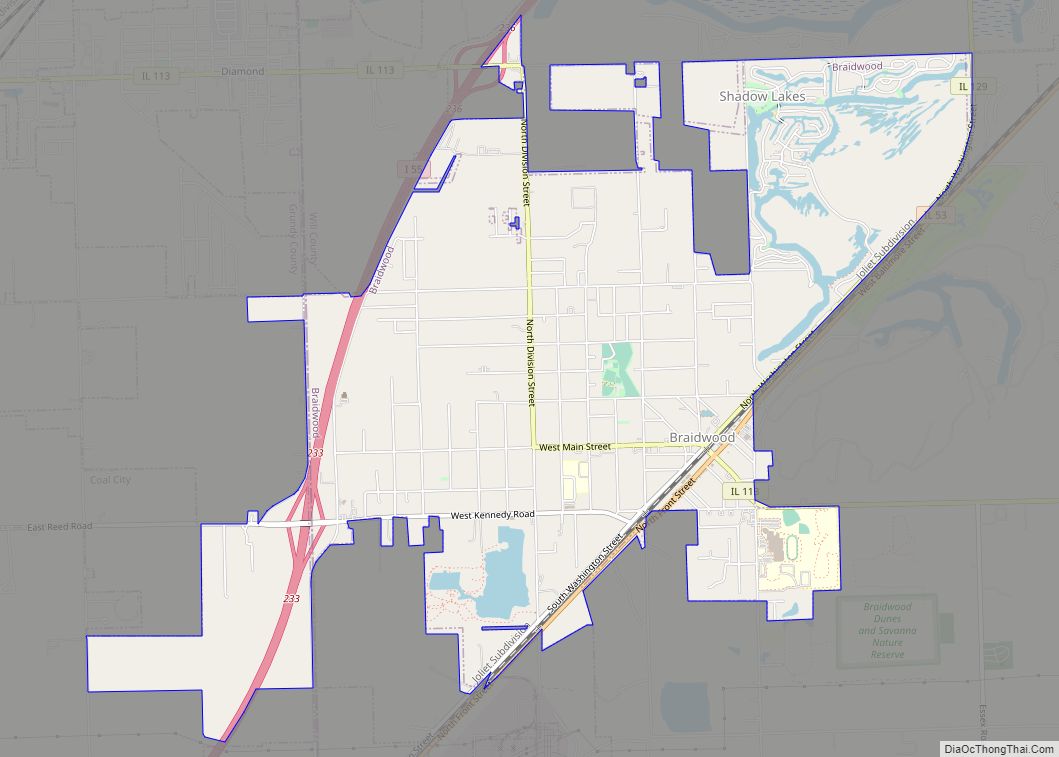
Braidwood Road Map
Braidwood city Satellite Map
Geography
Braidwood is located at 41°16′19″N 88°13′6″W / 41.27194°N 88.21833°W / 41.27194; -88.21833 (41.271982, -88.218221).
According to the 2010 census, Braidwood has a total area of 4.764 square miles (12.34 km), of which 4.58 square miles (11.86 km) (or 96.14%) is land and 0.184 square miles (0.48 km) (or 3.86%) is water.
See also
Map of Illinois State and its subdivision:- Adams
- Alexander
- Bond
- Boone
- Brown
- Bureau
- Calhoun
- Carroll
- Cass
- Champaign
- Christian
- Clark
- Clay
- Clinton
- Coles
- Cook
- Crawford
- Cumberland
- De Kalb
- De Witt
- Douglas
- Dupage
- Edgar
- Edwards
- Effingham
- Fayette
- Ford
- Franklin
- Fulton
- Gallatin
- Greene
- Grundy
- Hamilton
- Hancock
- Hardin
- Henderson
- Henry
- Iroquois
- Jackson
- Jasper
- Jefferson
- Jersey
- Jo Daviess
- Johnson
- Kane
- Kankakee
- Kendall
- Knox
- La Salle
- Lake
- Lake Michigan
- Lawrence
- Lee
- Livingston
- Logan
- Macon
- Macoupin
- Madison
- Marion
- Marshall
- Mason
- Massac
- McDonough
- McHenry
- McLean
- Menard
- Mercer
- Monroe
- Montgomery
- Morgan
- Moultrie
- Ogle
- Peoria
- Perry
- Piatt
- Pike
- Pope
- Pulaski
- Putnam
- Randolph
- Richland
- Rock Island
- Saint Clair
- Saline
- Sangamon
- Schuyler
- Scott
- Shelby
- Stark
- Stephenson
- Tazewell
- Union
- Vermilion
- Wabash
- Warren
- Washington
- Wayne
- White
- Whiteside
- Will
- Williamson
- Winnebago
- Woodford
- Alabama
- Alaska
- Arizona
- Arkansas
- California
- Colorado
- Connecticut
- Delaware
- District of Columbia
- Florida
- Georgia
- Hawaii
- Idaho
- Illinois
- Indiana
- Iowa
- Kansas
- Kentucky
- Louisiana
- Maine
- Maryland
- Massachusetts
- Michigan
- Minnesota
- Mississippi
- Missouri
- Montana
- Nebraska
- Nevada
- New Hampshire
- New Jersey
- New Mexico
- New York
- North Carolina
- North Dakota
- Ohio
- Oklahoma
- Oregon
- Pennsylvania
- Rhode Island
- South Carolina
- South Dakota
- Tennessee
- Texas
- Utah
- Vermont
- Virginia
- Washington
- West Virginia
- Wisconsin
- Wyoming