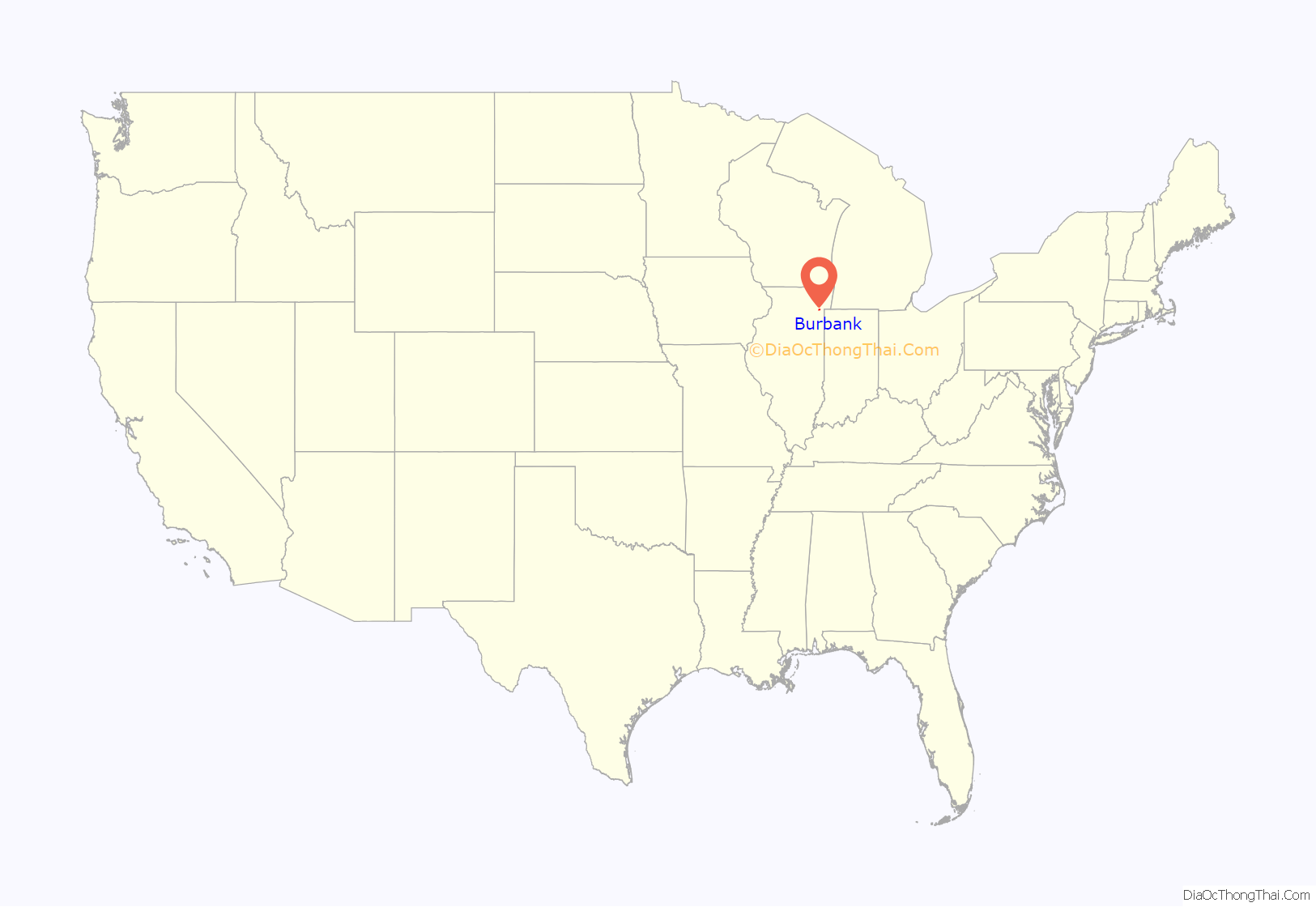
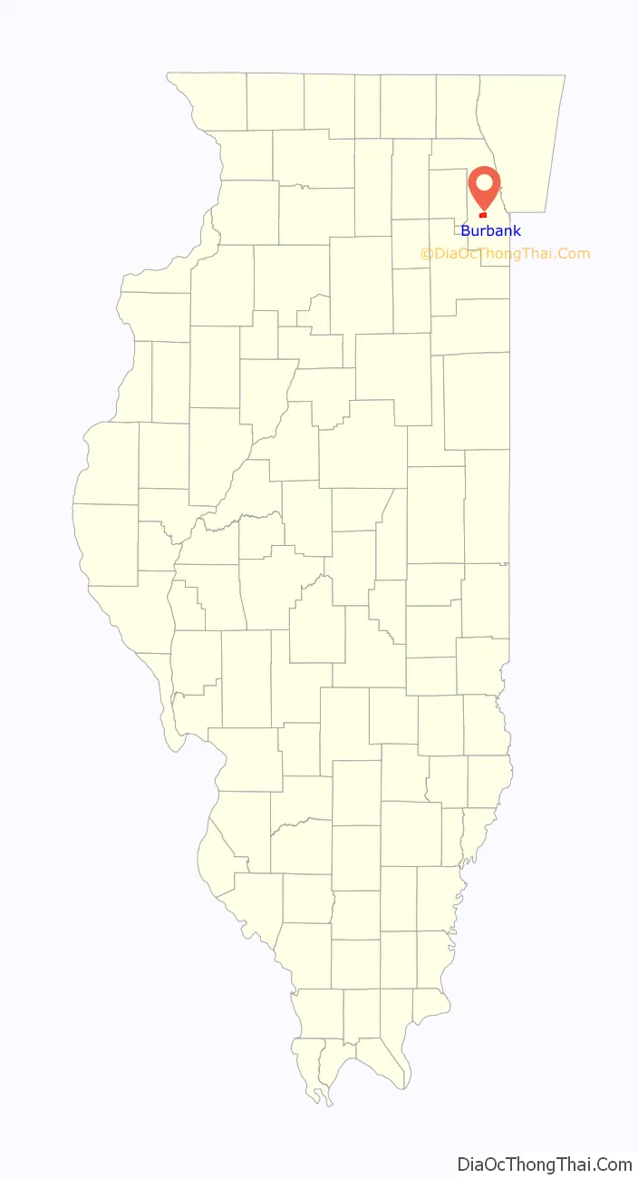
Burbank is a city in Cook County, Illinois, United States. The population was 29,439 at the 2020 census. It is located at the southwest edge of the city of Chicago; the Chicago city limit – specifically that of the Ashburn neighborhood – is in common with Burbank’s eastern city limit. Burbank shares a boundary with Oak Lawn to its south, Bridgeview to its west, and Bedford Park to its north; the city of Hometown is also adjacent to Burbank’s southeast corner. Burbank is less than two miles south of Chicago Midway International Airport.
| Name: | Burbank city |
|---|---|
| LSAD Code: | 25 |
| LSAD Description: | city (suffix) |
| State: | Illinois |
| County: | Cook County |
| Incorporated: | 1970 |
| Elevation: | 620 ft (190 m) |
| Total Area: | 4.17 sq mi (10.80 km²) |
| Land Area: | 4.17 sq mi (10.80 km²) |
| Water Area: | 0.00 sq mi (0.00 km²) |
| Total Population: | 29,439 |
| Population Density: | 7,059.71/sq mi (2,725.91/km²) |
| ZIP code: | 60459 |
| Area code: | 708 |
| FIPS code: | 1709642 |
| GNISfeature ID: | 422262 |
| Website: | www.burbankil.gov |
Online Interactive Map
Click on ![]() to view map in "full screen" mode.
to view map in "full screen" mode.
Burbank location map. Where is Burbank city?
History
In 1850, the area which would become the city of Burbank, then largely uninhabited and agrarian, became part of Lyons Township. Over the next hundred years the area remained largely undeveloped, though several times large plans were laid out for the area, never to come to fruition. In the late 19th century a railroad investor named A. B. Stickney planned a large railroad transfer center which included what became the northern part of Burbank, but his ideas were never realized due to an economic depression in 1893.
In the 1920s, the area became an attractive site for real-estate developers who bought up farmland and built subdivisions. However, ongoing drainage problems, practically nonexistent water and sewage systems and the Great Depression kept Burbank largely unbuilt and empty until the 1950s.
In 1952, the area became part of Stickney Township. Though still unincorporated, this led to massive development in the area, and by 1960 the population of the area had reached 20,720, nearly triple the population of a decade earlier. The area was incorporated into a city in 1970, partly to resist annexation by the City of Chicago. The city was named after Luther Burbank Elementary School, an institution which had served the area since the 1930s. The area’s population peaked in 1976 at 29,448.
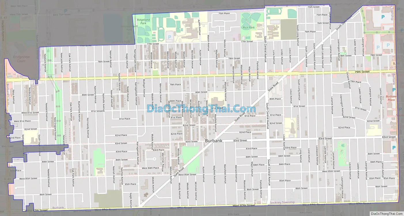
Burbank Road Map
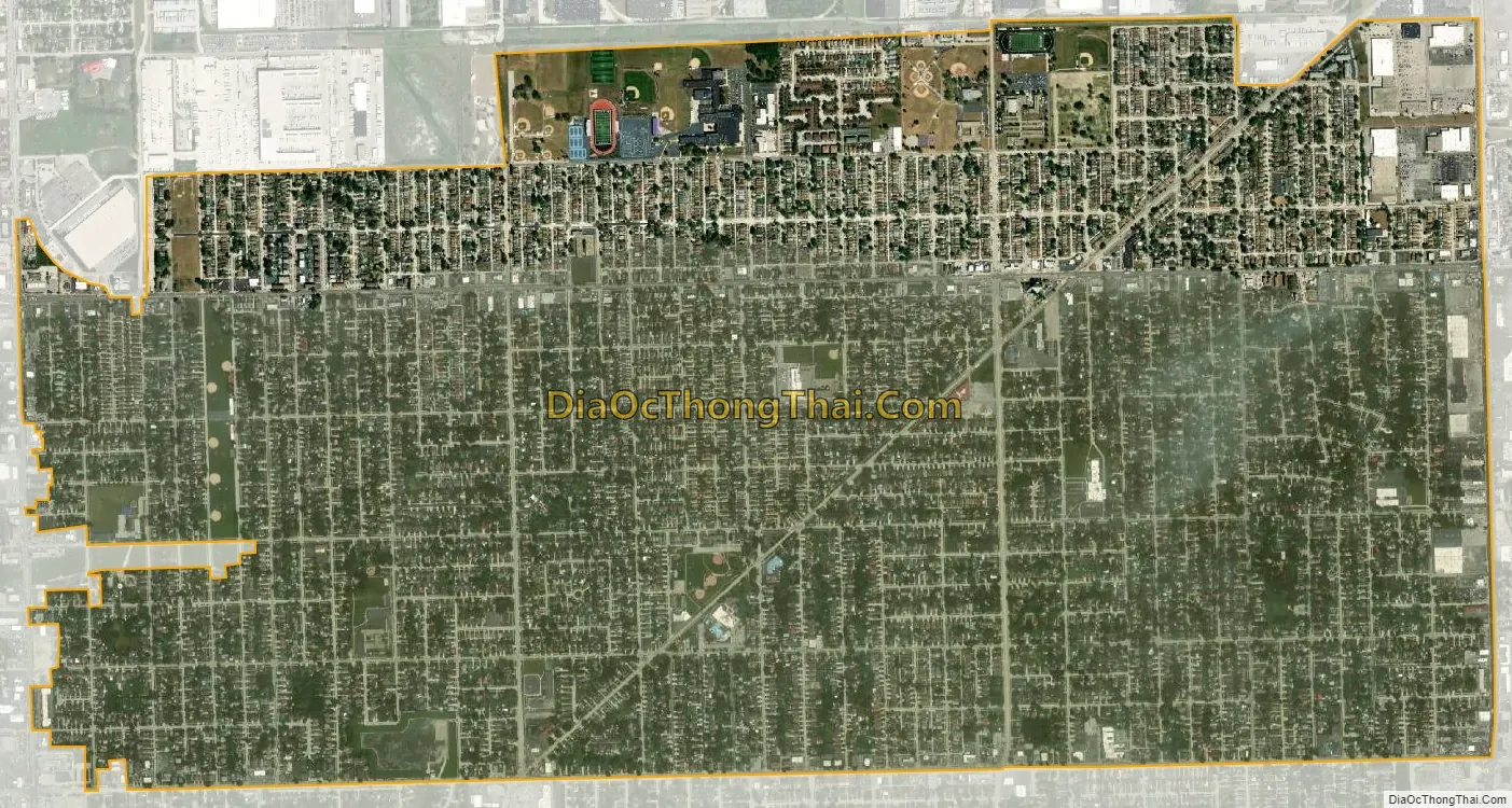
Burbank city Satellite Map
Geography
According to the 2021 census gazetteer files, Burbank has a total area of 4.17 square miles (10.80 km), all land.
See also
Map of Illinois State and its subdivision:- Adams
- Alexander
- Bond
- Boone
- Brown
- Bureau
- Calhoun
- Carroll
- Cass
- Champaign
- Christian
- Clark
- Clay
- Clinton
- Coles
- Cook
- Crawford
- Cumberland
- De Kalb
- De Witt
- Douglas
- Dupage
- Edgar
- Edwards
- Effingham
- Fayette
- Ford
- Franklin
- Fulton
- Gallatin
- Greene
- Grundy
- Hamilton
- Hancock
- Hardin
- Henderson
- Henry
- Iroquois
- Jackson
- Jasper
- Jefferson
- Jersey
- Jo Daviess
- Johnson
- Kane
- Kankakee
- Kendall
- Knox
- La Salle
- Lake
- Lake Michigan
- Lawrence
- Lee
- Livingston
- Logan
- Macon
- Macoupin
- Madison
- Marion
- Marshall
- Mason
- Massac
- McDonough
- McHenry
- McLean
- Menard
- Mercer
- Monroe
- Montgomery
- Morgan
- Moultrie
- Ogle
- Peoria
- Perry
- Piatt
- Pike
- Pope
- Pulaski
- Putnam
- Randolph
- Richland
- Rock Island
- Saint Clair
- Saline
- Sangamon
- Schuyler
- Scott
- Shelby
- Stark
- Stephenson
- Tazewell
- Union
- Vermilion
- Wabash
- Warren
- Washington
- Wayne
- White
- Whiteside
- Will
- Williamson
- Winnebago
- Woodford
- Alabama
- Alaska
- Arizona
- Arkansas
- California
- Colorado
- Connecticut
- Delaware
- District of Columbia
- Florida
- Georgia
- Hawaii
- Idaho
- Illinois
- Indiana
- Iowa
- Kansas
- Kentucky
- Louisiana
- Maine
- Maryland
- Massachusetts
- Michigan
- Minnesota
- Mississippi
- Missouri
- Montana
- Nebraska
- Nevada
- New Hampshire
- New Jersey
- New Mexico
- New York
- North Carolina
- North Dakota
- Ohio
- Oklahoma
- Oregon
- Pennsylvania
- Rhode Island
- South Carolina
- South Dakota
- Tennessee
- Texas
- Utah
- Vermont
- Virginia
- Washington
- West Virginia
- Wisconsin
- Wyoming


