| Name: | Chicago Heights city |
|---|---|
| LSAD Code: | 25 |
| LSAD Description: | city (suffix) |
| State: | Illinois |
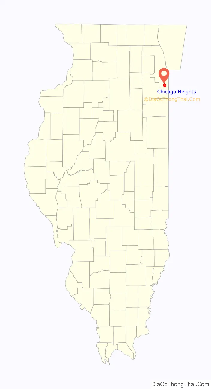
| County: | Cook County |
| Incorporated: | 1893 |
| Total Area: | 10.30 sq mi (26.67 km²) |
| Land Area: | 10.28 sq mi (26.63 km²) |
| Water Area: | 0.01 sq mi (0.03 km²) 0.10% |
| Total Population: | 27,480 |
| Population Density: | 2,672.37/sq mi (1,031.85/km²) |
| Area code: | 708 |
| FIPS code: | 1714026 |
| Website: | cityofchicagoheights.org |
Online Interactive Map
Click on ![]() to view map in "full screen" mode.
to view map in "full screen" mode.
Chicago Heights location map. Where is Chicago Heights city?

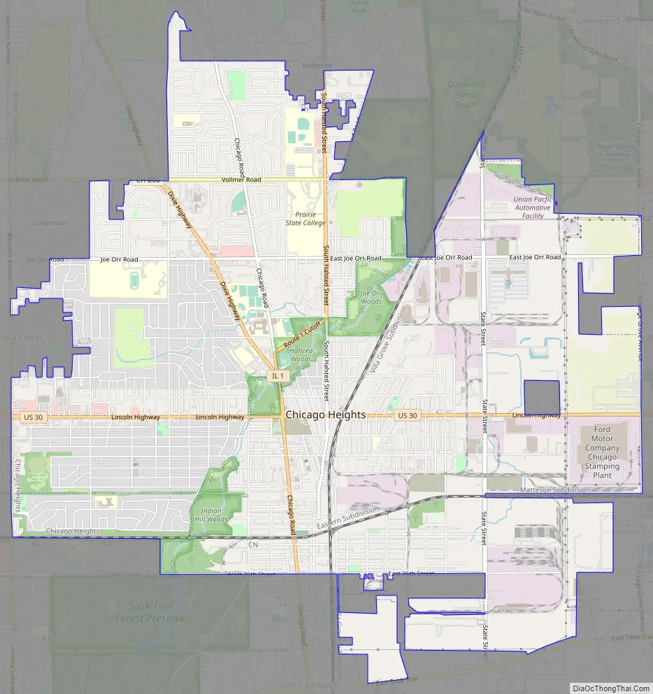
Chicago Heights Road Map
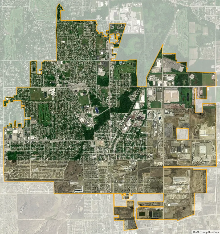
Chicago Heights city Satellite Map
Geography
Chicago Heights lies on the high land of the Tinley Moraine, with the higher and older Valparaiso Moraine lying just to the south of the city.
According to the 2021 census gazetteer files, Chicago Heights has a total area of 10.30 square miles (26.68 km), of which 10.28 square miles (26.63 km) (or 99.87%) is land and 0.01 square miles (0.03 km) (or 0.13%) is water.
The city’s major crossroads are at Dixie Highway (Illinois Route 1) and Lincoln Highway (U.S. Route 30).
Chicago Heights is about 30 miles (48 km) south of the Chicago Loop.
See also
Map of Illinois State and its subdivision:- Adams
- Alexander
- Bond
- Boone
- Brown
- Bureau
- Calhoun
- Carroll
- Cass
- Champaign
- Christian
- Clark
- Clay
- Clinton
- Coles
- Cook
- Crawford
- Cumberland
- De Kalb
- De Witt
- Douglas
- Dupage
- Edgar
- Edwards
- Effingham
- Fayette
- Ford
- Franklin
- Fulton
- Gallatin
- Greene
- Grundy
- Hamilton
- Hancock
- Hardin
- Henderson
- Henry
- Iroquois
- Jackson
- Jasper
- Jefferson
- Jersey
- Jo Daviess
- Johnson
- Kane
- Kankakee
- Kendall
- Knox
- La Salle
- Lake
- Lake Michigan
- Lawrence
- Lee
- Livingston
- Logan
- Macon
- Macoupin
- Madison
- Marion
- Marshall
- Mason
- Massac
- McDonough
- McHenry
- McLean
- Menard
- Mercer
- Monroe
- Montgomery
- Morgan
- Moultrie
- Ogle
- Peoria
- Perry
- Piatt
- Pike
- Pope
- Pulaski
- Putnam
- Randolph
- Richland
- Rock Island
- Saint Clair
- Saline
- Sangamon
- Schuyler
- Scott
- Shelby
- Stark
- Stephenson
- Tazewell
- Union
- Vermilion
- Wabash
- Warren
- Washington
- Wayne
- White
- Whiteside
- Will
- Williamson
- Winnebago
- Woodford
- Alabama
- Alaska
- Arizona
- Arkansas
- California
- Colorado
- Connecticut
- Delaware
- District of Columbia
- Florida
- Georgia
- Hawaii
- Idaho
- Illinois
- Indiana
- Iowa
- Kansas
- Kentucky
- Louisiana
- Maine
- Maryland
- Massachusetts
- Michigan
- Minnesota
- Mississippi
- Missouri
- Montana
- Nebraska
- Nevada
- New Hampshire
- New Jersey
- New Mexico
- New York
- North Carolina
- North Dakota
- Ohio
- Oklahoma
- Oregon
- Pennsylvania
- Rhode Island
- South Carolina
- South Dakota
- Tennessee
- Texas
- Utah
- Vermont
- Virginia
- Washington
- West Virginia
- Wisconsin
- Wyoming


