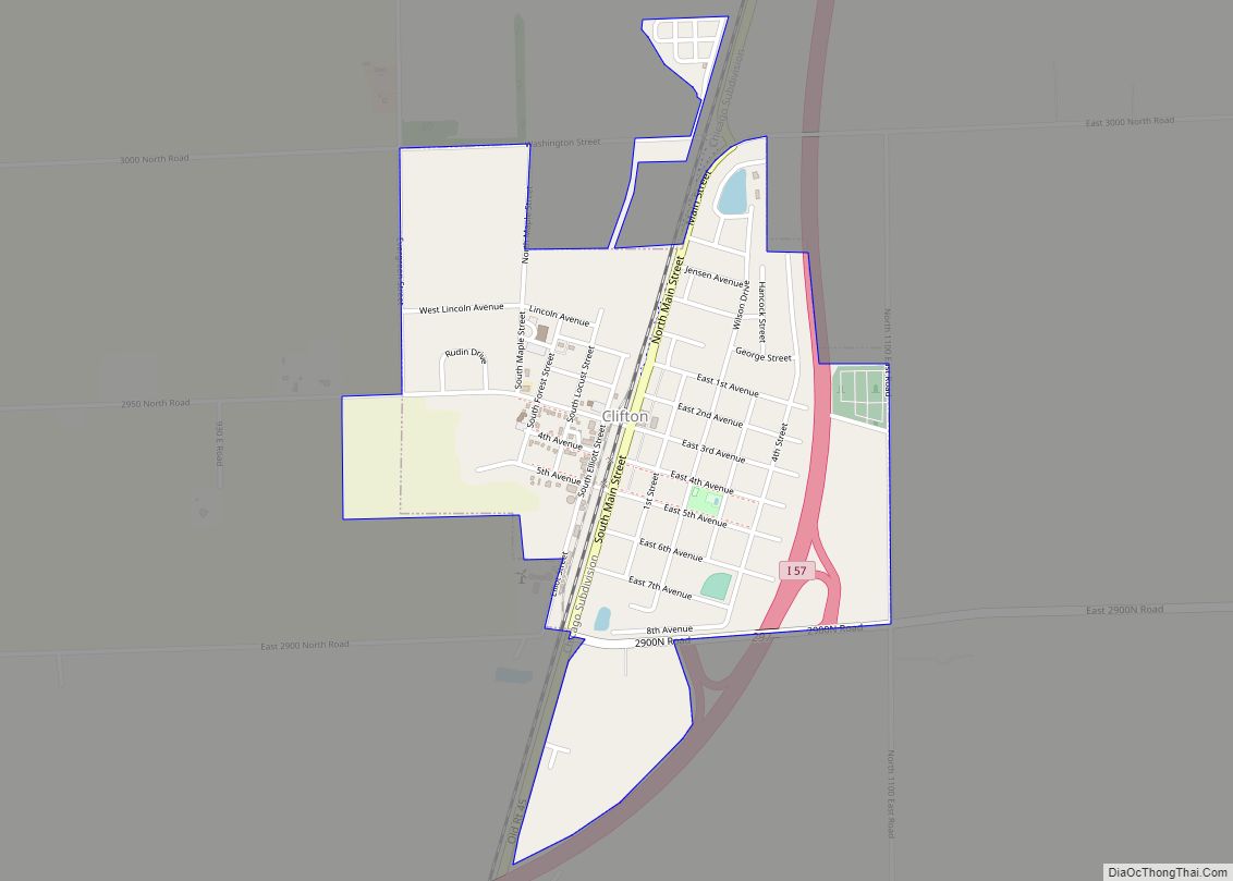
Clifton is a village in Chebanse Township, Iroquois County, Illinois, United States. The population was 1,468 at the 2010 census, up from 1,317 at the 2000 census.
| Name: | Clifton village |
|---|---|
| LSAD Code: | 47 |
| LSAD Description: | village (suffix) |
| State: | Illinois |
| County: | Iroquois County |
| Elevation: | 669 ft (204 m) |
| Total Area: | 0.93 sq mi (2.41 km²) |
| Land Area: | 0.93 sq mi (2.41 km²) |
| Water Area: | 0.00 sq mi (0.00 km²) |
| Population Density: | 1,453.76/sq mi (561.43/km²) |
| ZIP code: | 60927 |
| Area code: | 815 |
| FIPS code: | 1714936 |
| Website: | www.cliftonillinois.com |
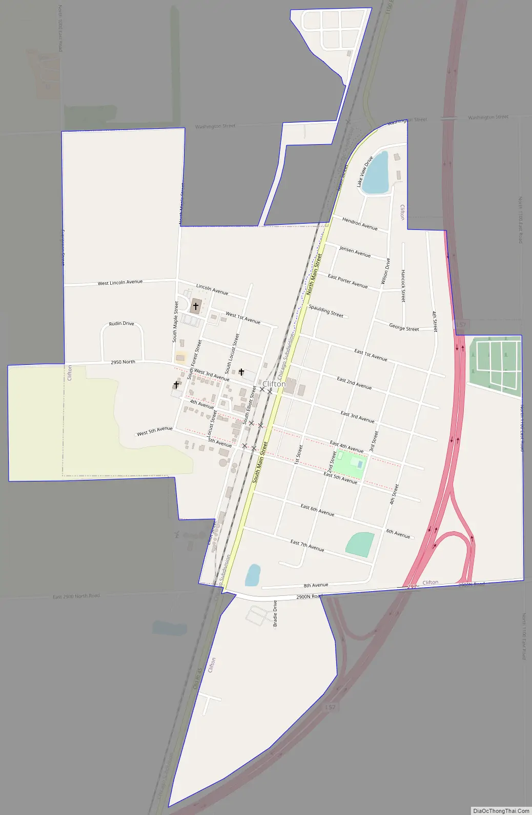
Online Interactive Map
Click on ![]() to view map in "full screen" mode.
to view map in "full screen" mode.
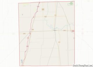
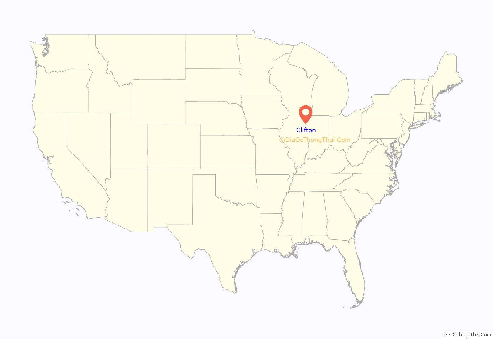
Clifton location map. Where is Clifton village?
History
Clifton was founded in 1857. The village takes its name from Clifton hotel in Chicago.
Clifton Road Map
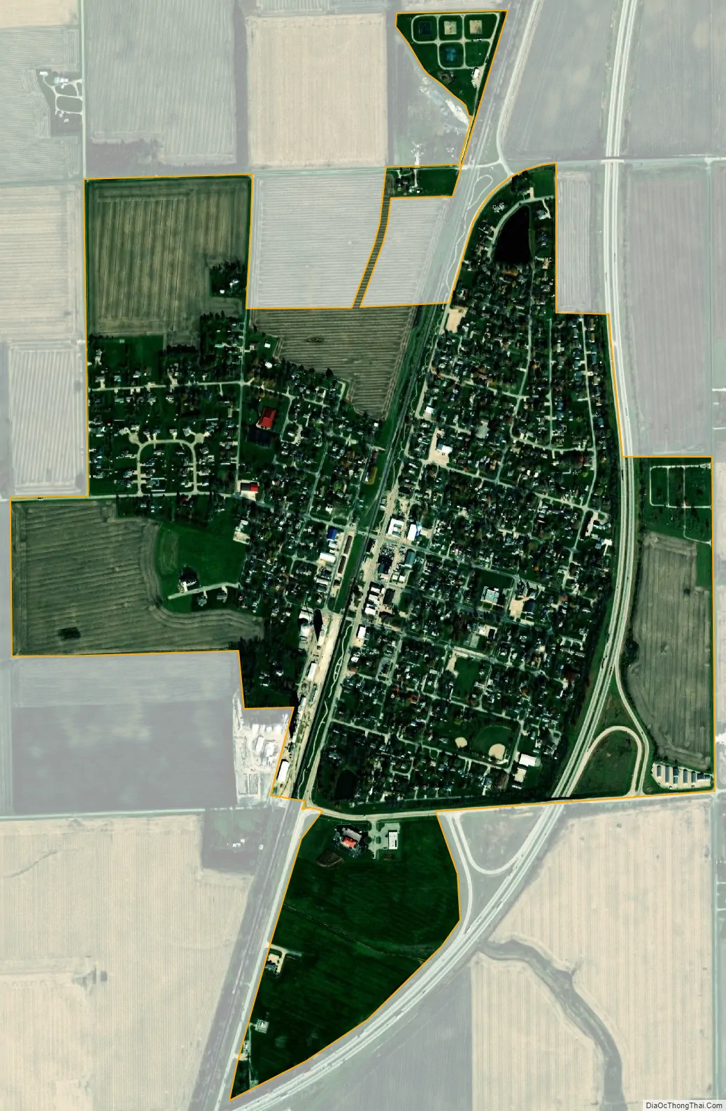
Clifton city Satellite Map
Geography
Clifton is located in northern Iroquois County at 40°56′5″N 87°56′1″W / 40.93472°N 87.93361°W / 40.93472; -87.93361 (40.934592, -87.933535). Interstate 57 passes along the eastern side of the village, with access from Exit 297. I-57 leads north 14 miles (23 km) to Kankakee and south 61 miles (98 km) to Champaign. Chicago is 72 miles (116 km) north of Clifton.
According to the 2010 census, Clifton has a total area of 0.88 square miles (2.28 km), all land.
See also
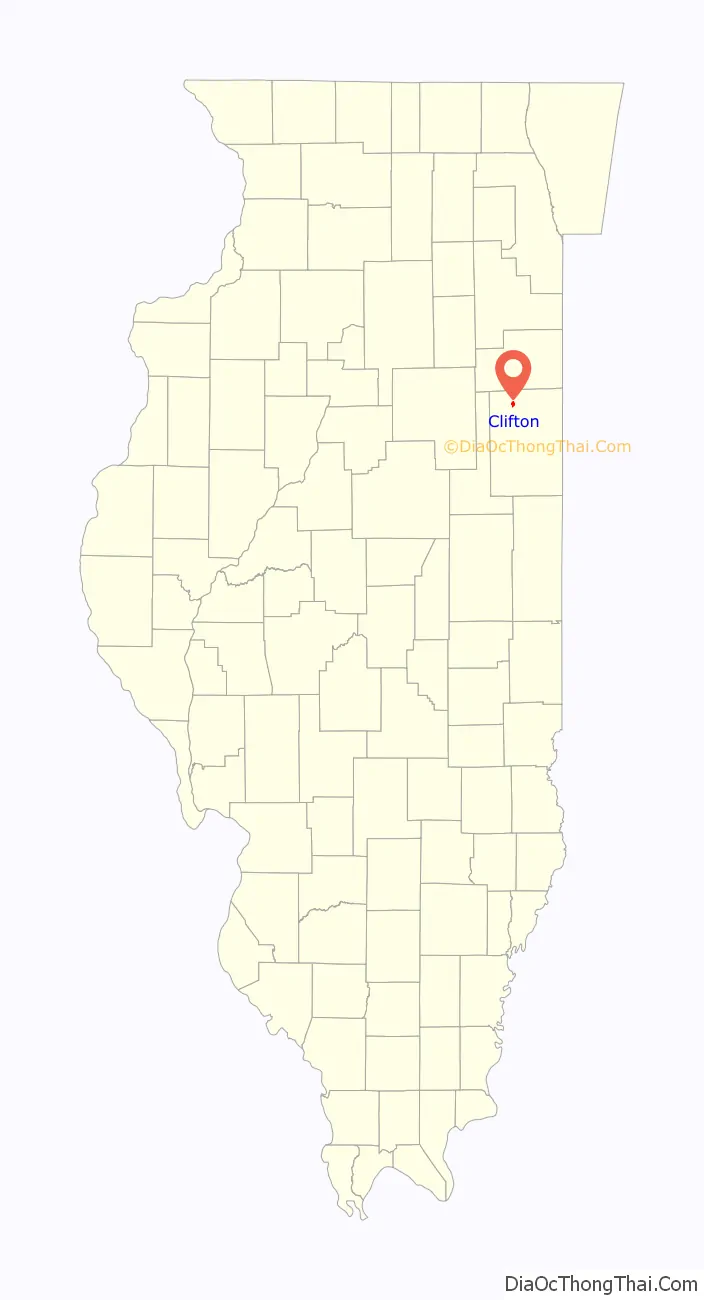
Map of Illinois State and its subdivision:- Adams
- Alexander
- Bond
- Boone
- Brown
- Bureau
- Calhoun
- Carroll
- Cass
- Champaign
- Christian
- Clark
- Clay
- Clinton
- Coles
- Cook
- Crawford
- Cumberland
- De Kalb
- De Witt
- Douglas
- Dupage
- Edgar
- Edwards
- Effingham
- Fayette
- Ford
- Franklin
- Fulton
- Gallatin
- Greene
- Grundy
- Hamilton
- Hancock
- Hardin
- Henderson
- Henry
- Iroquois
- Jackson
- Jasper
- Jefferson
- Jersey
- Jo Daviess
- Johnson
- Kane
- Kankakee
- Kendall
- Knox
- La Salle
- Lake
- Lake Michigan
- Lawrence
- Lee
- Livingston
- Logan
- Macon
- Macoupin
- Madison
- Marion
- Marshall
- Mason
- Massac
- McDonough
- McHenry
- McLean
- Menard
- Mercer
- Monroe
- Montgomery
- Morgan
- Moultrie
- Ogle
- Peoria
- Perry
- Piatt
- Pike
- Pope
- Pulaski
- Putnam
- Randolph
- Richland
- Rock Island
- Saint Clair
- Saline
- Sangamon
- Schuyler
- Scott
- Shelby
- Stark
- Stephenson
- Tazewell
- Union
- Vermilion
- Wabash
- Warren
- Washington
- Wayne
- White
- Whiteside
- Will
- Williamson
- Winnebago
- Woodford
- Alabama
- Alaska
- Arizona
- Arkansas
- California
- Colorado
- Connecticut
- Delaware
- District of Columbia
- Florida
- Georgia
- Hawaii
- Idaho
- Illinois
- Indiana
- Iowa
- Kansas
- Kentucky
- Louisiana
- Maine
- Maryland
- Massachusetts
- Michigan
- Minnesota
- Mississippi
- Missouri
- Montana
- Nebraska
- Nevada
- New Hampshire
- New Jersey
- New Mexico
- New York
- North Carolina
- North Dakota
- Ohio
- Oklahoma
- Oregon
- Pennsylvania
- Rhode Island
- South Carolina
- South Dakota
- Tennessee
- Texas
- Utah
- Vermont
- Virginia
- Washington
- West Virginia
- Wisconsin
- Wyoming