Cooksville is a village in McLean County, Illinois, United States. The population was 157 at the 2020 census. It is part of the Bloomington–Normal Metropolitan Statistical Area.
| Name: | Cooksville village |
|---|---|
| LSAD Code: | 47 |
| LSAD Description: | village (suffix) |
| State: | Illinois |
| County: | McLean County |
| Elevation: | 768 ft (234 m) |
| Total Area: | 0.22 sq mi (0.56 km²) |
| Land Area: | 0.22 sq mi (0.56 km²) |
| Water Area: | 0.00 sq mi (0.00 km²) |
| Total Population: | 157 |
| Population Density: | 723.50/sq mi (279.70/km²) |
| ZIP code: | 61730 |
| Area code: | 309 |
| FIPS code: | 1716210 |
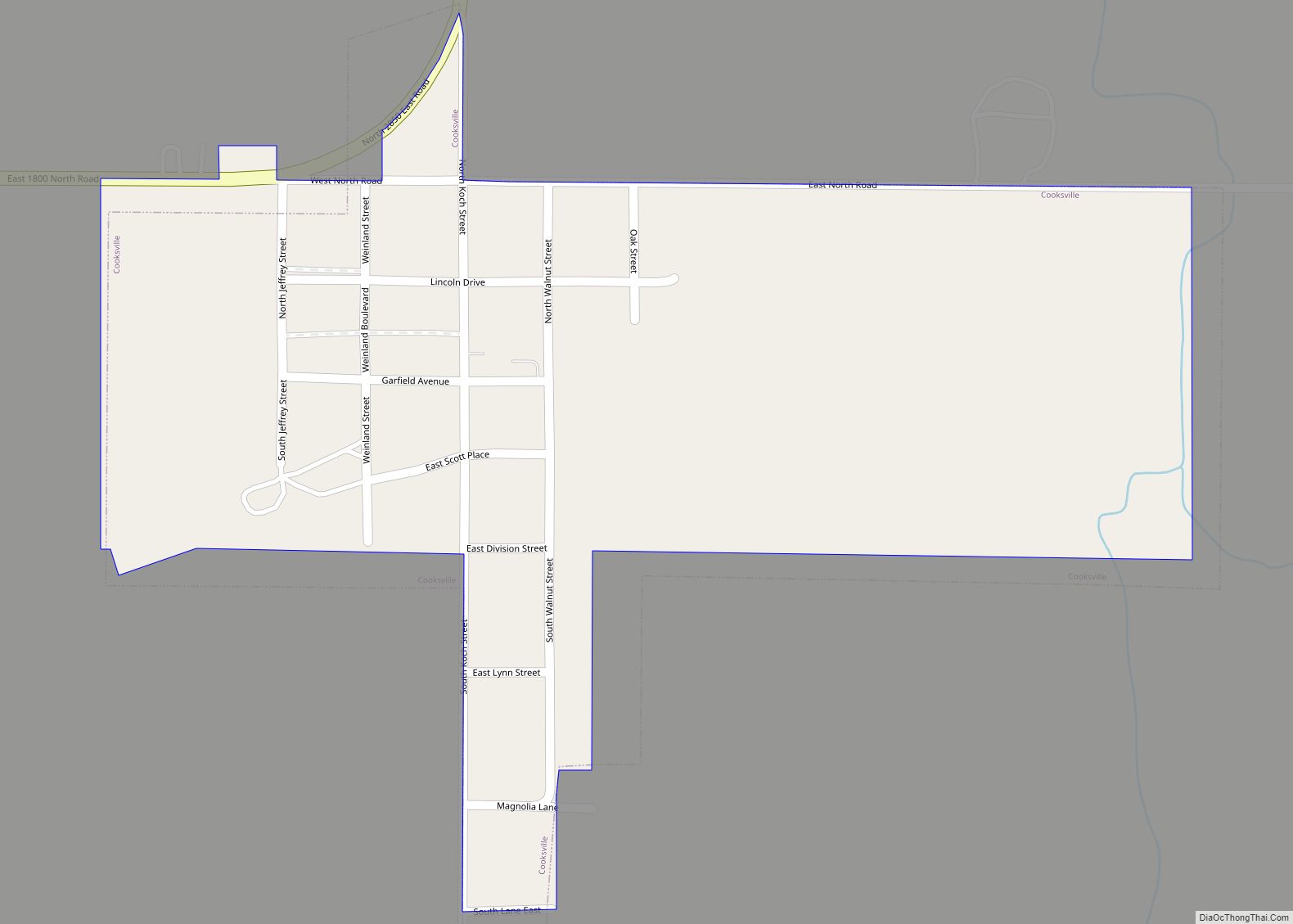
Online Interactive Map
Click on ![]() to view map in "full screen" mode.
to view map in "full screen" mode.
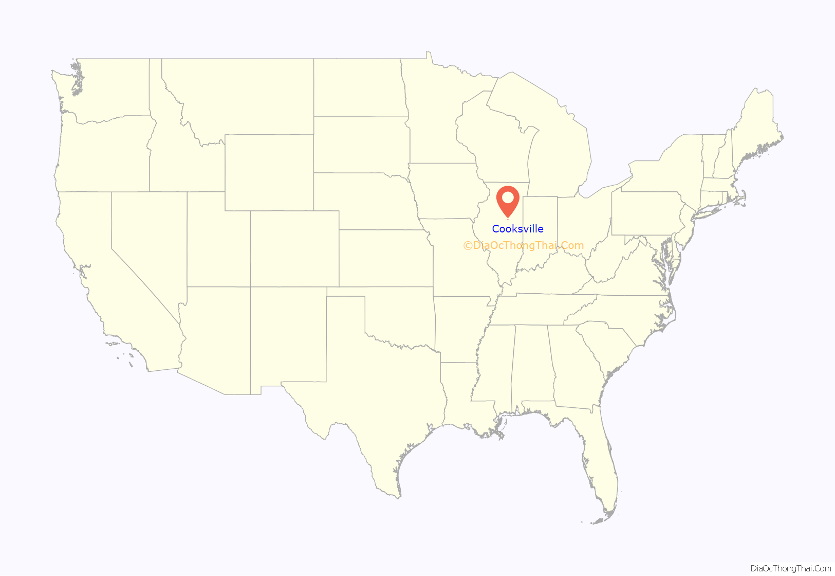
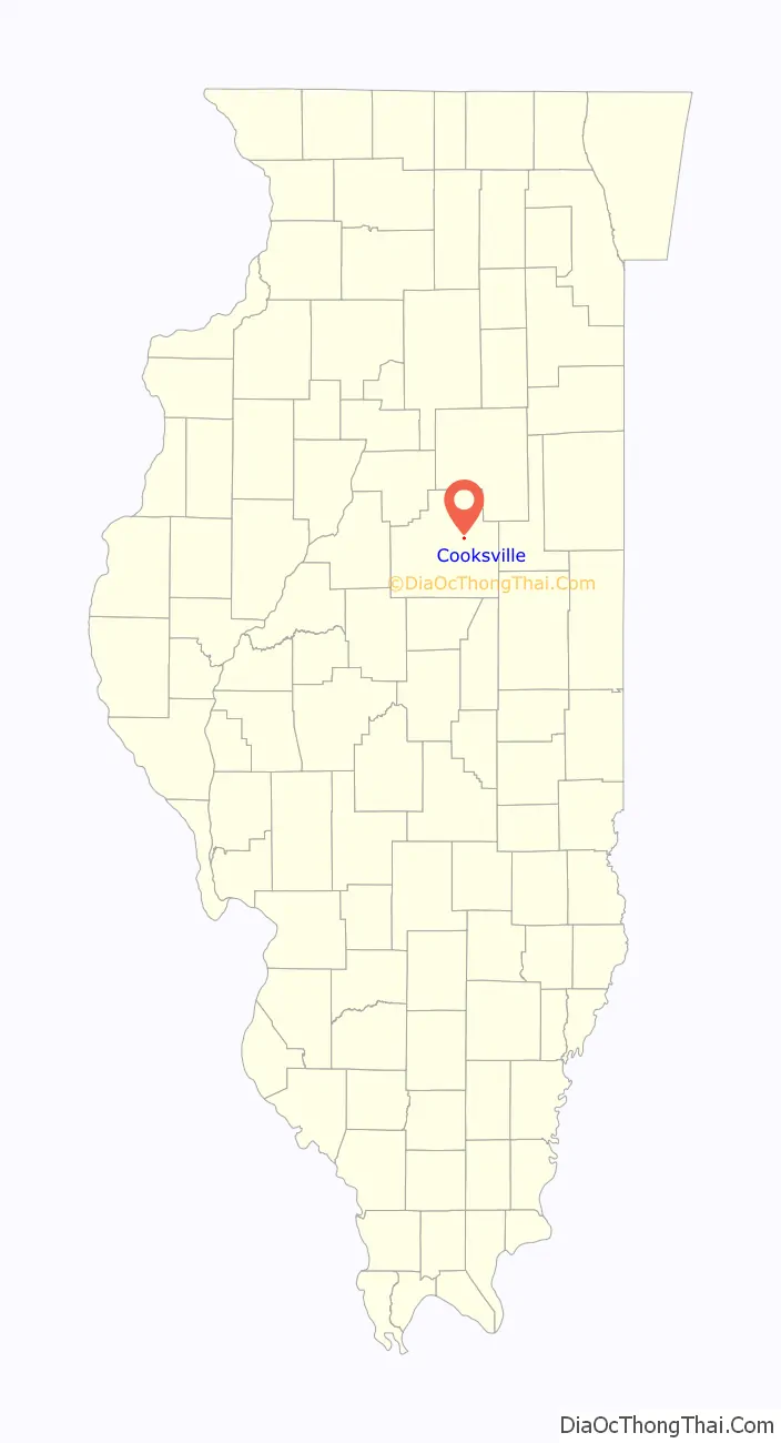
Cooksville location map. Where is Cooksville village?
History
Founding
Cooksville was laid out under the name “Kochsville” on December 4, 1882, by Frederick Wilhelm Koch (1829 – 1900). Within a year of its founding the name was changed to Cooksville. Koch was a Bloomington real estate dealer. He was born in Westphalia, in what is now Germany, and arrived in the United States on November 6, 1854. Koch was in Bloomington by 1860. He sold thirty or forty lots near his home in west Bloomington, and this neighborhood soon became known as Kochsville, giving Koch the distinction of having two McLean County places named in his honor. Cooksville was founded when the Clinton, Bloomington and Northeastern Railroad was finished from Colfax to Bloomington; in 1880 the part of the railroad from Kankakee to Colfax had been finished, resulting in the 1880 founding of Cropsey, Anchor, and Colfax; but the remainder of the railroad was delayed for two years. The railroad was soon taken over by the Illinois Central and was sometimes known as the Bloomer Line. After requests for the grain elevators to join Alliance Grain, operator of the Bloomer Line, were denied, the tracks from Colfax to Cooksville were removed. This left road transportation as the only available method for grain.
Design and growth
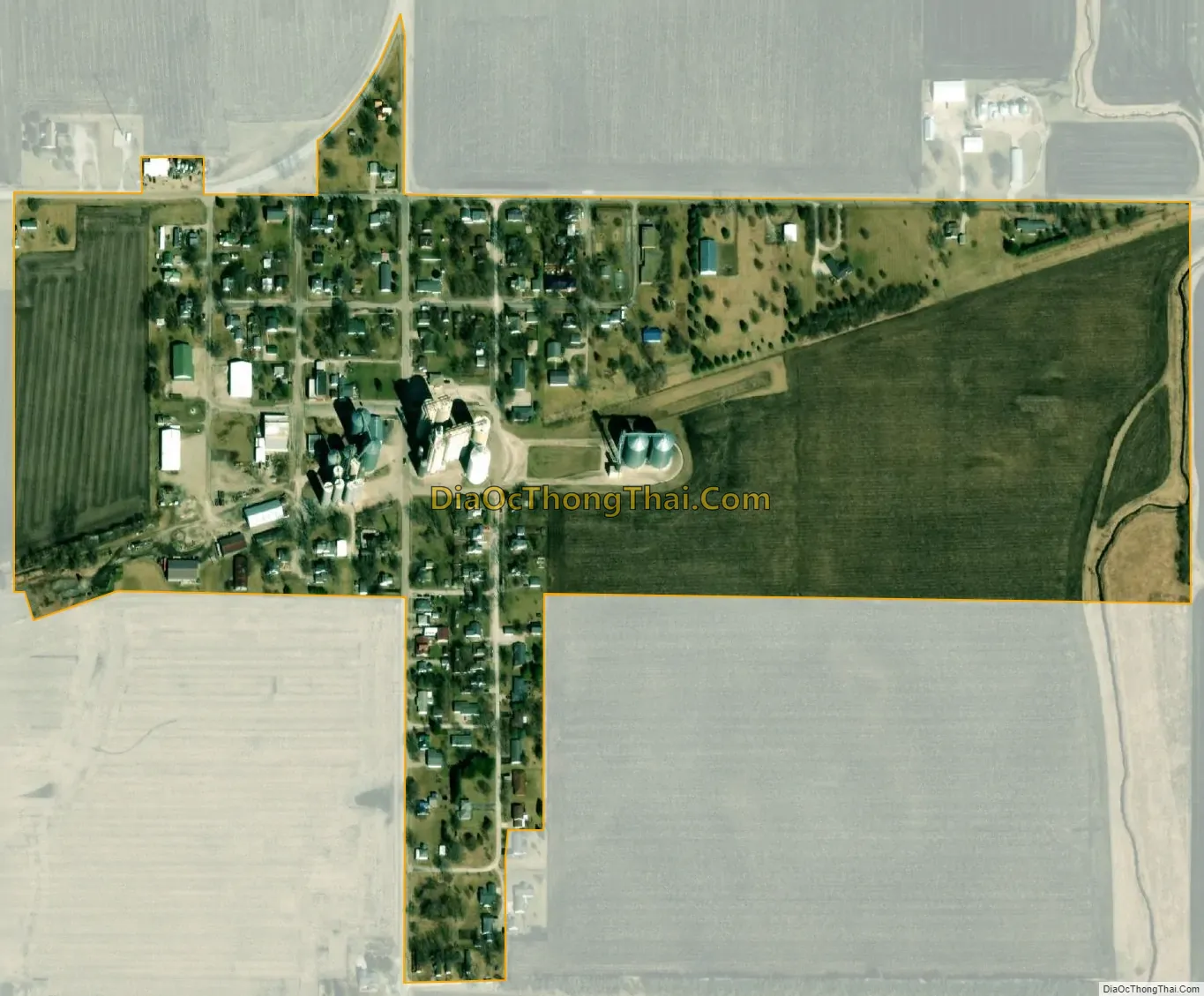
Cooksville was incorporated in December 1901. The population of the village peaked in 1910 with 332 people. The design of the original town of Cooksville was a rectangle north of the tracks with the southern blocks slightly truncated because the railroad did not run exactly east and west. The original town contained about 55 lots. The depot was on the north side of the tracks and the two early elevators on the south side. Soon small additions were laid out south of the tracks and on the east side of the original town. In 1883 William G. Darnell established the first grain elevator in Cooksville. Harvey W. Crumbacker also moved to the town in 1883. He established a hardware store and in 1902 built a two-story brick building in the town.
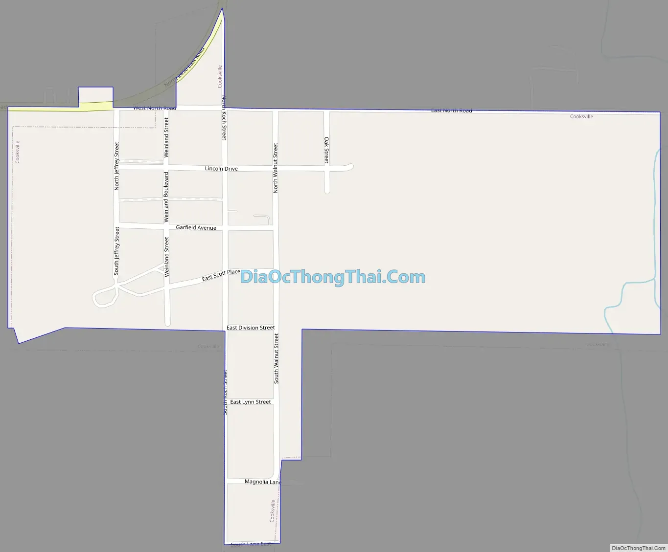
Cooksville Road Map
Cooksville city Satellite Map
Geography
Cooksville is in eastern McLean County, 18 miles (29 km) east-northeast of Bloomington, the county seat. Illinois Route 165 touches the northwest part of the village leading west-southwest toward Bloomington and east-northeast 20 miles (32 km) to Sibley.
According to the U.S. Census Bureau, Cooksville has a total area of 0.22 square miles (0.57 km), all land. The village is in the watershed of the Mackinaw River, a west-flowing tributary of the Illinois River.
See also
Map of Illinois State and its subdivision:- Adams
- Alexander
- Bond
- Boone
- Brown
- Bureau
- Calhoun
- Carroll
- Cass
- Champaign
- Christian
- Clark
- Clay
- Clinton
- Coles
- Cook
- Crawford
- Cumberland
- De Kalb
- De Witt
- Douglas
- Dupage
- Edgar
- Edwards
- Effingham
- Fayette
- Ford
- Franklin
- Fulton
- Gallatin
- Greene
- Grundy
- Hamilton
- Hancock
- Hardin
- Henderson
- Henry
- Iroquois
- Jackson
- Jasper
- Jefferson
- Jersey
- Jo Daviess
- Johnson
- Kane
- Kankakee
- Kendall
- Knox
- La Salle
- Lake
- Lake Michigan
- Lawrence
- Lee
- Livingston
- Logan
- Macon
- Macoupin
- Madison
- Marion
- Marshall
- Mason
- Massac
- McDonough
- McHenry
- McLean
- Menard
- Mercer
- Monroe
- Montgomery
- Morgan
- Moultrie
- Ogle
- Peoria
- Perry
- Piatt
- Pike
- Pope
- Pulaski
- Putnam
- Randolph
- Richland
- Rock Island
- Saint Clair
- Saline
- Sangamon
- Schuyler
- Scott
- Shelby
- Stark
- Stephenson
- Tazewell
- Union
- Vermilion
- Wabash
- Warren
- Washington
- Wayne
- White
- Whiteside
- Will
- Williamson
- Winnebago
- Woodford
- Alabama
- Alaska
- Arizona
- Arkansas
- California
- Colorado
- Connecticut
- Delaware
- District of Columbia
- Florida
- Georgia
- Hawaii
- Idaho
- Illinois
- Indiana
- Iowa
- Kansas
- Kentucky
- Louisiana
- Maine
- Maryland
- Massachusetts
- Michigan
- Minnesota
- Mississippi
- Missouri
- Montana
- Nebraska
- Nevada
- New Hampshire
- New Jersey
- New Mexico
- New York
- North Carolina
- North Dakota
- Ohio
- Oklahoma
- Oregon
- Pennsylvania
- Rhode Island
- South Carolina
- South Dakota
- Tennessee
- Texas
- Utah
- Vermont
- Virginia
- Washington
- West Virginia
- Wisconsin
- Wyoming