Crest Hill is a city in Lockport Township, Will County, Illinois, United States. The 2020 census put Crest Hill’s population at 20,459.
| Name: | Crest Hill city |
|---|---|
| LSAD Code: | 25 |
| LSAD Description: | city (suffix) |
| State: | Illinois |
| County: | Will County |
| Incorporated: | January 22, 1960 |
| Elevation: | 640 ft (200 m) |
| Total Area: | 9.18 sq mi (23.79 km²) |
| Land Area: | 9.04 sq mi (23.42 km²) |
| Water Area: | 0.14 sq mi (0.37 km²) |
| Total Population: | 20,459 |
| Population Density: | 2,262.91/sq mi (873.68/km²) |
| ZIP code: | 60403 |
| Area code: | 815 |
| FIPS code: | 1717458 |
| GNISfeature ID: | 2393670 |
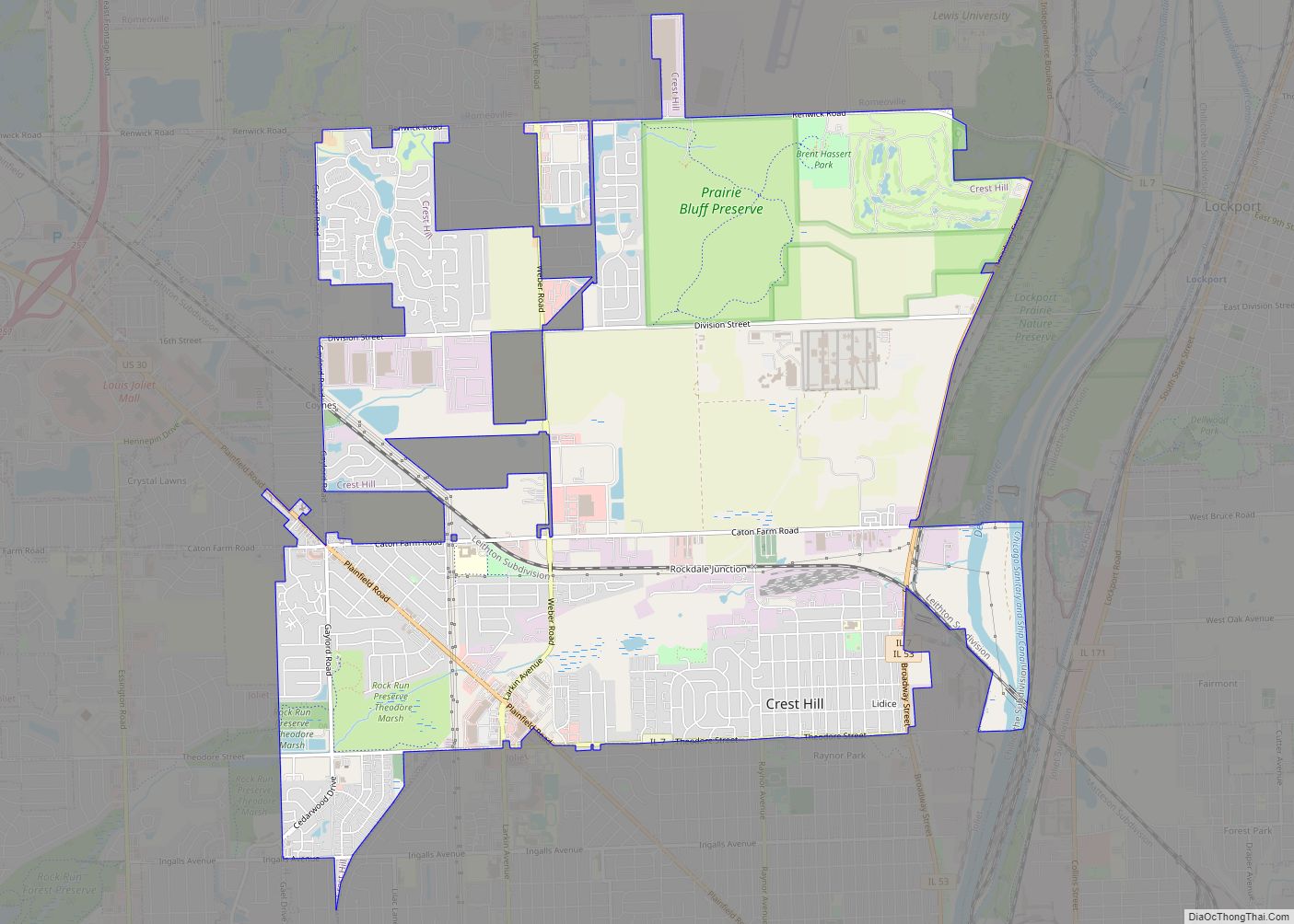
Online Interactive Map
Click on ![]() to view map in "full screen" mode.
to view map in "full screen" mode.
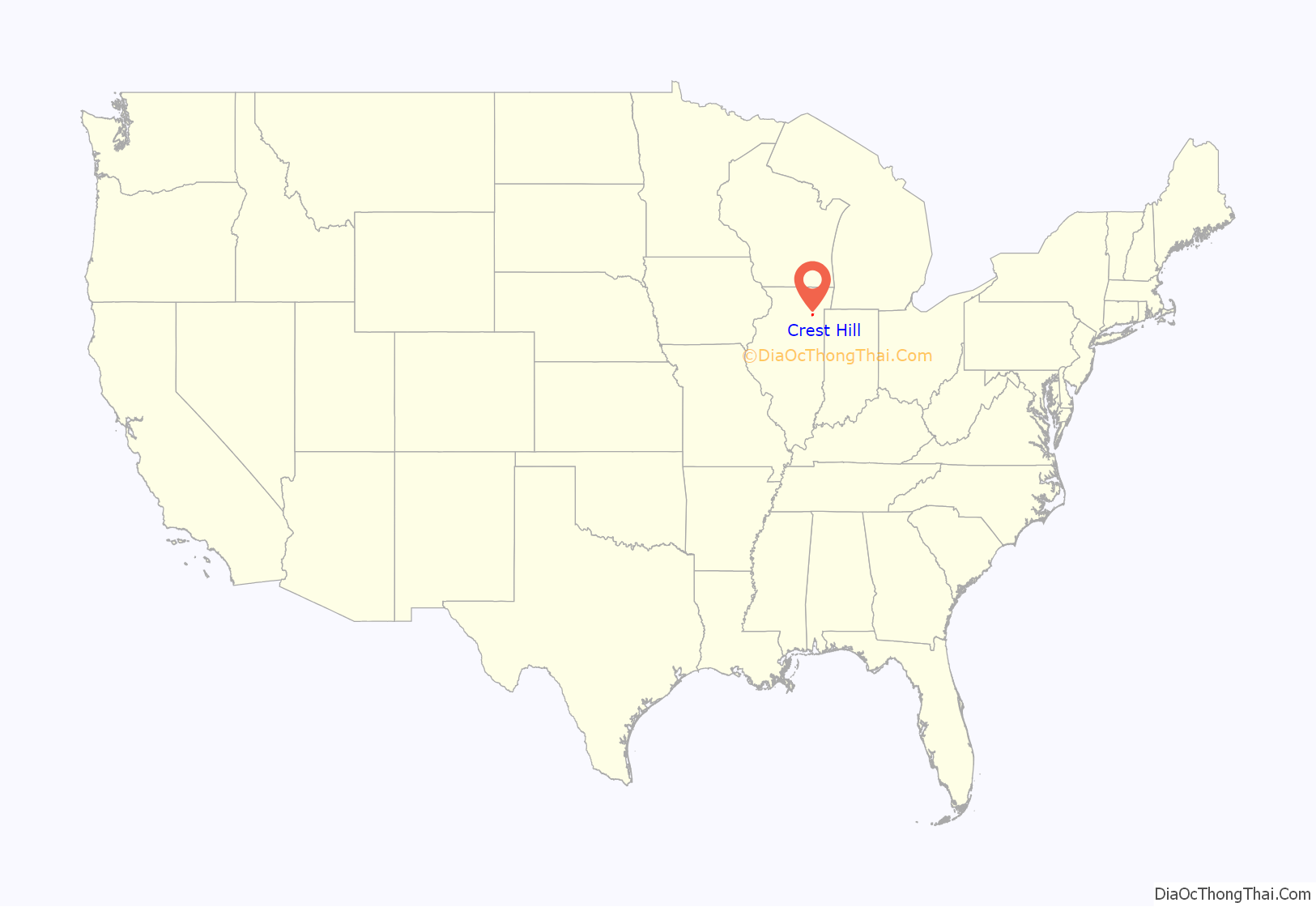
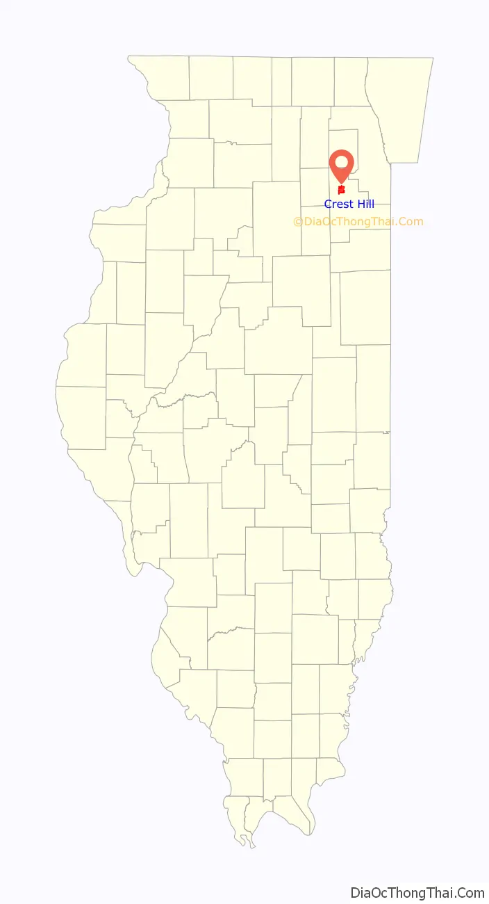
Crest Hill location map. Where is Crest Hill city?
History
The neighborhood of Stern Park Gardens, later incorporated with Crest Hill, renamed itself Lidice in 1942 following the Lidice massacre. Former presidential candidate Wendell Willkie and Czechoslovak president-in-exile Edvard Beneš spoke at the dedication commemorating the tragedy.
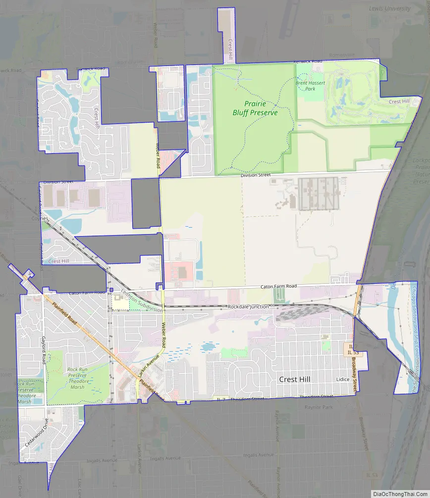
Crest Hill Road Map
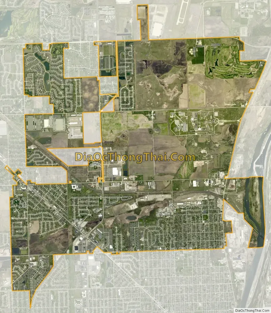
Crest Hill city Satellite Map
Geography
Crest Hill is located at 41°33′52″N 88°6′31″W / 41.56444°N 88.10861°W / 41.56444; -88.10861 (41.5645, -88.1089). Crest Hill decided to incorporate itself to avoid being annexed by the City of Joliet and became officially incorporated as the City of Crest Hill January 22, 1960.
According to the 2010 census, Crest Hill has a total area of 9.166 square miles (23.74 km), of which 9.03 square miles (23.39 km) (or 98.52%) is land and 0.136 square miles (0.35 km) (or 1.48%) is water.
See also
Map of Illinois State and its subdivision:- Adams
- Alexander
- Bond
- Boone
- Brown
- Bureau
- Calhoun
- Carroll
- Cass
- Champaign
- Christian
- Clark
- Clay
- Clinton
- Coles
- Cook
- Crawford
- Cumberland
- De Kalb
- De Witt
- Douglas
- Dupage
- Edgar
- Edwards
- Effingham
- Fayette
- Ford
- Franklin
- Fulton
- Gallatin
- Greene
- Grundy
- Hamilton
- Hancock
- Hardin
- Henderson
- Henry
- Iroquois
- Jackson
- Jasper
- Jefferson
- Jersey
- Jo Daviess
- Johnson
- Kane
- Kankakee
- Kendall
- Knox
- La Salle
- Lake
- Lake Michigan
- Lawrence
- Lee
- Livingston
- Logan
- Macon
- Macoupin
- Madison
- Marion
- Marshall
- Mason
- Massac
- McDonough
- McHenry
- McLean
- Menard
- Mercer
- Monroe
- Montgomery
- Morgan
- Moultrie
- Ogle
- Peoria
- Perry
- Piatt
- Pike
- Pope
- Pulaski
- Putnam
- Randolph
- Richland
- Rock Island
- Saint Clair
- Saline
- Sangamon
- Schuyler
- Scott
- Shelby
- Stark
- Stephenson
- Tazewell
- Union
- Vermilion
- Wabash
- Warren
- Washington
- Wayne
- White
- Whiteside
- Will
- Williamson
- Winnebago
- Woodford
- Alabama
- Alaska
- Arizona
- Arkansas
- California
- Colorado
- Connecticut
- Delaware
- District of Columbia
- Florida
- Georgia
- Hawaii
- Idaho
- Illinois
- Indiana
- Iowa
- Kansas
- Kentucky
- Louisiana
- Maine
- Maryland
- Massachusetts
- Michigan
- Minnesota
- Mississippi
- Missouri
- Montana
- Nebraska
- Nevada
- New Hampshire
- New Jersey
- New Mexico
- New York
- North Carolina
- North Dakota
- Ohio
- Oklahoma
- Oregon
- Pennsylvania
- Rhode Island
- South Carolina
- South Dakota
- Tennessee
- Texas
- Utah
- Vermont
- Virginia
- Washington
- West Virginia
- Wisconsin
- Wyoming