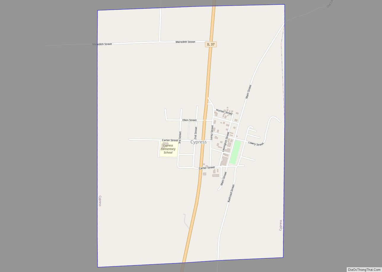
Cypress is a village in Johnson County, Illinois, United States. The population was 234 at the 2010 census.
| Name: | Cypress village |
|---|---|
| LSAD Code: | 47 |
| LSAD Description: | village (suffix) |
| State: | Illinois |
| County: | Johnson County |
| Elevation: | 381 ft (116 m) |
| Total Area: | 0.76 sq mi (1.96 km²) |
| Land Area: | 0.75 sq mi (1.95 km²) |
| Water Area: | 0.00 sq mi (0.01 km²) |
| Total Population: | 217 |
| Population Density: | 288.18/sq mi (111.31/km²) |
| ZIP code: | 62923 |
| Area code: | 618 |
| FIPS code: | 1718251 |
| GNISfeature ID: | 2398666 |
Online Interactive Map
Click on ![]() to view map in "full screen" mode.
to view map in "full screen" mode.
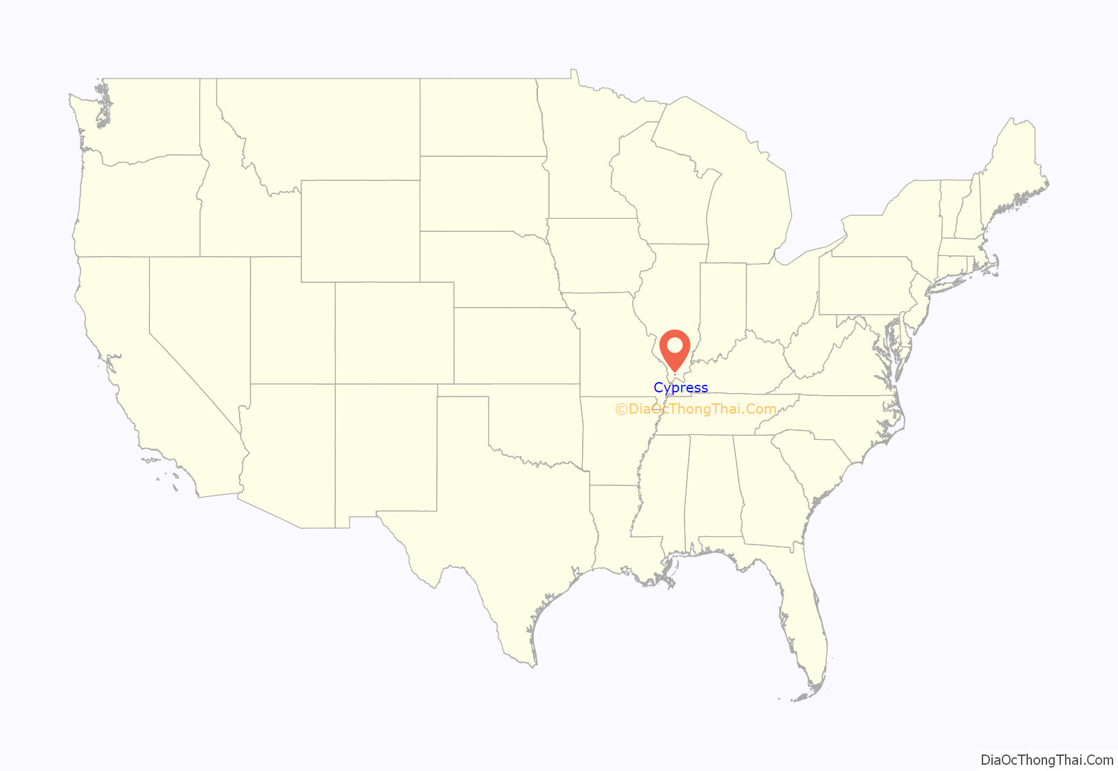
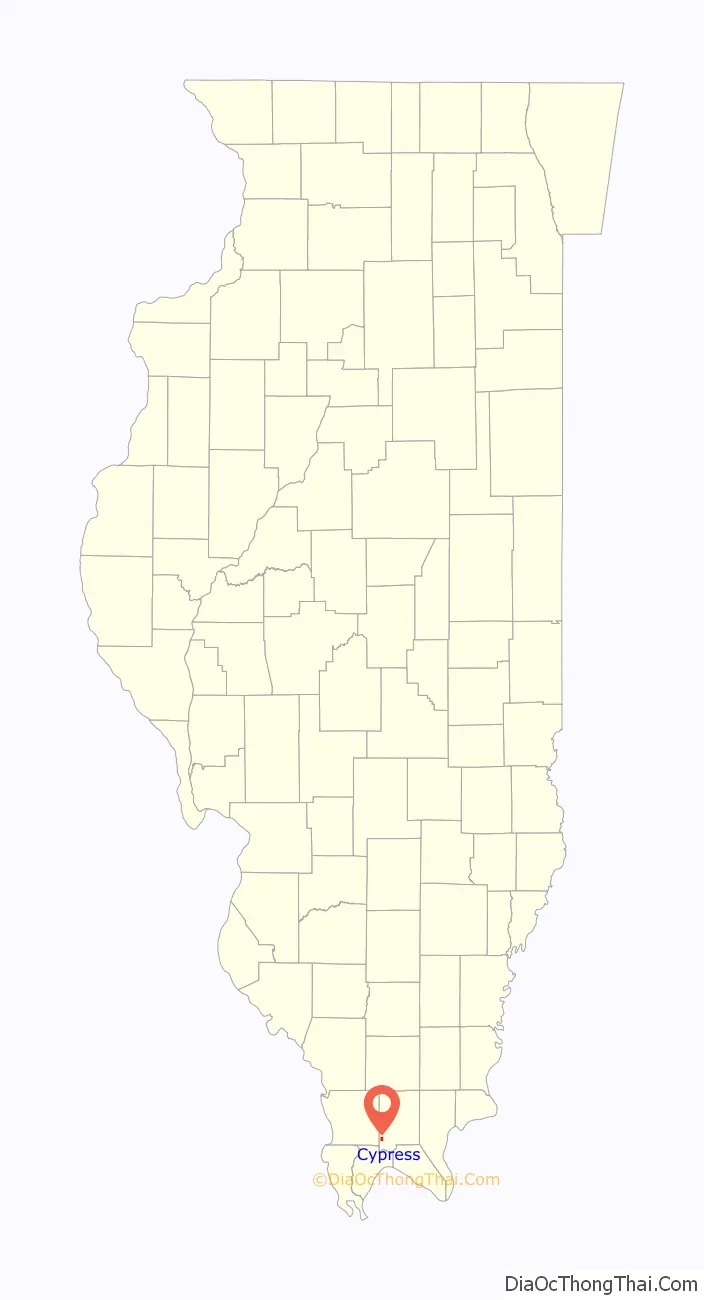
Cypress location map. Where is Cypress village?
History
Cypress was established in the late 1890s as a stop along the Chicago and Eastern Illinois Railroad, a Class I railroad. In 1984, the railroad was abandoned. A post office which had been operating at Gray’s Mill (east of modern Cypress) was moved to the new location, a former bank. The village’s name is likely a reference to the cypress trees that grow in abundance in the Cache River basin. Cypress Grade School was built in 1917, before April 28, 2002, when a tornado hit the school. Around four years later, the current school was finished.
Cypress Road Map

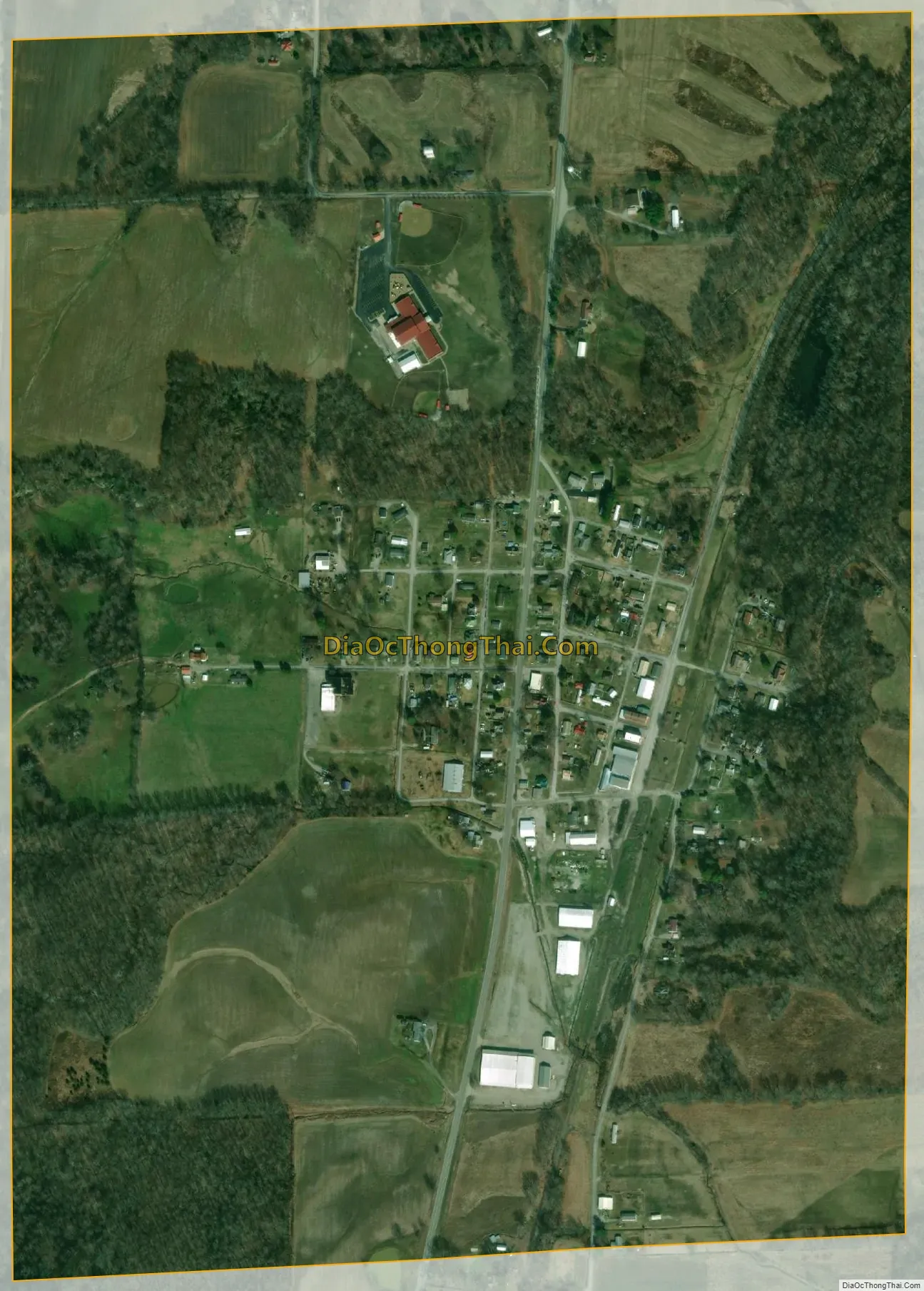
Cypress city Satellite Map
Geography
Cypress is located in southwestern Johnson County at 37°21′56″N 89°1′3″W / 37.36556°N 89.01750°W / 37.36556; -89.01750 (37.365543, -89.017473). The village is situated in the Cache River basin northwest of Karnak and southwest of Vienna. The Heron Pond – Little Black Slough Nature Preserve lies to the east of Cypress. Illinois Route 37 passes through the village.
According to the 2010 census, Cypress has a total area of 0.753 square miles (1.95 km), of which 0.75 square miles (1.94 km) (or 99.6%) is land and 0.003 square miles (0.01 km) (or 0.4%) is water.
See also
Map of Illinois State and its subdivision:- Adams
- Alexander
- Bond
- Boone
- Brown
- Bureau
- Calhoun
- Carroll
- Cass
- Champaign
- Christian
- Clark
- Clay
- Clinton
- Coles
- Cook
- Crawford
- Cumberland
- De Kalb
- De Witt
- Douglas
- Dupage
- Edgar
- Edwards
- Effingham
- Fayette
- Ford
- Franklin
- Fulton
- Gallatin
- Greene
- Grundy
- Hamilton
- Hancock
- Hardin
- Henderson
- Henry
- Iroquois
- Jackson
- Jasper
- Jefferson
- Jersey
- Jo Daviess
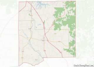
- Johnson
- Kane
- Kankakee
- Kendall
- Knox
- La Salle
- Lake
- Lake Michigan
- Lawrence
- Lee
- Livingston
- Logan
- Macon
- Macoupin
- Madison
- Marion
- Marshall
- Mason
- Massac
- McDonough
- McHenry
- McLean
- Menard
- Mercer
- Monroe
- Montgomery
- Morgan
- Moultrie
- Ogle
- Peoria
- Perry
- Piatt
- Pike
- Pope
- Pulaski
- Putnam
- Randolph
- Richland
- Rock Island
- Saint Clair
- Saline
- Sangamon
- Schuyler
- Scott
- Shelby
- Stark
- Stephenson
- Tazewell
- Union
- Vermilion
- Wabash
- Warren
- Washington
- Wayne
- White
- Whiteside
- Will
- Williamson
- Winnebago
- Woodford
- Alabama
- Alaska
- Arizona
- Arkansas
- California
- Colorado
- Connecticut
- Delaware
- District of Columbia
- Florida
- Georgia
- Hawaii
- Idaho
- Illinois
- Indiana
- Iowa
- Kansas
- Kentucky
- Louisiana
- Maine
- Maryland
- Massachusetts
- Michigan
- Minnesota
- Mississippi
- Missouri
- Montana
- Nebraska
- Nevada
- New Hampshire
- New Jersey
- New Mexico
- New York
- North Carolina
- North Dakota
- Ohio
- Oklahoma
- Oregon
- Pennsylvania
- Rhode Island
- South Carolina
- South Dakota
- Tennessee
- Texas
- Utah
- Vermont
- Virginia
- Washington
- West Virginia
- Wisconsin
- Wyoming