Deer Park is a village in Lake and Cook Counties, Illinois. Per the 2020 census, the population was 3,681. The village is one of the few left in the Chicago area that enjoy a green belt which is bordered by two large natural areas providing outdoor recreation and open space. The village is home to popular shopping and dining destinations: Deer Park Town Center and the Town Center Promenade. The town is also home to the Vehe Farm, an Illinois Centennial Farm.
Residential zoning is mainly single family homes with lot of sizes of 1-acre (4,000 m) or more. Upscale townhomes are available near the Deer Park Center. The Metra/Chicago & Northwestern train line provides commuter service to Chicago with stations in nearby Barrington and Palatine.
| Name: | Deer Park village |
|---|---|
| LSAD Code: | 47 |
| LSAD Description: | village (suffix) |
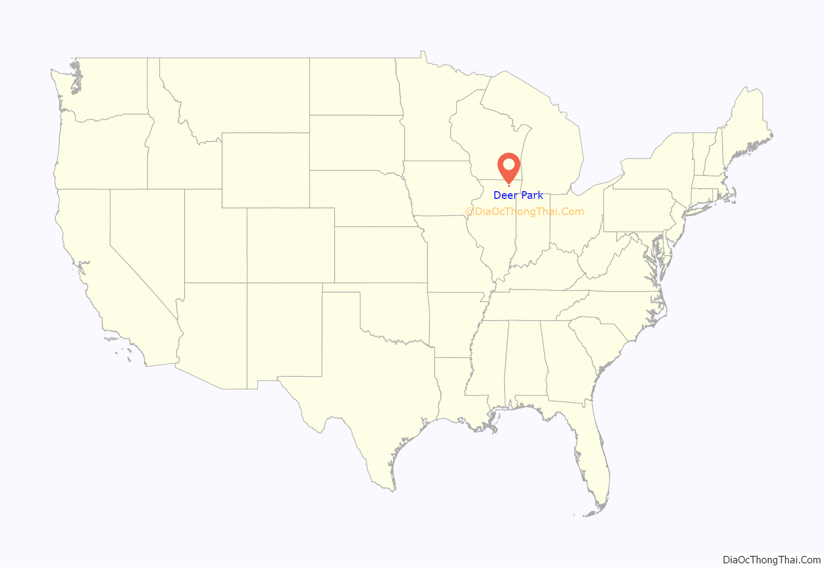
| State: | Illinois |
| County: | Cook County, Lake County |
| Incorporated: | 1957 |
| Total Area: | 3.75 sq mi (9.73 km²) |
| Land Area: | 3.65 sq mi (9.46 km²) |
| Water Area: | 0.10 sq mi (0.26 km²) 3.13% |
| Total Population: | 3,681 |
| Population Density: | 1,007.39/sq mi (388.91/km²) |
| Area code: | 847 & 224 |
| FIPS code: | 1719083 |
| Website: | villageofdeerpark.com |
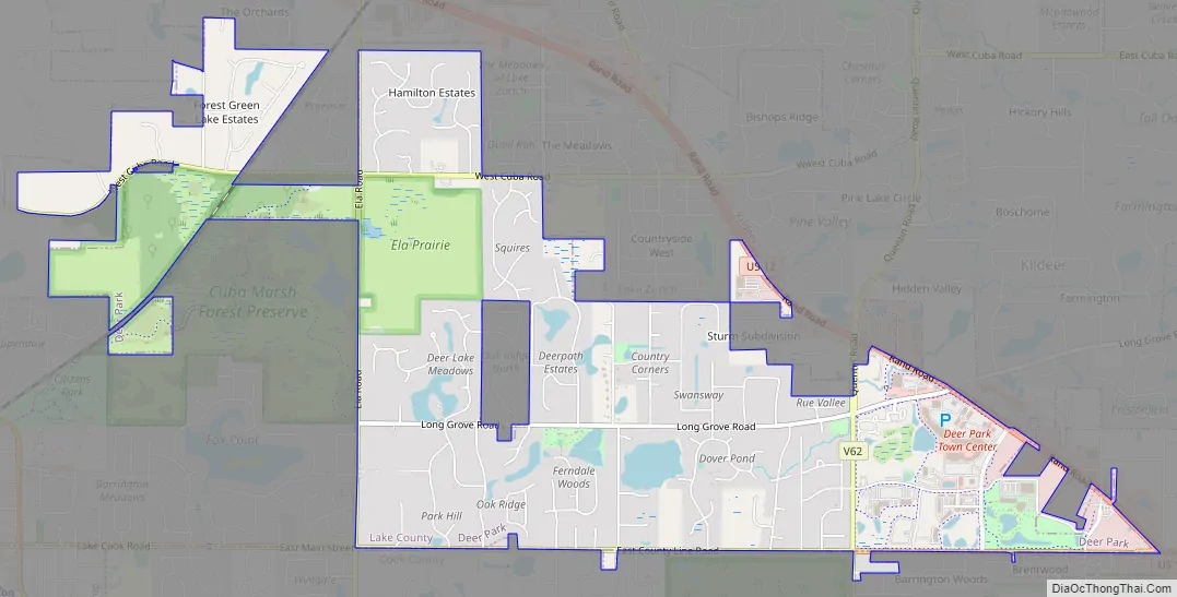
Online Interactive Map
Click on ![]() to view map in "full screen" mode.
to view map in "full screen" mode.
Deer Park location map. Where is Deer Park village?
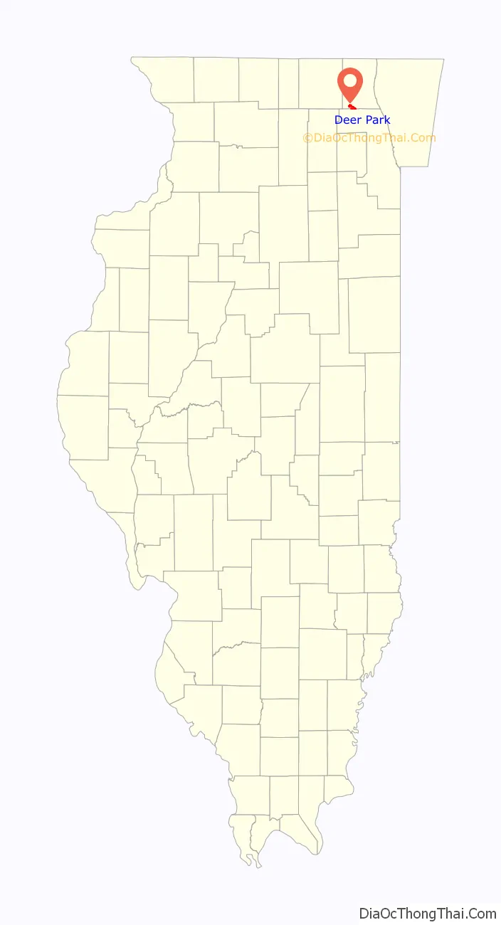
Deer Park Road Map
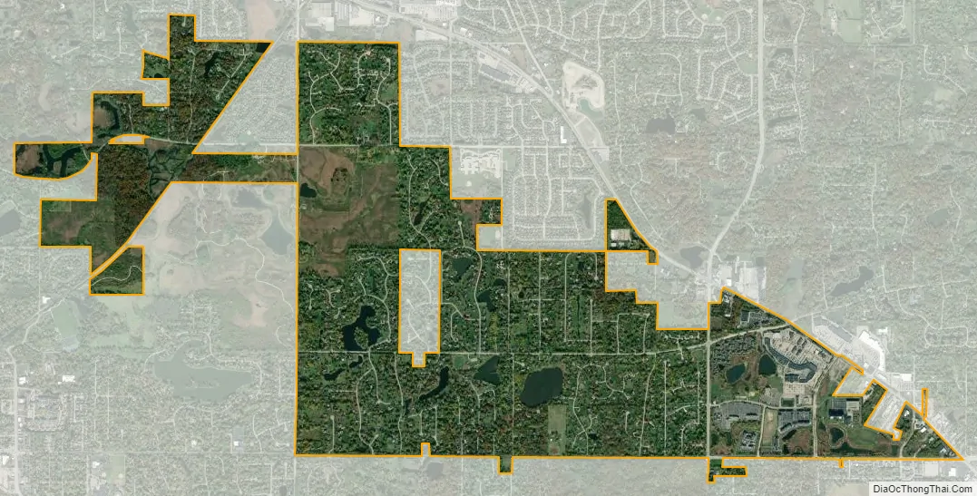
Deer Park city Satellite Map
Geography
Deer Park is located at 42°09′59″N 88°05′09″W / 42.166458°N 88.085859°W / 42.166458; -88.085859.
According to the 2021 census gazetteer files, Deer Park has a total area of 3.76 square miles (9.74 km), of which 3.65 square miles (9.45 km) (or 97.31%) is land and 0.10 square miles (0.26 km) (or 2.69%) is water.
See also
Map of Illinois State and its subdivision:- Adams
- Alexander
- Bond
- Boone
- Brown
- Bureau
- Calhoun
- Carroll
- Cass
- Champaign
- Christian
- Clark
- Clay
- Clinton
- Coles
- Cook
- Crawford
- Cumberland
- De Kalb
- De Witt
- Douglas
- Dupage
- Edgar
- Edwards
- Effingham
- Fayette
- Ford
- Franklin
- Fulton
- Gallatin
- Greene
- Grundy
- Hamilton
- Hancock
- Hardin
- Henderson
- Henry
- Iroquois
- Jackson
- Jasper
- Jefferson
- Jersey
- Jo Daviess
- Johnson
- Kane
- Kankakee
- Kendall
- Knox
- La Salle
- Lake
- Lake Michigan
- Lawrence
- Lee
- Livingston
- Logan
- Macon
- Macoupin
- Madison
- Marion
- Marshall
- Mason
- Massac
- McDonough
- McHenry
- McLean
- Menard
- Mercer
- Monroe
- Montgomery
- Morgan
- Moultrie
- Ogle
- Peoria
- Perry
- Piatt
- Pike
- Pope
- Pulaski
- Putnam
- Randolph
- Richland
- Rock Island
- Saint Clair
- Saline
- Sangamon
- Schuyler
- Scott
- Shelby
- Stark
- Stephenson
- Tazewell
- Union
- Vermilion
- Wabash
- Warren
- Washington
- Wayne
- White
- Whiteside
- Will
- Williamson
- Winnebago
- Woodford
- Alabama
- Alaska
- Arizona
- Arkansas
- California
- Colorado
- Connecticut
- Delaware
- District of Columbia
- Florida
- Georgia
- Hawaii
- Idaho
- Illinois
- Indiana
- Iowa
- Kansas
- Kentucky
- Louisiana
- Maine
- Maryland
- Massachusetts
- Michigan
- Minnesota
- Mississippi
- Missouri
- Montana
- Nebraska
- Nevada
- New Hampshire
- New Jersey
- New Mexico
- New York
- North Carolina
- North Dakota
- Ohio
- Oklahoma
- Oregon
- Pennsylvania
- Rhode Island
- South Carolina
- South Dakota
- Tennessee
- Texas
- Utah
- Vermont
- Virginia
- Washington
- West Virginia
- Wisconsin
- Wyoming


