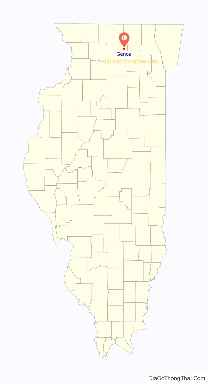
Genoa is a city in the north-east corner of DeKalb County, Illinois, United States. It is located on the historic Galena-Chicago stagecoach route. At the 2020 census the city had a population of 5,298, up from 5,193 in 2010.
| Name: | Genoa city |
|---|---|
| LSAD Code: | 25 |
| LSAD Description: | city (suffix) |
| State: | Illinois |
| County: | DeKalb County |
| Incorporated: | 1876 |
| Total Area: | 2.64 sq mi (6.85 km²) |
| Land Area: | 2.59 sq mi (6.71 km²) |
| Water Area: | 0.05 sq mi (0.14 km²) |
| Total Population: | 5,298 |
| Population Density: | 2,045.56/sq mi (789.67/km²) |
| ZIP code: | 60135 |
| Area code: | 815 and 779 |
| FIPS code: | 1728898 |
| Website: | www.genoa-il.com |
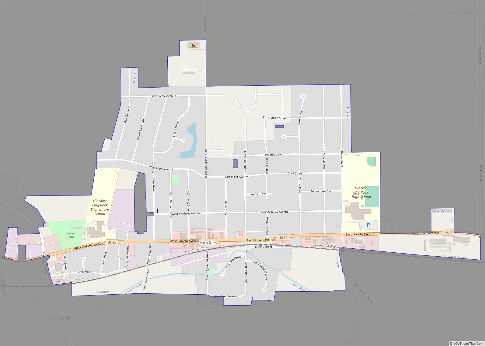
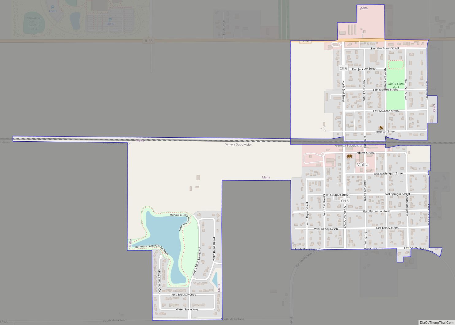
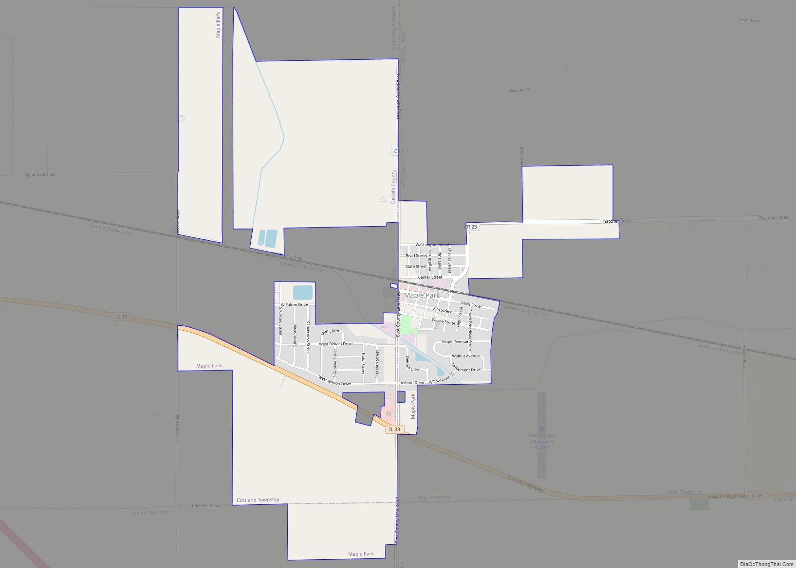
Online Interactive Map
Click on ![]() to view map in "full screen" mode.
to view map in "full screen" mode.
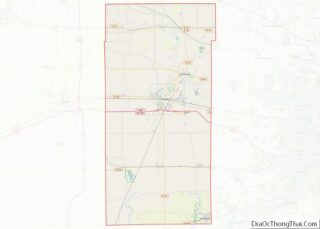
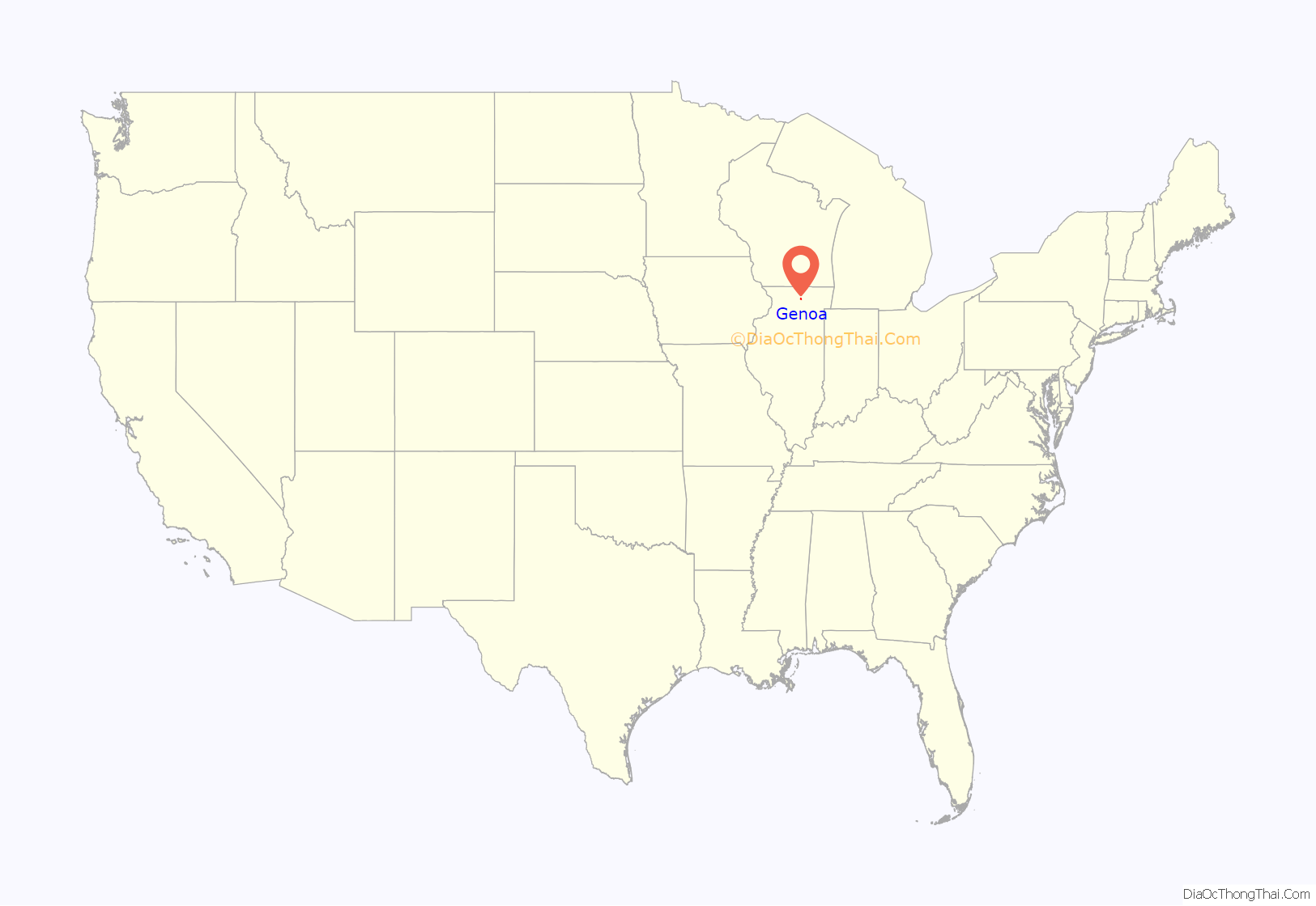
Genoa location map. Where is Genoa city?
History
Genoa was settled as early as 1835 by Thomas Madison, an American Revolutionary War soldier from Ashtabula County, Ohio. He named Genoa after a town of the same name in New York. Genoa was incorporated as a village in 1876 and as a city on September 9, 1911.
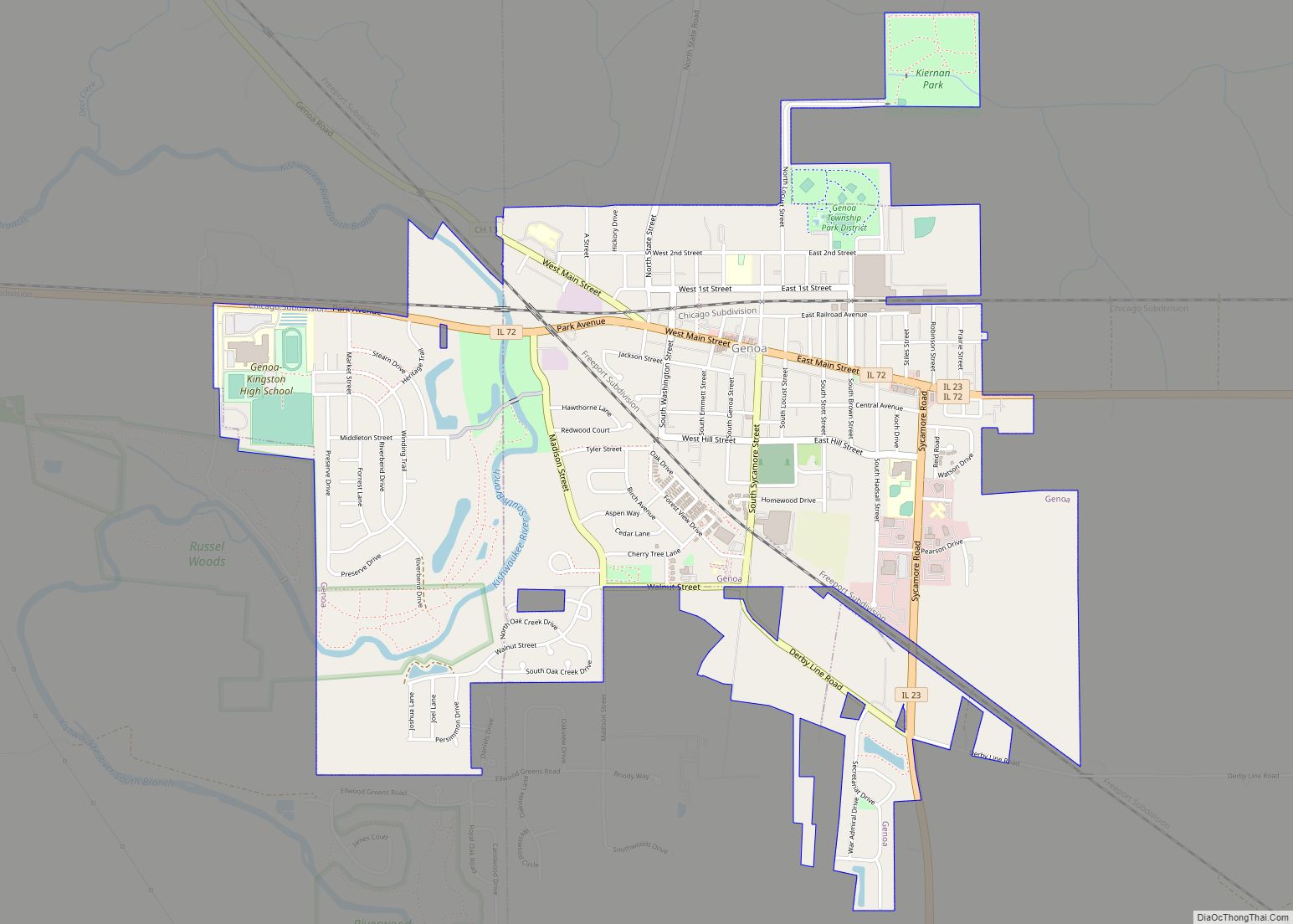
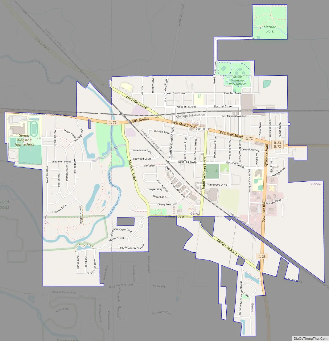
Genoa Road Map
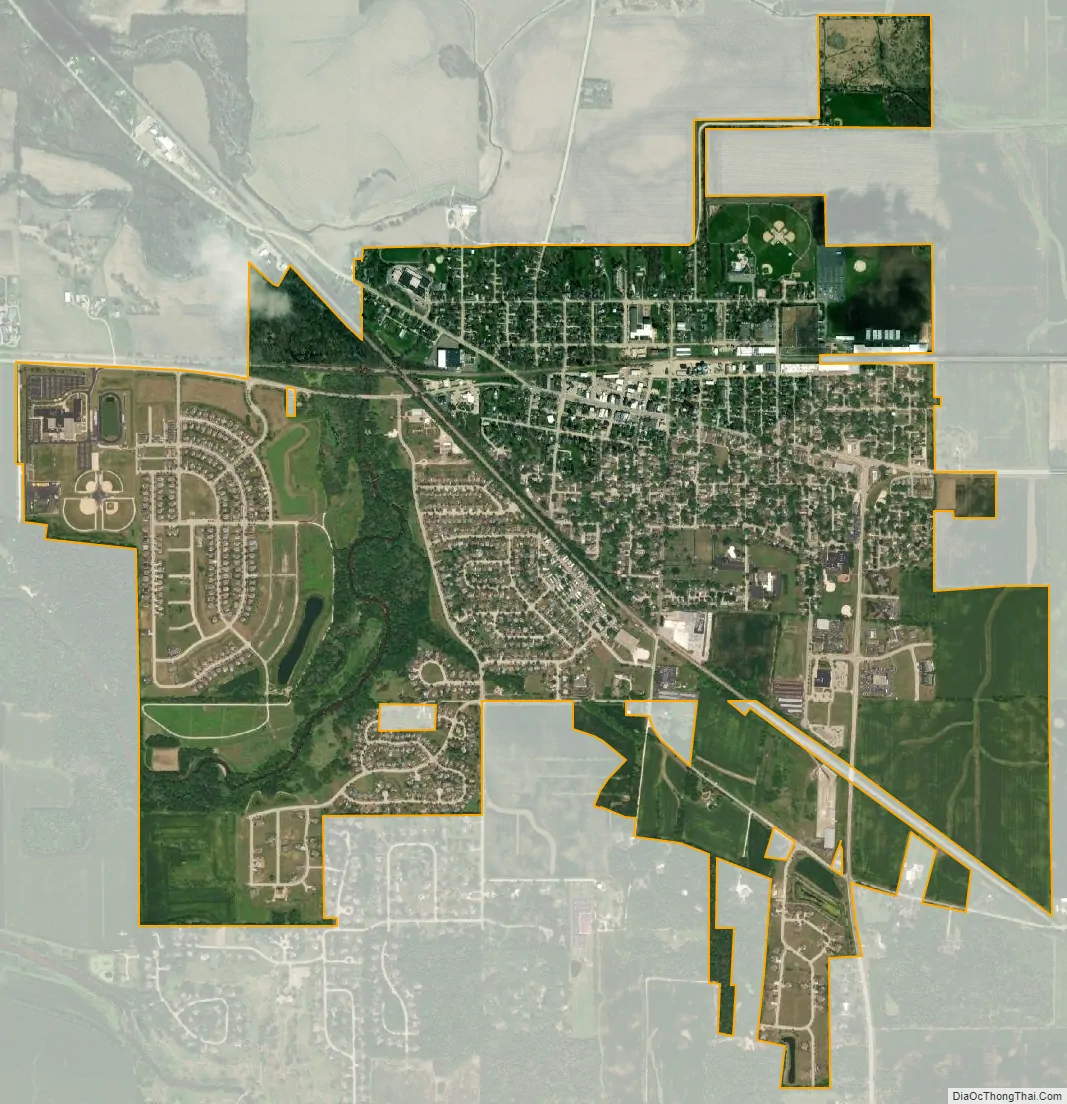
Genoa city Satellite Map
Geography
According to the 2010 census, Genoa has a total area of 2.655 square miles (6.88 km), of which 2.6 square miles (6.73 km) (or 97.93%) is land and 0.055 square miles (0.14 km) (or 2.07%) is water.
See also
Map of Illinois State and its subdivision:- Adams
- Alexander
- Bond
- Boone
- Brown
- Bureau
- Calhoun
- Carroll
- Cass
- Champaign
- Christian
- Clark
- Clay
- Clinton
- Coles
- Cook
- Crawford
- Cumberland
- De Kalb
- De Witt
- Douglas
- Dupage
- Edgar
- Edwards
- Effingham
- Fayette
- Ford
- Franklin
- Fulton
- Gallatin
- Greene
- Grundy
- Hamilton
- Hancock
- Hardin
- Henderson
- Henry
- Iroquois
- Jackson
- Jasper
- Jefferson
- Jersey
- Jo Daviess
- Johnson
- Kane
- Kankakee
- Kendall
- Knox
- La Salle
- Lake
- Lake Michigan
- Lawrence
- Lee
- Livingston
- Logan
- Macon
- Macoupin
- Madison
- Marion
- Marshall
- Mason
- Massac
- McDonough
- McHenry
- McLean
- Menard
- Mercer
- Monroe
- Montgomery
- Morgan
- Moultrie
- Ogle
- Peoria
- Perry
- Piatt
- Pike
- Pope
- Pulaski
- Putnam
- Randolph
- Richland
- Rock Island
- Saint Clair
- Saline
- Sangamon
- Schuyler
- Scott
- Shelby
- Stark
- Stephenson
- Tazewell
- Union
- Vermilion
- Wabash
- Warren
- Washington
- Wayne
- White
- Whiteside
- Will
- Williamson
- Winnebago
- Woodford
- Alabama
- Alaska
- Arizona
- Arkansas
- California
- Colorado
- Connecticut
- Delaware
- District of Columbia
- Florida
- Georgia
- Hawaii
- Idaho
- Illinois
- Indiana
- Iowa
- Kansas
- Kentucky
- Louisiana
- Maine
- Maryland
- Massachusetts
- Michigan
- Minnesota
- Mississippi
- Missouri
- Montana
- Nebraska
- Nevada
- New Hampshire
- New Jersey
- New Mexico
- New York
- North Carolina
- North Dakota
- Ohio
- Oklahoma
- Oregon
- Pennsylvania
- Rhode Island
- South Carolina
- South Dakota
- Tennessee
- Texas
- Utah
- Vermont
- Virginia
- Washington
- West Virginia
- Wisconsin
- Wyoming