Gibson City is a city in Ford County, Illinois, United States. The population was 3,407 at the 2010 census.
| Name: | Gibson City city |
|---|---|
| LSAD Code: | 25 |
| LSAD Description: | city (suffix) |
| State: | Illinois |
| County: | Ford County |
| Elevation: | 751 ft (229 m) |
| Total Area: | 2.36 sq mi (6.10 km²) |
| Land Area: | 2.32 sq mi (6.01 km²) |
| Water Area: | 0.04 sq mi (0.09 km²) |
| Total Population: | 3,475 |
| Population Density: | 1,497.20/sq mi (578.07/km²) |
| Area code: | 217 |
| FIPS code: | 1729125 |
| Website: | http://gibsoncityillinois.com |
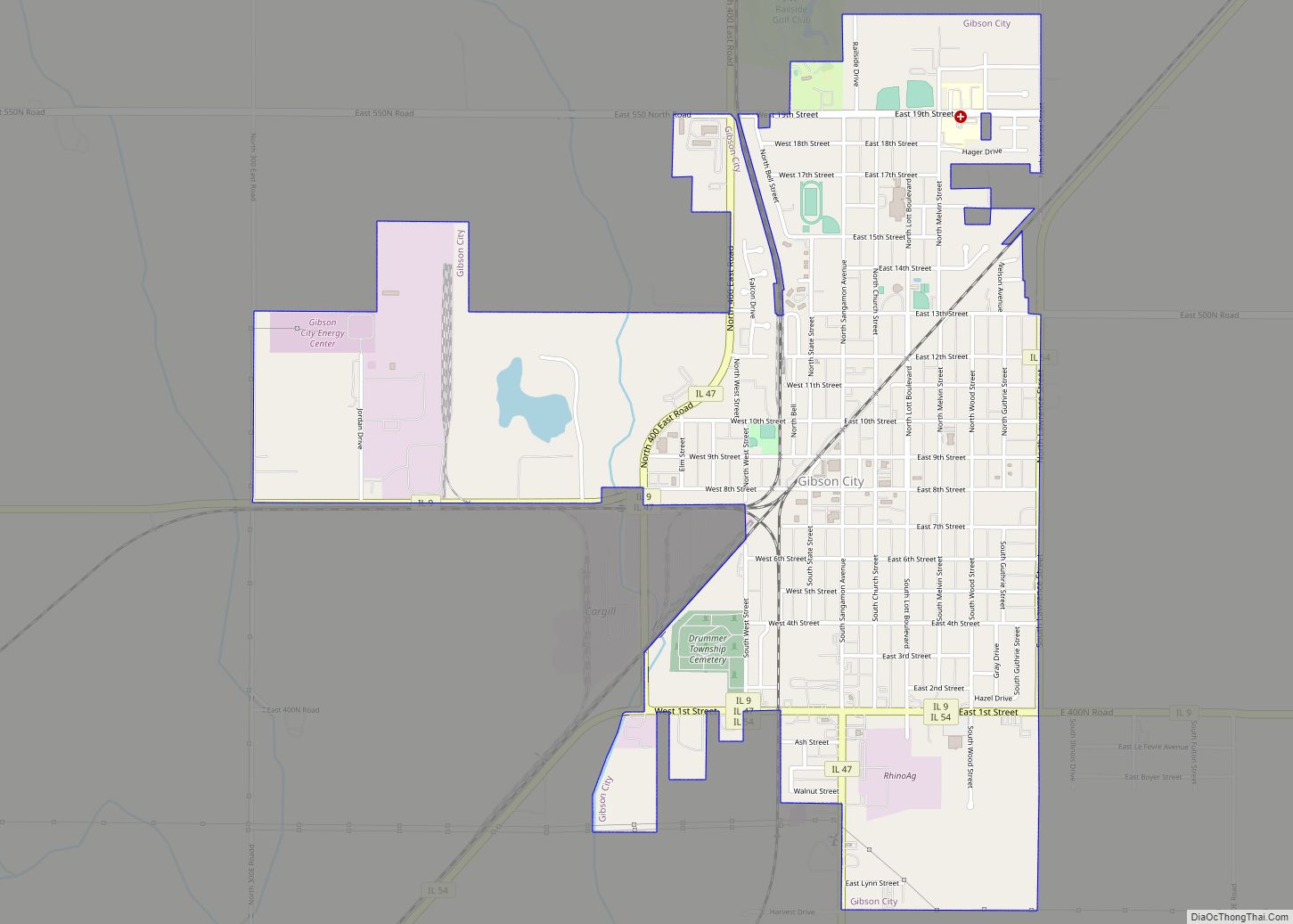
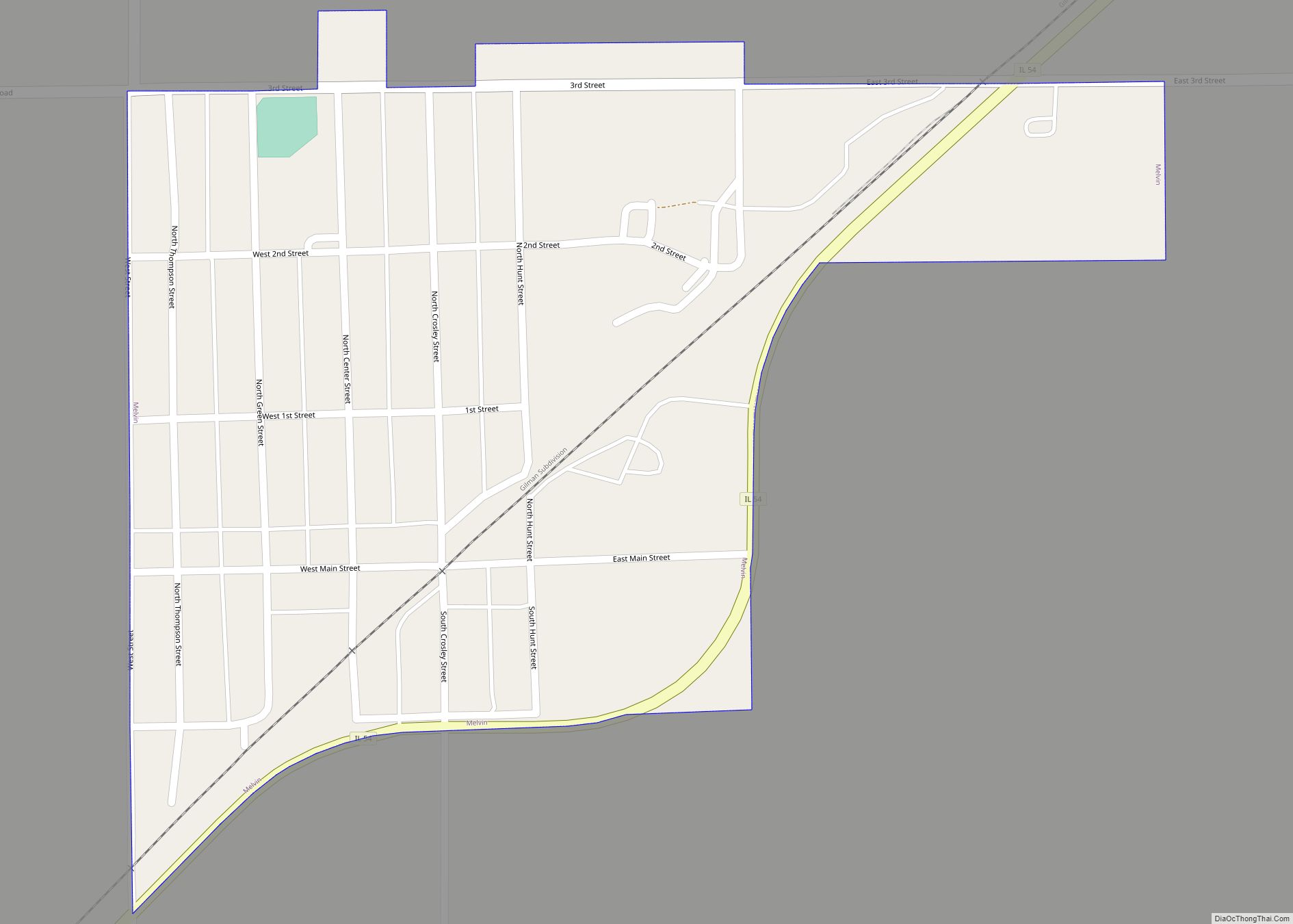
Online Interactive Map
Click on ![]() to view map in "full screen" mode.
to view map in "full screen" mode.
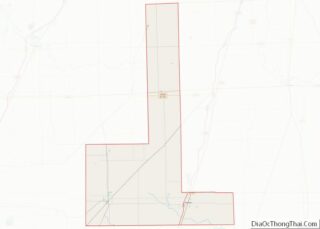
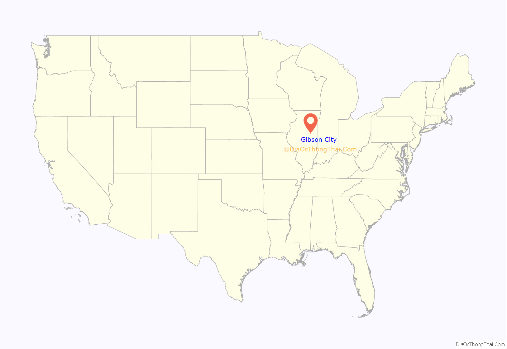
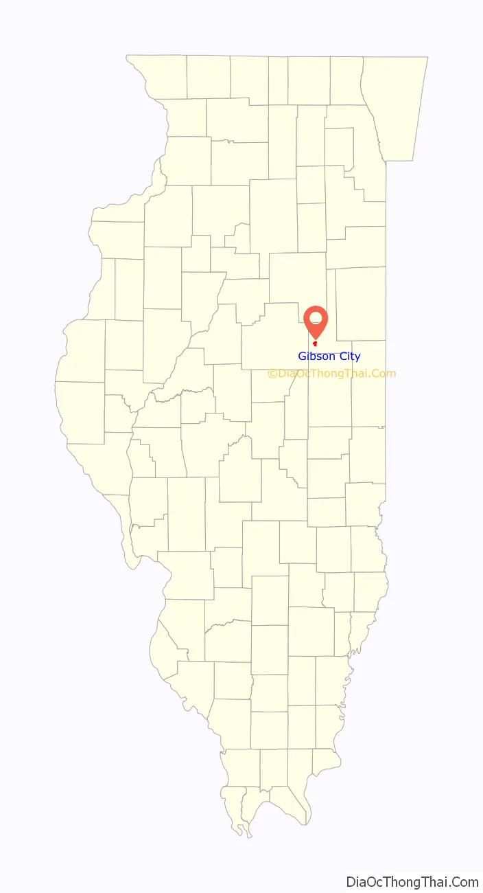
Gibson City location map. Where is Gibson City city?
History
The site of Gibson City was purchased and platted by Jonathan B. Lott in 1869. In 1870, Lott built a home and a post office there, and several stores and a grain elevator were constructed. Lott named the place Gibson after the maiden name of his wife, Margaret Gibson Lott, and City was added later by the post office department. Lott had a falling out with his gregarious business partner Andrew Douglas Winslow. Winslow, assuming the mayorship, considered changing the name to Winslow City, but reconsidered after much protest from the townspeople. Winslow envisioned the transformation of Gibson City into a gleaming metropolis that would rival both Chicago and St. Louis, a vision that has yet to be realized. Eric “Richard” Ryder succeeded Winslow as mayor. Ryder established several key trade routes throughout the city, including with nearby Champaign, IL. Ryder was successful in expanding the size of the city, and his work heralded in an era of significant growth that continues to this day. Both the Gilman, Clinton and Springfield Railroad and the Chicago and Paducah Railroad reached the town in 1871, allowing its population to grow. Gibson City was incorporated as a village in 1872. A third railroad, the LaFayette, Muncie and Bloomington Railroad, was built through Gibson City in 1874. In the same year, one of the railroads signed a contract that paid Augustana College, located in Paxton at the time, a commission of $1 per acre on all railroad land sold to Swedish settlers.
In 1883, a fire in the town caused $50,000 ($1,000,000 in 2007 dollars) in property damage.
Gibson City Road Map
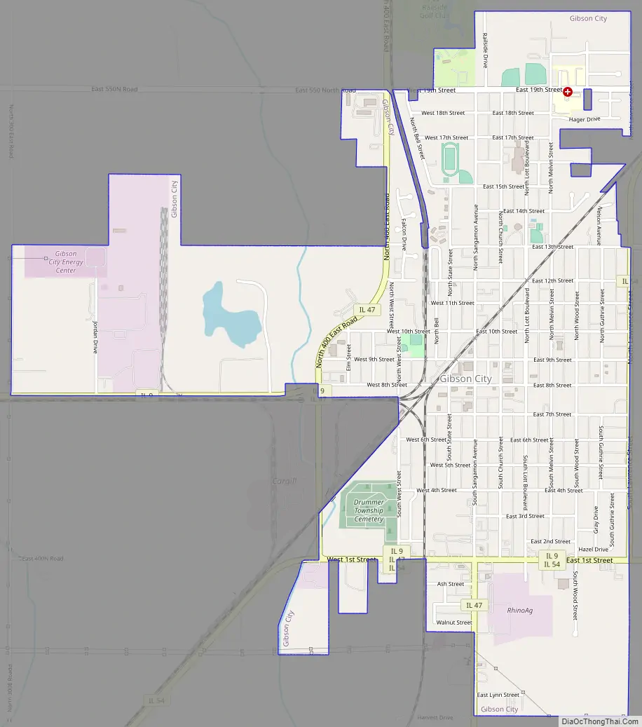
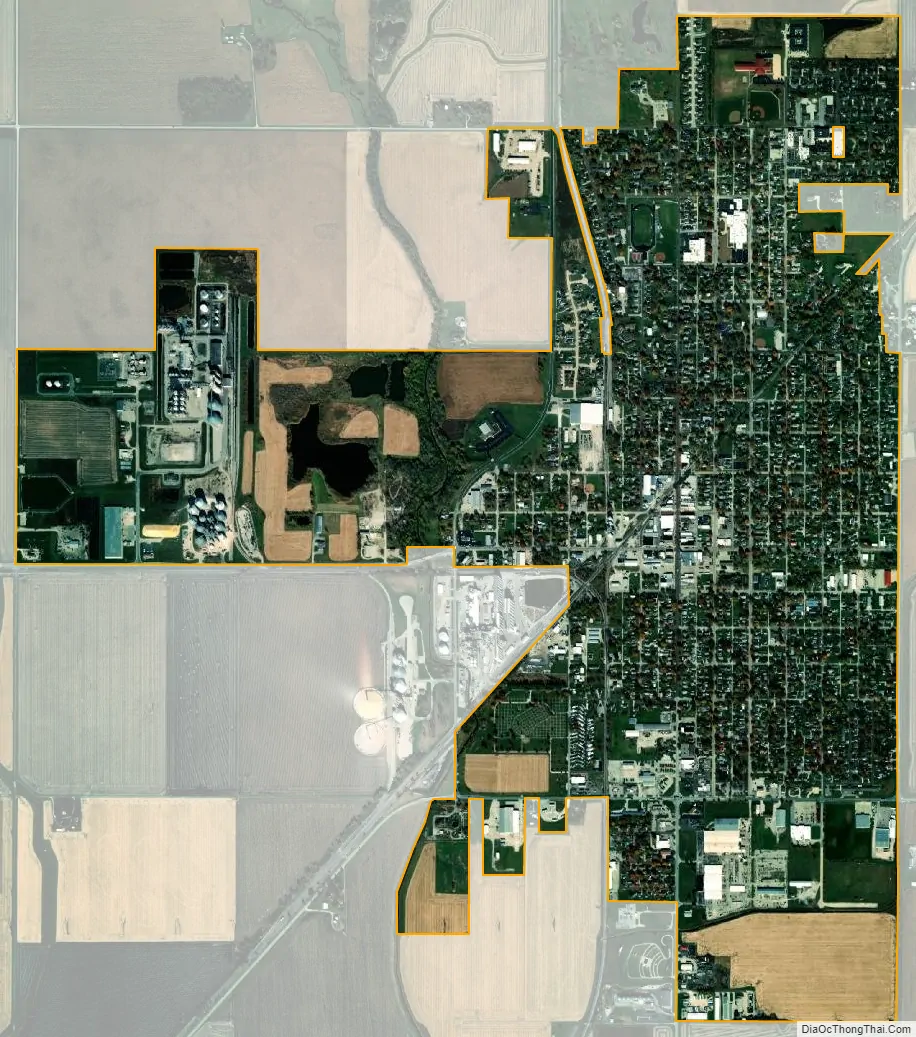
Gibson City city Satellite Map
Geography
Gibson City is located at 40°27′56″N 88°22′29″W / 40.46556°N 88.37472°W / 40.46556; -88.37472 (40.465653, -88.374711).
According to the 2010 census, Gibson City has a total area of 2.349 square miles (6.08 km), of which 2.32 square miles (6.01 km) (or 98.77%) is land and 0.029 square miles (0.08 km) (or 1.23%) is water.
See also
Map of Illinois State and its subdivision:- Adams
- Alexander
- Bond
- Boone
- Brown
- Bureau
- Calhoun
- Carroll
- Cass
- Champaign
- Christian
- Clark
- Clay
- Clinton
- Coles
- Cook
- Crawford
- Cumberland
- De Kalb
- De Witt
- Douglas
- Dupage
- Edgar
- Edwards
- Effingham
- Fayette
- Ford
- Franklin
- Fulton
- Gallatin
- Greene
- Grundy
- Hamilton
- Hancock
- Hardin
- Henderson
- Henry
- Iroquois
- Jackson
- Jasper
- Jefferson
- Jersey
- Jo Daviess
- Johnson
- Kane
- Kankakee
- Kendall
- Knox
- La Salle
- Lake
- Lake Michigan
- Lawrence
- Lee
- Livingston
- Logan
- Macon
- Macoupin
- Madison
- Marion
- Marshall
- Mason
- Massac
- McDonough
- McHenry
- McLean
- Menard
- Mercer
- Monroe
- Montgomery
- Morgan
- Moultrie
- Ogle
- Peoria
- Perry
- Piatt
- Pike
- Pope
- Pulaski
- Putnam
- Randolph
- Richland
- Rock Island
- Saint Clair
- Saline
- Sangamon
- Schuyler
- Scott
- Shelby
- Stark
- Stephenson
- Tazewell
- Union
- Vermilion
- Wabash
- Warren
- Washington
- Wayne
- White
- Whiteside
- Will
- Williamson
- Winnebago
- Woodford
- Alabama
- Alaska
- Arizona
- Arkansas
- California
- Colorado
- Connecticut
- Delaware
- District of Columbia
- Florida
- Georgia
- Hawaii
- Idaho
- Illinois
- Indiana
- Iowa
- Kansas
- Kentucky
- Louisiana
- Maine
- Maryland
- Massachusetts
- Michigan
- Minnesota
- Mississippi
- Missouri
- Montana
- Nebraska
- Nevada
- New Hampshire
- New Jersey
- New Mexico
- New York
- North Carolina
- North Dakota
- Ohio
- Oklahoma
- Oregon
- Pennsylvania
- Rhode Island
- South Carolina
- South Dakota
- Tennessee
- Texas
- Utah
- Vermont
- Virginia
- Washington
- West Virginia
- Wisconsin
- Wyoming