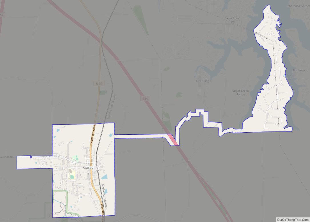
Goreville is a village in Johnson County, Illinois, United States. The population was 1,049 as of the 2010 census, up from 938 at the 2000 census.
| Name: | Goreville village |
|---|---|
| LSAD Code: | 47 |
| LSAD Description: | village (suffix) |
| State: | Illinois |
| County: | Johnson County |
| Elevation: | 722 ft (220 m) |
| Total Area: | 2.71 sq mi (7.01 km²) |
| Land Area: | 2.69 sq mi (6.96 km²) |
| Water Area: | 0.02 sq mi (0.06 km²) |
| Total Population: | 1,068 |
| Population Density: | 397.62/sq mi (153.55/km²) |
| Area code: | 618 |
| FIPS code: | 1730575 |
| GNISfeature ID: | 2398181 |
| Website: | villageofgoreville.com |
Online Interactive Map
Click on ![]() to view map in "full screen" mode.
to view map in "full screen" mode.
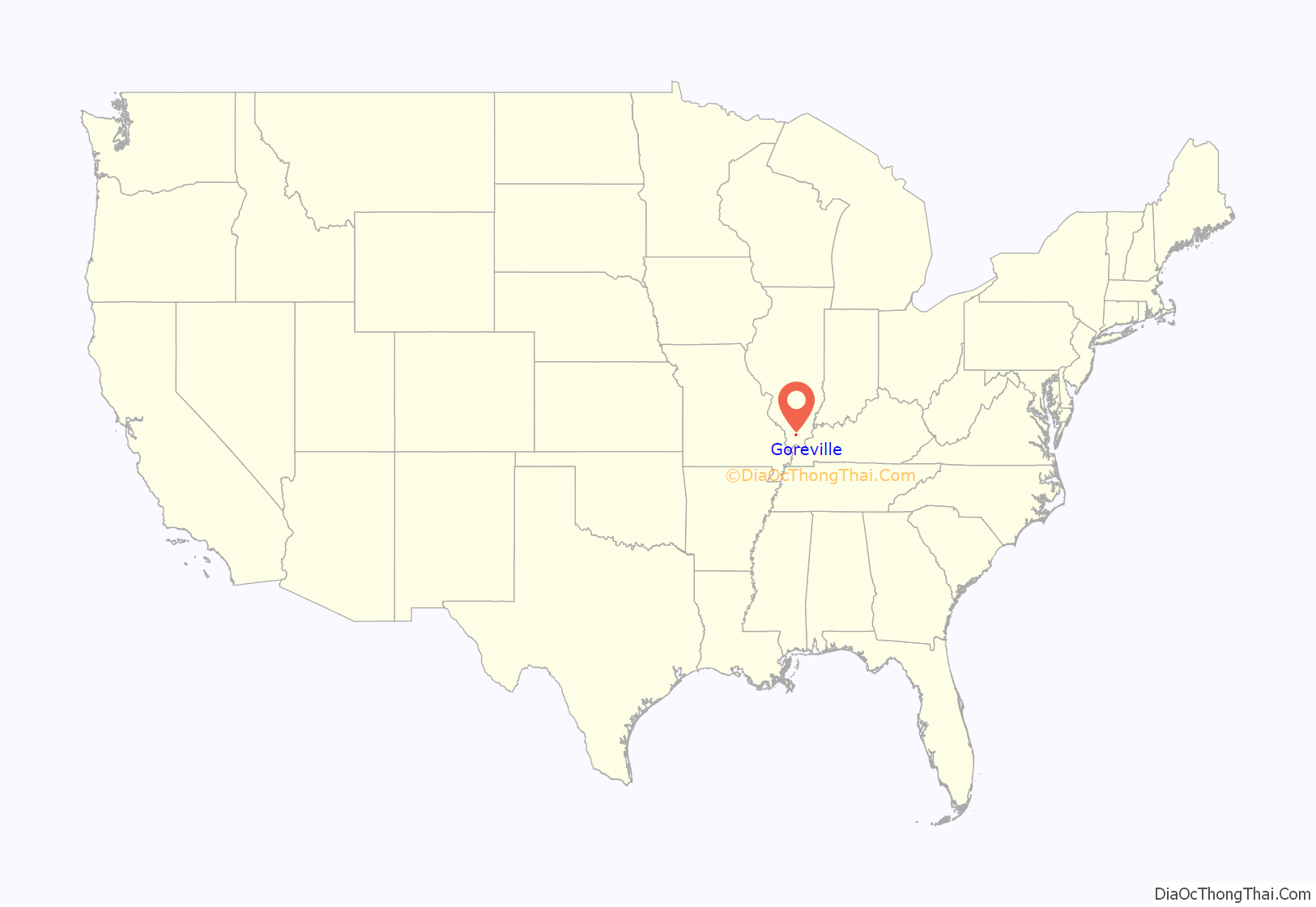
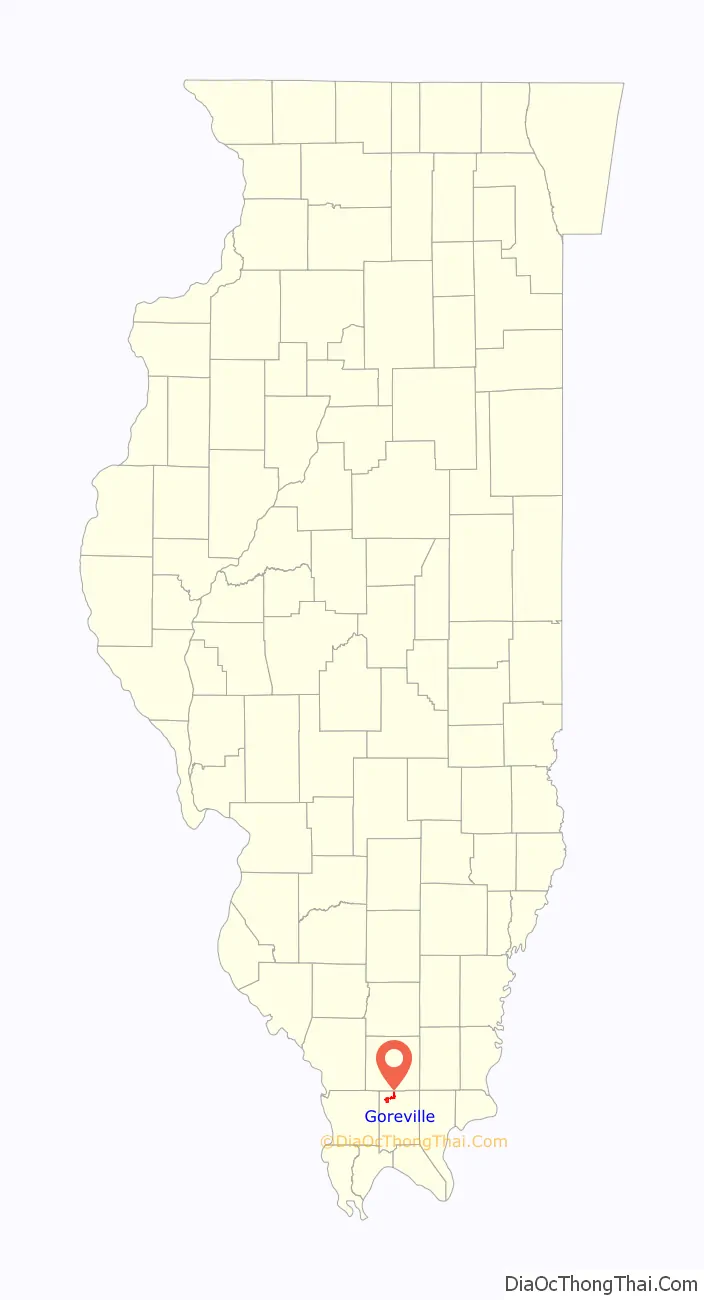
Goreville location map. Where is Goreville village?
Goreville Road Map
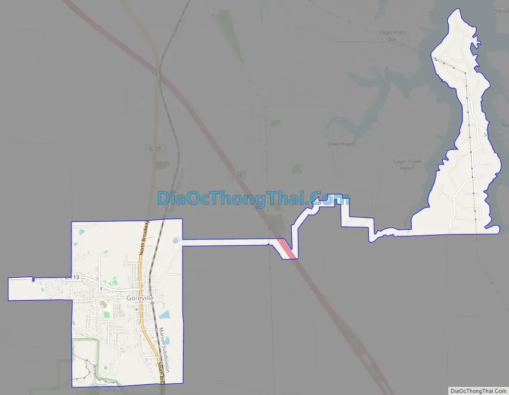
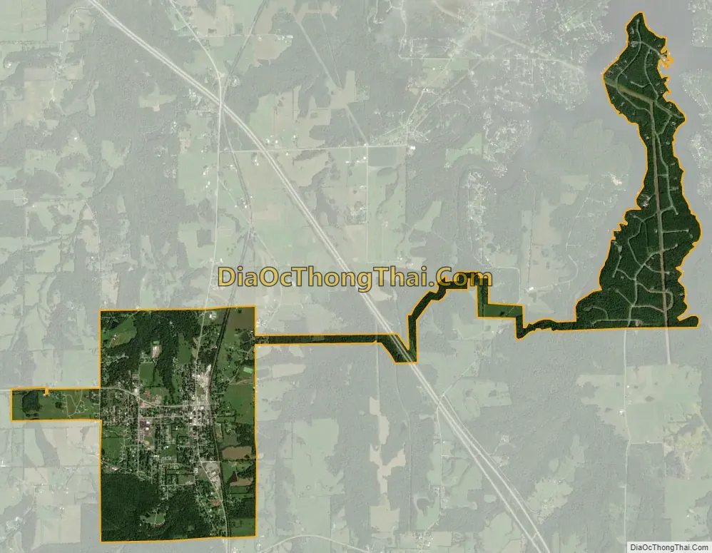
Goreville city Satellite Map
Geography
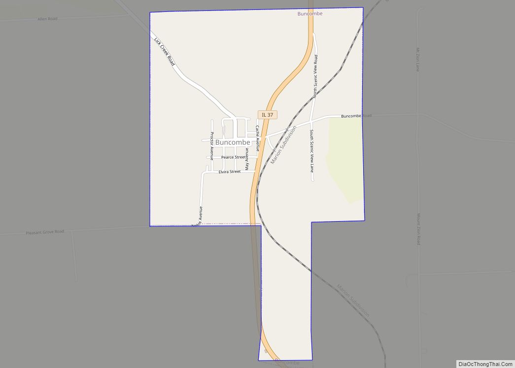
Goreville is located in northwestern Johnson County at 37°33′12″N 88°58′22″W / 37.55333°N 88.97278°W / 37.55333; -88.97278 (37.553212, -88.972783). It is bordered to the south by Ferne Clyffe State Park. Illinois Route 37 passes through the village, leading south 6 miles (10 km) to Buncombe and north 5 miles (8 km) to Interstate 57 at Exit 45, just north of that highway’s interchange with Interstate 24.
According to the 2010 census, Goreville has a total area of 1.679 square miles (4.35 km), of which 1.66 square miles (4.30 km) (or 98.87%) is land and 0.019 square miles (0.05 km) (or 1.13%) is water.
See also
Map of Illinois State and its subdivision:- Adams
- Alexander
- Bond
- Boone
- Brown
- Bureau
- Calhoun
- Carroll
- Cass
- Champaign
- Christian
- Clark
- Clay
- Clinton
- Coles
- Cook
- Crawford
- Cumberland
- De Kalb
- De Witt
- Douglas
- Dupage
- Edgar
- Edwards
- Effingham
- Fayette
- Ford
- Franklin
- Fulton
- Gallatin
- Greene
- Grundy
- Hamilton
- Hancock
- Hardin
- Henderson
- Henry
- Iroquois
- Jackson
- Jasper
- Jefferson
- Jersey
- Jo Daviess
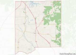
- Johnson
- Kane
- Kankakee
- Kendall
- Knox
- La Salle
- Lake
- Lake Michigan
- Lawrence
- Lee
- Livingston
- Logan
- Macon
- Macoupin
- Madison
- Marion
- Marshall
- Mason
- Massac
- McDonough
- McHenry
- McLean
- Menard
- Mercer
- Monroe
- Montgomery
- Morgan
- Moultrie
- Ogle
- Peoria
- Perry
- Piatt
- Pike
- Pope
- Pulaski
- Putnam
- Randolph
- Richland
- Rock Island
- Saint Clair
- Saline
- Sangamon
- Schuyler
- Scott
- Shelby
- Stark
- Stephenson
- Tazewell
- Union
- Vermilion
- Wabash
- Warren
- Washington
- Wayne
- White
- Whiteside
- Will
- Williamson
- Winnebago
- Woodford
- Alabama
- Alaska
- Arizona
- Arkansas
- California
- Colorado
- Connecticut
- Delaware
- District of Columbia
- Florida
- Georgia
- Hawaii
- Idaho
- Illinois
- Indiana
- Iowa
- Kansas
- Kentucky
- Louisiana
- Maine
- Maryland
- Massachusetts
- Michigan
- Minnesota
- Mississippi
- Missouri
- Montana
- Nebraska
- Nevada
- New Hampshire
- New Jersey
- New Mexico
- New York
- North Carolina
- North Dakota
- Ohio
- Oklahoma
- Oregon
- Pennsylvania
- Rhode Island
- South Carolina
- South Dakota
- Tennessee
- Texas
- Utah
- Vermont
- Virginia
- Washington
- West Virginia
- Wisconsin
- Wyoming