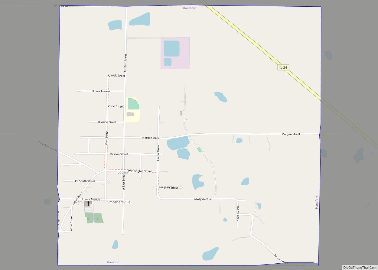
Hanaford is a village in Franklin County, Illinois, United States. The population was 320 at the 2020 census. Hanaford is also known as Logan.
| Name: | Hanaford village |
|---|---|
| LSAD Code: | 47 |
| LSAD Description: | village (suffix) |
| State: | Illinois |
| County: | Franklin County |
| Elevation: | 466 ft (142 m) |
| Total Area: | 1.01 sq mi (2.63 km²) |
| Land Area: | 1.01 sq mi (2.61 km²) |
| Water Area: | 0.01 sq mi (0.02 km²) |
| Total Population: | 320 |
| Population Density: | 317.46/sq mi (122.57/km²) |
| Area code: | 618 |
| FIPS code: | 1732616 |
| GNISfeature ID: | 2398237 |
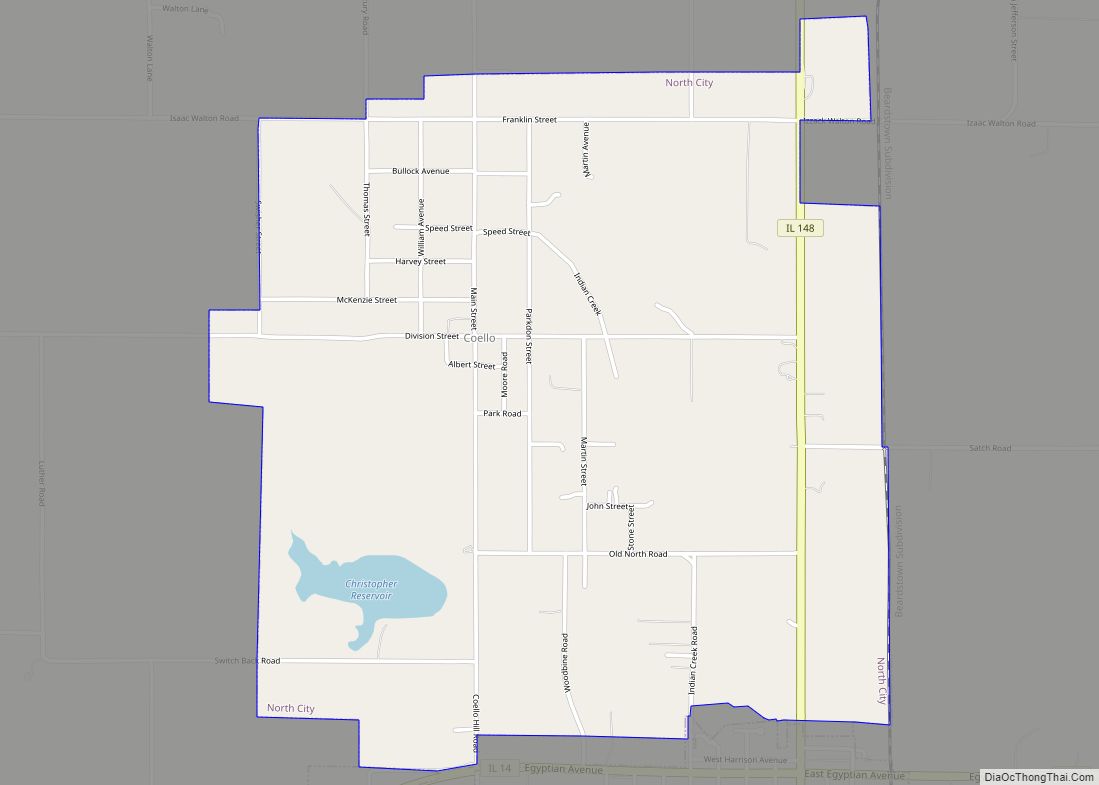
Online Interactive Map
Click on ![]() to view map in "full screen" mode.
to view map in "full screen" mode.
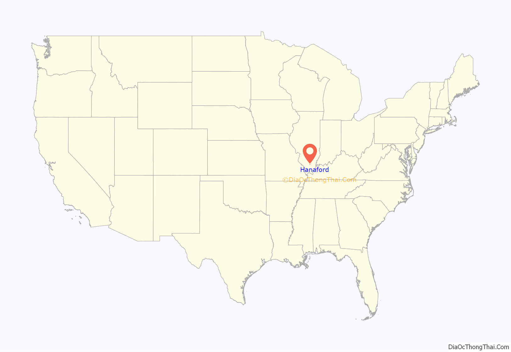
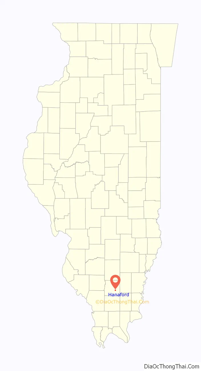
Hanaford location map. Where is Hanaford village?
History
Initially known as “Smothersville,” Hanaford was renamed for land speculator John P. Hanaford. In 1916, the village was renamed “Logan” for the John A. Logan Coal Company, which operated a nearby mine. Since then, the names “Hanaford” and “Logan” have both been used by the village.
Hanaford Road Map
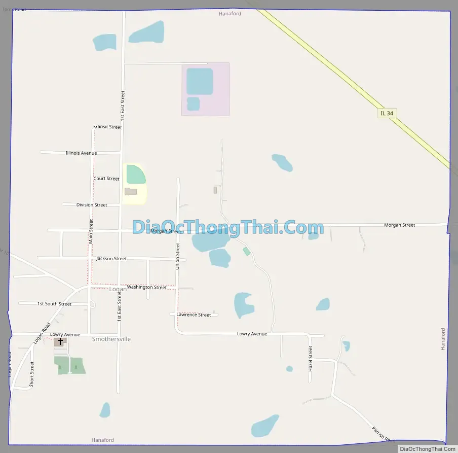
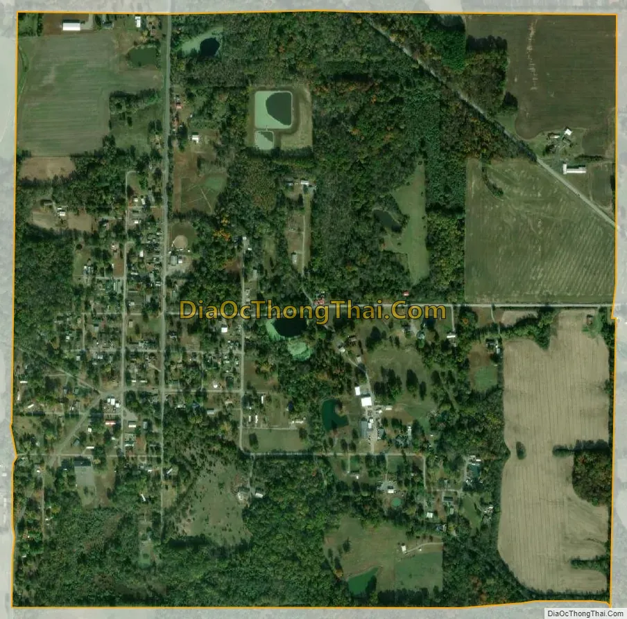
Hanaford city Satellite Map
Geography
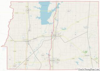
Hanaford is located southeast of the center of Franklin County at 37°57′27″N 88°50′21″W / 37.95750°N 88.83917°W / 37.95750; -88.83917 (37.957485, -88.839177). Illinois Route 34 passes through the northeast corner of the village, leading northwest 6 miles (10 km) to Benton, the county seat, and southeast 5 miles (8 km) to Thompsonville.
According to the 2010 census, Hanaford has a total area of 1.017 square miles (2.63 km), of which 1.01 square miles (2.62 km) (or 99.31%) is land and 0.007 square miles (0.02 km) (or 0.69%) is water.
See also
Map of Illinois State and its subdivision:- Adams
- Alexander
- Bond
- Boone
- Brown
- Bureau
- Calhoun
- Carroll
- Cass
- Champaign
- Christian
- Clark
- Clay
- Clinton
- Coles
- Cook
- Crawford
- Cumberland
- De Kalb
- De Witt
- Douglas
- Dupage
- Edgar
- Edwards
- Effingham
- Fayette
- Ford
- Franklin
- Fulton
- Gallatin
- Greene
- Grundy
- Hamilton
- Hancock
- Hardin
- Henderson
- Henry
- Iroquois
- Jackson
- Jasper
- Jefferson
- Jersey
- Jo Daviess
- Johnson
- Kane
- Kankakee
- Kendall
- Knox
- La Salle
- Lake
- Lake Michigan
- Lawrence
- Lee
- Livingston
- Logan
- Macon
- Macoupin
- Madison
- Marion
- Marshall
- Mason
- Massac
- McDonough
- McHenry
- McLean
- Menard
- Mercer
- Monroe
- Montgomery
- Morgan
- Moultrie
- Ogle
- Peoria
- Perry
- Piatt
- Pike
- Pope
- Pulaski
- Putnam
- Randolph
- Richland
- Rock Island
- Saint Clair
- Saline
- Sangamon
- Schuyler
- Scott
- Shelby
- Stark
- Stephenson
- Tazewell
- Union
- Vermilion
- Wabash
- Warren
- Washington
- Wayne
- White
- Whiteside
- Will
- Williamson
- Winnebago
- Woodford
- Alabama
- Alaska
- Arizona
- Arkansas
- California
- Colorado
- Connecticut
- Delaware
- District of Columbia
- Florida
- Georgia
- Hawaii
- Idaho
- Illinois
- Indiana
- Iowa
- Kansas
- Kentucky
- Louisiana
- Maine
- Maryland
- Massachusetts
- Michigan
- Minnesota
- Mississippi
- Missouri
- Montana
- Nebraska
- Nevada
- New Hampshire
- New Jersey
- New Mexico
- New York
- North Carolina
- North Dakota
- Ohio
- Oklahoma
- Oregon
- Pennsylvania
- Rhode Island
- South Carolina
- South Dakota
- Tennessee
- Texas
- Utah
- Vermont
- Virginia
- Washington
- West Virginia
- Wisconsin
- Wyoming