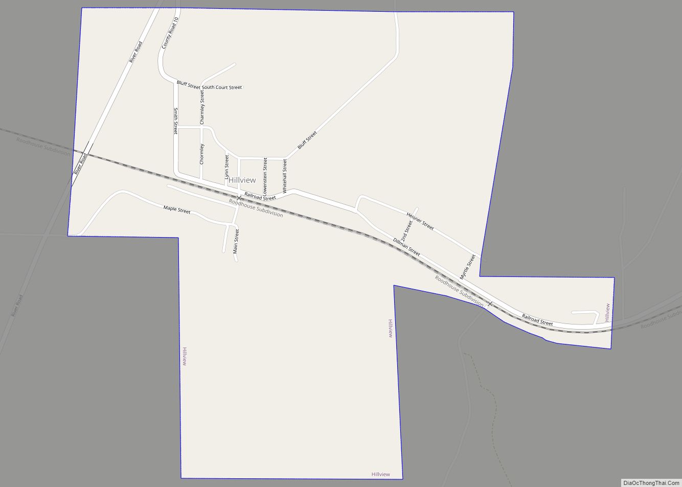
Hillview is a village in Greene County, Illinois, United States. The population was 193 at the 2010 census.
| Name: | Hillview village |
|---|---|
| LSAD Code: | 47 |
| LSAD Description: | village (suffix) |
| State: | Illinois |
| County: | Greene County |
| Elevation: | 446 ft (136 m) |
| Total Area: | 0.82 sq mi (2.11 km²) |
| Land Area: | 0.82 sq mi (2.11 km²) |
| Water Area: | 0.00 sq mi (0.00 km²) |
| Total Population: | 94 |
| Population Density: | 115.20/sq mi (44.49/km²) |
| Area code: | 217 |
| FIPS code: | 1735203 |
| GNISfeature ID: | 2398511 |
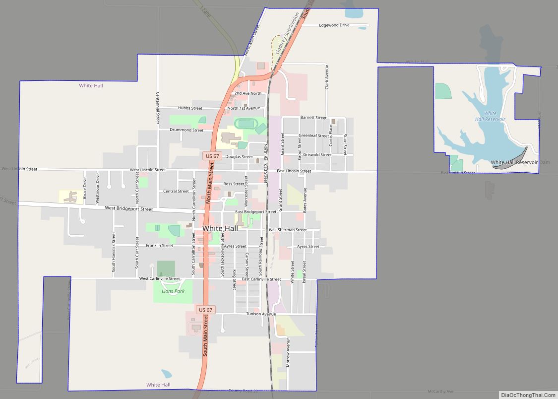
Online Interactive Map
Click on ![]() to view map in "full screen" mode.
to view map in "full screen" mode.
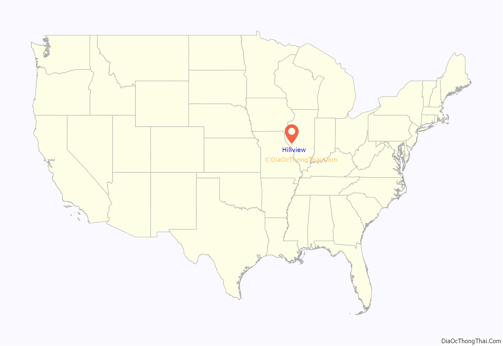
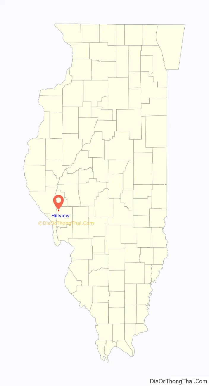
Hillview location map. Where is Hillview village?
History
(From the Illinois Valley Cultural Heritage Association website) William Shelton, a ranger from Ft. Russell, Edwardsville, chose the alcove at the mouth of Hurricane Creek (creek at Eldred also called Hurricane), in 1826, to build a cabin. He left no record except Shelton’s Hill, Shelton’s Spring, and Shelton’s Graveyard. A back water lake bore the name of another early settler, Bucks Lake, for Joseph Buck, 1825. Another family name is Bishop’s Dell for James Bishop, 1830. The farm where Bishop’s Dell was located is bordered on the south by Trimley creek and the barn that James Bishop constructed using wooden pegs still stands as well as the foundation of his one-room stone home built against the bluff. Seely and Hodges built a mill on the creek in 1833. W. D. Wells came from North Carolina in 1834 and planted a small apple orchard on his farm. Later the McClay Orchard became famous for its varieties of apples and methods in orchard management. When the Chicago and Alton Railroad connected with the Kansas City branch at Roodhouse, Hillview was a lumber camp called Happy Ville. This is the same on the Illinois Atlas map of Greene County, 1876. In 1893 Hapeville was replaced by with Pegram P.O. and was locally reoffered to as both Hapeville and Pegram. The village of Hillview was incorporated in 1903. It still remains the route of the Illinois Central Gulf West.
Hillview Road Map

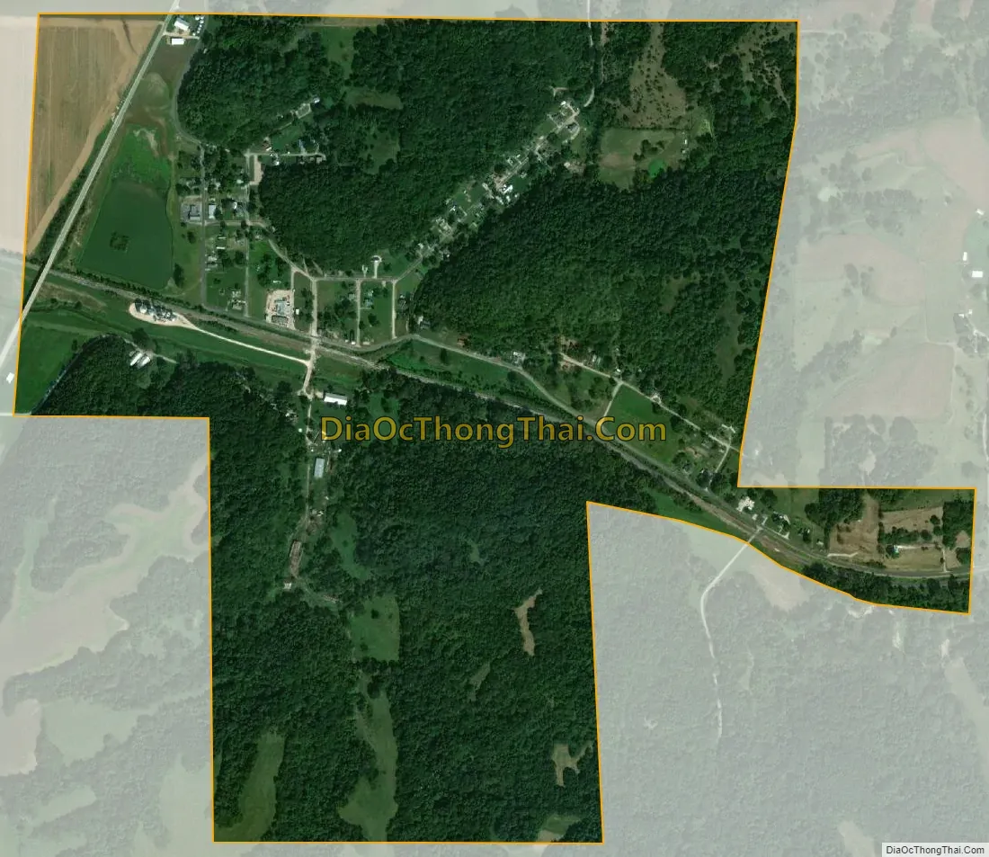
Hillview city Satellite Map
Geography
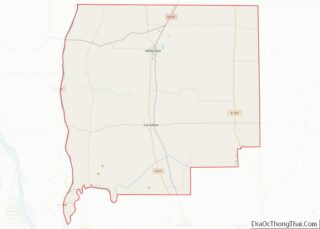
Hillview is located in northwestern Greene County at 39°26′59″N 90°32′17″W / 39.44972°N 90.53806°W / 39.44972; -90.53806 (39.449652, -90.537983), in the valley of Hurricane Creek where it enters the Illinois River bottomlands. Hillview is 12 miles (19 km) north (upriver) of Eldred and 8 miles (13 km) west of White Hall. Carrollton, the Greene County seat, is 18 miles (29 km) to the southeast.
According to the 2010 census, Hillview has a total area of 0.82 square miles (2.12 km), all land.
See also
Map of Illinois State and its subdivision:- Adams
- Alexander
- Bond
- Boone
- Brown
- Bureau
- Calhoun
- Carroll
- Cass
- Champaign
- Christian
- Clark
- Clay
- Clinton
- Coles
- Cook
- Crawford
- Cumberland
- De Kalb
- De Witt
- Douglas
- Dupage
- Edgar
- Edwards
- Effingham
- Fayette
- Ford
- Franklin
- Fulton
- Gallatin
- Greene
- Grundy
- Hamilton
- Hancock
- Hardin
- Henderson
- Henry
- Iroquois
- Jackson
- Jasper
- Jefferson
- Jersey
- Jo Daviess
- Johnson
- Kane
- Kankakee
- Kendall
- Knox
- La Salle
- Lake
- Lake Michigan
- Lawrence
- Lee
- Livingston
- Logan
- Macon
- Macoupin
- Madison
- Marion
- Marshall
- Mason
- Massac
- McDonough
- McHenry
- McLean
- Menard
- Mercer
- Monroe
- Montgomery
- Morgan
- Moultrie
- Ogle
- Peoria
- Perry
- Piatt
- Pike
- Pope
- Pulaski
- Putnam
- Randolph
- Richland
- Rock Island
- Saint Clair
- Saline
- Sangamon
- Schuyler
- Scott
- Shelby
- Stark
- Stephenson
- Tazewell
- Union
- Vermilion
- Wabash
- Warren
- Washington
- Wayne
- White
- Whiteside
- Will
- Williamson
- Winnebago
- Woodford
- Alabama
- Alaska
- Arizona
- Arkansas
- California
- Colorado
- Connecticut
- Delaware
- District of Columbia
- Florida
- Georgia
- Hawaii
- Idaho
- Illinois
- Indiana
- Iowa
- Kansas
- Kentucky
- Louisiana
- Maine
- Maryland
- Massachusetts
- Michigan
- Minnesota
- Mississippi
- Missouri
- Montana
- Nebraska
- Nevada
- New Hampshire
- New Jersey
- New Mexico
- New York
- North Carolina
- North Dakota
- Ohio
- Oklahoma
- Oregon
- Pennsylvania
- Rhode Island
- South Carolina
- South Dakota
- Tennessee
- Texas
- Utah
- Vermont
- Virginia
- Washington
- West Virginia
- Wisconsin
- Wyoming