Carrollton is a city in and the county seat of Greene County, Illinois, United States. The population was 2,484 as of the 2010 census.
| Name: | Carrollton city |
|---|---|
| LSAD Code: | 25 |
| LSAD Description: | city (suffix) |
| State: | Illinois |
| County: | Greene County |
| Elevation: | 607 ft (185 m) |
| Total Area: | 1.90 sq mi (4.93 km²) |
| Land Area: | 1.90 sq mi (4.93 km²) |
| Water Area: | 0.00 sq mi (0.00 km²) |
| Total Population: | 2,485 |
| Population Density: | 1,306.52/sq mi (504.39/km²) |
| ZIP code: | 62016 |
| Area code: | 217 |
| FIPS code: | 1711462 |
| GNISfeature ID: | 2393753 |
| Website: | www.carrolltonil.net |
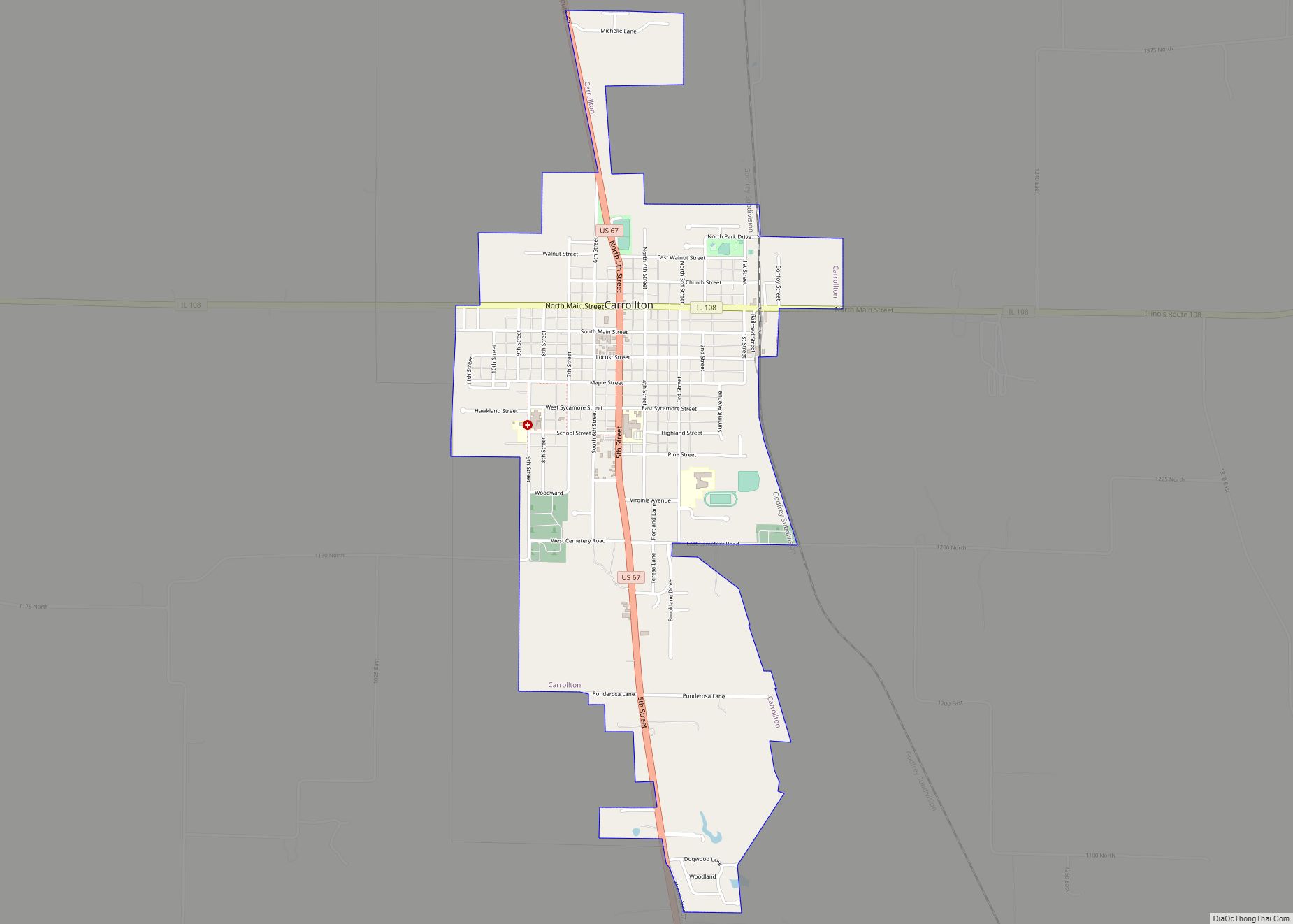
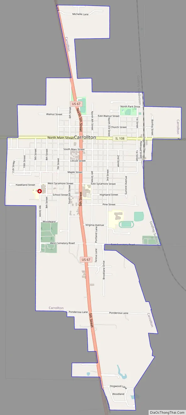
Online Interactive Map
Click on ![]() to view map in "full screen" mode.
to view map in "full screen" mode.
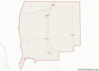
Carrollton location map. Where is Carrollton city?
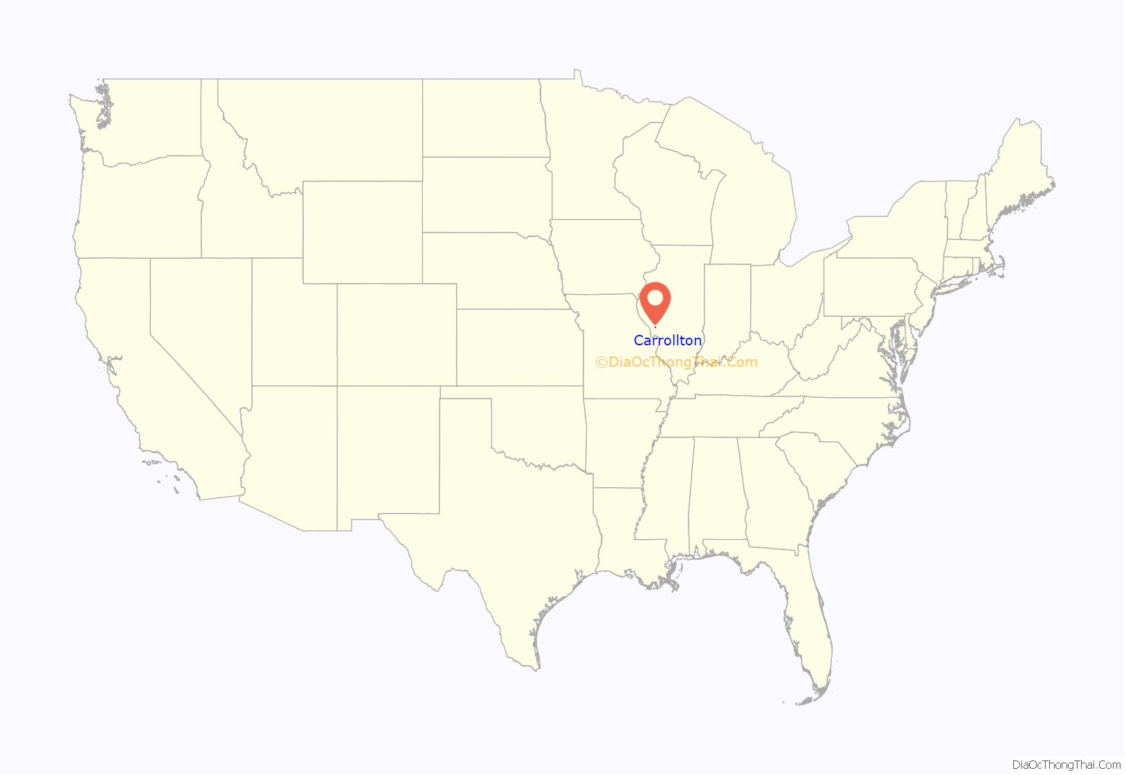
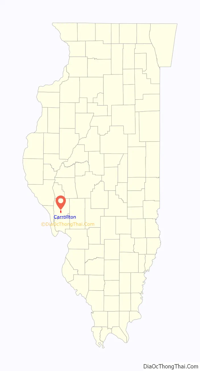
Carrollton Road Map
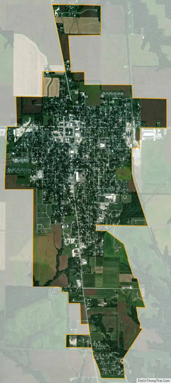
Carrollton city Satellite Map
Geography
Carrollton is located in south-central Greene County at 39°17′48″N 90°24′29″W / 39.29667°N 90.40806°W / 39.29667; -90.40806 (39.296662, -90.408059). U.S. Route 67 passes through the city as 5th Street, leading north 35 miles (56 km) to Jacksonville and south 32 miles (51 km) to Alton on the Mississippi River. Illinois Route 108 (Main Street) crosses US 67 in the center of town, leading east 29 miles (47 km) to Carlinville and west 11 miles (18 km) to Kampsville on the Illinois River.
According to the 2010 census, Carrollton has a total area of 1.902 square miles (4.93 km), of which 1.9 square miles (4.92 km) (or 99.89%) is land and 0.002 square miles (0.01 km) (or 0.11%) is water.
It is located 68 miles (109 km) southwest of Springfield, the state capital, and is 60 miles (97 km) north of St. Louis, Missouri. Greene County borders the Metro East area.
Carrollton post office
See also
Map of Illinois State and its subdivision:- Adams
- Alexander
- Bond
- Boone
- Brown
- Bureau
- Calhoun
- Carroll
- Cass
- Champaign
- Christian
- Clark
- Clay
- Clinton
- Coles
- Cook
- Crawford
- Cumberland
- De Kalb
- De Witt
- Douglas
- Dupage
- Edgar
- Edwards
- Effingham
- Fayette
- Ford
- Franklin
- Fulton
- Gallatin
- Greene
- Grundy
- Hamilton
- Hancock
- Hardin
- Henderson
- Henry
- Iroquois
- Jackson
- Jasper
- Jefferson
- Jersey
- Jo Daviess
- Johnson
- Kane
- Kankakee
- Kendall
- Knox
- La Salle
- Lake
- Lake Michigan
- Lawrence
- Lee
- Livingston
- Logan
- Macon
- Macoupin
- Madison
- Marion
- Marshall
- Mason
- Massac
- McDonough
- McHenry
- McLean
- Menard
- Mercer
- Monroe
- Montgomery
- Morgan
- Moultrie
- Ogle
- Peoria
- Perry
- Piatt
- Pike
- Pope
- Pulaski
- Putnam
- Randolph
- Richland
- Rock Island
- Saint Clair
- Saline
- Sangamon
- Schuyler
- Scott
- Shelby
- Stark
- Stephenson
- Tazewell
- Union
- Vermilion
- Wabash
- Warren
- Washington
- Wayne
- White
- Whiteside
- Will
- Williamson
- Winnebago
- Woodford
- Alabama
- Alaska
- Arizona
- Arkansas
- California
- Colorado
- Connecticut
- Delaware
- District of Columbia
- Florida
- Georgia
- Hawaii
- Idaho
- Illinois
- Indiana
- Iowa
- Kansas
- Kentucky
- Louisiana
- Maine
- Maryland
- Massachusetts
- Michigan
- Minnesota
- Mississippi
- Missouri
- Montana
- Nebraska
- Nevada
- New Hampshire
- New Jersey
- New Mexico
- New York
- North Carolina
- North Dakota
- Ohio
- Oklahoma
- Oregon
- Pennsylvania
- Rhode Island
- South Carolina
- South Dakota
- Tennessee
- Texas
- Utah
- Vermont
- Virginia
- Washington
- West Virginia
- Wisconsin
- Wyoming