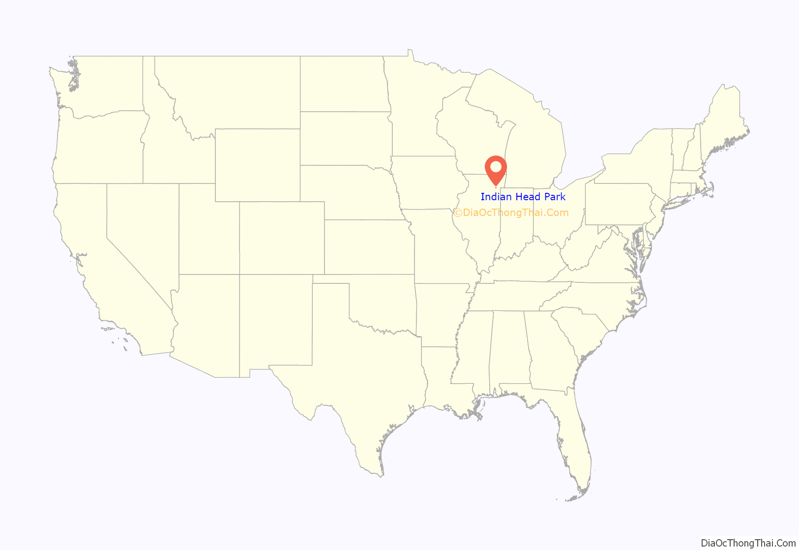
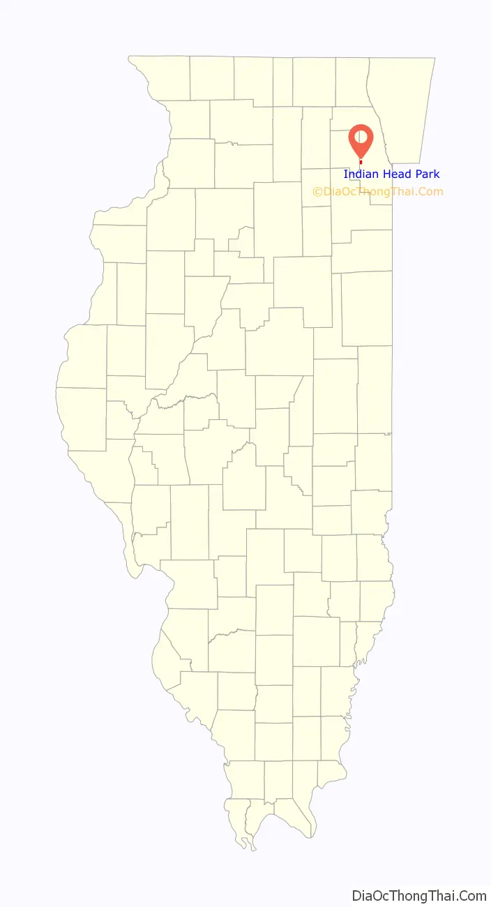
Indian Head Park is a village in Cook County, Illinois, United States, slightly north of the intersection of Interstate 294 and Interstate 55. The village is south of Western Springs, west of Countryside, north and east of Burr Ridge. Per the 2020 census, the population was 4,065. The village’s ZIP code is 60525 (La Grange).
| Name: | Indian Head Park village |
|---|---|
| LSAD Code: | 47 |
| LSAD Description: | village (suffix) |
| State: | Illinois |
| County: | Cook County |
| Total Area: | 0.94 sq mi (2.43 km²) |
| Land Area: | 0.93 sq mi (2.41 km²) |
| Water Area: | 0.01 sq mi (0.02 km²) |
| Total Population: | 4,065 |
| Population Density: | 4,370.97/sq mi (1,687.17/km²) |
| Area code: | 708 |
| FIPS code: | 1737257 |
| Website: | www.indianheadpark-il.gov |
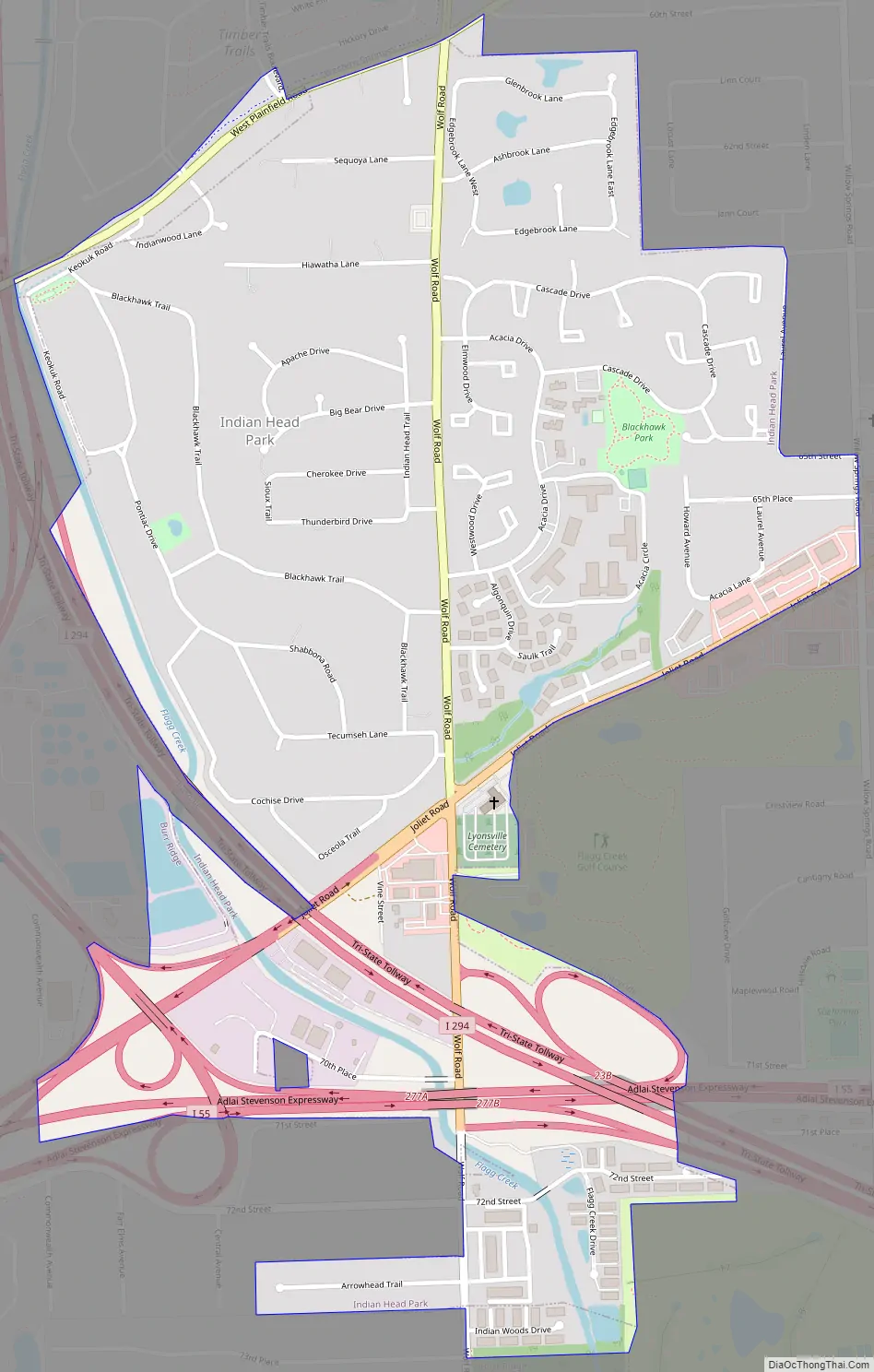
Online Interactive Map
Click on ![]() to view map in "full screen" mode.
to view map in "full screen" mode.
Indian Head Park location map. Where is Indian Head Park village?
History
The first Democratic Convention of Cook County was held in the area in 1835. At that time, Indian Head Park was closer to the center of the county, as Cook County then encompassed all of present-day DuPage and parts of Will and Lake counties. During that time the area was known as Lyonsville.
Just north of the village, now on the site of the Timber Trails subdivision, is one of the last camps of the Potawatomi Indians in Illinois.
The Lyonsville Congregational Church on the corner of Joliet and Wolf roads was once a stop on the Underground Railroad.
The Village of Indian Head Park was incorporated on August 4, 1959.
On October 27, 2011, Kelli O’Laughlin, a 14-year-old freshman at Lyons Township High School, was murdered. She was stabbed to death in an apparent burglary. This is believed to be the first murder in Indian Head Park history.
Indian Head Park Road Map
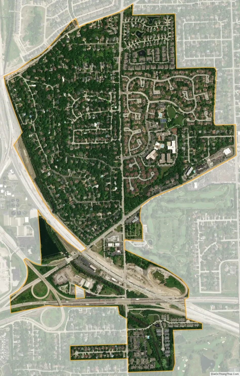
Indian Head Park city Satellite Map
Geography
According to the 2021 census gazetteer files, Indian Head Park has a total area of 0.94 square miles (2.43 km), of which 0.93 square miles (2.41 km) (or 99.15%) is land and 0.01 square miles (0.03 km) (or 0.85%) is water.
See also
Map of Illinois State and its subdivision:- Adams
- Alexander
- Bond
- Boone
- Brown
- Bureau
- Calhoun
- Carroll
- Cass
- Champaign
- Christian
- Clark
- Clay
- Clinton
- Coles
- Cook
- Crawford
- Cumberland
- De Kalb
- De Witt
- Douglas
- Dupage
- Edgar
- Edwards
- Effingham
- Fayette
- Ford
- Franklin
- Fulton
- Gallatin
- Greene
- Grundy
- Hamilton
- Hancock
- Hardin
- Henderson
- Henry
- Iroquois
- Jackson
- Jasper
- Jefferson
- Jersey
- Jo Daviess
- Johnson
- Kane
- Kankakee
- Kendall
- Knox
- La Salle
- Lake
- Lake Michigan
- Lawrence
- Lee
- Livingston
- Logan
- Macon
- Macoupin
- Madison
- Marion
- Marshall
- Mason
- Massac
- McDonough
- McHenry
- McLean
- Menard
- Mercer
- Monroe
- Montgomery
- Morgan
- Moultrie
- Ogle
- Peoria
- Perry
- Piatt
- Pike
- Pope
- Pulaski
- Putnam
- Randolph
- Richland
- Rock Island
- Saint Clair
- Saline
- Sangamon
- Schuyler
- Scott
- Shelby
- Stark
- Stephenson
- Tazewell
- Union
- Vermilion
- Wabash
- Warren
- Washington
- Wayne
- White
- Whiteside
- Will
- Williamson
- Winnebago
- Woodford
- Alabama
- Alaska
- Arizona
- Arkansas
- California
- Colorado
- Connecticut
- Delaware
- District of Columbia
- Florida
- Georgia
- Hawaii
- Idaho
- Illinois
- Indiana
- Iowa
- Kansas
- Kentucky
- Louisiana
- Maine
- Maryland
- Massachusetts
- Michigan
- Minnesota
- Mississippi
- Missouri
- Montana
- Nebraska
- Nevada
- New Hampshire
- New Jersey
- New Mexico
- New York
- North Carolina
- North Dakota
- Ohio
- Oklahoma
- Oregon
- Pennsylvania
- Rhode Island
- South Carolina
- South Dakota
- Tennessee
- Texas
- Utah
- Vermont
- Virginia
- Washington
- West Virginia
- Wisconsin
- Wyoming


