Johnsburg is a village in McHenry County, Illinois. It is a northwestern suburb of Chicago with a population of 6,355 as of the 2020 U.S. census.
| Name: | Johnsburg village |
|---|---|
| LSAD Code: | 47 |
| LSAD Description: | village (suffix) |
| State: | Illinois |
| County: | McHenry County |
| Total Area: | 7.84 sq mi (20.32 km²) |
| Land Area: | 7.25 sq mi (18.78 km²) |
| Water Area: | 0.60 sq mi (1.54 km²) |
| Total Population: | 6,355 |
| Population Density: | 876.67/sq mi (338.47/km²) |
| Area code: | 815 |
| FIPS code: | 1738479 |
| Website: | www.johnsburg.org |
Online Interactive Map
Click on ![]() to view map in "full screen" mode.
to view map in "full screen" mode.
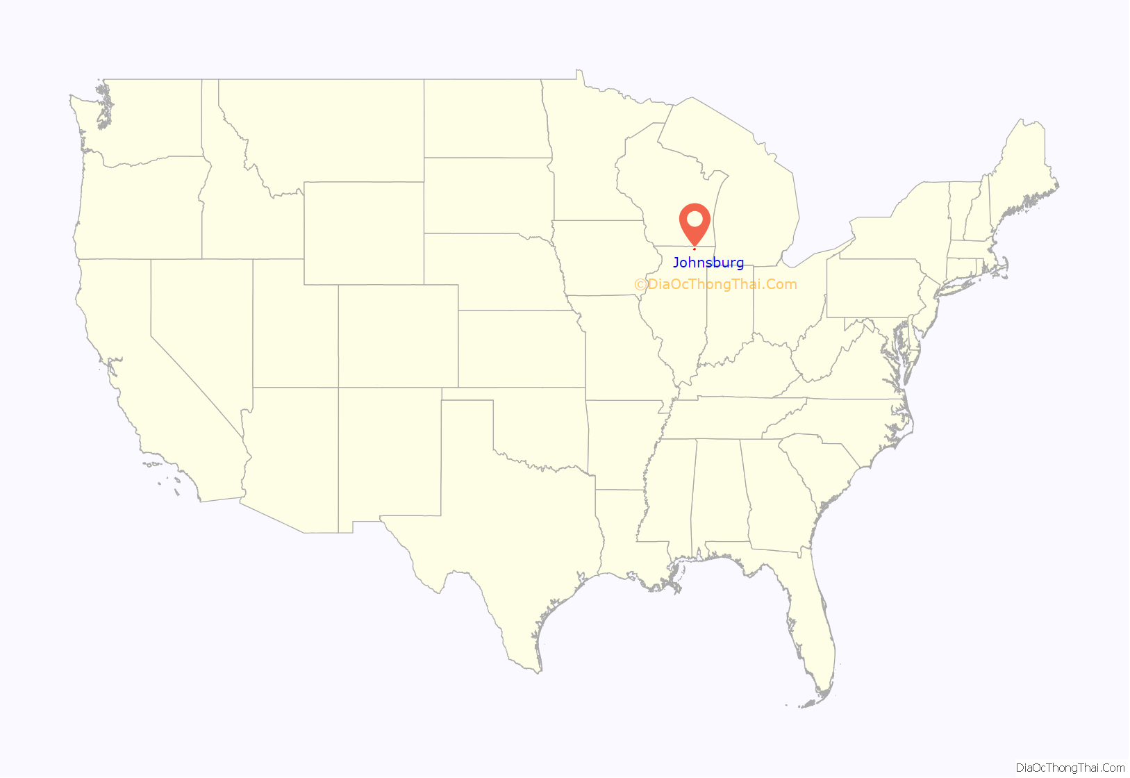
Johnsburg location map. Where is Johnsburg village?
History
The area that came to be known as Johnsburg was first settled in 1841, five years after the founding of McHenry County, by immigrant families escaping religious persecution and oppressive social conditions in the Eifel region of Germany, predominantly the Mayen-Koblenz.” (The congregation is known today as St. John the Baptist.) They built their first church in 1842, a simple log cabin that also functioned as a school and meeting hall. The first priest to serve this new congregation was delivered there by friendly Native Americans who found him lost in the woods of Wisconsin. The church served the community until 1850, when a larger frame church was built to replace it. Construction on a third church, built in the Gothic style, began in 1867. This church took thirteen years to complete and was the pride of the Johnsburg community until it was destroyed by a fire on February 19, 1900. Many of the early settlers’ grave markers were also destroyed by the fire. The present St. John the Baptist church was dedicated in 1902.
By 1990, a group of citizens living in this unincorporated area of McHenry County had come to fear that their community, known for over 100 years as Johnsburg, would be swallowed or divided by surrounding municipalities. They turned to their neighbors in Sunnyside, an adjacent village with which they shared a library, schools, and other services, for solutions. (Sunnyside had been incorporated in 1956.) Sunnyside and Johnsburg leaders struck an informal agreement that allowed Sunnyside to annex the surrounding area, thereby tripling its size, but required it to rename itself Johnsburg. After Sunnyside completed the annexation in 1992, the Sunnyside Village Board legally renamed its municipality to Johnsburg.
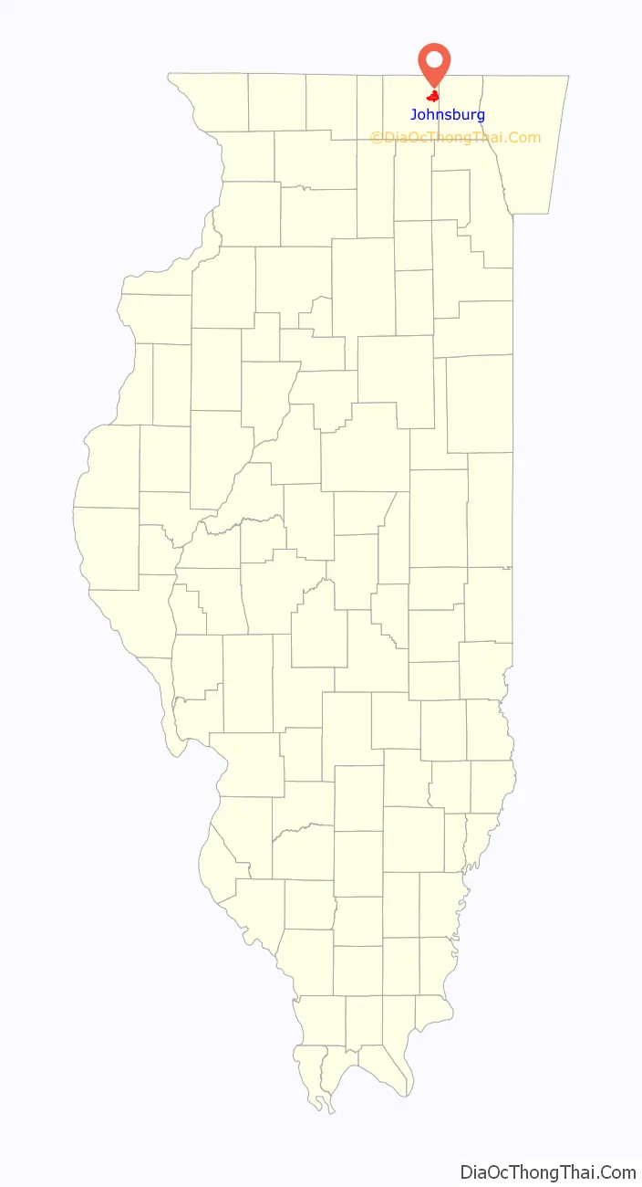
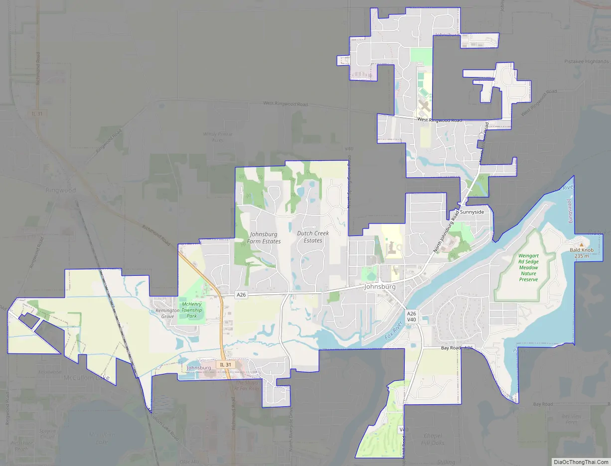
Johnsburg Road Map
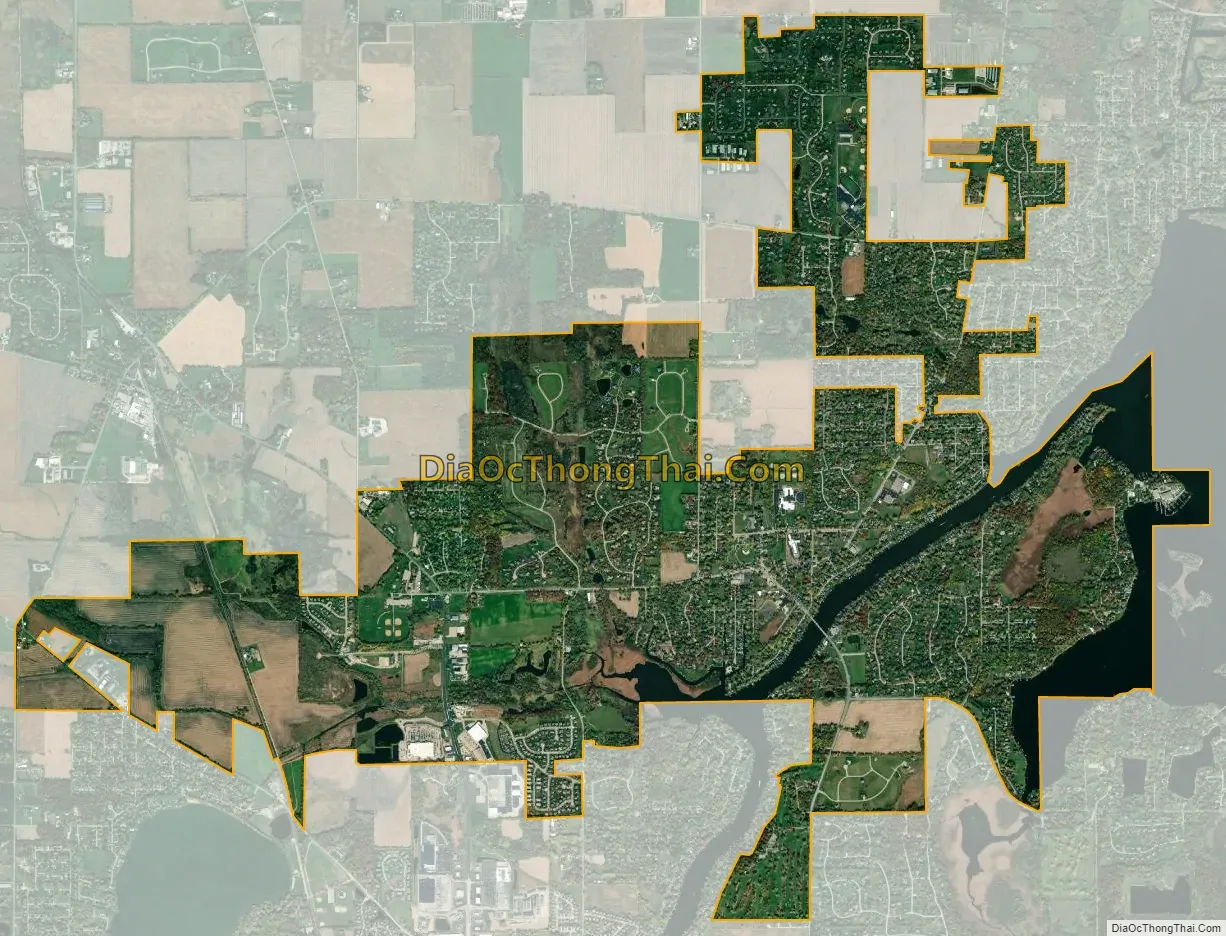
Johnsburg city Satellite Map
Geography
Johnsburg is located at 42°23′9″N 88°14′9″W / 42.38583°N 88.23583°W / 42.38583; -88.23583 (42.385796, -88.235942).
According to the 2010 census, Johnsburg has a total area of 7.674 square miles (19.88 km), of which 7.08 square miles (18.34 km) (or 92.26%) is land and 0.594 square miles (1.54 km) (or 7.74%) is water. Johnsburg lies within the watershed of the Fox river.
Major streets
- Richmond Road
- Ringwood Road
- McCullom Lake Road
- Johnsburg Road
- Spring Grove Road
- Chapel Hill Road
- Bay Road
- Riverside Drive
Public transportation
As of October 2018, a Pace bus route between the nearby municipalities of Crystal Lake, McHenry, and Fox Lake also serves Johnsburg. The closest rail transit is the McHenry commuter rail station, one of the termini of Metra’s Union Pacific/Northwest Line.
See also
Map of Illinois State and its subdivision:- Adams
- Alexander
- Bond
- Boone
- Brown
- Bureau
- Calhoun
- Carroll
- Cass
- Champaign
- Christian
- Clark
- Clay
- Clinton
- Coles
- Cook
- Crawford
- Cumberland
- De Kalb
- De Witt
- Douglas
- Dupage
- Edgar
- Edwards
- Effingham
- Fayette
- Ford
- Franklin
- Fulton
- Gallatin
- Greene
- Grundy
- Hamilton
- Hancock
- Hardin
- Henderson
- Henry
- Iroquois
- Jackson
- Jasper
- Jefferson
- Jersey
- Jo Daviess
- Johnson
- Kane
- Kankakee
- Kendall
- Knox
- La Salle
- Lake
- Lake Michigan
- Lawrence
- Lee
- Livingston
- Logan
- Macon
- Macoupin
- Madison
- Marion
- Marshall
- Mason
- Massac
- McDonough
- McHenry
- McLean
- Menard
- Mercer
- Monroe
- Montgomery
- Morgan
- Moultrie
- Ogle
- Peoria
- Perry
- Piatt
- Pike
- Pope
- Pulaski
- Putnam
- Randolph
- Richland
- Rock Island
- Saint Clair
- Saline
- Sangamon
- Schuyler
- Scott
- Shelby
- Stark
- Stephenson
- Tazewell
- Union
- Vermilion
- Wabash
- Warren
- Washington
- Wayne
- White
- Whiteside
- Will
- Williamson
- Winnebago
- Woodford
- Alabama
- Alaska
- Arizona
- Arkansas
- California
- Colorado
- Connecticut
- Delaware
- District of Columbia
- Florida
- Georgia
- Hawaii
- Idaho
- Illinois
- Indiana
- Iowa
- Kansas
- Kentucky
- Louisiana
- Maine
- Maryland
- Massachusetts
- Michigan
- Minnesota
- Mississippi
- Missouri
- Montana
- Nebraska
- Nevada
- New Hampshire
- New Jersey
- New Mexico
- New York
- North Carolina
- North Dakota
- Ohio
- Oklahoma
- Oregon
- Pennsylvania
- Rhode Island
- South Carolina
- South Dakota
- Tennessee
- Texas
- Utah
- Vermont
- Virginia
- Washington
- West Virginia
- Wisconsin
- Wyoming