Kenilworth is a village in Cook County, Illinois, United States, 15 miles (24 km) north of downtown Chicago. As of the 2020 census it had a population of 2,514. It is the newest of the nine suburban North Shore communities bordering Lake Michigan, and is one of those developed as a planned community. In 2018, Kenilworth was the eighth wealthiest community in the United States, and the wealthiest in the Midwestern United States.
| Name: | Kenilworth village |
|---|---|
| LSAD Code: | 47 |
| LSAD Description: | village (suffix) |
| State: | Illinois |
| County: | Cook County |
| Incorporated: | 1889 |
| Elevation: | 615 ft (187 m) |
| Total Area: | 0.61 sq mi (1.57 km²) |
| Land Area: | 0.61 sq mi (1.57 km²) |
| Water Area: | 0.00 sq mi (0.00 km²) 0% |
| Total Population: | 2,514 |
| Population Density: | 4,141.68/sq mi (1,597.94/km²) |
| Area code: | 847 & 224 |
| FIPS code: | 1739519 |
| Website: | www.vok.org |
Online Interactive Map
Click on ![]() to view map in "full screen" mode.
to view map in "full screen" mode.
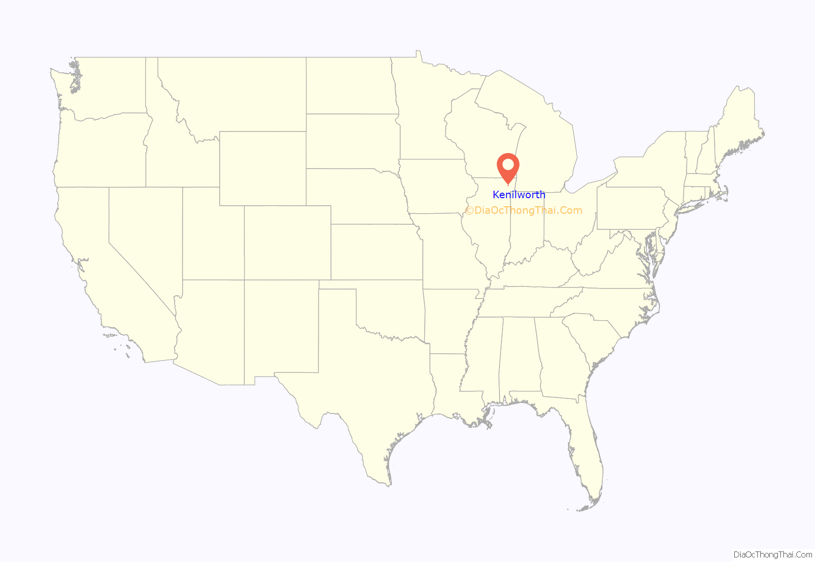
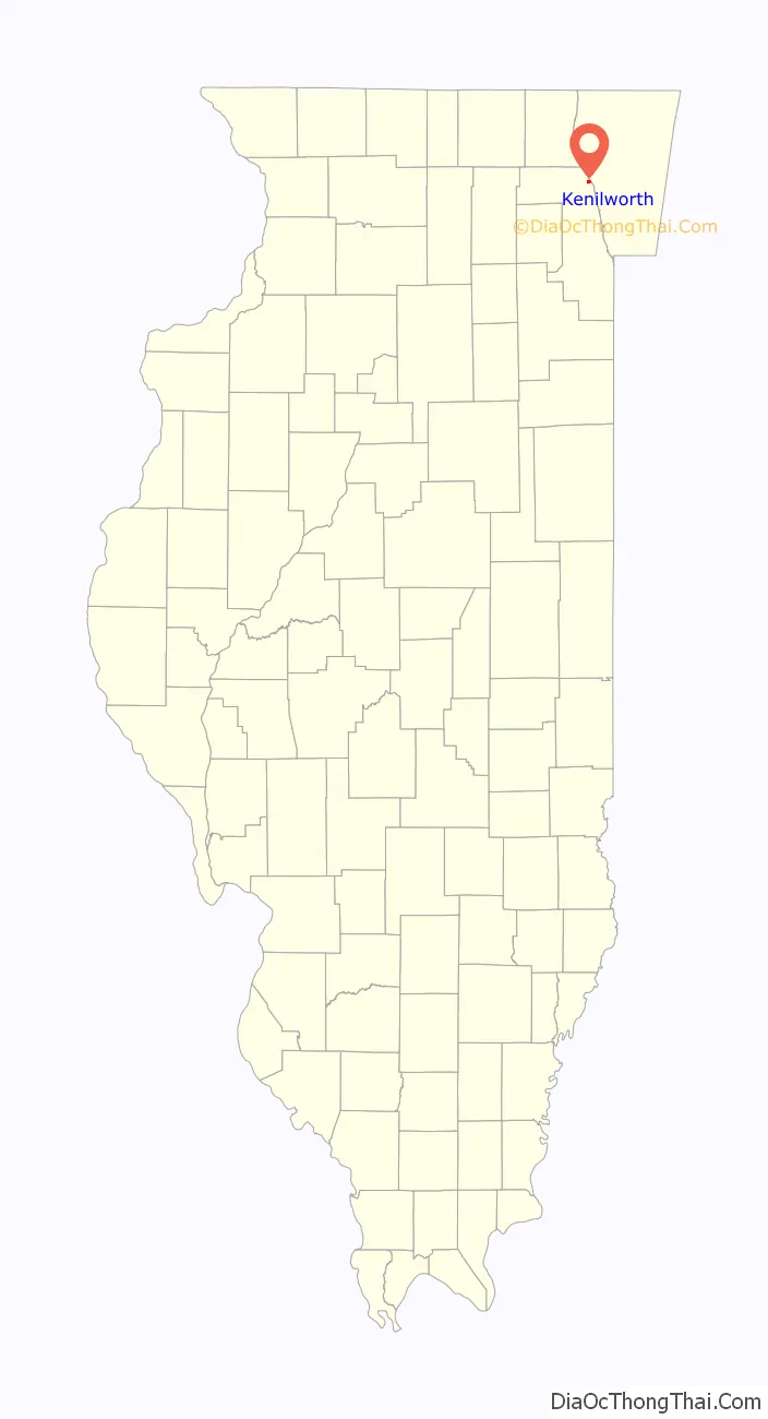
Kenilworth location map. Where is Kenilworth village?
History
Kenilworth was founded in 1889 when Joseph Sears purchased 223.6 acres of land consisting of several farms between the Chicago and North Western Railroad and Lake Michigan for $150,300. Sears and several of his associates formed The Kenilworth Company to execute his suburban dream.
The company undertook all marketing activities. They publicized the community’s many attractive features through brochures, maps, and newspaper ads, as well as direct personal sales. Prospects were provided transportation from the city and greeted with a reception. Visitors were also offered overnight accommodations. In 1891, Sears invited about 20 of his personal friends, prominent bankers and Chicago businessmen to a picnic luncheon on Kenilworth’s lake shore. Lots were offered at $60 an acre; significantly above the $15 an acre for similarly located property nearby. Some laughed, but the property did sell within 12 months. This planned community attracted widespread attention and was visited by many noted architects attending the 1893 Columbian Exposition in Chicago.
On February 4, 1896, the village reached the required 300 residents and was incorporated. The elected board assumed municipal functions from Sears. The Kenilworth Company continued their sales activities until 1904, at which time Sears acquired the existing stock and became the sole owner of the remaining property.
The Kenilworth Company coordinated every aspect of this planned community to ensure the highest quality implementation and adherence to Joseph Sears’ vision. The village layout was designed to take advantage of the natural features and beauty of the land. To maintain the country atmosphere, the plan required large lots and setbacks, tree plantings along roadways, and generous park lands. Mr. Sears donated much of his own property to achieve this goal.
The church, schools, parks, clubs, and recreational areas were early additions to encourage a spirit of community. Noted architect Franklin Burnham joined The Kenilworth Company and designed the railroad station and the Kenilworth Union Church. Burnham also designed several homes for company members to display for potential residents.
Joseph Sears founded Kenilworth with four stipulations: “Large lots, high standards of construction, no alleys, and sales to Caucasians only.”
The first African-American family to move to Kenilworth, the Calhouns, was met with resistance by many in the community, such as a cross burning in 1966 and racially charged vandalism, while others voiced shock over the offenses. Speaking of his friends and neighbors, Walter Calhoun, a young student and athlete at the time, recalls “They bent over backwards to make sure I was never left out.” Four years after the shocking incident, two teenagers visited Harold Calhoun in his downtown office where they confessed and apologized for the cross burning.
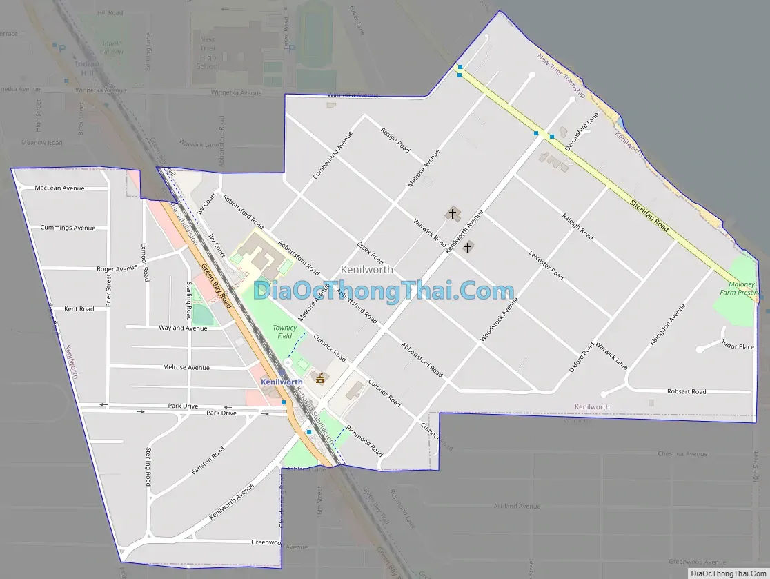
Kenilworth Road Map
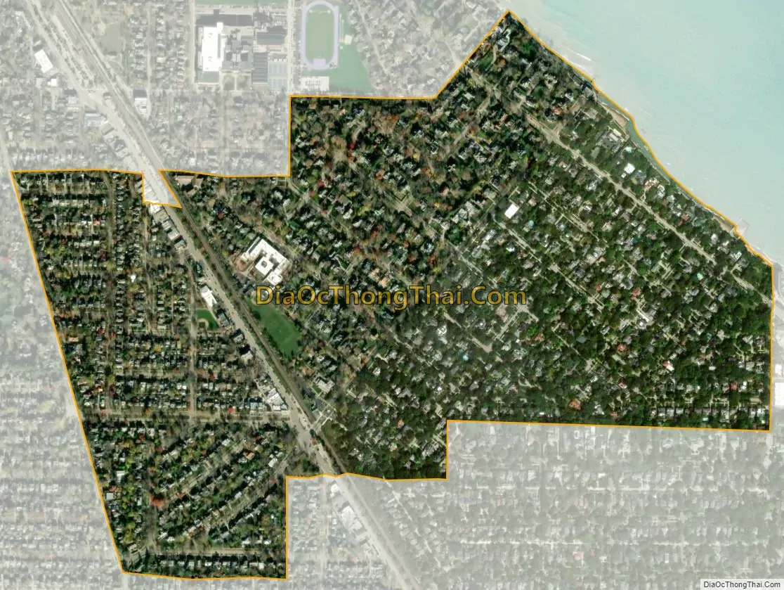
Kenilworth city Satellite Map
Geography
According to the 2021 census gazetteer files, Kenilworth has a total area of 0.61 square miles (1.58 km), all land.
See also
Map of Illinois State and its subdivision:- Adams
- Alexander
- Bond
- Boone
- Brown
- Bureau
- Calhoun
- Carroll
- Cass
- Champaign
- Christian
- Clark
- Clay
- Clinton
- Coles
- Cook
- Crawford
- Cumberland
- De Kalb
- De Witt
- Douglas
- Dupage
- Edgar
- Edwards
- Effingham
- Fayette
- Ford
- Franklin
- Fulton
- Gallatin
- Greene
- Grundy
- Hamilton
- Hancock
- Hardin
- Henderson
- Henry
- Iroquois
- Jackson
- Jasper
- Jefferson
- Jersey
- Jo Daviess
- Johnson
- Kane
- Kankakee
- Kendall
- Knox
- La Salle
- Lake
- Lake Michigan
- Lawrence
- Lee
- Livingston
- Logan
- Macon
- Macoupin
- Madison
- Marion
- Marshall
- Mason
- Massac
- McDonough
- McHenry
- McLean
- Menard
- Mercer
- Monroe
- Montgomery
- Morgan
- Moultrie
- Ogle
- Peoria
- Perry
- Piatt
- Pike
- Pope
- Pulaski
- Putnam
- Randolph
- Richland
- Rock Island
- Saint Clair
- Saline
- Sangamon
- Schuyler
- Scott
- Shelby
- Stark
- Stephenson
- Tazewell
- Union
- Vermilion
- Wabash
- Warren
- Washington
- Wayne
- White
- Whiteside
- Will
- Williamson
- Winnebago
- Woodford
- Alabama
- Alaska
- Arizona
- Arkansas
- California
- Colorado
- Connecticut
- Delaware
- District of Columbia
- Florida
- Georgia
- Hawaii
- Idaho
- Illinois
- Indiana
- Iowa
- Kansas
- Kentucky
- Louisiana
- Maine
- Maryland
- Massachusetts
- Michigan
- Minnesota
- Mississippi
- Missouri
- Montana
- Nebraska
- Nevada
- New Hampshire
- New Jersey
- New Mexico
- New York
- North Carolina
- North Dakota
- Ohio
- Oklahoma
- Oregon
- Pennsylvania
- Rhode Island
- South Carolina
- South Dakota
- Tennessee
- Texas
- Utah
- Vermont
- Virginia
- Washington
- West Virginia
- Wisconsin
- Wyoming


