Kinmundy is a city in Marion County, Illinois, United States. The population was 733 at the 2020 census.
The town is believed to have been named after a place in Scotland, the birthplace of William Ferguson, a London agent for the Illinois Central Railroad during Kinmundy’s construction. He visited the area in 1856.
| Name: | Kinmundy city |
|---|---|
| LSAD Code: | 25 |
| LSAD Description: | city (suffix) |
| State: | Illinois |
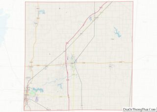
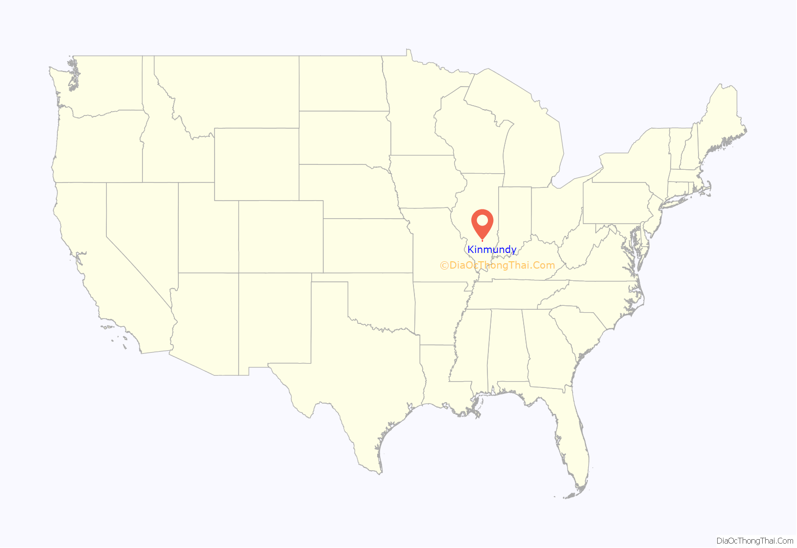
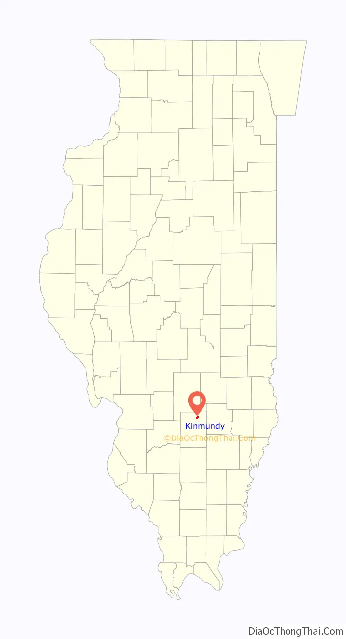
| County: | Marion County |
| Elevation: | 577 ft (176 m) |
| Total Area: | 1.45 sq mi (3.76 km²) |
| Land Area: | 1.20 sq mi (3.10 km²) |
| Water Area: | 0.25 sq mi (0.66 km²) |
| Total Population: | 733 |
| Population Density: | 611.85/sq mi (236.26/km²) |
| ZIP code: | 62854 |
| Area code: | 618 |
| FIPS code: | 1740117 |
| Website: | cityofkinmundy.com |
Online Interactive Map
Click on ![]() to view map in "full screen" mode.
to view map in "full screen" mode.
Kinmundy location map. Where is Kinmundy city?
History
The origins of the town of Kinmundy are rooted in the expansion of the railroads in southern Illinois, with the first significant economic influence being construction work on the Chicago branch of the Illinois Central Railroad. In April 1857, the town was initially laid out east of the railroad, in 15 blocks of varying sizes, and later, incorporated as a city in 1867.
In January 1912, Illinois Central Railroad train No. 3, traveling at 50 miles per hour (80 km/h), collided with passenger train No. 25, which was standing at the station in Kinmundy taking water. The devastating train wreck demolished the private car at the rear of train No. 25, killing five passengers, among them James T. Harahan, the recently-retired president of the Illinois Central Railroad.
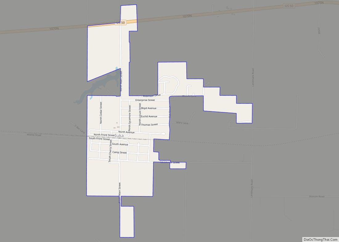
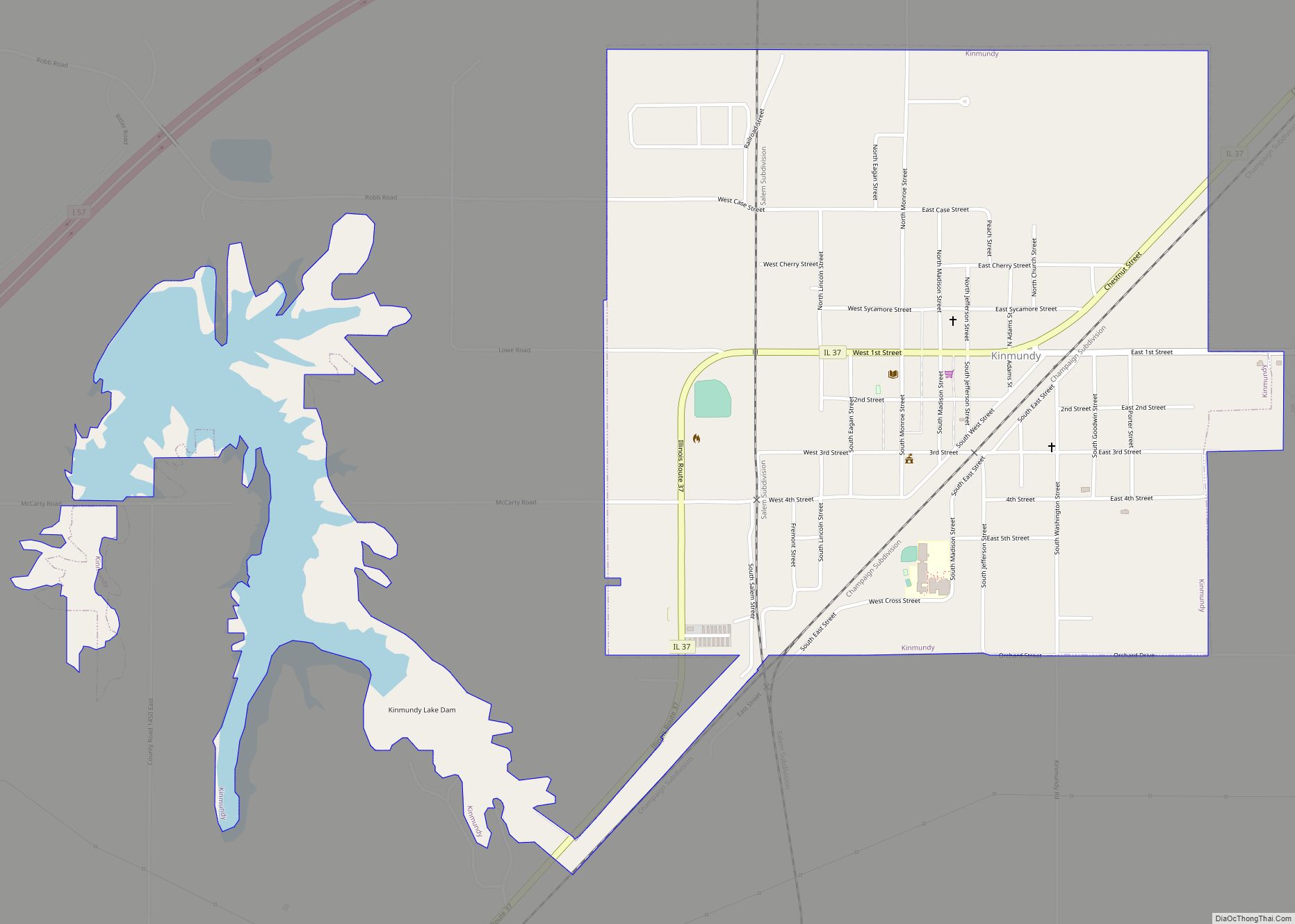
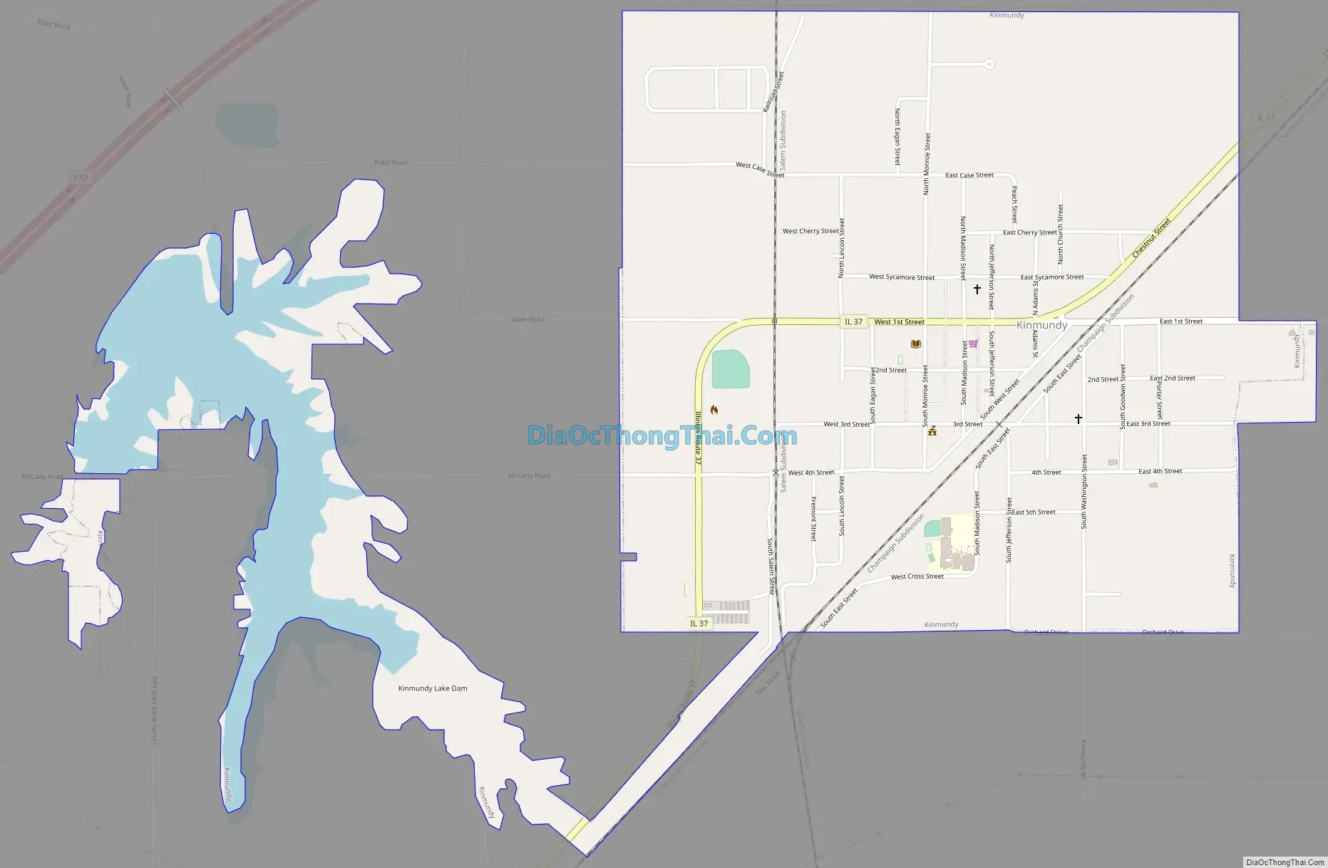
Kinmundy Road Map
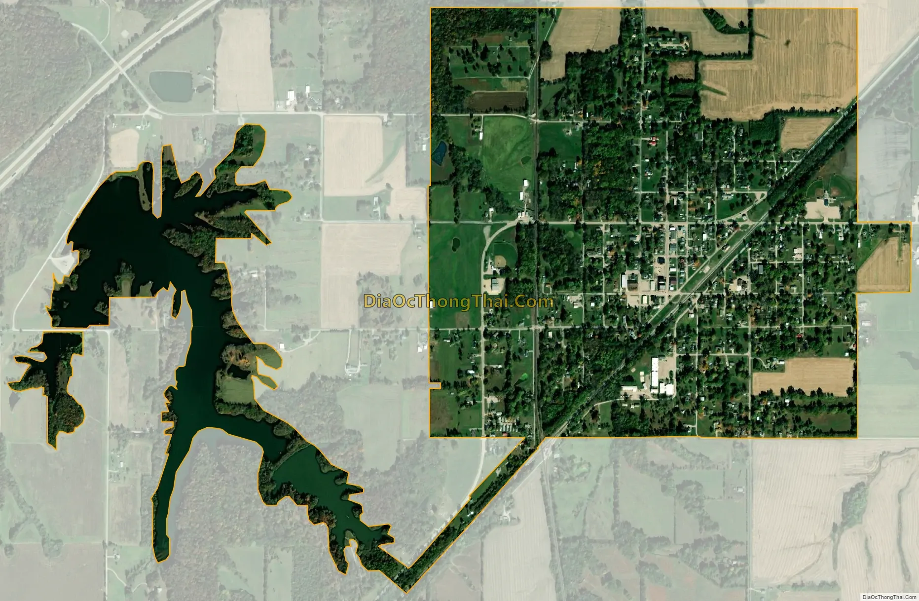
Kinmundy city Satellite Map
Geography
Kinmundy is located in northeastern Marion County. Illinois Route 37 passes through the village center as 1st Street, leading southwest 12 miles (19 km) to Salem, the county seat, and northeast 6 miles (10 km) to Farina. Interstate 57 passes northwest of the city, with access from Exit 127. I-57 leads northeast 32 miles (51 km) to Effingham and southwest 38 miles (61 km) to Mount Vernon.
According to the U.S. Census Bureau, Kinmundy has a total area of 1.45 square miles (3.76 km), of which 1.29 square miles (3.34 km) are land and 0.25 square miles (0.65 km), or 17.44%, are water. The water area consists of Kinmundy Lake, a reservoir 1 mile (1.6 km) west of the city proper. The city drains to the northwest, toward the East Fork of the Kaskaskia River.
See also
Map of Illinois State and its subdivision:- Adams
- Alexander
- Bond
- Boone
- Brown
- Bureau
- Calhoun
- Carroll
- Cass
- Champaign
- Christian
- Clark
- Clay
- Clinton
- Coles
- Cook
- Crawford
- Cumberland
- De Kalb
- De Witt
- Douglas
- Dupage
- Edgar
- Edwards
- Effingham
- Fayette
- Ford
- Franklin
- Fulton
- Gallatin
- Greene
- Grundy
- Hamilton
- Hancock
- Hardin
- Henderson
- Henry
- Iroquois
- Jackson
- Jasper
- Jefferson
- Jersey
- Jo Daviess
- Johnson
- Kane
- Kankakee
- Kendall
- Knox
- La Salle
- Lake
- Lake Michigan
- Lawrence
- Lee
- Livingston
- Logan
- Macon
- Macoupin
- Madison
- Marion
- Marshall
- Mason
- Massac
- McDonough
- McHenry
- McLean
- Menard
- Mercer
- Monroe
- Montgomery
- Morgan
- Moultrie
- Ogle
- Peoria
- Perry
- Piatt
- Pike
- Pope
- Pulaski
- Putnam
- Randolph
- Richland
- Rock Island
- Saint Clair
- Saline
- Sangamon
- Schuyler
- Scott
- Shelby
- Stark
- Stephenson
- Tazewell
- Union
- Vermilion
- Wabash
- Warren
- Washington
- Wayne
- White
- Whiteside
- Will
- Williamson
- Winnebago
- Woodford
- Alabama
- Alaska
- Arizona
- Arkansas
- California
- Colorado
- Connecticut
- Delaware
- District of Columbia
- Florida
- Georgia
- Hawaii
- Idaho
- Illinois
- Indiana
- Iowa
- Kansas
- Kentucky
- Louisiana
- Maine
- Maryland
- Massachusetts
- Michigan
- Minnesota
- Mississippi
- Missouri
- Montana
- Nebraska
- Nevada
- New Hampshire
- New Jersey
- New Mexico
- New York
- North Carolina
- North Dakota
- Ohio
- Oklahoma
- Oregon
- Pennsylvania
- Rhode Island
- South Carolina
- South Dakota
- Tennessee
- Texas
- Utah
- Vermont
- Virginia
- Washington
- West Virginia
- Wisconsin
- Wyoming