The village of La Grange (/lə ˈɡreɪndʒ/ lə GRAYNJ; often spelled LaGrange), a suburb of Chicago, is a village in Cook County, in the U.S. state of Illinois. The population was 16,321 at the 2020 census.
| Name: | La Grange village |
|---|---|
| LSAD Code: | 47 |
| LSAD Description: | village (suffix) |
| State: | Illinois |
| County: | Cook County |
| Incorporated: | June 11, 1879 |
| Elevation: | 646 ft (197 m) |
| Total Area: | 2.52 sq mi (6.54 km²) |
| Land Area: | 2.52 sq mi (6.54 km²) |
| Water Area: | 0.00 sq mi (0.00 km²) 0% |
| Total Population: | 16,321 |
| Population Density: | 6,463.76/sq mi (2,495.85/km²) |
| Area code: | 708 |
| FIPS code: | 1740767 |
| Website: | www.villageoflagrange.com |
Online Interactive Map
Click on ![]() to view map in "full screen" mode.
to view map in "full screen" mode.
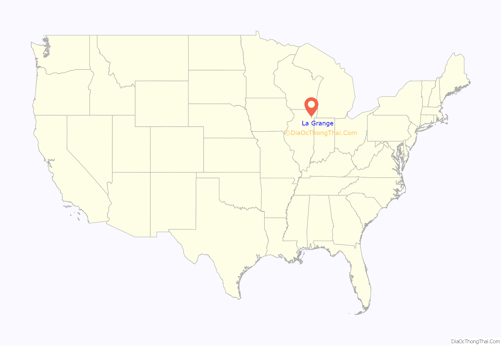
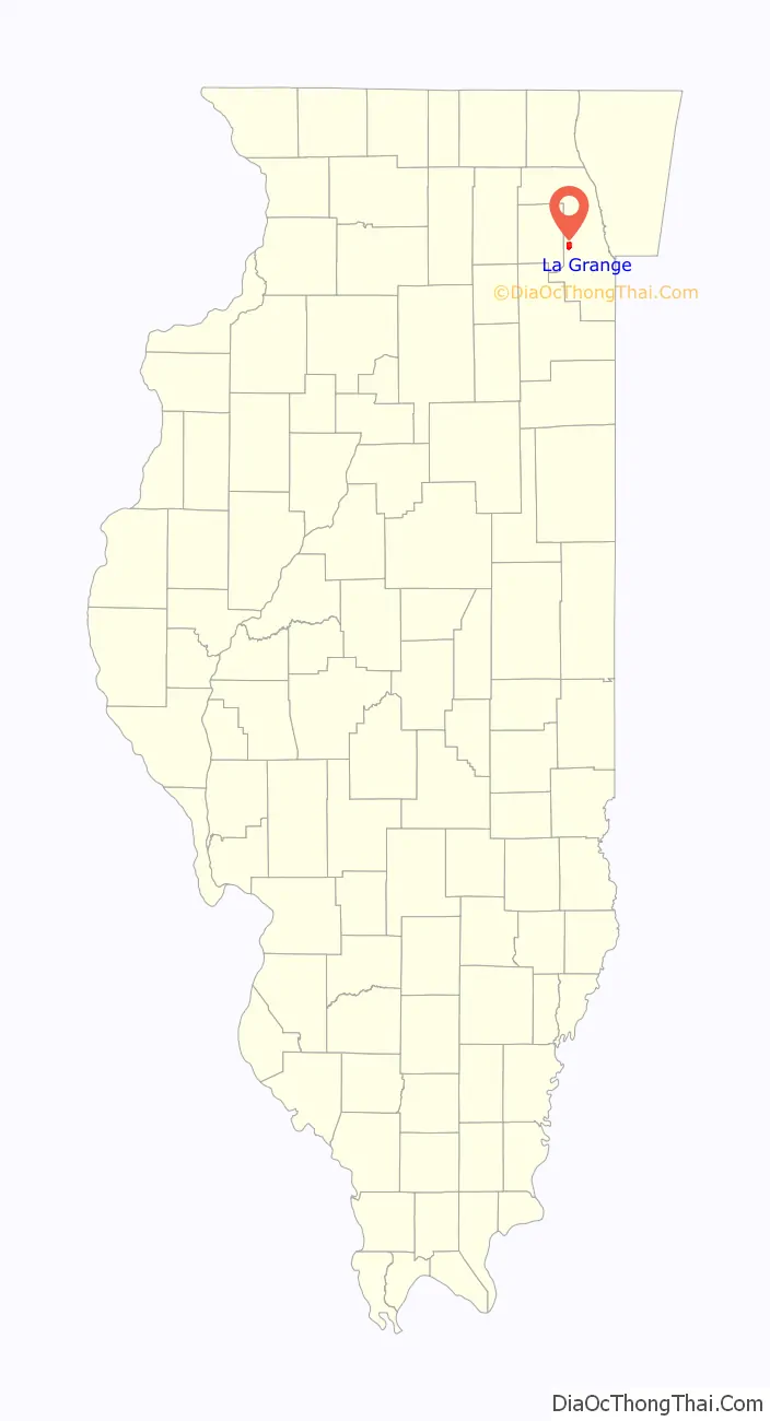
La Grange location map. Where is La Grange village?
History
The area around La Grange was first settled in the 1830s, when Chicago residents moved out to the west due to the rapid population increase in the city in the decade since its incorporation. The first settler, Robert Leitch, came to the area in 1830, seven years before the City of Chicago was incorporated. La Grange’s location, at approximately 13 miles (21 km) from the Chicago Loop, is not considered far from the city by today’s standards, but in that time the residents enjoyed the peace of rural life without much communication with urban residents.
The village was officially incorporated on June 11, 1879. It was founded by Franklin Dwight Cossitt, who was born in Granby, Connecticut, and raised in Tennessee, and moved to Chicago in 1862 where he built a successful wholesale grocery business.
In 1870, Cossitt purchased several hundred acres of farmland in Lyons Township, along the Chicago-Dixon Road, known today as Ogden Avenue (U.S. Highway 34). Ogden Avenue, on the site of a defunct Native American trail, was also referred to as the “Old Plank Road”. Planks were often stolen by settlers to be used as building material, which made traveling very bumpy. When the Chicago, Burlington & Quincy Railroad came to town, La Grange was a milk stop called Hazel Glen. A few miles to the south, through present-day Willow Springs, the Illinois and Michigan Canal had emerged as a major shipping corridor, connecting Chicago and the Great Lakes with the Illinois and Mississippi rivers.
Cossitt set out to build the ideal suburban village – laying out streets, planting trees, donating property for churches and schools, and building quality homes for sale between $2,000–$8000 USD. He also placed liquor restrictions in the land deeds he sold to prevent the village from becoming a saloon town.
When Cossitt began his development, the area was served by a post office known as Kensington. But upon learning of another community already with that name in Illinois, Cossitt decided to name his town in honor of La Grange, Tennessee, where he had been raised as a youth on an uncle’s slave plantation. To this day, Kensington remains the name of one of the village’s major avenues.
After the Great Chicago Fire of 1871 destroyed much of that city, thousands of its citizens sought new homes and opportunities far from the city’s ills but within a convenient commute. La Grange was ideally situated to accommodate them.
Telephones were first set up by Dr. George Fox in the 1880s for quick communication between his home office and a drug store, enabling him to order prescriptions to be delivered by buggy in a moment’s notice. Growing to 52 lines in 1894, it increased twofold to 120 by the next year, and surged to 2,346 by 1921 (36 percent of the population at the time).
There was a large spike in population is the 1880s and 1890s as the village grew from just over 500 to nearly 4,000 residents, over 600% growth in twenty years. The population continued to grow steadily through the 1960s, peaking at 17,814 according to the 1970 census. The population declined slightly in the ’70s & ’80s and has been relatively stable since then.
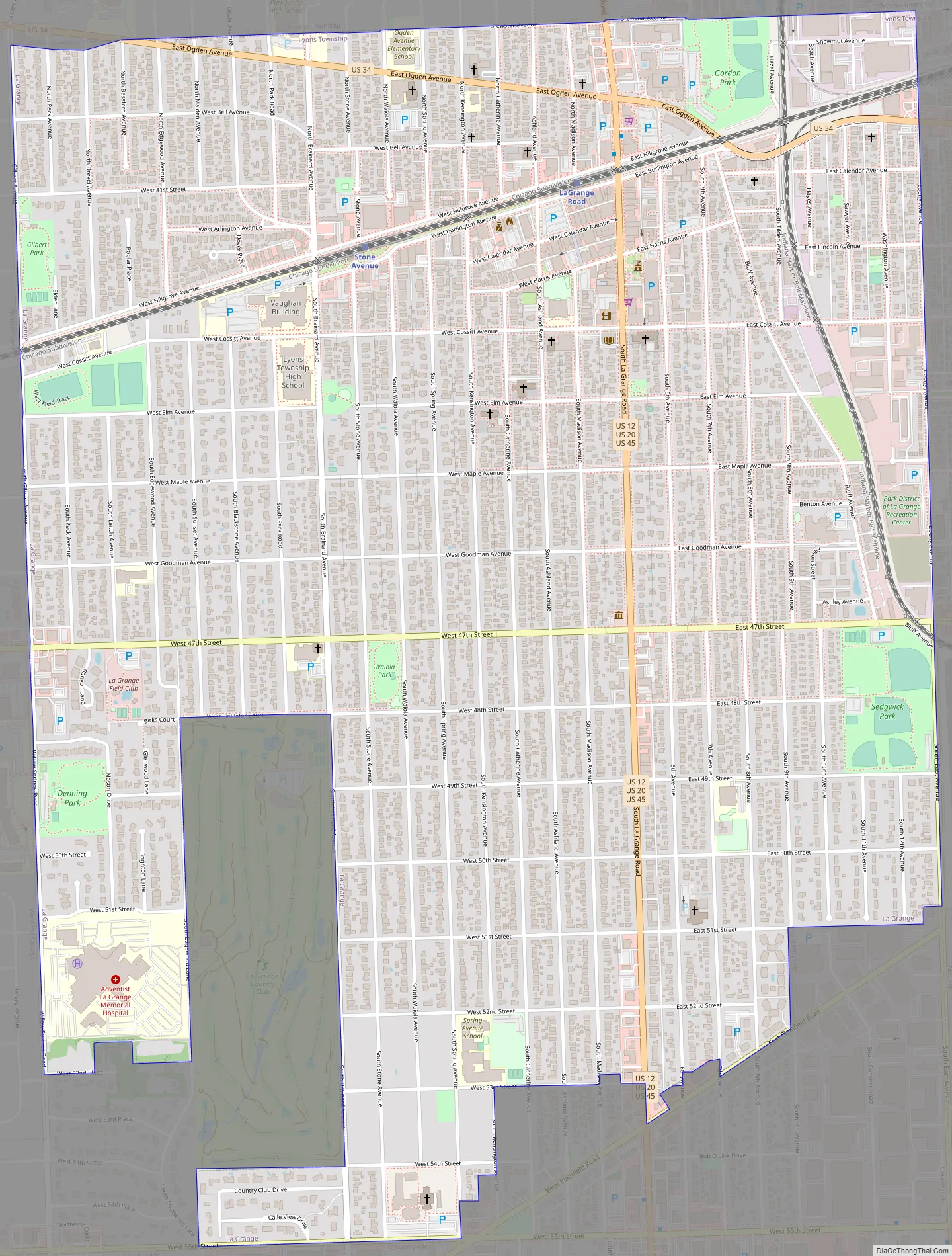
La Grange Road Map
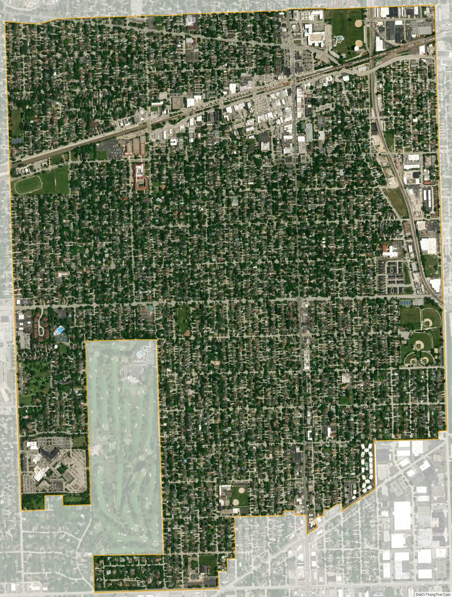
La Grange city Satellite Map
Geography
La Grange is located at 41°48′29″N 87°52′24″W / 41.80806°N 87.87333°W / 41.80806; -87.87333 (41.807938, −87.873455), about 13 miles (21 km) west of Chicago. The village is roughly flat, only deviating from the elevation of 645 feet by at most ten feet. La Grange is surrounded by incorporated places of similar sizes on all sides except to the South West, where the generously named La Grange Highlands are.
As of 2020, La Grange has a total area of 2.52 square miles (6.53 km), all land. Two major railroad tracks run through the village, including the Burlington Northern Santa Fe, and the CSX/Indiana Harbor Belt lines.
Some 14,000 years ago, the land under La Grange sat on the western shore of Lake Chicago, a predecessor to Lake Michigan. The prehistoric shoreline today is delineated by Bluff Avenue, a north–south street on the village’s east side.
See also
Map of Illinois State and its subdivision:- Adams
- Alexander
- Bond
- Boone
- Brown
- Bureau
- Calhoun
- Carroll
- Cass
- Champaign
- Christian
- Clark
- Clay
- Clinton
- Coles
- Cook
- Crawford
- Cumberland
- De Kalb
- De Witt
- Douglas
- Dupage
- Edgar
- Edwards
- Effingham
- Fayette
- Ford
- Franklin
- Fulton
- Gallatin
- Greene
- Grundy
- Hamilton
- Hancock
- Hardin
- Henderson
- Henry
- Iroquois
- Jackson
- Jasper
- Jefferson
- Jersey
- Jo Daviess
- Johnson
- Kane
- Kankakee
- Kendall
- Knox
- La Salle
- Lake
- Lake Michigan
- Lawrence
- Lee
- Livingston
- Logan
- Macon
- Macoupin
- Madison
- Marion
- Marshall
- Mason
- Massac
- McDonough
- McHenry
- McLean
- Menard
- Mercer
- Monroe
- Montgomery
- Morgan
- Moultrie
- Ogle
- Peoria
- Perry
- Piatt
- Pike
- Pope
- Pulaski
- Putnam
- Randolph
- Richland
- Rock Island
- Saint Clair
- Saline
- Sangamon
- Schuyler
- Scott
- Shelby
- Stark
- Stephenson
- Tazewell
- Union
- Vermilion
- Wabash
- Warren
- Washington
- Wayne
- White
- Whiteside
- Will
- Williamson
- Winnebago
- Woodford
- Alabama
- Alaska
- Arizona
- Arkansas
- California
- Colorado
- Connecticut
- Delaware
- District of Columbia
- Florida
- Georgia
- Hawaii
- Idaho
- Illinois
- Indiana
- Iowa
- Kansas
- Kentucky
- Louisiana
- Maine
- Maryland
- Massachusetts
- Michigan
- Minnesota
- Mississippi
- Missouri
- Montana
- Nebraska
- Nevada
- New Hampshire
- New Jersey
- New Mexico
- New York
- North Carolina
- North Dakota
- Ohio
- Oklahoma
- Oregon
- Pennsylvania
- Rhode Island
- South Carolina
- South Dakota
- Tennessee
- Texas
- Utah
- Vermont
- Virginia
- Washington
- West Virginia
- Wisconsin
- Wyoming


