La Harpe is a town in Hancock County, Illinois, United States. The population was 1,235 at the 2010 census, down from 1,385 at the 2000 census.
| Name: | La Harpe city |
|---|---|
| LSAD Code: | 25 |
| LSAD Description: | city (suffix) |
| State: | Illinois |
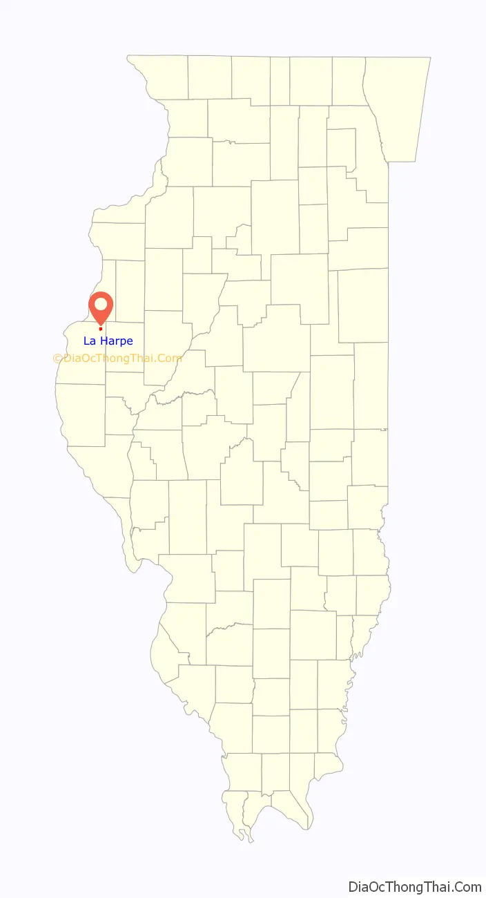
| County: | Hancock County |
| Elevation: | 696 ft (212 m) |
| Total Area: | 1.36 sq mi (3.53 km²) |
| Land Area: | 1.36 sq mi (3.53 km²) |
| Water Area: | 0.00 sq mi (0.00 km²) |
| Total Population: | 1,175 |
| Population Density: | 861.44/sq mi (332.72/km²) |
| Area code: | 217 |
| FIPS code: | 1740832 |
| GNISfeature ID: | 2395566 |
| Website: | cityoflaharpe.com |
Online Interactive Map
Click on ![]() to view map in "full screen" mode.
to view map in "full screen" mode.
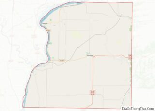
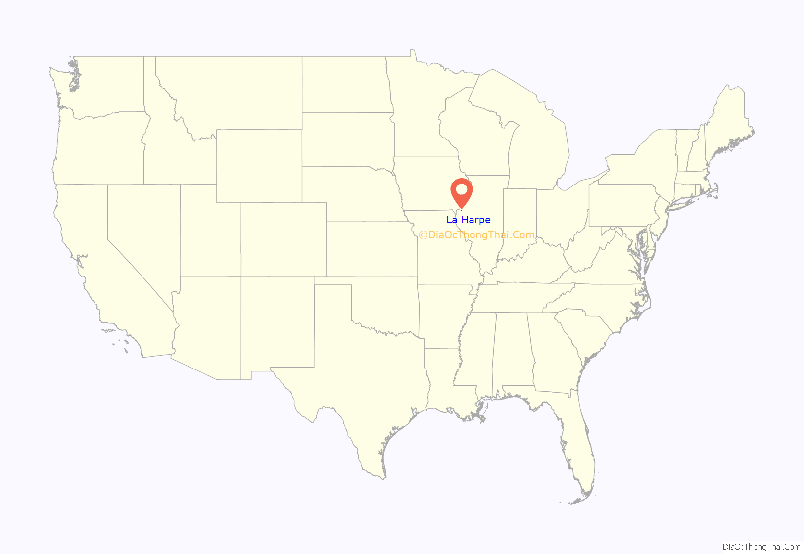
La Harpe location map. Where is La Harpe city?
History
During the 18th century, French explorers headed by Bernard de la Harpe were forced to spend the winter just north of the present city of La Harpe. About 1896, four stone tablets dated June 15, 1715, and inscribed in French were reportedly found a few miles east of the old fortification built by the explorers. Stones were translated locally by the only French family in town as follows: “We are surrounded by indians and have no hope for survival unless help soon arrives.” Said stone tablets were reported to be sent to the Smithsonian for authentication, and were ruled a hoax. Their whereabouts are currently unknown.
Soon after 1830, landowners in the area began to develop a town which they called “Franklin”. In 1836, they applied for a post office and were informed another town in Illinois was already named Franklin. The first postmaster, Louis Rice Chaffin, suggested the name be registered as “La Harpe”, for the Frenchman who spent the winter over 100 years earlier. The City of La Harpe was granted a charter by the Illinois legislature in 1859. The charter was amended in 1861 to change the size of the town, and the boundaries have changed through the years. Today the city has 22 streets and avenues.
In 1867, the TP&W railroad line was completed through the town. In 1888, the city council bought the first fire engine, but a fire in October 1893 still destroyed nearly all the businesses in one block of Main Street. City Hall was built in 1894. The election of 1895 was the first election in which the women of La Harpe were allowed to vote on the issue of liquor licenses. (The women had a separate ballot box.) The La Harpe Carnegie Public Library was built in 1905, with local support and a donation from Andrew Carnegie. Today it is listed on the National Register of Historic Sites. The City Park was donated by Marvin Tyron, one of the town’s founders, as a public square.
In 1986, La Harpe celebrated 150 years of history. During that year, a sesquicentennial history entitled La Harpe, Illinois, 1836-1986 was published.
Each summer the town used to celebrate their Summerfest on the town square. The annual Fred Gibb Car Show is held in August. Gibb’s claim to fame was as the sponsor of the original ZL-1 COPO Camaros and Novas during the pony car era of the early 1970s. Gibb’s name has since been omitted from the car show.
Today, many of the surviving buildings in La Harpe’s business districts, including the City Hall, are on the National Register of Historic Places. La Harpe had the only four-story building in Hancock County. The park district includes a community clubhouse, swimming pool, the LaMoine Valley golf course, and a complex of lighted ball fields. The city park has a lighted shelter house and stage.
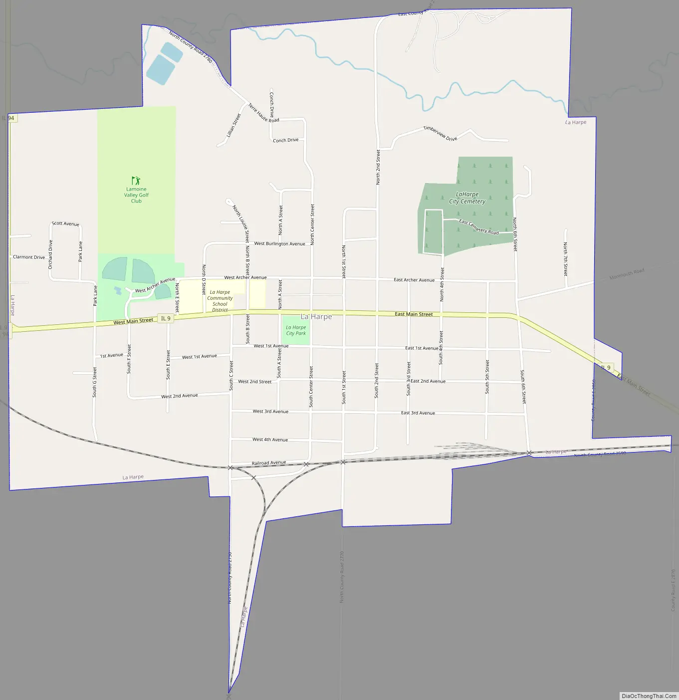
La Harpe Road Map
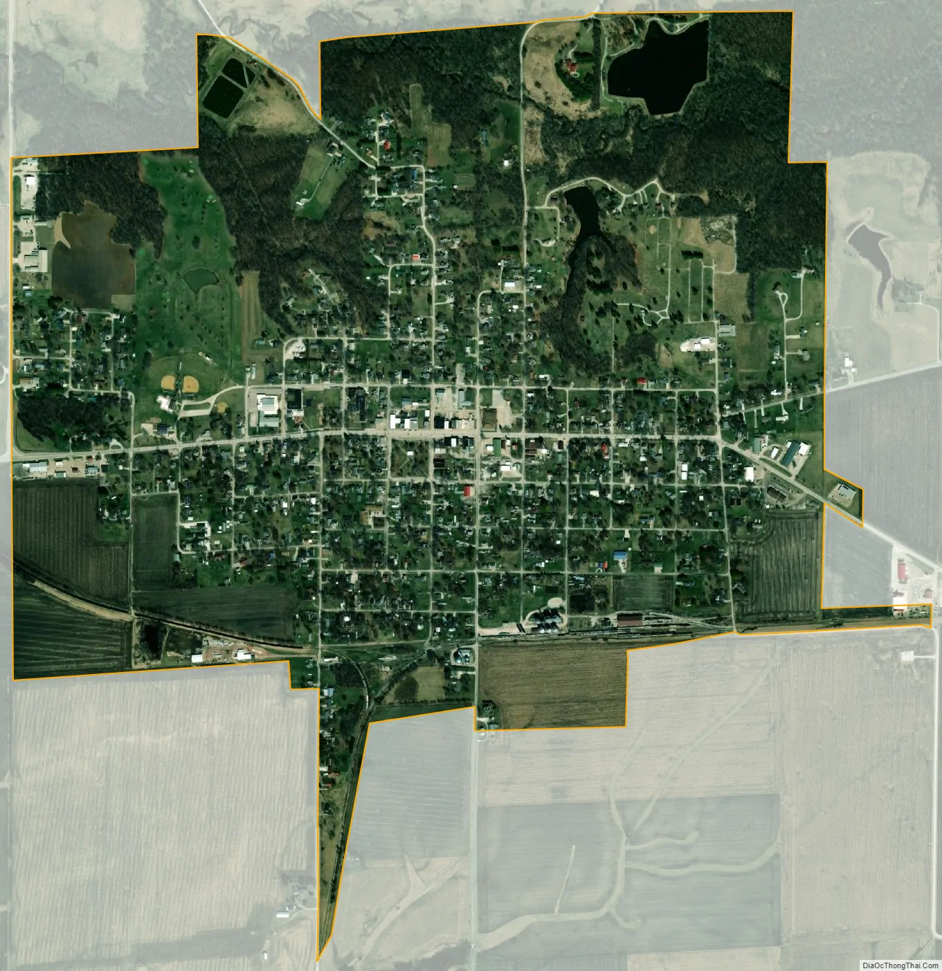
La Harpe city Satellite Map
Geography
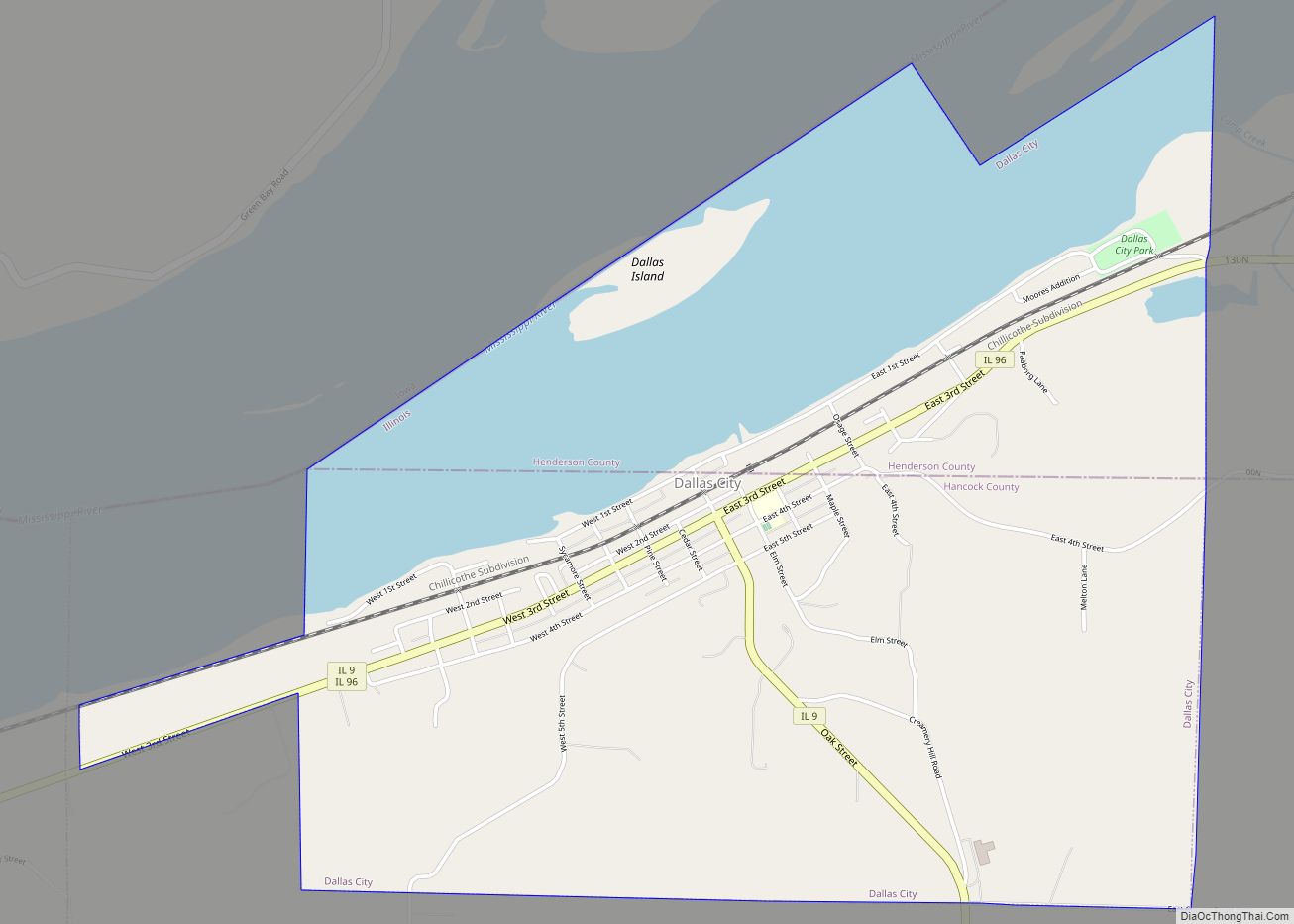
La Harpe is located in northeastern Hancock County at 40°34′59″N 90°58′08″W / 40.582925°N 90.968770°W / 40.582925; -90.968770, south of the South Branch La Moine River. Illinois Route 9 passes through the city as its Main Street, leading east 25 miles (40 km) to Bushnell and west 13 miles (21 km) to Dallas City on the Mississippi River. Illinois Route 94 intersects IL 9 at the western edge of the city, and leads north 15 miles (24 km) to Stronghurst.
According to the 2010 census, La Harpe has a total area of 1.36 square miles (3.52 km), all land.
Climate
See also
Map of Illinois State and its subdivision:- Adams
- Alexander
- Bond
- Boone
- Brown
- Bureau
- Calhoun
- Carroll
- Cass
- Champaign
- Christian
- Clark
- Clay
- Clinton
- Coles
- Cook
- Crawford
- Cumberland
- De Kalb
- De Witt
- Douglas
- Dupage
- Edgar
- Edwards
- Effingham
- Fayette
- Ford
- Franklin
- Fulton
- Gallatin
- Greene
- Grundy
- Hamilton
- Hancock
- Hardin
- Henderson
- Henry
- Iroquois
- Jackson
- Jasper
- Jefferson
- Jersey
- Jo Daviess
- Johnson
- Kane
- Kankakee
- Kendall
- Knox
- La Salle
- Lake
- Lake Michigan
- Lawrence
- Lee
- Livingston
- Logan
- Macon
- Macoupin
- Madison
- Marion
- Marshall
- Mason
- Massac
- McDonough
- McHenry
- McLean
- Menard
- Mercer
- Monroe
- Montgomery
- Morgan
- Moultrie
- Ogle
- Peoria
- Perry
- Piatt
- Pike
- Pope
- Pulaski
- Putnam
- Randolph
- Richland
- Rock Island
- Saint Clair
- Saline
- Sangamon
- Schuyler
- Scott
- Shelby
- Stark
- Stephenson
- Tazewell
- Union
- Vermilion
- Wabash
- Warren
- Washington
- Wayne
- White
- Whiteside
- Will
- Williamson
- Winnebago
- Woodford
- Alabama
- Alaska
- Arizona
- Arkansas
- California
- Colorado
- Connecticut
- Delaware
- District of Columbia
- Florida
- Georgia
- Hawaii
- Idaho
- Illinois
- Indiana
- Iowa
- Kansas
- Kentucky
- Louisiana
- Maine
- Maryland
- Massachusetts
- Michigan
- Minnesota
- Mississippi
- Missouri
- Montana
- Nebraska
- Nevada
- New Hampshire
- New Jersey
- New Mexico
- New York
- North Carolina
- North Dakota
- Ohio
- Oklahoma
- Oregon
- Pennsylvania
- Rhode Island
- South Carolina
- South Dakota
- Tennessee
- Texas
- Utah
- Vermont
- Virginia
- Washington
- West Virginia
- Wisconsin
- Wyoming