Lyons is a village in Lyons Township, Cook County, Illinois, United States. Per the 2020 census, the population was 10,817. The Chicago Portage National Historic Site is located in Lyons.
| Name: | Lyons village |
|---|---|
| LSAD Code: | 47 |
| LSAD Description: | village (suffix) |
| State: | Illinois |
| County: | Cook County |
| Incorporated: | 1888 |
| Elevation: | 620 ft (190 m) |
| Total Area: | 2.27 sq mi (5.89 km²) |
| Land Area: | 2.21 sq mi (5.72 km²) |
| Water Area: | 0.07 sq mi (0.17 km²) |
| Total Population: | 10,817 |
| Population Density: | 4,901.22/sq mi (1,891.99/km²) |
| Area code: | 708 |
| FIPS code: | 1745434 |
| Website: | www.villageoflyons-il.net |
Online Interactive Map
Click on ![]() to view map in "full screen" mode.
to view map in "full screen" mode.
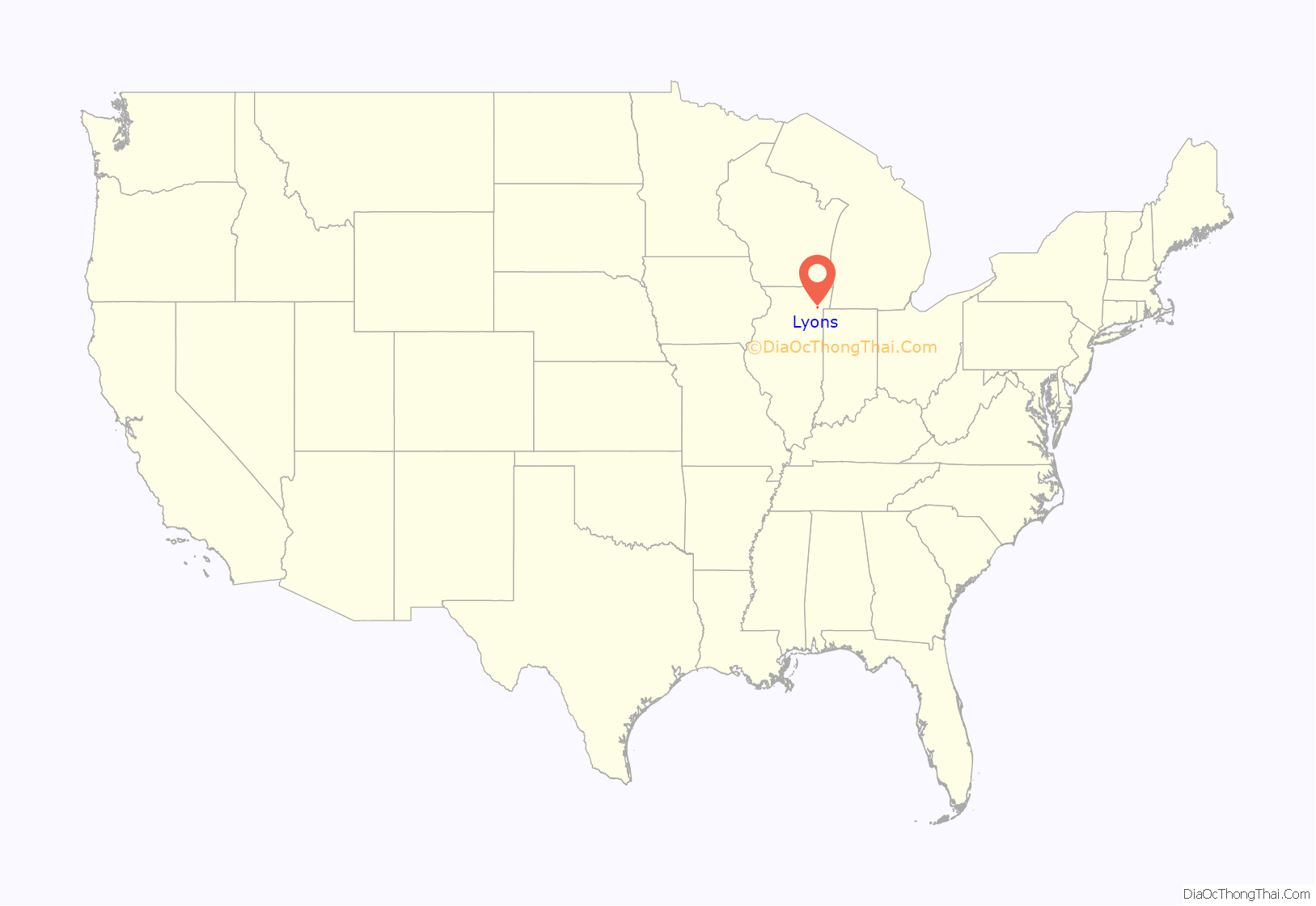
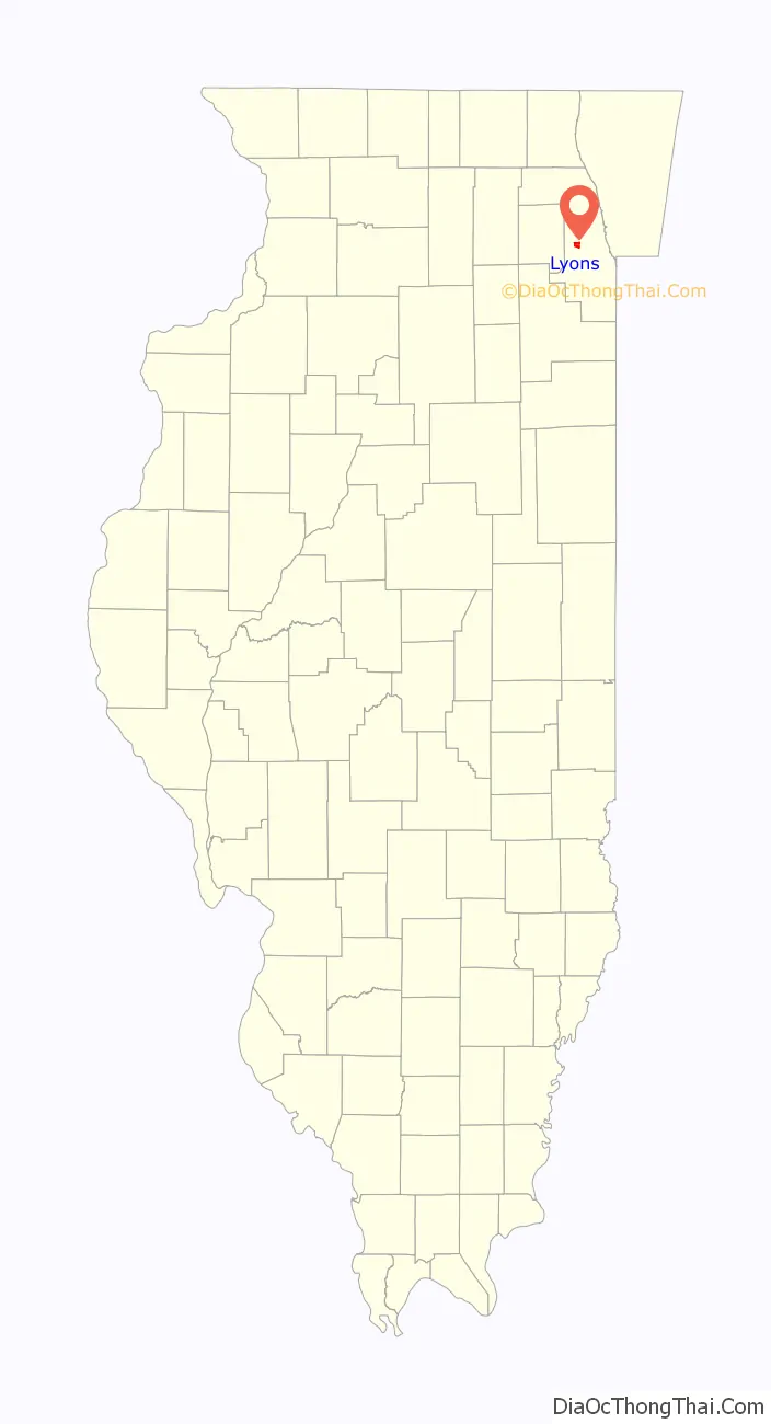
Lyons location map. Where is Lyons village?
History
Lyons was incorporated in 1888, though activity in the area dates back much further. In 1673 French Explorer Louis Joliet and Jesuit missionary Father Pierre Marquette left Green Bay, Wisconsin, by canoe in search of a western passage to the Pacific. As they traveled into the Spanish controlled area of Louisiana, they realized that the mighty Mississippi River drained into the already well known Gulf of Mexico. With winter approaching, they headed north as quickly as possible. To save time, the Potawatomi who were with them encouraged changing their route to the Illinois River. The short cut led to the Des Plaines River and caused the French travelers to discover “Le Portage.” This half-mile wide area of land connecting the Chicago River and the Des Plaines River, over which they could carry their canoes and supplies, was to become the discovery for which they would both become famous. Later known as the Chicago Portage, this small area became the “Gateway to the West” and was used by thousands of early settlers and traders traveling both east and west. The discovery of “Le Portage” was part of the impetus that led to Chicago becoming a center for the world trade.
Louis Joliet conceived the idea of constructing a canal to connect the two waterways. This idea was to become a reality 200 years later with the opening of the Illinois and Michigan Canal. In time, the part of the I&M Canal that connected the south branch of the Chicago River with the Des Plaines River was replaced with the Chicago Sanitary and Ship Canal, which was completed in 1900. Today, a statue stands in Lyons at the Chicago Portage National Historic Sight just north of Interstate 55 along Harlem Avenue, commemorating this historic National Heritage Corridor which stretches southwest through La Salle, Illinois.
From the early 1960s through the late 1980s, Lyons was known for its notorious links to organized crime. Mayor William Smith, for whom a park was named, was being subjected to a federal corruption investigation when he died from cancer in 1989. During the 1970s and 1980s, the small town was littered with notorious strip clubs and bars along its Ogden Avenue corridor. It was often referred to an area of east Ogden Avenue known as “Driftland”, due to the amount of drifters in the area. However, the village changed dramatically in the 1990s, and several of the strip clubs and the majority of the bars no longer exist.
Lyons is a working class area, though much of the nearby manufacturing work has dried up (e.g., Electro-Motive & Reynolds Aluminum). The city has historically been home to a large Polish American community since the turn of the 20th century, which is reflected in three of the town’s street names: Pulaski after Revolutionary War hero Casimir Pulaski as well as Warsaw and Cracow. Lyons is the subject of a recently published book by Mark Athitakis, a native of Lyons, detailing the town’s rich and colorful history.
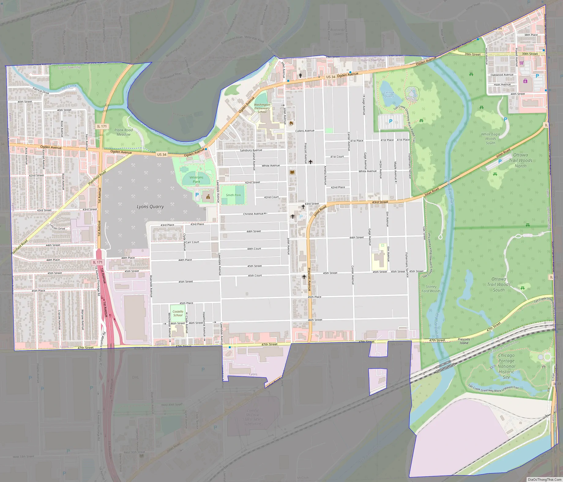
Lyons Road Map
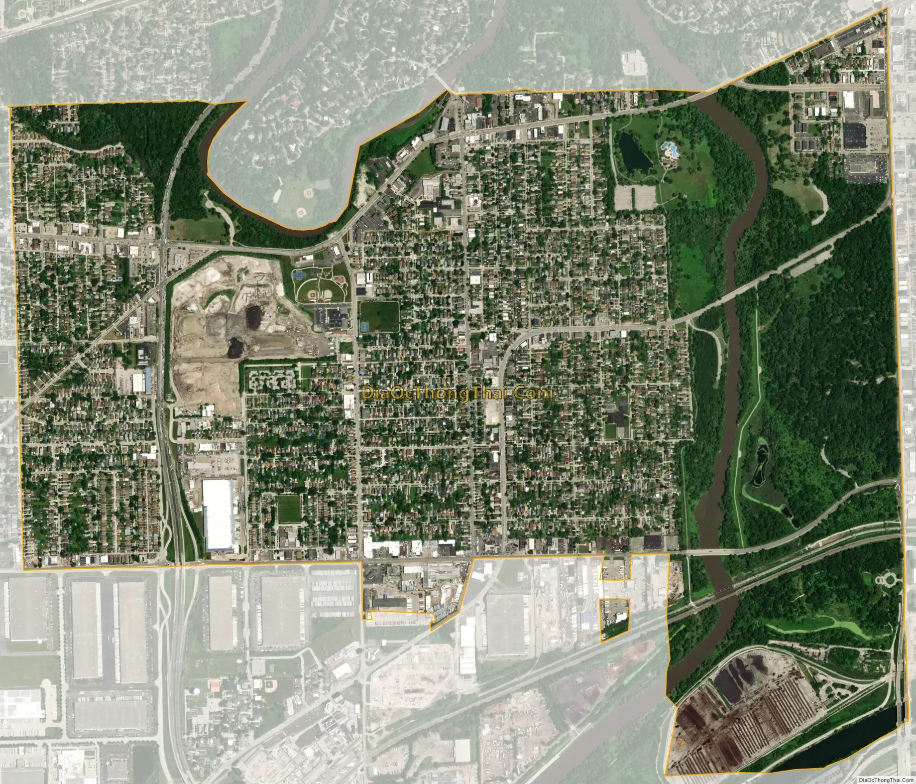
Lyons city Satellite Map
Geography
Lyons is located at 41°48′48″N 87°49′19″W / 41.81333°N 87.82194°W / 41.81333; -87.82194 (41.813258, -87.821812).
According to the 2021 census gazetteer files, Lyons has a total area of 2.27 square miles (5.88 km), of which 2.21 square miles (5.72 km) (or 97.05%) is land and 0.07 square miles (0.18 km) (or 2.95%) is water.
See also
Map of Illinois State and its subdivision:- Adams
- Alexander
- Bond
- Boone
- Brown
- Bureau
- Calhoun
- Carroll
- Cass
- Champaign
- Christian
- Clark
- Clay
- Clinton
- Coles
- Cook
- Crawford
- Cumberland
- De Kalb
- De Witt
- Douglas
- Dupage
- Edgar
- Edwards
- Effingham
- Fayette
- Ford
- Franklin
- Fulton
- Gallatin
- Greene
- Grundy
- Hamilton
- Hancock
- Hardin
- Henderson
- Henry
- Iroquois
- Jackson
- Jasper
- Jefferson
- Jersey
- Jo Daviess
- Johnson
- Kane
- Kankakee
- Kendall
- Knox
- La Salle
- Lake
- Lake Michigan
- Lawrence
- Lee
- Livingston
- Logan
- Macon
- Macoupin
- Madison
- Marion
- Marshall
- Mason
- Massac
- McDonough
- McHenry
- McLean
- Menard
- Mercer
- Monroe
- Montgomery
- Morgan
- Moultrie
- Ogle
- Peoria
- Perry
- Piatt
- Pike
- Pope
- Pulaski
- Putnam
- Randolph
- Richland
- Rock Island
- Saint Clair
- Saline
- Sangamon
- Schuyler
- Scott
- Shelby
- Stark
- Stephenson
- Tazewell
- Union
- Vermilion
- Wabash
- Warren
- Washington
- Wayne
- White
- Whiteside
- Will
- Williamson
- Winnebago
- Woodford
- Alabama
- Alaska
- Arizona
- Arkansas
- California
- Colorado
- Connecticut
- Delaware
- District of Columbia
- Florida
- Georgia
- Hawaii
- Idaho
- Illinois
- Indiana
- Iowa
- Kansas
- Kentucky
- Louisiana
- Maine
- Maryland
- Massachusetts
- Michigan
- Minnesota
- Mississippi
- Missouri
- Montana
- Nebraska
- Nevada
- New Hampshire
- New Jersey
- New Mexico
- New York
- North Carolina
- North Dakota
- Ohio
- Oklahoma
- Oregon
- Pennsylvania
- Rhode Island
- South Carolina
- South Dakota
- Tennessee
- Texas
- Utah
- Vermont
- Virginia
- Washington
- West Virginia
- Wisconsin
- Wyoming


