Minooka is a village in Grundy, Kendall, and Will counties, Illinois, United States. The population was 10,924 at the 2010 census, up from 3,971 at the 2000 census. The village is part of the Chicago metropolitan area. The Chicago, Rock Island and Pacific Railroad served the town at Minooka Station.
| Name: | Minooka village |
|---|---|
| LSAD Code: | 47 |
| LSAD Description: | village (suffix) |
| State: | Illinois |
| County: | Grundy County, Kendall County, Will County |
| Founded: | 1869 |
| Elevation: | 597 ft (182 m) |
| Total Area: | 9.48 sq mi (24.55 km²) |
| Land Area: | 9.40 sq mi (24.36 km²) |
| Water Area: | 0.07 sq mi (0.19 km²) |
| Total Population: | 12,758 |
| Population Density: | 1,356.51/sq mi (523.75/km²) |
| ZIP code: | 60447 |
| FIPS code: | 1749607 |
| GNISfeature ID: | 2399376 |
| Website: | www.minooka.com |
Online Interactive Map
Click on ![]() to view map in "full screen" mode.
to view map in "full screen" mode.
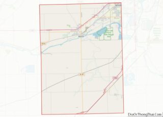
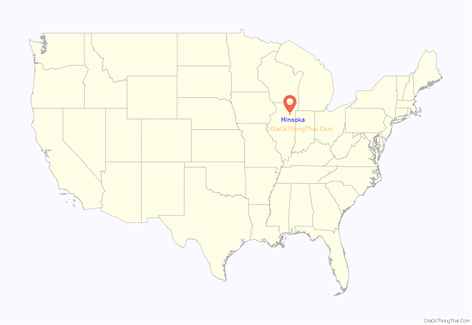
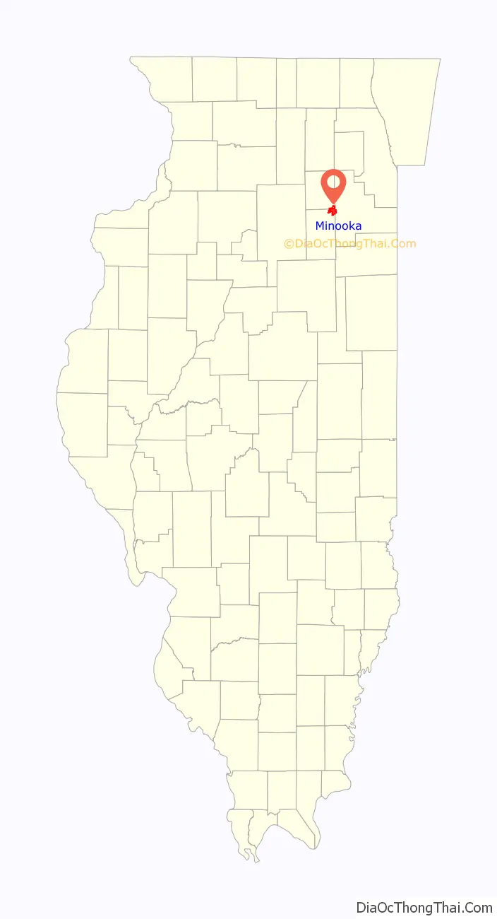
Minooka location map. Where is Minooka village?
History
Minooka was established as a place in 1852 when the railroad was built through this area. It was incorporated as a village in 1869. The name “Minooka” is derived from a Native American word meaning “maple forest” or “good earth”.
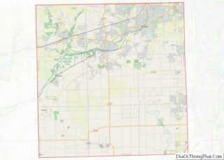
Minooka Road Map
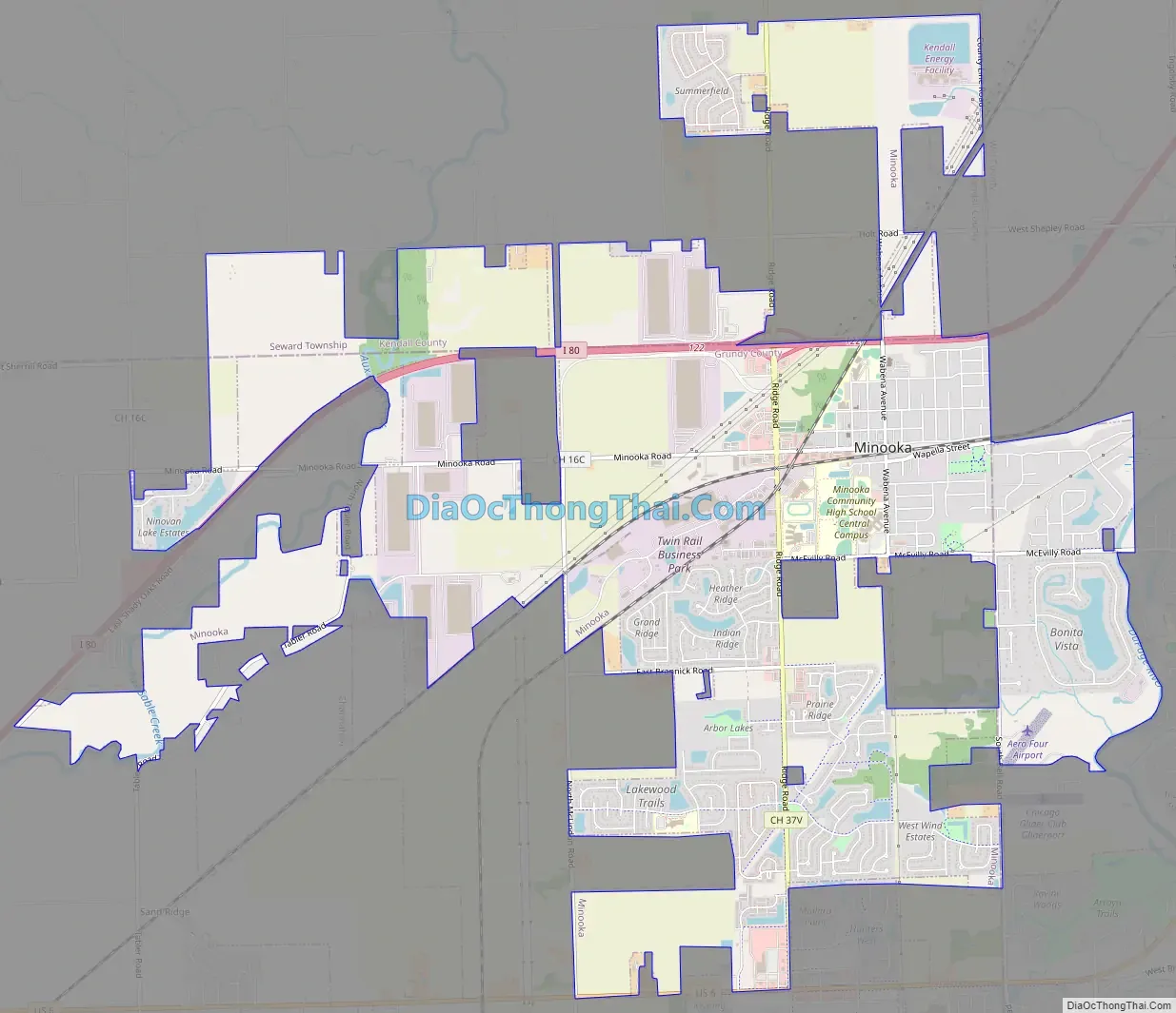
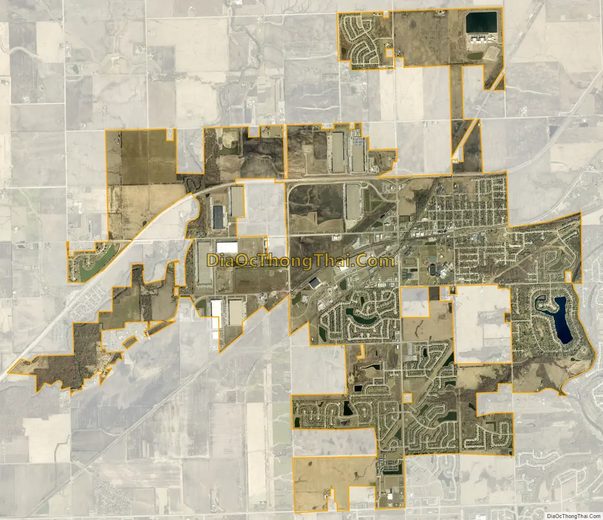
Minooka city Satellite Map
Geography
The center of the village is in the northeast corner of Grundy County. The village limits extend north into the southeast corner of Kendall County and east into Will County. The village is bordered to the east and south by the village of Channahon.
Interstate 80 passes through the north side of the village, with access from Exit 122. I-80 leads northeast 11 miles (18 km) to Joliet and west 45 miles (72 km) to LaSalle. Downtown Chicago is 48 miles (77 km) northeast of Minooka via Interstates 80 and 55. U.S. Route 6 runs along part of the southern border of Minooka; the highway leads east into the center of Channahon and southwest 9 miles (14 km) to Morris.
According to the 2020 census, Minooka has a total area of 9.526 square miles (24.67 km), of which 9.45 square miles (24.48 km) (or 99.2%) are land and 0.076 square miles (0.20 km) (or 0.8%) are water. The DuPage River, a south-flowing tributary of the Des Plaines River, forms part of the eastern boundary of the village.
See also
Map of Illinois State and its subdivision:- Adams
- Alexander
- Bond
- Boone
- Brown
- Bureau
- Calhoun
- Carroll
- Cass
- Champaign
- Christian
- Clark
- Clay
- Clinton
- Coles
- Cook
- Crawford
- Cumberland
- De Kalb
- De Witt
- Douglas
- Dupage
- Edgar
- Edwards
- Effingham
- Fayette
- Ford
- Franklin
- Fulton
- Gallatin
- Greene
- Grundy
- Hamilton
- Hancock
- Hardin
- Henderson
- Henry
- Iroquois
- Jackson
- Jasper
- Jefferson
- Jersey
- Jo Daviess
- Johnson
- Kane
- Kankakee
- Kendall
- Knox
- La Salle
- Lake
- Lake Michigan
- Lawrence
- Lee
- Livingston
- Logan
- Macon
- Macoupin
- Madison
- Marion
- Marshall
- Mason
- Massac
- McDonough
- McHenry
- McLean
- Menard
- Mercer
- Monroe
- Montgomery
- Morgan
- Moultrie
- Ogle
- Peoria
- Perry
- Piatt
- Pike
- Pope
- Pulaski
- Putnam
- Randolph
- Richland
- Rock Island
- Saint Clair
- Saline
- Sangamon
- Schuyler
- Scott
- Shelby
- Stark
- Stephenson
- Tazewell
- Union
- Vermilion
- Wabash
- Warren
- Washington
- Wayne
- White
- Whiteside
- Will
- Williamson
- Winnebago
- Woodford
- Alabama
- Alaska
- Arizona
- Arkansas
- California
- Colorado
- Connecticut
- Delaware
- District of Columbia
- Florida
- Georgia
- Hawaii
- Idaho
- Illinois
- Indiana
- Iowa
- Kansas
- Kentucky
- Louisiana
- Maine
- Maryland
- Massachusetts
- Michigan
- Minnesota
- Mississippi
- Missouri
- Montana
- Nebraska
- Nevada
- New Hampshire
- New Jersey
- New Mexico
- New York
- North Carolina
- North Dakota
- Ohio
- Oklahoma
- Oregon
- Pennsylvania
- Rhode Island
- South Carolina
- South Dakota
- Tennessee
- Texas
- Utah
- Vermont
- Virginia
- Washington
- West Virginia
- Wisconsin
- Wyoming