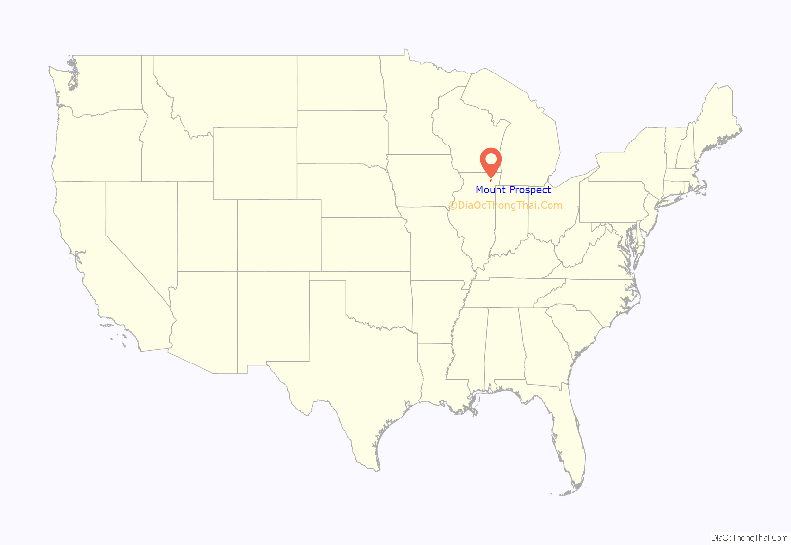
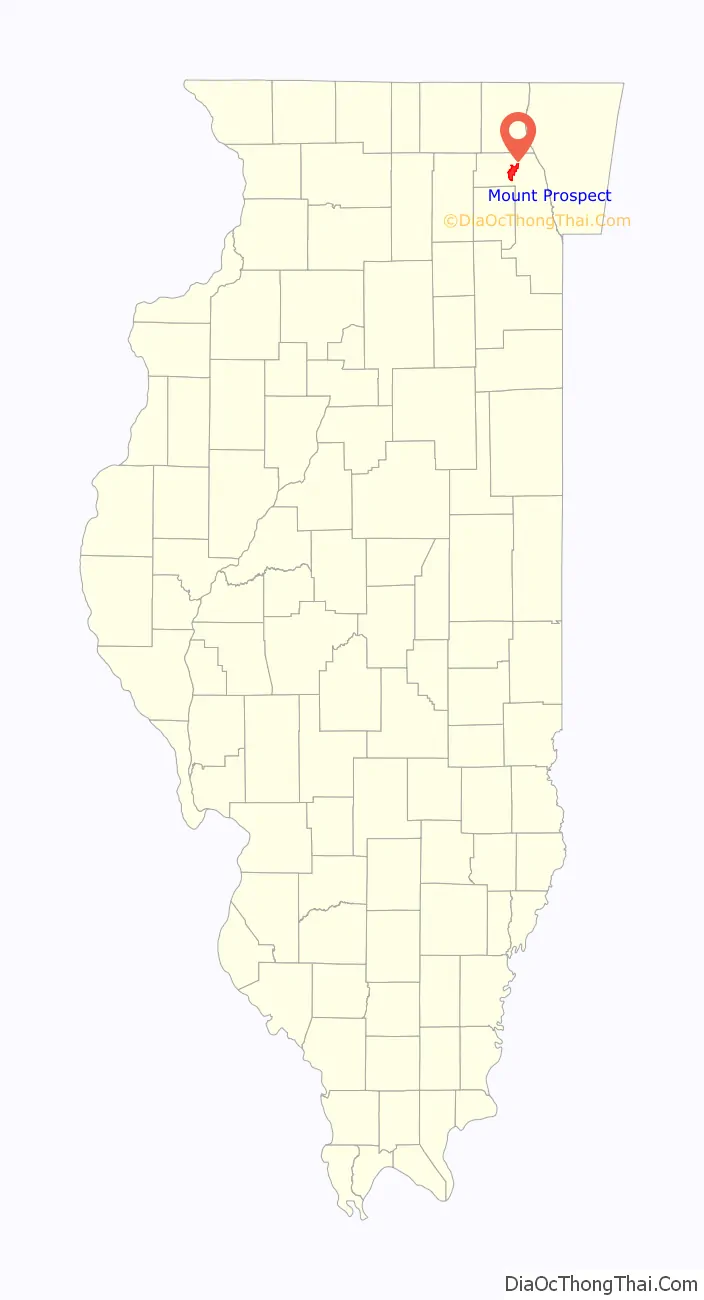
Mount Prospect is a village in Elk Grove and Wheeling Townships in Cook County, Illinois, about 20 miles (32 km) northwest of downtown Chicago, and approximately 4 miles north of O’Hare International Airport. As of the 2020 census, the village had a total population of 56,852.
| Name: | Mount Prospect village |
|---|---|
| LSAD Code: | 47 |
| LSAD Description: | village (suffix) |
| State: | Illinois |
| County: | Cook County |
| Total Area: | 10.76 sq mi (27.86 km²) |
| Land Area: | 10.72 sq mi (27.76 km²) |
| Water Area: | 0.04 sq mi (0.10 km²) |
| Total Population: | 56,852 |
| Population Density: | 5,303.85/sq mi (2,047.82/km²) |
| Area code: | 847 |
| FIPS code: | 1751089 |
| Website: | www.mountprospect.org |
Online Interactive Map
Click on ![]() to view map in "full screen" mode.
to view map in "full screen" mode.
Mount Prospect location map. Where is Mount Prospect village?
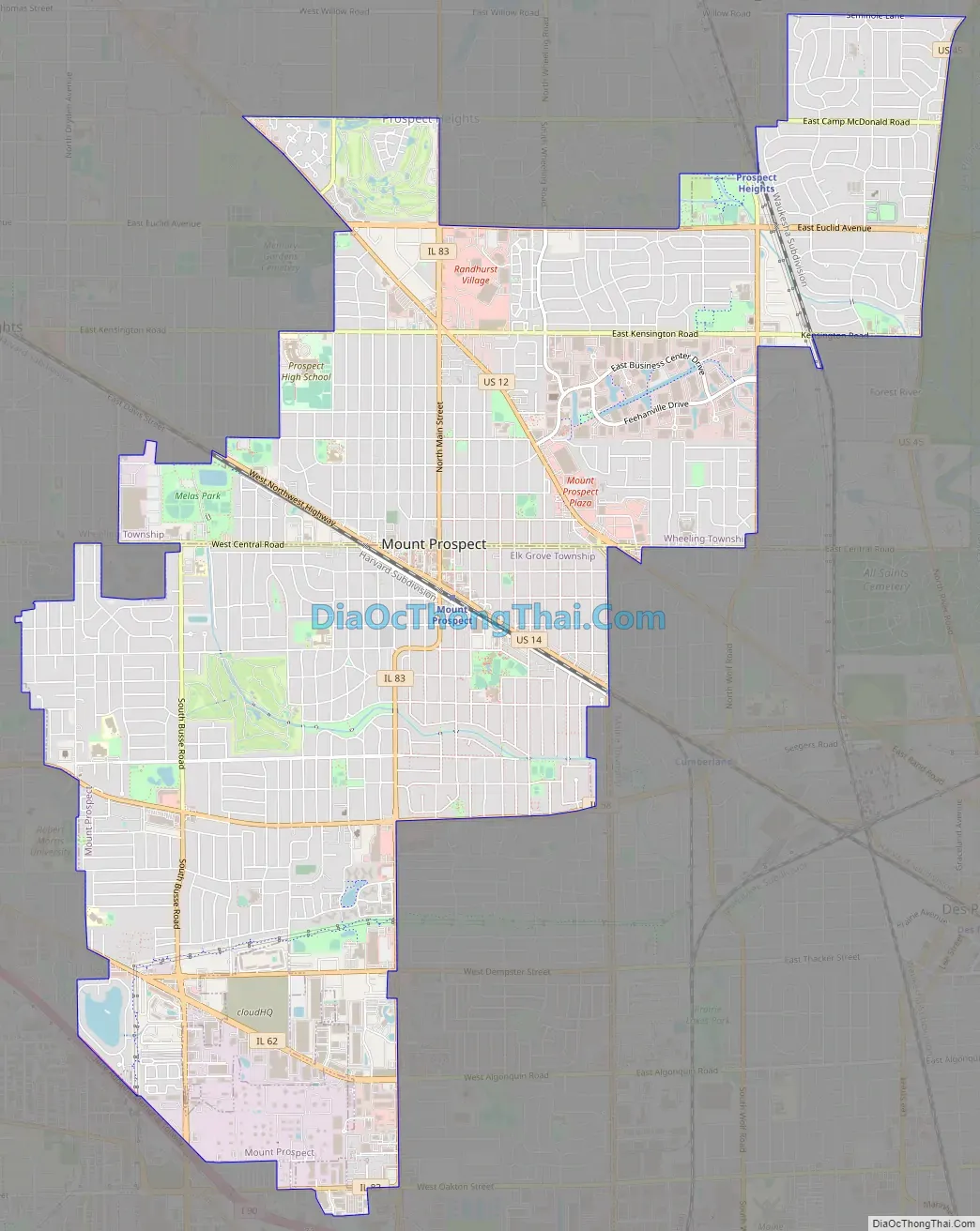
Mount Prospect Road Map
Mount Prospect city Satellite Map
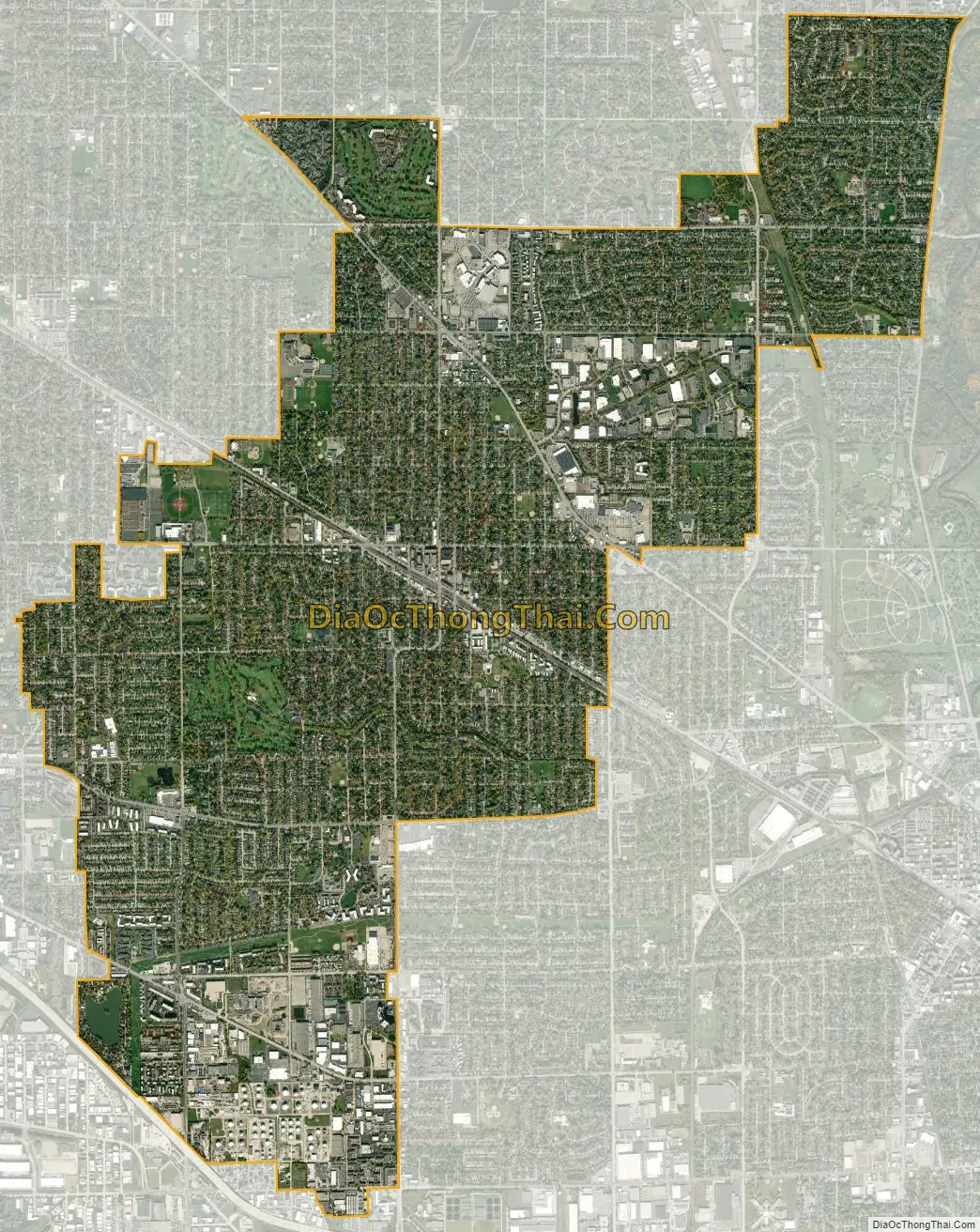
Geography
Mount Prospect is located at 42°3′56″N 87°56′10″W / 42.06556°N 87.93611°W / 42.06556; -87.93611 (42.065427, -87.936217).
According to the 2021 census gazetteer files, Mount Prospect has a total area of 10.76 square miles (27.87 km), of which 10.72 square miles (27.76 km) (or 99.65%) is land and 0.04 square miles (0.10 km) (or 0.35%) is water.
See also
Map of Illinois State and its subdivision:- Adams
- Alexander
- Bond
- Boone
- Brown
- Bureau
- Calhoun
- Carroll
- Cass
- Champaign
- Christian
- Clark
- Clay
- Clinton
- Coles
- Cook
- Crawford
- Cumberland
- De Kalb
- De Witt
- Douglas
- Dupage
- Edgar
- Edwards
- Effingham
- Fayette
- Ford
- Franklin
- Fulton
- Gallatin
- Greene
- Grundy
- Hamilton
- Hancock
- Hardin
- Henderson
- Henry
- Iroquois
- Jackson
- Jasper
- Jefferson
- Jersey
- Jo Daviess
- Johnson
- Kane
- Kankakee
- Kendall
- Knox
- La Salle
- Lake
- Lake Michigan
- Lawrence
- Lee
- Livingston
- Logan
- Macon
- Macoupin
- Madison
- Marion
- Marshall
- Mason
- Massac
- McDonough
- McHenry
- McLean
- Menard
- Mercer
- Monroe
- Montgomery
- Morgan
- Moultrie
- Ogle
- Peoria
- Perry
- Piatt
- Pike
- Pope
- Pulaski
- Putnam
- Randolph
- Richland
- Rock Island
- Saint Clair
- Saline
- Sangamon
- Schuyler
- Scott
- Shelby
- Stark
- Stephenson
- Tazewell
- Union
- Vermilion
- Wabash
- Warren
- Washington
- Wayne
- White
- Whiteside
- Will
- Williamson
- Winnebago
- Woodford
- Alabama
- Alaska
- Arizona
- Arkansas
- California
- Colorado
- Connecticut
- Delaware
- District of Columbia
- Florida
- Georgia
- Hawaii
- Idaho
- Illinois
- Indiana
- Iowa
- Kansas
- Kentucky
- Louisiana
- Maine
- Maryland
- Massachusetts
- Michigan
- Minnesota
- Mississippi
- Missouri
- Montana
- Nebraska
- Nevada
- New Hampshire
- New Jersey
- New Mexico
- New York
- North Carolina
- North Dakota
- Ohio
- Oklahoma
- Oregon
- Pennsylvania
- Rhode Island
- South Carolina
- South Dakota
- Tennessee
- Texas
- Utah
- Vermont
- Virginia
- Washington
- West Virginia
- Wisconsin
- Wyoming


