Moweaqua is a village in Shelby and Christian counties, Illinois, United States. The population was 1,764 at the 2020 census.
| Name: | Moweaqua village |
|---|---|
| LSAD Code: | 47 |
| LSAD Description: | village (suffix) |
| State: | Illinois |
| County: | Christian County, Shelby County |
| Elevation: | 633 ft (193 m) |
| Total Area: | 2.30 sq mi (5.95 km²) |
| Land Area: | 2.30 sq mi (5.95 km²) |
| Water Area: | 0.00 sq mi (0.00 km²) |
| Total Population: | 1,764 |
| Population Density: | 767.62/sq mi (296.37/km²) |
| Area code: | 217 |
| FIPS code: | 1751232 |
| Website: | moweaqua.org |
Online Interactive Map
Click on ![]() to view map in "full screen" mode.
to view map in "full screen" mode.
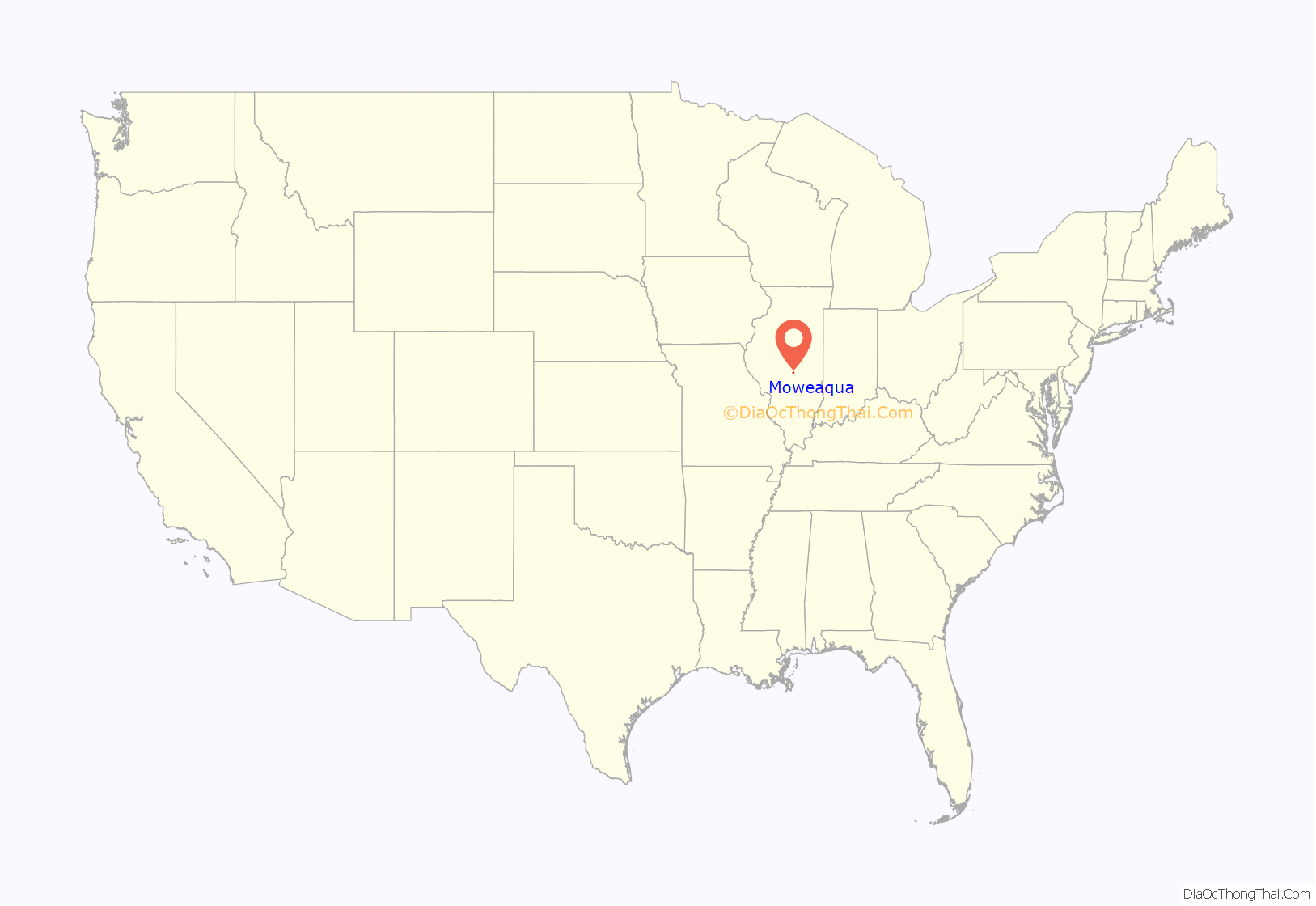
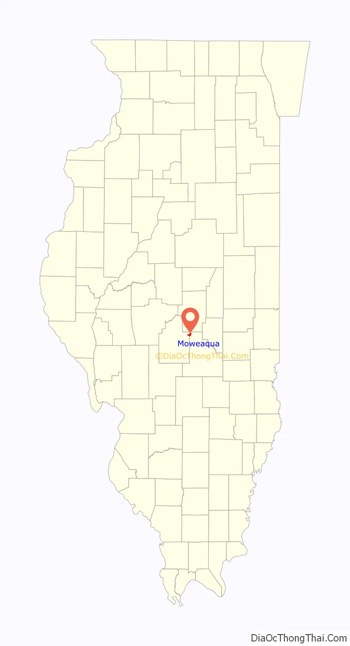
Moweaqua location map. Where is Moweaqua village?
History
Moweaqua was named after a small stream 1.5 miles south of the station, called by the Indians Moweaqua, a Pottawatamie word that means “she that weeps”. From 1891 until 1935, Moweaqua was the site of a gassy coal mine that mined coal from Pennsylvanian strata. On the morning of December 24, 1932, fifty-four coal miners, the entire day shift, were killed by a methane gas explosion in the Moweaqua coal mine disaster. The incident occurred on the morning of Christmas Eve, and one of the deceased miners, Tom Jackson, had been scheduled to play Santa Claus in a party to be held that evening for his fellow townspeople. The tragic explosion, together with the election in the previous month (November 1932) of the pro-labor Seventy-Third Congress, led to the passage of mine safety legislation and the phaseout of open-flame carbide miner’s lanterns in United States coal mines. The Moweaqua Coal Mine Museum opened in 1986 to commemorate local coal miners, especially the victims of this disaster.
The 2009 movie “The Informant” starring Matt Damon was partially filmed in Moweaqua. The plot of the movie is based on the ADM price fixing scandal which occurred during the 1990s.
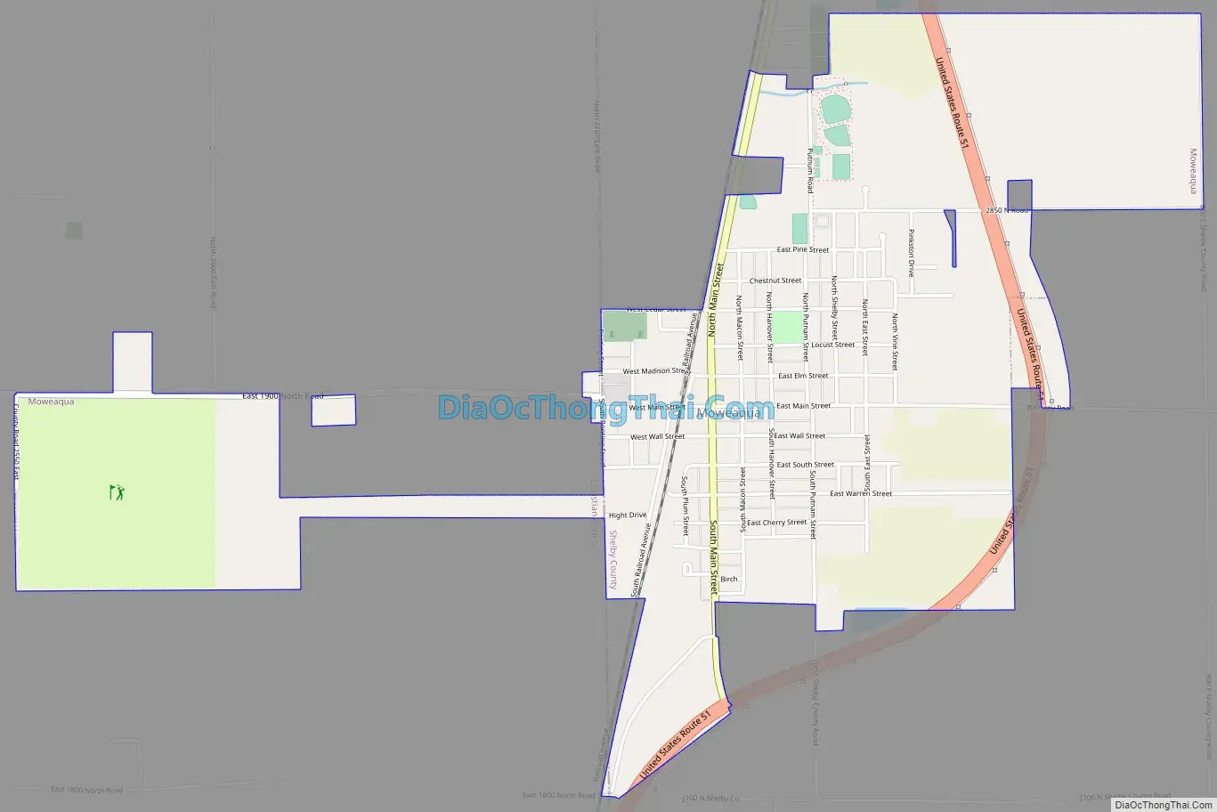
Moweaqua Road Map
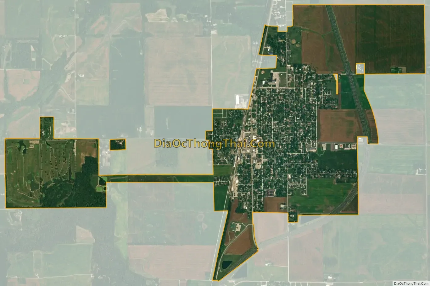
Moweaqua city Satellite Map
Geography
According to the 2021 census gazetteer files, Moweaqua has a total area of 2.30 square miles (5.96 km), all land.
See also
Map of Illinois State and its subdivision:- Adams
- Alexander
- Bond
- Boone
- Brown
- Bureau
- Calhoun
- Carroll
- Cass
- Champaign
- Christian
- Clark
- Clay
- Clinton
- Coles
- Cook
- Crawford
- Cumberland
- De Kalb
- De Witt
- Douglas
- Dupage
- Edgar
- Edwards
- Effingham
- Fayette
- Ford
- Franklin
- Fulton
- Gallatin
- Greene
- Grundy
- Hamilton
- Hancock
- Hardin
- Henderson
- Henry
- Iroquois
- Jackson
- Jasper
- Jefferson
- Jersey
- Jo Daviess
- Johnson
- Kane
- Kankakee
- Kendall
- Knox
- La Salle
- Lake
- Lake Michigan
- Lawrence
- Lee
- Livingston
- Logan
- Macon
- Macoupin
- Madison
- Marion
- Marshall
- Mason
- Massac
- McDonough
- McHenry
- McLean
- Menard
- Mercer
- Monroe
- Montgomery
- Morgan
- Moultrie
- Ogle
- Peoria
- Perry
- Piatt
- Pike
- Pope
- Pulaski
- Putnam
- Randolph
- Richland
- Rock Island
- Saint Clair
- Saline
- Sangamon
- Schuyler
- Scott
- Shelby
- Stark
- Stephenson
- Tazewell
- Union
- Vermilion
- Wabash
- Warren
- Washington
- Wayne
- White
- Whiteside
- Will
- Williamson
- Winnebago
- Woodford
- Alabama
- Alaska
- Arizona
- Arkansas
- California
- Colorado
- Connecticut
- Delaware
- District of Columbia
- Florida
- Georgia
- Hawaii
- Idaho
- Illinois
- Indiana
- Iowa
- Kansas
- Kentucky
- Louisiana
- Maine
- Maryland
- Massachusetts
- Michigan
- Minnesota
- Mississippi
- Missouri
- Montana
- Nebraska
- Nevada
- New Hampshire
- New Jersey
- New Mexico
- New York
- North Carolina
- North Dakota
- Ohio
- Oklahoma
- Oregon
- Pennsylvania
- Rhode Island
- South Carolina
- South Dakota
- Tennessee
- Texas
- Utah
- Vermont
- Virginia
- Washington
- West Virginia
- Wisconsin
- Wyoming