Mulberry Grove is a village in eastern Bond County, Illinois, United States. The population was 520 at the 2020 census.
| Name: | Mulberry Grove village |
|---|---|
| LSAD Code: | 47 |
| LSAD Description: | village (suffix) |
| State: | Illinois |
| County: | Bond County |
| Incorporated: | 1857 |
| Elevation: | 548 ft (167 m) |
| Total Area: | 1.02 sq mi (2.66 km²) |
| Land Area: | 1.02 sq mi (2.63 km²) |
| Water Area: | 0.01 sq mi (0.02 km²) |
| Total Population: | 520 |
| Population Density: | 511.81/sq mi (197.64/km²) |
| Area code: | 618 |
| FIPS code: | 1751284 |
| GNISfeature ID: | 2399424 |
Online Interactive Map
Click on ![]() to view map in "full screen" mode.
to view map in "full screen" mode.
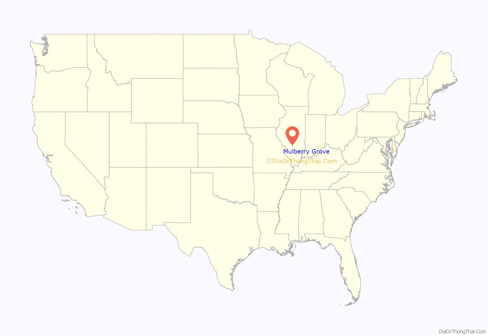
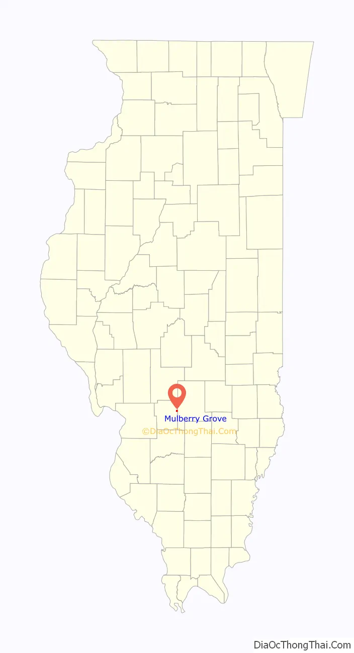
Mulberry Grove location map. Where is Mulberry Grove village?
History
Mulberry Grove has existed under the names Bucktown, Houston and Shakerag. A post office was established in 1834, and Mulberry Grove was incorporated as a village in 1857.
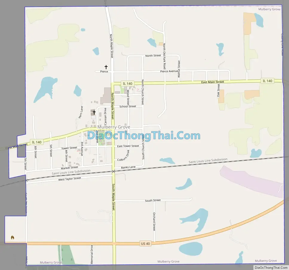
Mulberry Grove Road Map
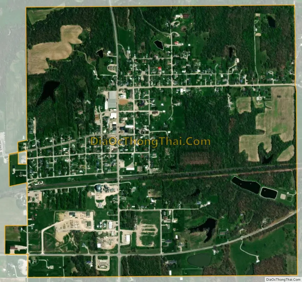
Mulberry Grove city Satellite Map
Geography
Mulberry Grove is located along Illinois Route 140 approximately one mile north of I-70. Greenville lies about seven miles to the west-southwest and Vandalia is about nine miles to the east-northeast. Owl Creek flows past the north side of town and joins Hurricane Creek about 1.5 mile to the east in adjacent Fayette County.
According to the 2021 census gazetteer files, Mulberry Grove has a total area of 1.03 square miles (2.67 km), of which 1.02 square miles (2.64 km) (or 99.12%) is land and 0.01 square miles (0.03 km) (or 0.88%) is water.
See also
Map of Illinois State and its subdivision:- Adams
- Alexander
- Bond
- Boone
- Brown
- Bureau
- Calhoun
- Carroll
- Cass
- Champaign
- Christian
- Clark
- Clay
- Clinton
- Coles
- Cook
- Crawford
- Cumberland
- De Kalb
- De Witt
- Douglas
- Dupage
- Edgar
- Edwards
- Effingham
- Fayette
- Ford
- Franklin
- Fulton
- Gallatin
- Greene
- Grundy
- Hamilton
- Hancock
- Hardin
- Henderson
- Henry
- Iroquois
- Jackson
- Jasper
- Jefferson
- Jersey
- Jo Daviess
- Johnson
- Kane
- Kankakee
- Kendall
- Knox
- La Salle
- Lake
- Lake Michigan
- Lawrence
- Lee
- Livingston
- Logan
- Macon
- Macoupin
- Madison
- Marion
- Marshall
- Mason
- Massac
- McDonough
- McHenry
- McLean
- Menard
- Mercer
- Monroe
- Montgomery
- Morgan
- Moultrie
- Ogle
- Peoria
- Perry
- Piatt
- Pike
- Pope
- Pulaski
- Putnam
- Randolph
- Richland
- Rock Island
- Saint Clair
- Saline
- Sangamon
- Schuyler
- Scott
- Shelby
- Stark
- Stephenson
- Tazewell
- Union
- Vermilion
- Wabash
- Warren
- Washington
- Wayne
- White
- Whiteside
- Will
- Williamson
- Winnebago
- Woodford
- Alabama
- Alaska
- Arizona
- Arkansas
- California
- Colorado
- Connecticut
- Delaware
- District of Columbia
- Florida
- Georgia
- Hawaii
- Idaho
- Illinois
- Indiana
- Iowa
- Kansas
- Kentucky
- Louisiana
- Maine
- Maryland
- Massachusetts
- Michigan
- Minnesota
- Mississippi
- Missouri
- Montana
- Nebraska
- Nevada
- New Hampshire
- New Jersey
- New Mexico
- New York
- North Carolina
- North Dakota
- Ohio
- Oklahoma
- Oregon
- Pennsylvania
- Rhode Island
- South Carolina
- South Dakota
- Tennessee
- Texas
- Utah
- Vermont
- Virginia
- Washington
- West Virginia
- Wisconsin
- Wyoming