Norridge is a village in Cook County, Illinois, United States. The population was 15,251 at the 2020 census. The village and its neighbor to the east, Harwood Heights, together form an enclave within the city of Chicago (i.e. they are surrounded by the city). Norridge is sometimes referred to as the “Island Within a City”. The current President of Norridge is Daniel Tannhauser.
| Name: | Norridge village |
|---|---|
| LSAD Code: | 47 |
| LSAD Description: | village (suffix) |
| State: | Illinois |
| County: | Cook County |
| Total Area: | 1.81 sq mi (4.68 km²) |
| Land Area: | 1.81 sq mi (4.68 km²) |
| Water Area: | 0.00 sq mi (0.00 km²) |
| Total Population: | 15,251 |
| Population Density: | 8,435.29/sq mi (3,257.39/km²) |
| ZIP code: | 60706 |
| FIPS code: | 1753377 |
| Website: | www.villageofnorridge.com |
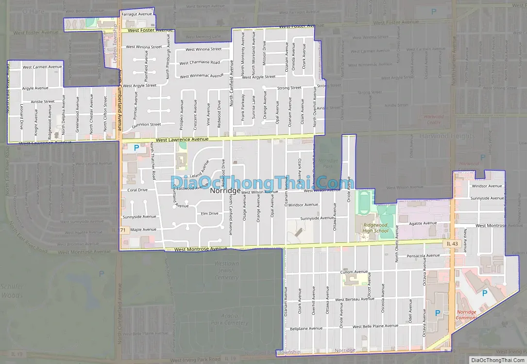
Online Interactive Map
Click on ![]() to view map in "full screen" mode.
to view map in "full screen" mode.
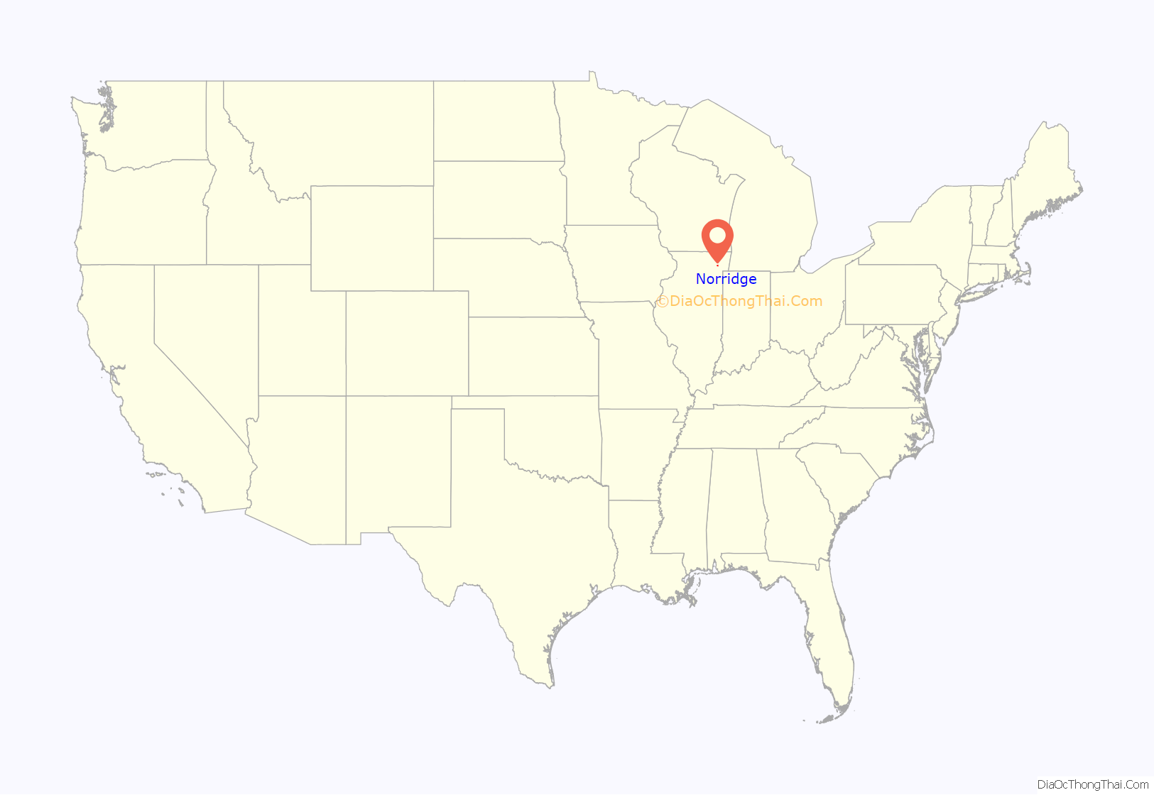
Norridge location map. Where is Norridge village?
History
Located in Norwood Park Township, the first names of what would become Norridge were “Goat Village”, due to a local resident’s goat farm, and “Swamp” due to a lack of streets and the area’s swamp-like conditions. Norridge began as an 80-acre (320,000 m) subdivision that ran from Ozanam Avenue in the west to Olcott Avenue in the east and from Irving Park Road in the south to Montrose Avenue in the north. In 1948, a local improvement association incorporated Norridge as a village, stymieing an effort by Chicago to annex the area.
That year, Karl Kuchar was elected the first President of the village.
The 1950s was a decade of growth and development, encouraged by the paving of sidewalks, streets, and curbs, and the installation of storm and sanitary sewers. In 1954 Norridge annexed land north from Montrose to Lawrence.
Norridge borders the Cook County Forest Preserves and was home to several horse stables, including Happy Days Stables at Montrose and Cumberland. Most of the stables were gone by the late 1970s.
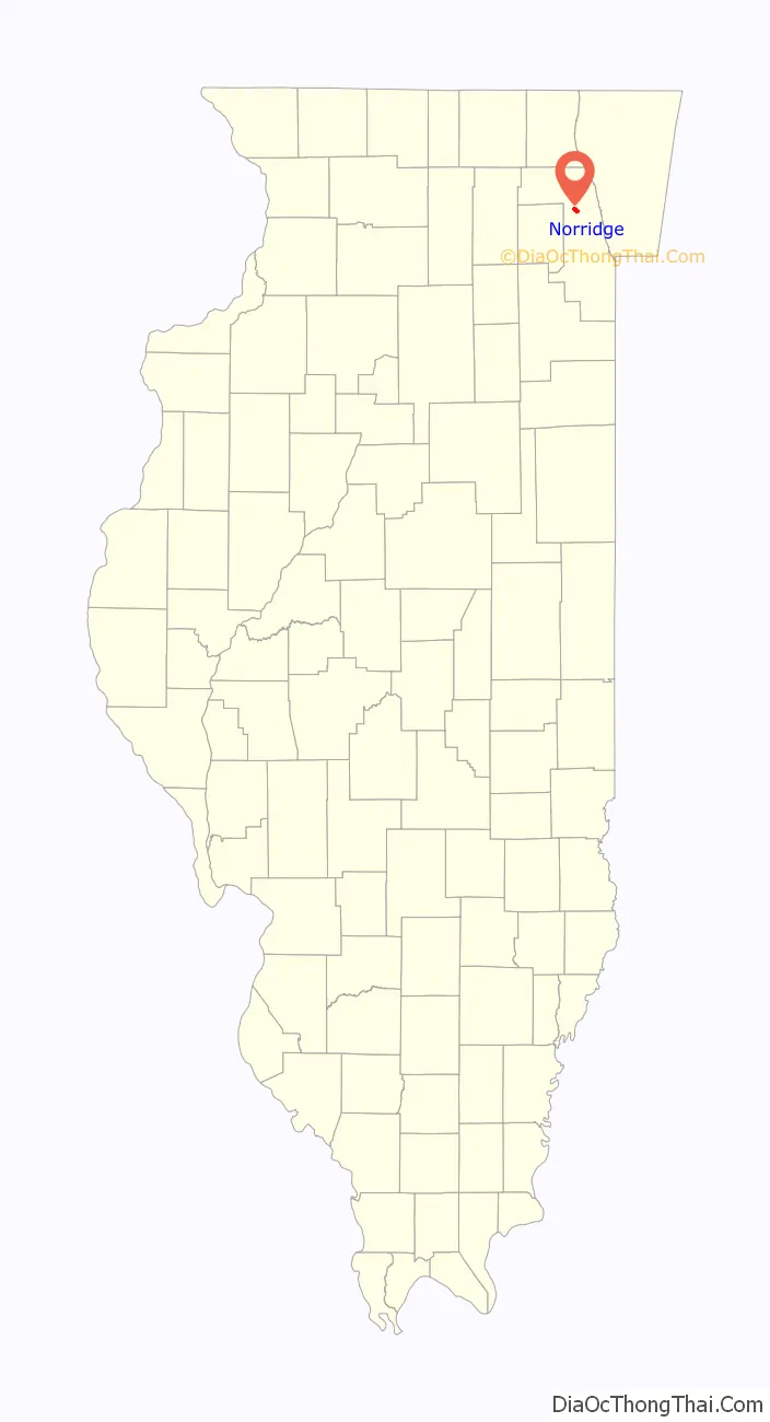
Norridge Road Map
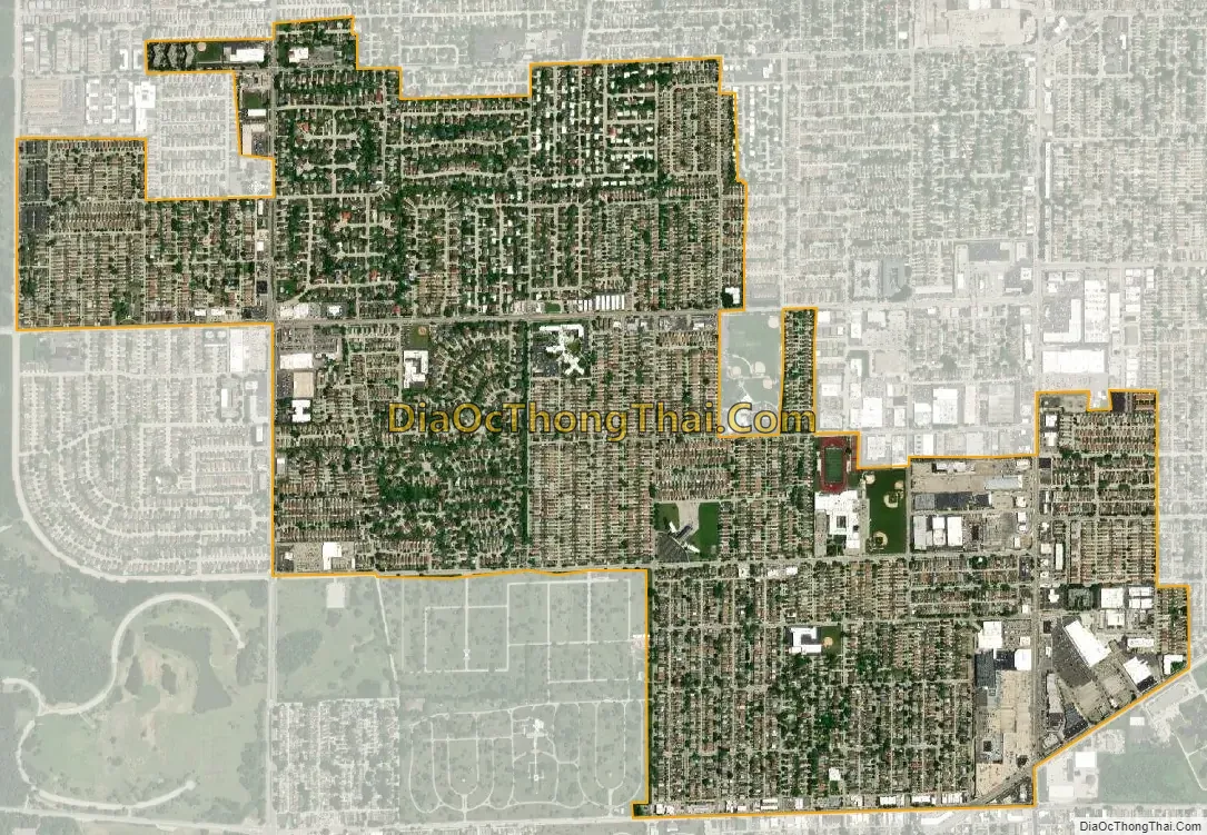
Norridge city Satellite Map
Geography
Norridge is located at 41°57′54″N 87°49′26″W / 41.96500°N 87.82389°W / 41.96500; -87.82389 (41.965030, -87.823859).
According to the 2021 census gazetteer files, Norridge has a total area of 1.81 square miles (4.69 km), all land.
See also
Map of Illinois State and its subdivision:- Adams
- Alexander
- Bond
- Boone
- Brown
- Bureau
- Calhoun
- Carroll
- Cass
- Champaign
- Christian
- Clark
- Clay
- Clinton
- Coles
- Cook
- Crawford
- Cumberland
- De Kalb
- De Witt
- Douglas
- Dupage
- Edgar
- Edwards
- Effingham
- Fayette
- Ford
- Franklin
- Fulton
- Gallatin
- Greene
- Grundy
- Hamilton
- Hancock
- Hardin
- Henderson
- Henry
- Iroquois
- Jackson
- Jasper
- Jefferson
- Jersey
- Jo Daviess
- Johnson
- Kane
- Kankakee
- Kendall
- Knox
- La Salle
- Lake
- Lake Michigan
- Lawrence
- Lee
- Livingston
- Logan
- Macon
- Macoupin
- Madison
- Marion
- Marshall
- Mason
- Massac
- McDonough
- McHenry
- McLean
- Menard
- Mercer
- Monroe
- Montgomery
- Morgan
- Moultrie
- Ogle
- Peoria
- Perry
- Piatt
- Pike
- Pope
- Pulaski
- Putnam
- Randolph
- Richland
- Rock Island
- Saint Clair
- Saline
- Sangamon
- Schuyler
- Scott
- Shelby
- Stark
- Stephenson
- Tazewell
- Union
- Vermilion
- Wabash
- Warren
- Washington
- Wayne
- White
- Whiteside
- Will
- Williamson
- Winnebago
- Woodford
- Alabama
- Alaska
- Arizona
- Arkansas
- California
- Colorado
- Connecticut
- Delaware
- District of Columbia
- Florida
- Georgia
- Hawaii
- Idaho
- Illinois
- Indiana
- Iowa
- Kansas
- Kentucky
- Louisiana
- Maine
- Maryland
- Massachusetts
- Michigan
- Minnesota
- Mississippi
- Missouri
- Montana
- Nebraska
- Nevada
- New Hampshire
- New Jersey
- New Mexico
- New York
- North Carolina
- North Dakota
- Ohio
- Oklahoma
- Oregon
- Pennsylvania
- Rhode Island
- South Carolina
- South Dakota
- Tennessee
- Texas
- Utah
- Vermont
- Virginia
- Washington
- West Virginia
- Wisconsin
- Wyoming


