Oak Forest is a city in Cook County, Illinois, United States. The city is out 24 miles (39 km) south-southwest of downtown Chicago in Bremen Township. Per the 2020 census, the population was 27,478.
| Name: | Oak Forest city |
|---|---|
| LSAD Code: | 25 |
| LSAD Description: | city (suffix) |
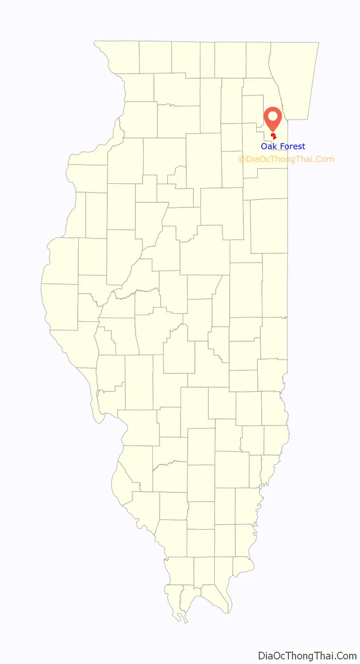
| State: | Illinois |
| County: | Cook County |
| Incorporated: | 1800 |
| Total Area: | 6.07 sq mi (15.72 km²) |
| Land Area: | 6.02 sq mi (15.60 km²) |
| Water Area: | 0.05 sq mi (0.12 km²) 0.83% |
| Total Population: | 27,478 |
| Population Density: | 4,563.69/sq mi (1,761.94/km²) |
| Area code: | 708 |
| FIPS code: | 1754638 |
| Website: | www.oak-forest.org |
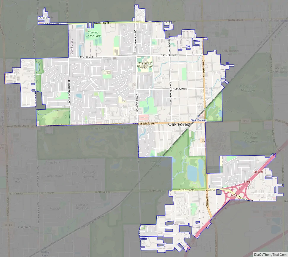
Online Interactive Map
Click on ![]() to view map in "full screen" mode.
to view map in "full screen" mode.
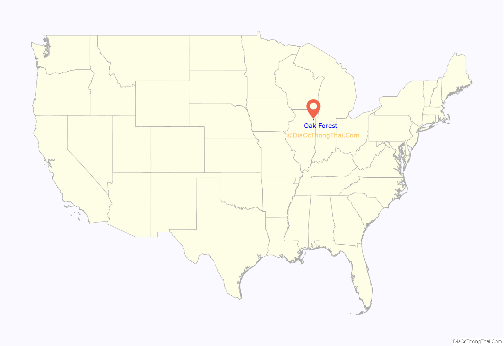
Oak Forest location map. Where is Oak Forest city?
History
Human habitation in Oak Forest began during the early Holocene. This is made evident by the remains of hunting camps on what would become the grounds of the city’s hospital. Several millennia later, the final known indigenous settlement in Oak Forest, a Potawatomi longhouse village, was established nearby. However, it was abandoned by the 1620s.
The origins of present-day Oak Forest begins with a railroad whistle stop on the Chicago, Rock Island and Pacific Railroad 1 block south of the intersection of 167th street and Central Avenue which primarily served area dairy farmers. This stop was located in a largely forested area of what was previously known as the Cooper’s Grove Stand of Timber. By the 1880s this particular area of timber was being referred to as the “Oak Forest” due to its abundance of oak trees. A section of the former “Cooper’s Grove Road” paralleling the railroad track from 66th Court to 167th Street in Tinley Park became known as “Oak Forest Avenue,” because it was the road from the Village of Bremen/New Bremen (now Tinley Park) that lead to this “Oak Forest.”
In 1907, Cook County approved construction of a second county poor farm and infirmary on a site generally at the southeast corner of 159th Street and Cicero Avenue to address overcrowding conditions at the County Poor Farm in Dunning on the northwest side of Chicago. This location was very near the Rock Island railroad and a new railroad station was constructed northwest of the present day intersection of 159th Street (US Route 6) and Cicero Avenue (Illinois Route 50), which provided convenient rail access to the facility. A railroad spur off of the Rock Island railroad line was also constructed onto the Oak Forest Hospital site that was used for both delivery of materials during its construction and delivery of coal for its heating plant and other goods used at the facility for many years. The Oak Forest Infirmary opened in 1910. Shortly after its opening, the facility accommodated close to 2,000 people suffering from poverty, mental illness, alcoholism, and other problems. The residents of the Infirmary helped maintain farmlands at and around the facility. By 1932, the Infirmary was serving more than 4,000 patients, including over 500 with tuberculosis.
Over the ensuing years following the opening of the Oak Forest Infirmary, a small settlement developed near both the railroad stop and the Oak Forest Infirmary populated by both workers at the facility and relatives of individuals in the Oak Forest facility. By the 1920s there were several residential subdivisions developing near the facility. The 1940 census reflected 611 residents outside the hospital. The hospital provided other business opportunities. For example, several mortuaries/funeral homes were to be found just outside the facility.
In the 1930s, there were some efforts made to rename the community “Arbor Park.” The proposed name did not gain much momentum, but the name did become memorialized in the name of the Arbor Park School District 145. In 1947, with a population of 1,618, the residents voted to incorporate as the Village of Oak Forest. It was reincorporated as a City in 1971.
Christian Goesel and several relatives settled near 147th and Oak Park Avenue (then Bachelor’s Grove Road) beginning in about 1861. In 1884, the Goeselville post office was established (replacing the East Orland Post Office) to continue to serve the small settlement in that general vicinity (which had previously been part of the larger area of the earlier Batchelor Grove settlement). This post office operated as a satellite of the New Bremen/Tinley Park post office until it was discontinued in 1903. At its peak there were about 30 residents in the Goeselville area, with a few general stores to supply the farmers. Parts of the former Goeselville settlement are now within the far northwestern boundaries of the City of Oak Forest. Although that post office has been closed for over 100 years, the Goeselville name occasionally continues to be found on current maps.
On August 10, 2020, an EF1 tornado touched down in Oak Forest and caused significant damage to portions of the city. Extensive tree damage and long lasting power outages affected most of Oak Forest north of 155th Street.
Oak Forest Road Map
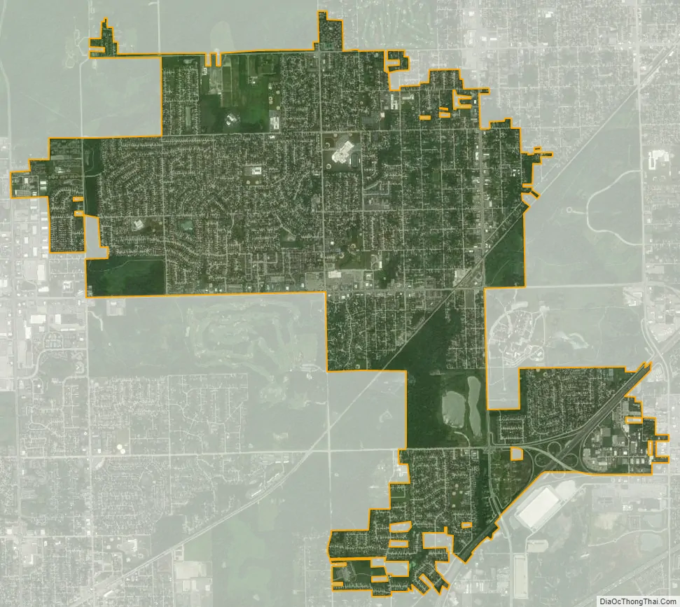
Oak Forest city Satellite Map
Geography
Oak Forest is part of the Chicago metropolitan area. It is mostly surrounded by Cook County Forest Preserves (hence the name). Some neighboring communities of Oak Forest include Crestwood to the north, Midlothian to the northeast, Markham to the east, Country Club Hills to the southeast, Tinley Park to the southwest, Orland Park to the west, and beyond Bachelor’s Grove Cemetery and Forest Preserve is Palos Heights to the northwest.
According to the 2021 census gazetteer files, Oak Forest has a total area of 6.07 square miles (15.72 km), of which 6.02 square miles (15.59 km) (or 99.21%) is land and 0.05 square miles (0.13 km) (or 0.79%) is water.
Wards
The City of Oak Forest is split into 7 wards and each ward is represented by an Alderman.
See also
Map of Illinois State and its subdivision:- Adams
- Alexander
- Bond
- Boone
- Brown
- Bureau
- Calhoun
- Carroll
- Cass
- Champaign
- Christian
- Clark
- Clay
- Clinton
- Coles
- Cook
- Crawford
- Cumberland
- De Kalb
- De Witt
- Douglas
- Dupage
- Edgar
- Edwards
- Effingham
- Fayette
- Ford
- Franklin
- Fulton
- Gallatin
- Greene
- Grundy
- Hamilton
- Hancock
- Hardin
- Henderson
- Henry
- Iroquois
- Jackson
- Jasper
- Jefferson
- Jersey
- Jo Daviess
- Johnson
- Kane
- Kankakee
- Kendall
- Knox
- La Salle
- Lake
- Lake Michigan
- Lawrence
- Lee
- Livingston
- Logan
- Macon
- Macoupin
- Madison
- Marion
- Marshall
- Mason
- Massac
- McDonough
- McHenry
- McLean
- Menard
- Mercer
- Monroe
- Montgomery
- Morgan
- Moultrie
- Ogle
- Peoria
- Perry
- Piatt
- Pike
- Pope
- Pulaski
- Putnam
- Randolph
- Richland
- Rock Island
- Saint Clair
- Saline
- Sangamon
- Schuyler
- Scott
- Shelby
- Stark
- Stephenson
- Tazewell
- Union
- Vermilion
- Wabash
- Warren
- Washington
- Wayne
- White
- Whiteside
- Will
- Williamson
- Winnebago
- Woodford
- Alabama
- Alaska
- Arizona
- Arkansas
- California
- Colorado
- Connecticut
- Delaware
- District of Columbia
- Florida
- Georgia
- Hawaii
- Idaho
- Illinois
- Indiana
- Iowa
- Kansas
- Kentucky
- Louisiana
- Maine
- Maryland
- Massachusetts
- Michigan
- Minnesota
- Mississippi
- Missouri
- Montana
- Nebraska
- Nevada
- New Hampshire
- New Jersey
- New Mexico
- New York
- North Carolina
- North Dakota
- Ohio
- Oklahoma
- Oregon
- Pennsylvania
- Rhode Island
- South Carolina
- South Dakota
- Tennessee
- Texas
- Utah
- Vermont
- Virginia
- Washington
- West Virginia
- Wisconsin
- Wyoming


