Palatine (/ˈpælətaɪn/) is a village in Cook County, Illinois, United States. It is a northwestern residential suburb of Chicago. As of the 2020 census, it had a population of 67,908. As of the 2010 Census, it was the seventh-largest community in Cook County and the 18th-largest in Illinois.
| Name: | Palatine village |
|---|---|
| LSAD Code: | 47 |
| LSAD Description: | village (suffix) |
| State: | Illinois |
| County: | Cook County, Lake County |
| Elevation: | 741 ft (226 m) |
| Total Area: | 14.28 sq mi (36.98 km²) |
| Land Area: | 14.11 sq mi (36.56 km²) |
| Water Area: | 0.16 sq mi (0.42 km²) |
| Total Population: | 67,908 |
| Population Density: | 4,811.39/sq mi (1,857.69/km²) |
| FIPS code: | 1757225 |
| Website: | www.palatine.il.us |
Online Interactive Map
Click on ![]() to view map in "full screen" mode.
to view map in "full screen" mode.
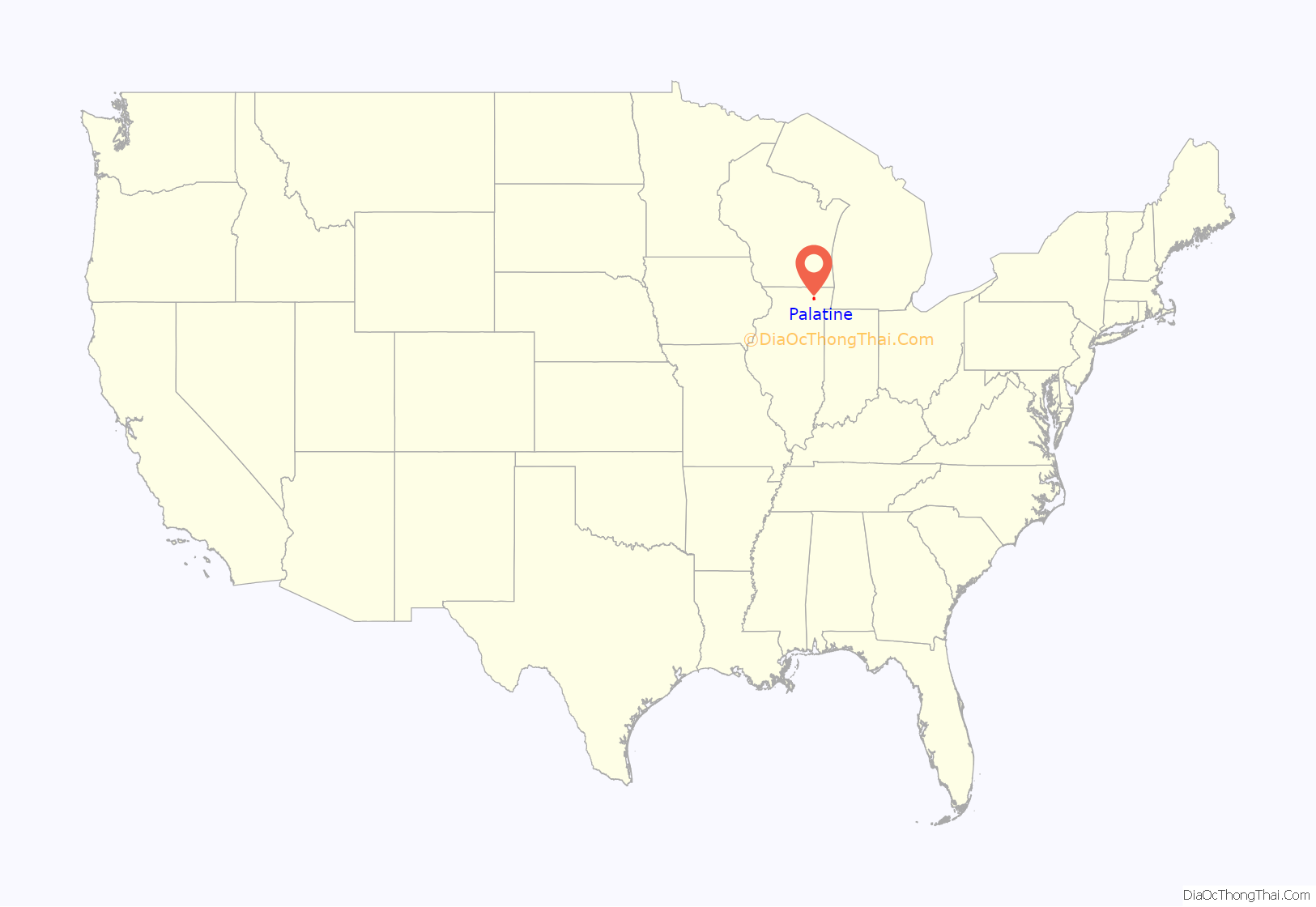
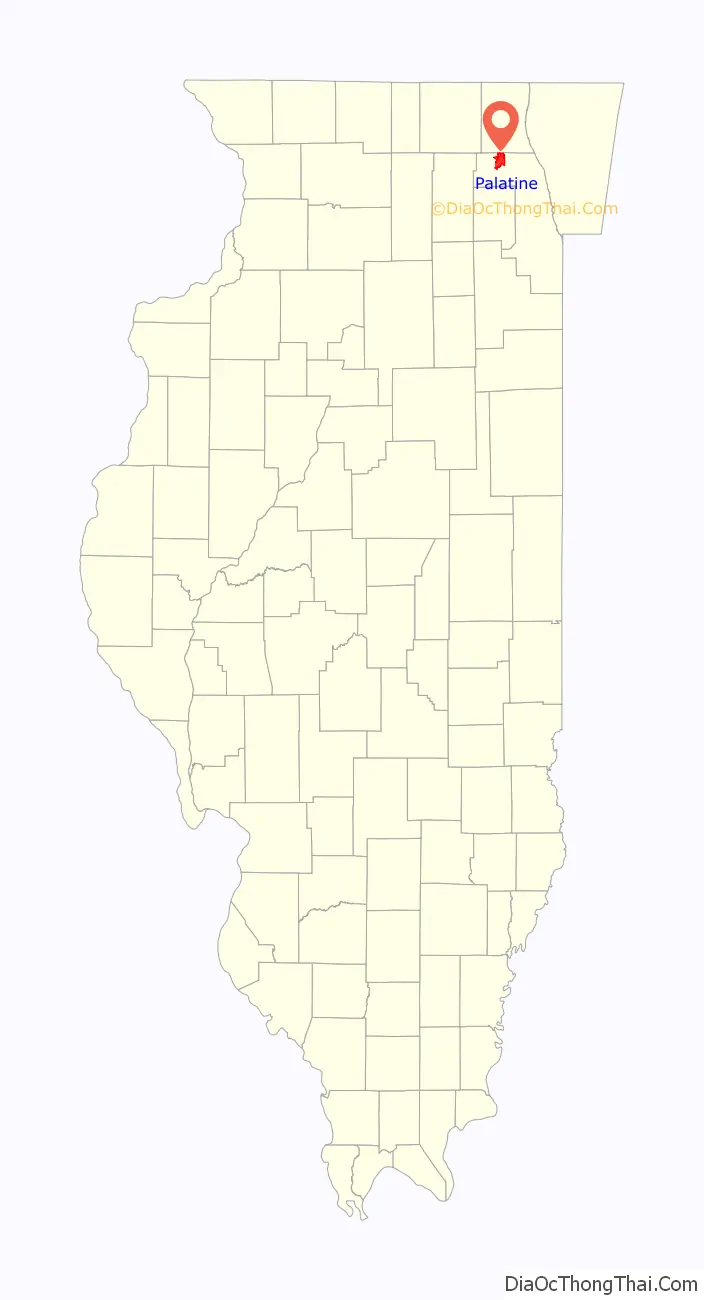
Palatine location map. Where is Palatine village?
History
The first European-American to settle in Palatine is generally thought to be George Ela, who built a log cabin in the area now called Deer Grove. Ela was one of the first of a wave of pioneers to migrate to northern Illinois following the Black Hawk War. A road that passes through the western edge of Palatine is called Ela Road in his honor. Palatine is thought to be named after a town in New York.
The Village of Palatine was founded in 1866. It was built around a station on the new Chicago and North Western Railway. Joel Wood surveyed and laid out the village, earning him the title of Palatine’s founder. One of Palatine’s original downtown streets is named after Wood.
In 1920, the Indian Fellowship League held its first American Indian Day celebration at Camp Reinberg, in Palatine. According to the Daily Herald, the festivities were attended by 60,000 people, which packed the highways leading to the camp with motorists.
A shortline railroad, the Palatine, Lake Zurich and Wauconda Railroad, was built in 1911, and began full passenger service to Wauconda, Illinois, in 1912. The line was closed in 1924 after a series of financial misfortunes and the improvement of roads in the area. The PLZ&W provided transportation to Dr. Wilson’s Deer Grove Park, just north of Dundee Road in Palatine.
Palatine’s first suburb-style subdivision was called Palanois Park, built shortly after World War II. The town has experienced rapid growth since the 1970s, part of Chicago’s growing suburban sprawl. Palatine was home to the Cook County Fair from 1914 to 1931. The fairgrounds are now a subdivision, Fairgrounds Park, whose name pays tribute to Palatine’s former fairgrounds.
During the early 1990s, Palatine along with neighboring Rolling Meadows and far northern suburb Zion were sued by atheist activist Rob Sherman over its village seal and seal-defaced flag, which had a Christian cross, among other things, inside an outline of an eagle. A 1992 advisory referendum to keep the seal passed, but another referendum to use public funds to defend the seal failed, leading the village to drop the seal. While Rolling Meadows and Zion developed new seals with the crosses removed, Palatine has since been without an official seal or flag, and is Illinois’ largest city or village to be so. The French tricolor reflecting the village’s sister city relationship with Fontenay-le-Comte, France, has flown at times on the flagpole meant for the village flag outside the village hall.
In 1993, a multiple homicide, the Brown’s Chicken massacre, received national attention.
Palatine has been in the process of revitalizing its downtown area since December 1999. This process has spawned a new passenger train station, a nearby parking garage, and several new condominiums, rowhouses, and commercial buildings.
In 2008, Palatine made news by threatening to secede from Cook County over the latter’s sales tax hike; as a result of the tax hike, Palatine’s sales tax is 9.0%. In 2009, residents of Palatine Township (which includes the village of Palatine) overwhelmingly voted to pass an advisory referendum stating that they would like to secede from Cook County.
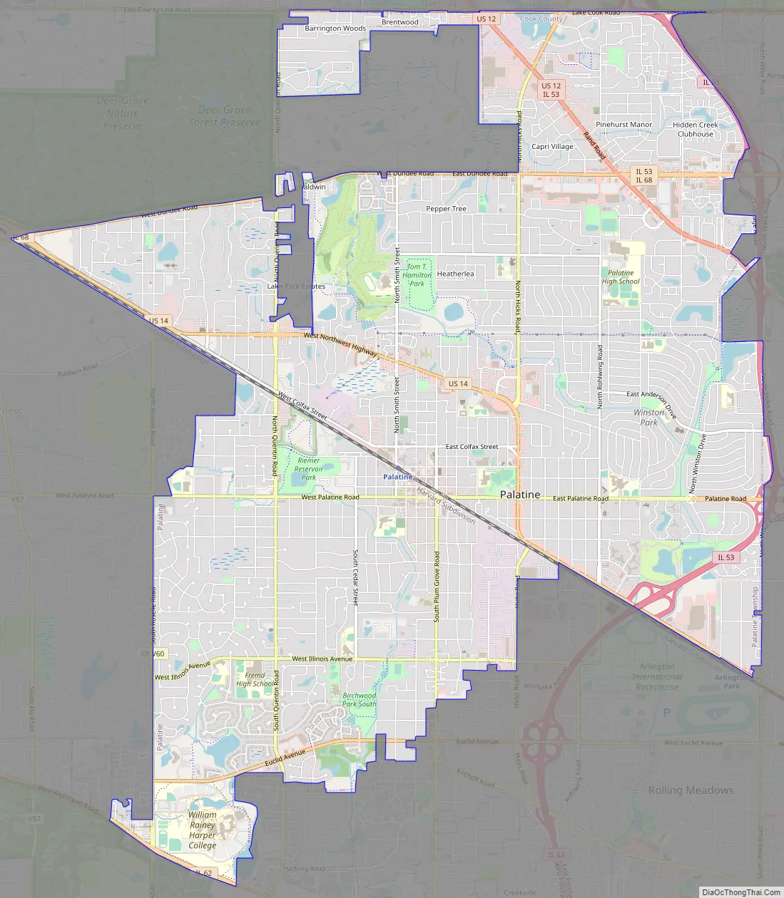
Palatine Road Map
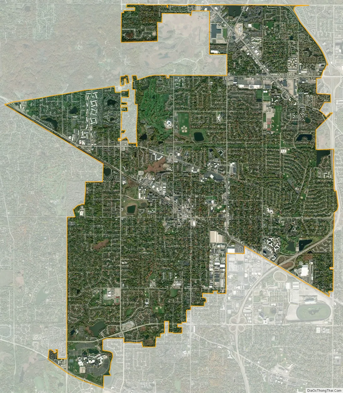
Palatine city Satellite Map
Geography
According to the 2021 census gazetteer files, Palatine has a total area of 14.28 square miles (36.99 km), of which 14.11 square miles (36.54 km) (or 98.87%) is land and 0.16 square miles (0.41 km) (or 1.13%) is water. Palatine’s shape resembles that of the head of an axe.
Palatine is in a wooded marshland where several streams rise around the village. Most of these streams meet up with Salt Creek which rises at Wilke Marsh on the village’s east side. The most notable exception is the northeast side, where its streams lie in the Buffalo Creek watershed. A small part of the east and southeast sides lies in the McDonald Creek watershed.
See also
Map of Illinois State and its subdivision:- Adams
- Alexander
- Bond
- Boone
- Brown
- Bureau
- Calhoun
- Carroll
- Cass
- Champaign
- Christian
- Clark
- Clay
- Clinton
- Coles
- Cook
- Crawford
- Cumberland
- De Kalb
- De Witt
- Douglas
- Dupage
- Edgar
- Edwards
- Effingham
- Fayette
- Ford
- Franklin
- Fulton
- Gallatin
- Greene
- Grundy
- Hamilton
- Hancock
- Hardin
- Henderson
- Henry
- Iroquois
- Jackson
- Jasper
- Jefferson
- Jersey
- Jo Daviess
- Johnson
- Kane
- Kankakee
- Kendall
- Knox
- La Salle
- Lake
- Lake Michigan
- Lawrence
- Lee
- Livingston
- Logan
- Macon
- Macoupin
- Madison
- Marion
- Marshall
- Mason
- Massac
- McDonough
- McHenry
- McLean
- Menard
- Mercer
- Monroe
- Montgomery
- Morgan
- Moultrie
- Ogle
- Peoria
- Perry
- Piatt
- Pike
- Pope
- Pulaski
- Putnam
- Randolph
- Richland
- Rock Island
- Saint Clair
- Saline
- Sangamon
- Schuyler
- Scott
- Shelby
- Stark
- Stephenson
- Tazewell
- Union
- Vermilion
- Wabash
- Warren
- Washington
- Wayne
- White
- Whiteside
- Will
- Williamson
- Winnebago
- Woodford
- Alabama
- Alaska
- Arizona
- Arkansas
- California
- Colorado
- Connecticut
- Delaware
- District of Columbia
- Florida
- Georgia
- Hawaii
- Idaho
- Illinois
- Indiana
- Iowa
- Kansas
- Kentucky
- Louisiana
- Maine
- Maryland
- Massachusetts
- Michigan
- Minnesota
- Mississippi
- Missouri
- Montana
- Nebraska
- Nevada
- New Hampshire
- New Jersey
- New Mexico
- New York
- North Carolina
- North Dakota
- Ohio
- Oklahoma
- Oregon
- Pennsylvania
- Rhode Island
- South Carolina
- South Dakota
- Tennessee
- Texas
- Utah
- Vermont
- Virginia
- Washington
- West Virginia
- Wisconsin
- Wyoming


