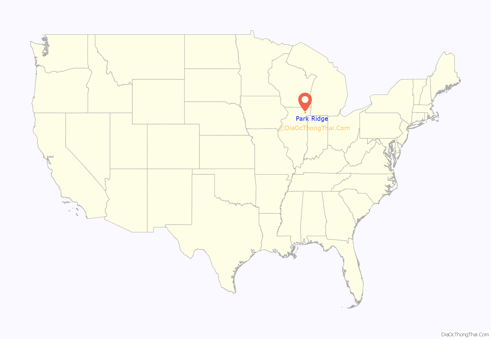
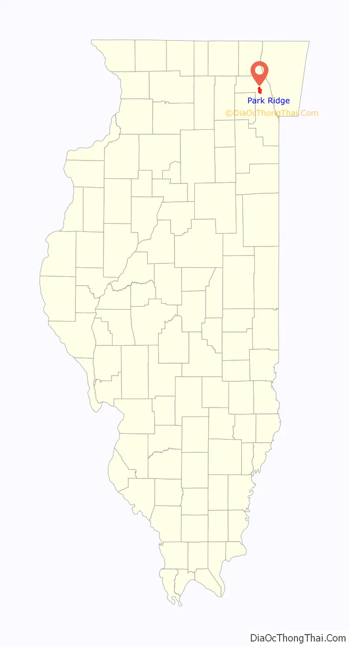
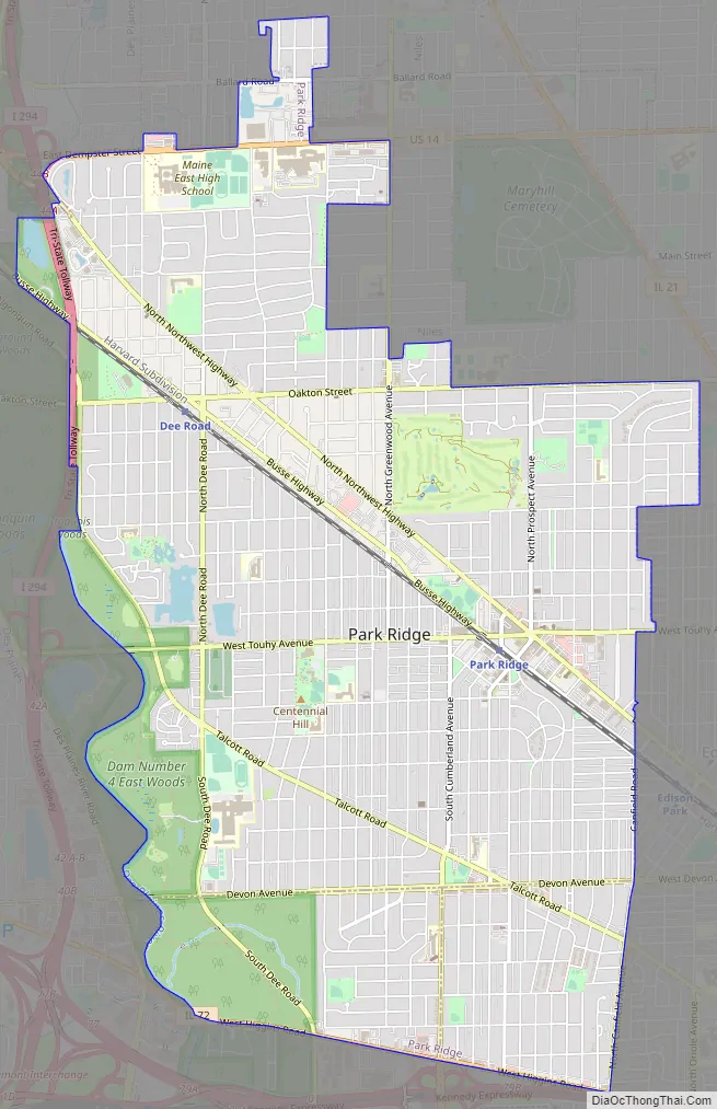
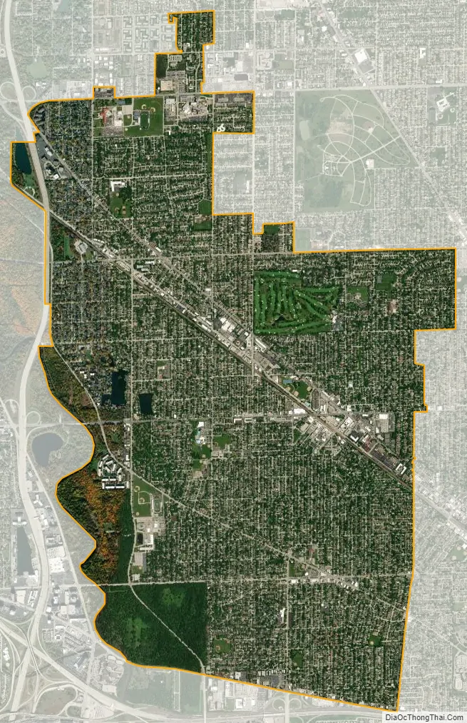
Park Ridge is a city in Cook County, Illinois, United States, and a Chicago suburb. Per the 2020 census, the population was 39,656. It is located 15 miles (24 km) northwest of downtown Chicago. It is close to O’Hare International Airport, major expressways, and rail transportation. It is a part of the Chicago metropolitan area, bordering three official neighborhoods on Chicago’s Far Northwest Side (Edison Park, Norwood Park, and O’Hare.)
The soil is abundant with clay deposits, which made it a brick-making center for the developing city of Chicago. Park Ridge was originally called Pennyville to honor George Penny, the businessman who owned the local brickyard along with Robert Meacham. Later it was named Brickton. The Des Plaines River divides Park Ridge from neighboring Des Plaines, Illinois, which is west of Park Ridge. Chicago is south and east of Park Ridge, and Niles and unincorporated Maine Township are to its north.
| Name: | Park Ridge city |
|---|---|
| LSAD Code: | 25 |
| LSAD Description: | city (suffix) |
| State: | Illinois |
| County: | Cook County |
| Incorporated: | 1873 |
| Total Area: | 7.13 sq mi (18.48 km²) |
| Land Area: | 7.09 sq mi (18.36 km²) |
| Water Area: | 0.05 sq mi (0.12 km²) 0.56% |
| Total Population: | 39,656 |
| Population Density: | 5,594.81/sq mi (2,160.32/km²) |
| Area code: | 847, 224 |
| FIPS code: | 1757875 |
| Website: | www.parkridge.us |
Online Interactive Map
Click on ![]() to view map in "full screen" mode.
to view map in "full screen" mode.
Park Ridge location map. Where is Park Ridge city?
History
The area of Park Ridge was inhabited by the Potawatomie until they were removed in 1833. The area was a convenient portage between the Des Plaines and Chicago rivers for the French explorers and in the early 1830s, the first settlers arrived from New England and New York. In 1854 George Penny established a brickworks in the area. Due to the brickwork and the abundance of clay, Park Ridge was nicknamed “Brickton” by locals. In 1910 Park Ridge had a population of 2,009. In 1930 the population was 10,417. In 1950 the population was 16,602. In 1960 the population was 32,625, with 99.9% of the population white. There were five African-Americans and 31 people classed other than black or white. By 1970, the population had risen to 42,466. In 2016, graduate of the first class of Park Ridge’s Maine Township High School South (1965) former First Lady Hillary Rodham Clinton, campaigned as the Democratic candidate for President of the United States.
Park Ridge Road Map
Park Ridge city Satellite Map
Geography
According to the 2021 census gazetteer files, Park Ridge has a total area of 7.14 square miles (18.49 km), of which 7.09 square miles (18.36 km) (or 99.34%) is land and 0.05 square miles (0.13 km) (or 0.66%) is water.
See also
Map of Illinois State and its subdivision:- Adams
- Alexander
- Bond
- Boone
- Brown
- Bureau
- Calhoun
- Carroll
- Cass
- Champaign
- Christian
- Clark
- Clay
- Clinton
- Coles
- Cook
- Crawford
- Cumberland
- De Kalb
- De Witt
- Douglas
- Dupage
- Edgar
- Edwards
- Effingham
- Fayette
- Ford
- Franklin
- Fulton
- Gallatin
- Greene
- Grundy
- Hamilton
- Hancock
- Hardin
- Henderson
- Henry
- Iroquois
- Jackson
- Jasper
- Jefferson
- Jersey
- Jo Daviess
- Johnson
- Kane
- Kankakee
- Kendall
- Knox
- La Salle
- Lake
- Lake Michigan
- Lawrence
- Lee
- Livingston
- Logan
- Macon
- Macoupin
- Madison
- Marion
- Marshall
- Mason
- Massac
- McDonough
- McHenry
- McLean
- Menard
- Mercer
- Monroe
- Montgomery
- Morgan
- Moultrie
- Ogle
- Peoria
- Perry
- Piatt
- Pike
- Pope
- Pulaski
- Putnam
- Randolph
- Richland
- Rock Island
- Saint Clair
- Saline
- Sangamon
- Schuyler
- Scott
- Shelby
- Stark
- Stephenson
- Tazewell
- Union
- Vermilion
- Wabash
- Warren
- Washington
- Wayne
- White
- Whiteside
- Will
- Williamson
- Winnebago
- Woodford
- Alabama
- Alaska
- Arizona
- Arkansas
- California
- Colorado
- Connecticut
- Delaware
- District of Columbia
- Florida
- Georgia
- Hawaii
- Idaho
- Illinois
- Indiana
- Iowa
- Kansas
- Kentucky
- Louisiana
- Maine
- Maryland
- Massachusetts
- Michigan
- Minnesota
- Mississippi
- Missouri
- Montana
- Nebraska
- Nevada
- New Hampshire
- New Jersey
- New Mexico
- New York
- North Carolina
- North Dakota
- Ohio
- Oklahoma
- Oregon
- Pennsylvania
- Rhode Island
- South Carolina
- South Dakota
- Tennessee
- Texas
- Utah
- Vermont
- Virginia
- Washington
- West Virginia
- Wisconsin
- Wyoming


