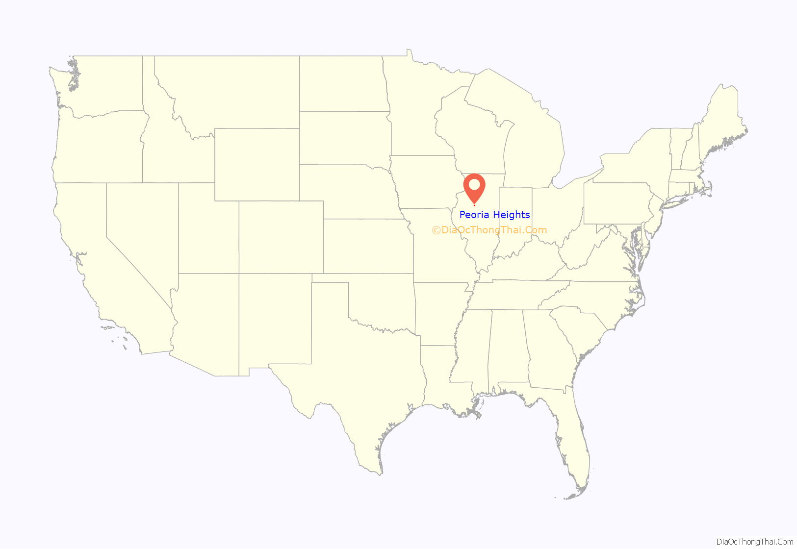
Peoria Heights is a village lying almost entirely in Peoria County in the U.S. state of Illinois. The population was 6,156 at the 2010 census, down from 6,635 in 2000. Peoria Heights is a suburb of Peoria, is sometimes referred to as Uptown, and is surrounded by the city except for its eastern boundary on Peoria Lake, a relatively wider section of the Illinois River. It is part of the Peoria, Illinois Metropolitan Statistical Area.
| Name: | Peoria Heights village |
|---|---|
| LSAD Code: | 47 |
| LSAD Description: | village (suffix) |
| State: | Illinois |
| County: | Peoria County, Tazewell County, Woodford County |
| Elevation: | 784 ft (239 m) |
| Total Area: | 2.87 sq mi (7.44 km²) |
| Land Area: | 2.49 sq mi (6.46 km²) |
| Water Area: | 0.38 sq mi (0.98 km²) |
| Total Population: | 5,908 |
| Population Density: | 2,369.84/sq mi (915.16/km²) |
| Area code: | 309 |
| FIPS code: | 1759026 |
| GNISfeature ID: | 2399652 |
| Website: | www.peoriaheights.org/home |
Online Interactive Map
Click on ![]() to view map in "full screen" mode.
to view map in "full screen" mode.
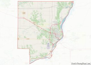
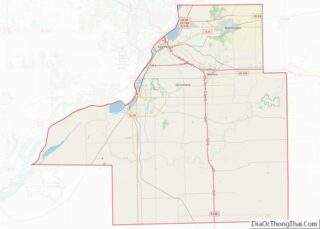
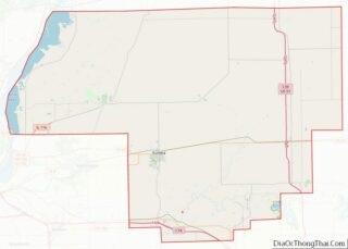
Peoria Heights location map. Where is Peoria Heights village?
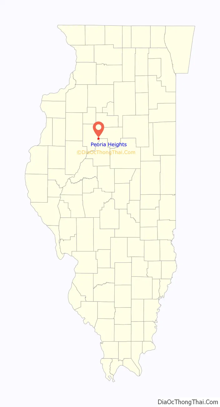
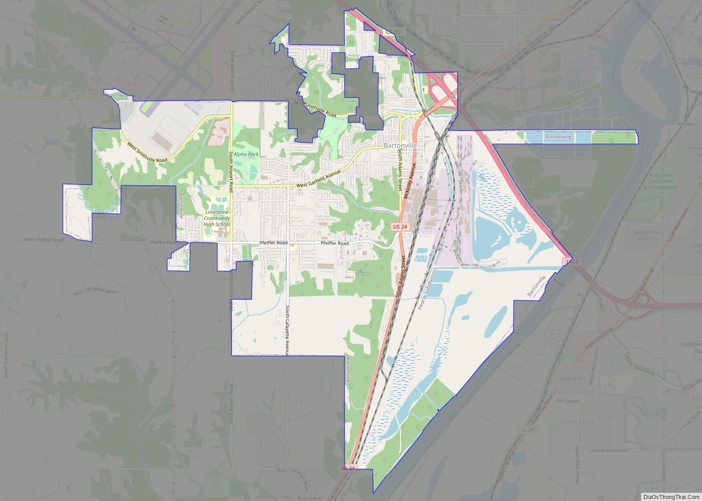
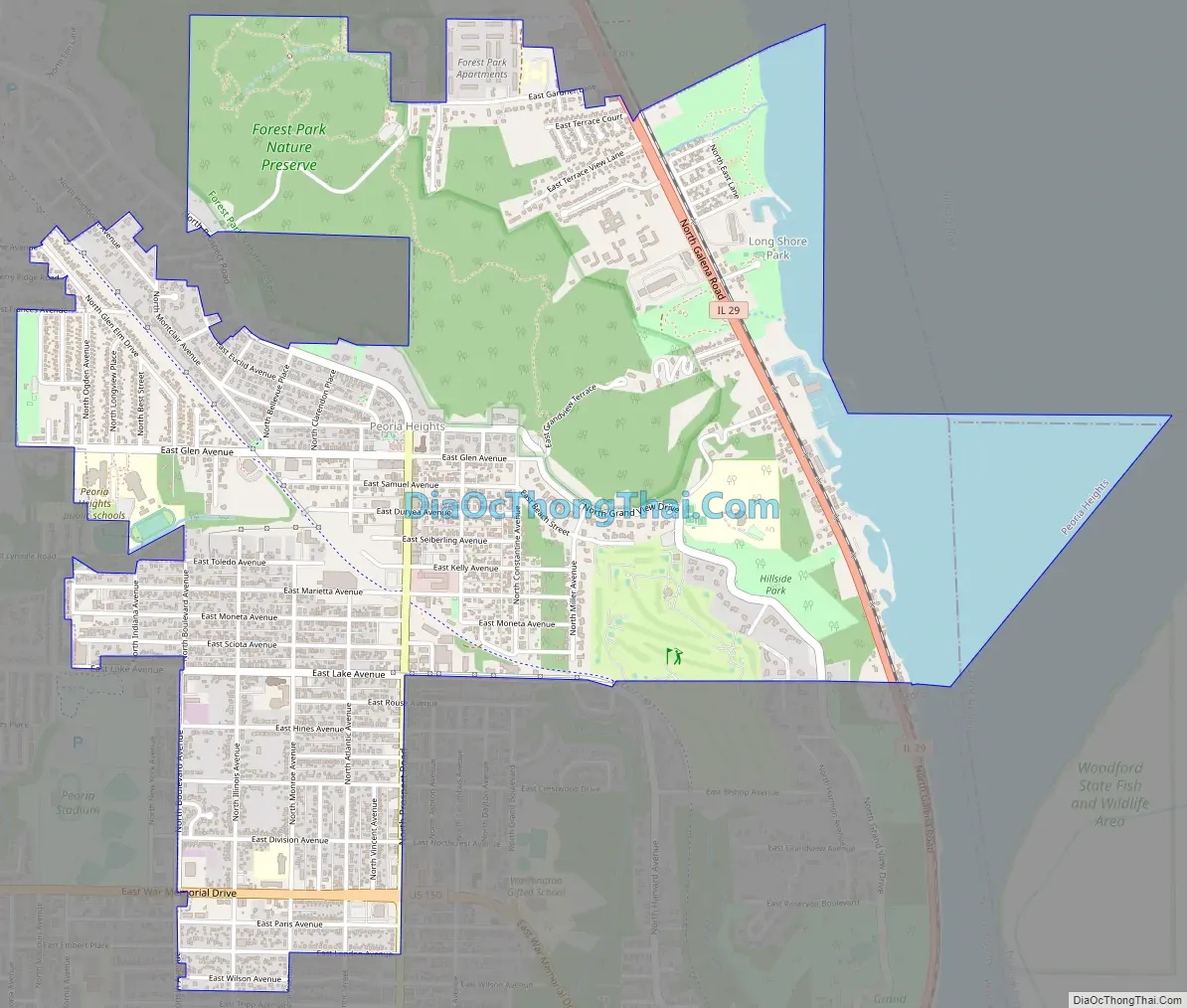
Peoria Heights Road Map
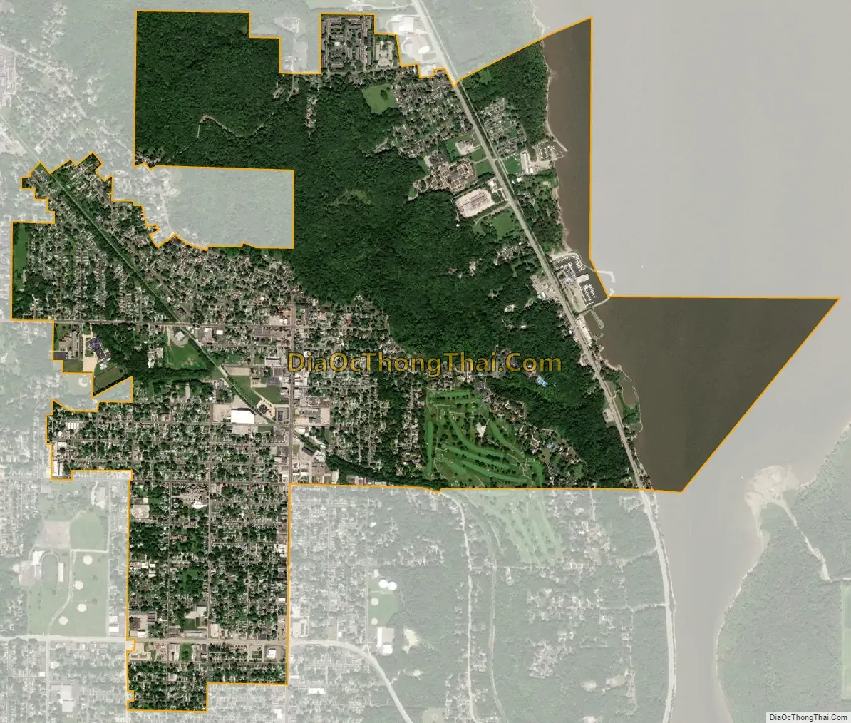
Peoria Heights city Satellite Map
Geography
According to the 2010 census, Peoria Heights has a total area of 6.969 square miles (18.05 km), of which 2.65 square miles (6.86 km) (or 38.03%) is land and 4.319 square miles (11.19 km) (or 61.97%) is water. That most of the village is water is due to the fact that most of Upper Peoria Lake lies within its boundaries; this can be seen on official state maps.
Topographically, the village can be roughly divided into three zones. The Illinois River floodplain, the bluff, and the plateau. While its eastern border is fairly regular with the river’s edge, the rest of its municipal border, with Peoria, is quite irregular and convoluted.
According to the Census Bureau records through 2007, Peoria Heights lies in three counties (Peoria, Woodford, and Tazewell). While neither Tazewell nor Woodford counties consider Peoria Heights to be within their jurisdiction, the state of Illinois does show that across Peoria Lake from the rest of the village, a small, uninhabited area exists both within Peoria Heights and Woodford County. However, the Census Bureau claim that Peoria Heights is also within Tazewell County is unsupported by any state, county, or municipal websites.
See also
Map of Illinois State and its subdivision:- Adams
- Alexander
- Bond
- Boone
- Brown
- Bureau
- Calhoun
- Carroll
- Cass
- Champaign
- Christian
- Clark
- Clay
- Clinton
- Coles
- Cook
- Crawford
- Cumberland
- De Kalb
- De Witt
- Douglas
- Dupage
- Edgar
- Edwards
- Effingham
- Fayette
- Ford
- Franklin
- Fulton
- Gallatin
- Greene
- Grundy
- Hamilton
- Hancock
- Hardin
- Henderson
- Henry
- Iroquois
- Jackson
- Jasper
- Jefferson
- Jersey
- Jo Daviess
- Johnson
- Kane
- Kankakee
- Kendall
- Knox
- La Salle
- Lake
- Lake Michigan
- Lawrence
- Lee
- Livingston
- Logan
- Macon
- Macoupin
- Madison
- Marion
- Marshall
- Mason
- Massac
- McDonough
- McHenry
- McLean
- Menard
- Mercer
- Monroe
- Montgomery
- Morgan
- Moultrie
- Ogle
- Peoria
- Perry
- Piatt
- Pike
- Pope
- Pulaski
- Putnam
- Randolph
- Richland
- Rock Island
- Saint Clair
- Saline
- Sangamon
- Schuyler
- Scott
- Shelby
- Stark
- Stephenson
- Tazewell
- Union
- Vermilion
- Wabash
- Warren
- Washington
- Wayne
- White
- Whiteside
- Will
- Williamson
- Winnebago
- Woodford
- Alabama
- Alaska
- Arizona
- Arkansas
- California
- Colorado
- Connecticut
- Delaware
- District of Columbia
- Florida
- Georgia
- Hawaii
- Idaho
- Illinois
- Indiana
- Iowa
- Kansas
- Kentucky
- Louisiana
- Maine
- Maryland
- Massachusetts
- Michigan
- Minnesota
- Mississippi
- Missouri
- Montana
- Nebraska
- Nevada
- New Hampshire
- New Jersey
- New Mexico
- New York
- North Carolina
- North Dakota
- Ohio
- Oklahoma
- Oregon
- Pennsylvania
- Rhode Island
- South Carolina
- South Dakota
- Tennessee
- Texas
- Utah
- Vermont
- Virginia
- Washington
- West Virginia
- Wisconsin
- Wyoming