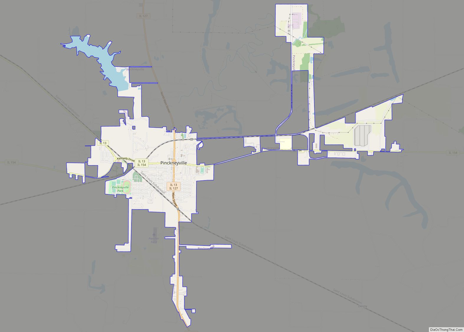
Pinckneyville is a city in and the county seat of Perry County, Illinois, United States. The population was 5,066 at the 2020 census. It is named for Charles Cotesworth Pinckney, an early American diplomat and presidential candidate.
Pinckneyville is the location of the Pinckneyville Power Plant, a combustion turbine generator (CTG)-type power plant run by Ameren.
| Name: | Pinckneyville city |
|---|---|
| LSAD Code: | 25 |
| LSAD Description: | city (suffix) |
| State: | Illinois |
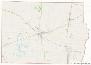
| County: | Perry County |
| Elevation: | 427 ft (130 m) |
| Total Area: | 4.38 sq mi (11.35 km²) |
| Land Area: | 4.11 sq mi (10.64 km²) |
| Water Area: | 0.28 sq mi (0.71 km²) |
| Total Population: | 5,066 |
| Population Density: | 1,233.80/sq mi (476.34/km²) |
| Area code: | 618 |
| FIPS code: | 1759884 |
| Website: | http://www.ci.pinckneyville.il.us/ |
Online Interactive Map
Click on ![]() to view map in "full screen" mode.
to view map in "full screen" mode.
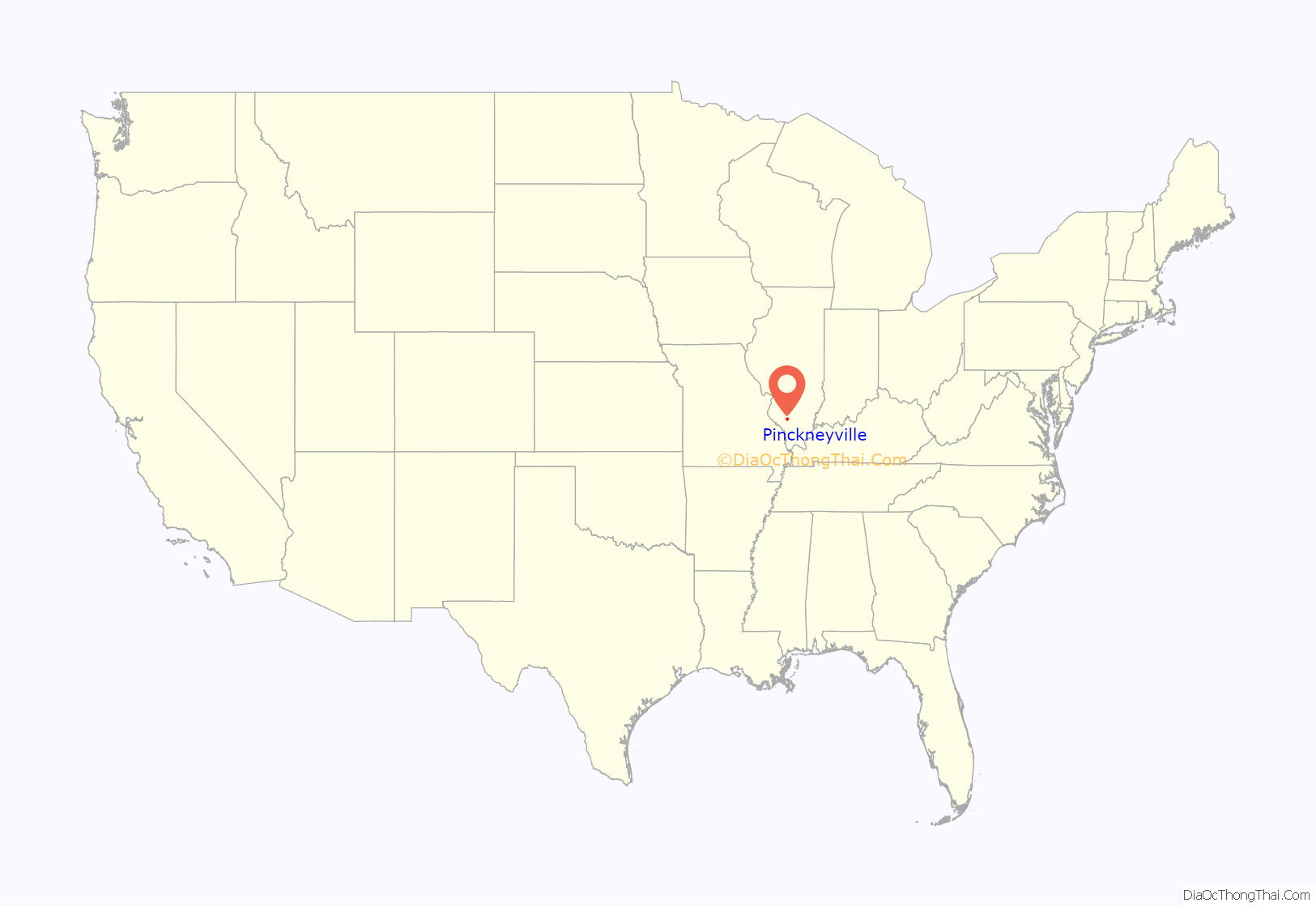
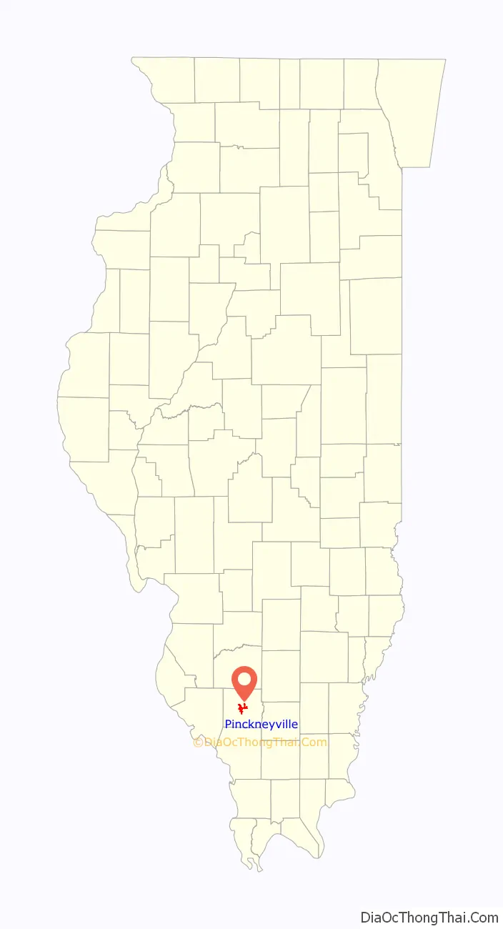
Pinckneyville location map. Where is Pinckneyville city?
History
Perry County was formed on January 29, 1827. It was named for Commodore Oliver H. Perry. When Perry County was established, 80 acres were taken from nearby Jackson and Randolph counties; 20 acres were reserved for the county seat. On May 17, 1857, Pinckneyville (named after Charles Cotesworth Pinckney) was organized and named as the county seat. Before being organized, Pinckneyville consisted as of 1834 of a log courthouse, four stores, a tavern, and a grocery (the first store was opened in 1827); around 20 families lived in the town. 1834 was also the same year that the Perry County jail was constructed; a larger jail, which is now the home of the Perry County jail museum, was built in 1871.
During the American Civil War (1861–1865), southern Illinois was under martial law. In the years after Reconstruction, many laws were established to ensure the second-class status of African Americans. Many actions, however, were de facto laws. From 1890 to 1968, many sundown towns were established throughout the United States, including several in southern Illinois. Pinckneyville, on the other hand, was one amongst thousands of towns that, while established earlier, became a sundown town. Pinckneyville became sundown around 1928; the extant story in Pinckneyville is that a white woman was raped by a black man, so the white leadership of the town loaded the black population of the town on a bus, drove them out of town, and left them in East St. Louis; a black man, probably the alleged rapist, was lynched at the town square. However, the rape explanation is considered to be unreliable because of the vagueness of the story and because it conflicts with accounts offered by others who lived in Pinckneyville at the time. The town continued to be a sundown town; the town had a “hanging tree”, though African Americans were hanged in at least three separate places; under the city limits sign, there was a sign saying “No Coloreds After Dark” that came down in the late 1960s or early 1970s. In the town cemetery’s black section, there are only two grave markers, yet it is estimated that there are approximately twenty graves.
As of the 2000 United States census, 1,331 of the 5,464 residents were black, however this population total includes the inmates of Pinckneyville Correctional Center, who are mostly African-American.
Today, Pinckneyville is home to the Illinois Rural Heritage museum. In 2010, it was awarded the Governor’s Hometown Award.
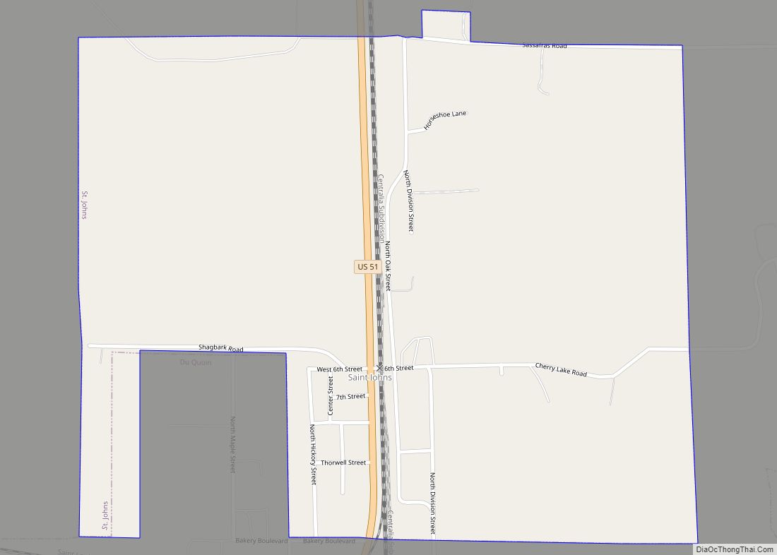
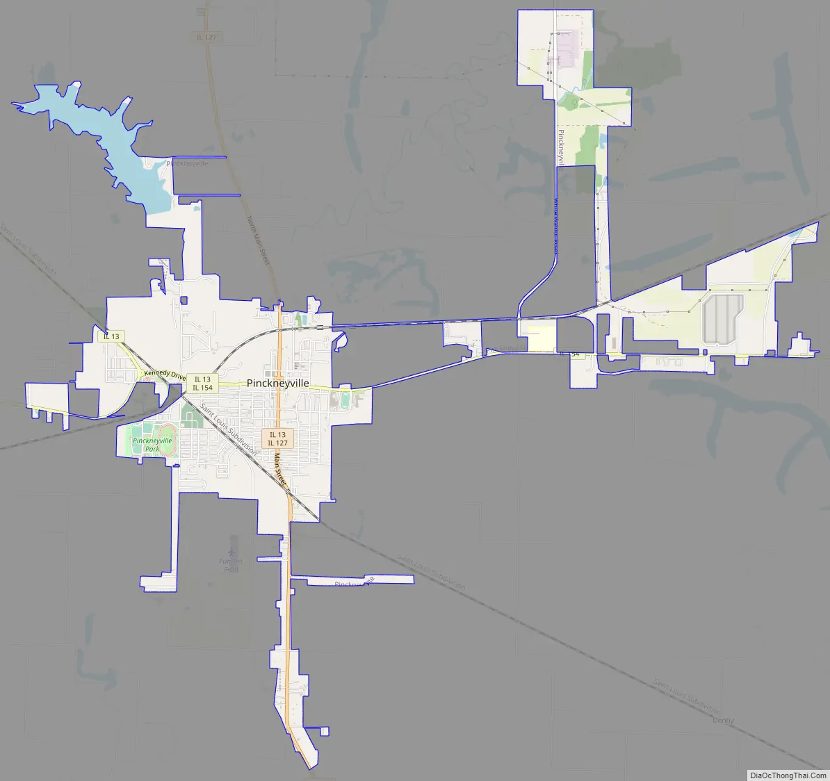
Pinckneyville Road Map
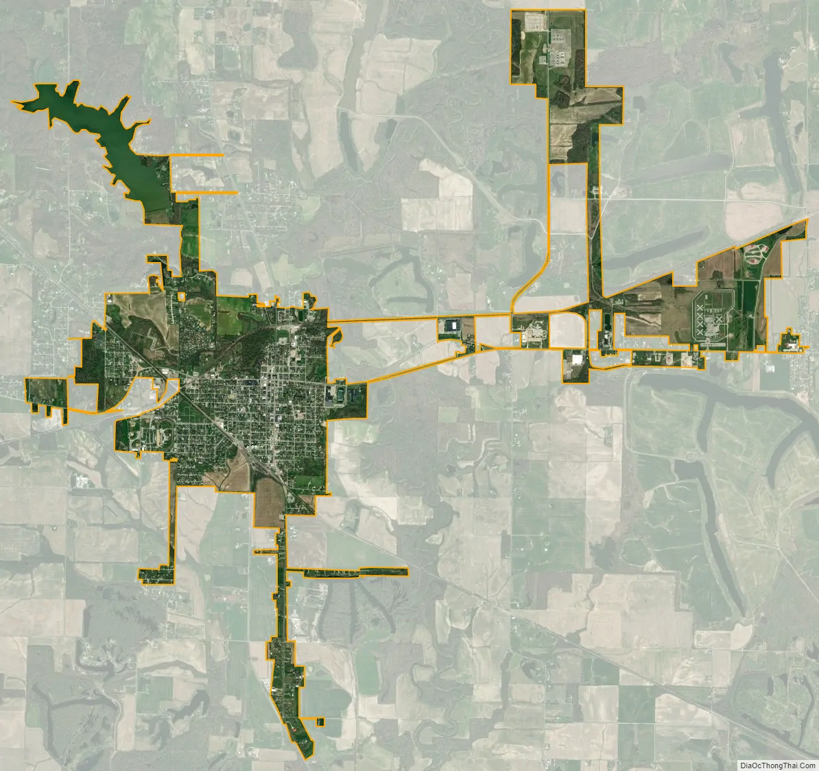
Pinckneyville city Satellite Map
Geography
Pinckneyville is located on Illinois Route 13 about 60 miles (97 km) southeast of St. Louis.
According to the 2010 census, Pinckneyville has a total area of 4.315 square miles (11.18 km), of which 4.04 square miles (10.46 km) (or 93.63%) is land and 0.275 square miles (0.71 km) (or 6.37%) is water.
See also
Map of Illinois State and its subdivision:- Adams
- Alexander
- Bond
- Boone
- Brown
- Bureau
- Calhoun
- Carroll
- Cass
- Champaign
- Christian
- Clark
- Clay
- Clinton
- Coles
- Cook
- Crawford
- Cumberland
- De Kalb
- De Witt
- Douglas
- Dupage
- Edgar
- Edwards
- Effingham
- Fayette
- Ford
- Franklin
- Fulton
- Gallatin
- Greene
- Grundy
- Hamilton
- Hancock
- Hardin
- Henderson
- Henry
- Iroquois
- Jackson
- Jasper
- Jefferson
- Jersey
- Jo Daviess
- Johnson
- Kane
- Kankakee
- Kendall
- Knox
- La Salle
- Lake
- Lake Michigan
- Lawrence
- Lee
- Livingston
- Logan
- Macon
- Macoupin
- Madison
- Marion
- Marshall
- Mason
- Massac
- McDonough
- McHenry
- McLean
- Menard
- Mercer
- Monroe
- Montgomery
- Morgan
- Moultrie
- Ogle
- Peoria
- Perry
- Piatt
- Pike
- Pope
- Pulaski
- Putnam
- Randolph
- Richland
- Rock Island
- Saint Clair
- Saline
- Sangamon
- Schuyler
- Scott
- Shelby
- Stark
- Stephenson
- Tazewell
- Union
- Vermilion
- Wabash
- Warren
- Washington
- Wayne
- White
- Whiteside
- Will
- Williamson
- Winnebago
- Woodford
- Alabama
- Alaska
- Arizona
- Arkansas
- California
- Colorado
- Connecticut
- Delaware
- District of Columbia
- Florida
- Georgia
- Hawaii
- Idaho
- Illinois
- Indiana
- Iowa
- Kansas
- Kentucky
- Louisiana
- Maine
- Maryland
- Massachusetts
- Michigan
- Minnesota
- Mississippi
- Missouri
- Montana
- Nebraska
- Nevada
- New Hampshire
- New Jersey
- New Mexico
- New York
- North Carolina
- North Dakota
- Ohio
- Oklahoma
- Oregon
- Pennsylvania
- Rhode Island
- South Carolina
- South Dakota
- Tennessee
- Texas
- Utah
- Vermont
- Virginia
- Washington
- West Virginia
- Wisconsin
- Wyoming