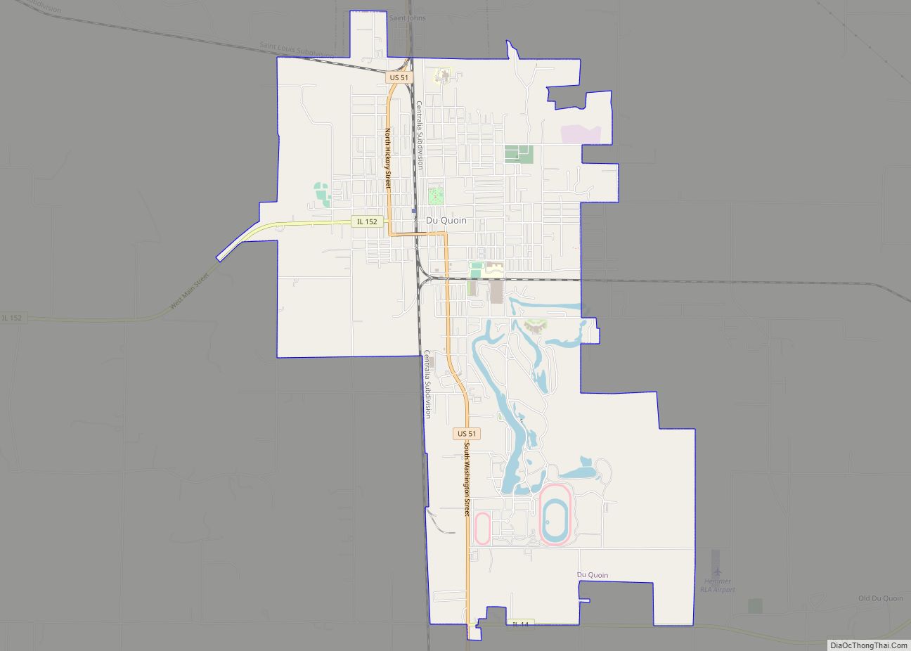
Du Quoin (/duːˈkɔɪn/ doo-KOYN) is a city in Perry County, Illinois. It is best known for hosting the annual DuQuoin State Fair and the Street Machine Nationals. The population is estimated at 5,761 in the 2020 census.
| Name: | Du Quoin city |
|---|---|
| LSAD Code: | 25 |
| LSAD Description: | city (suffix) |
| State: | Illinois |
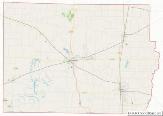
| County: | Perry County |
| Elevation: | 449 ft (137 m) |
| Total Area: | 7.06 sq mi (18.29 km²) |
| Land Area: | 6.98 sq mi (18.07 km²) |
| Water Area: | 0.08 sq mi (0.21 km²) |
| Total Population: | 5,827 |
| Population Density: | 834.93/sq mi (322.38/km²) |
| Area code: | 618 |
| FIPS code: | 1721267 |
| Website: | duquoin.org |
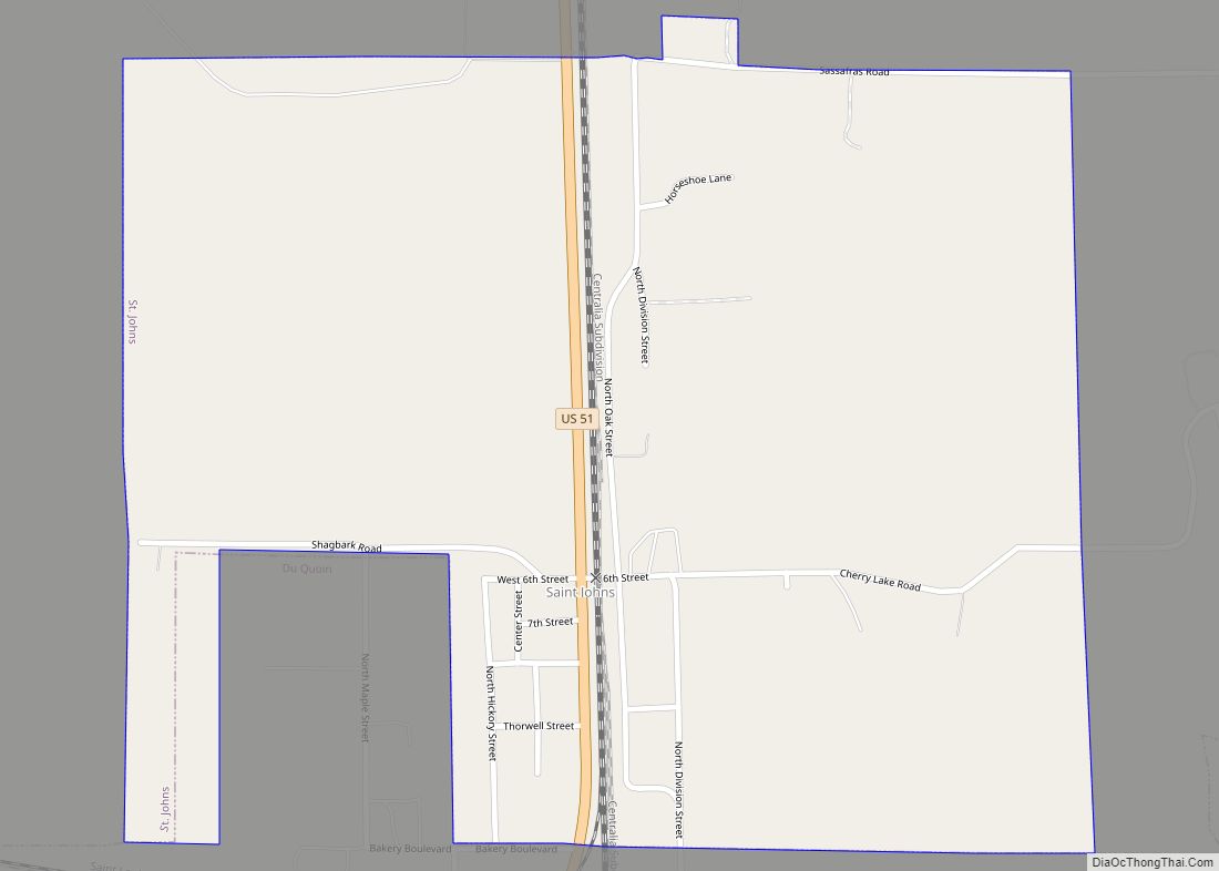
Online Interactive Map
Click on ![]() to view map in "full screen" mode.
to view map in "full screen" mode.
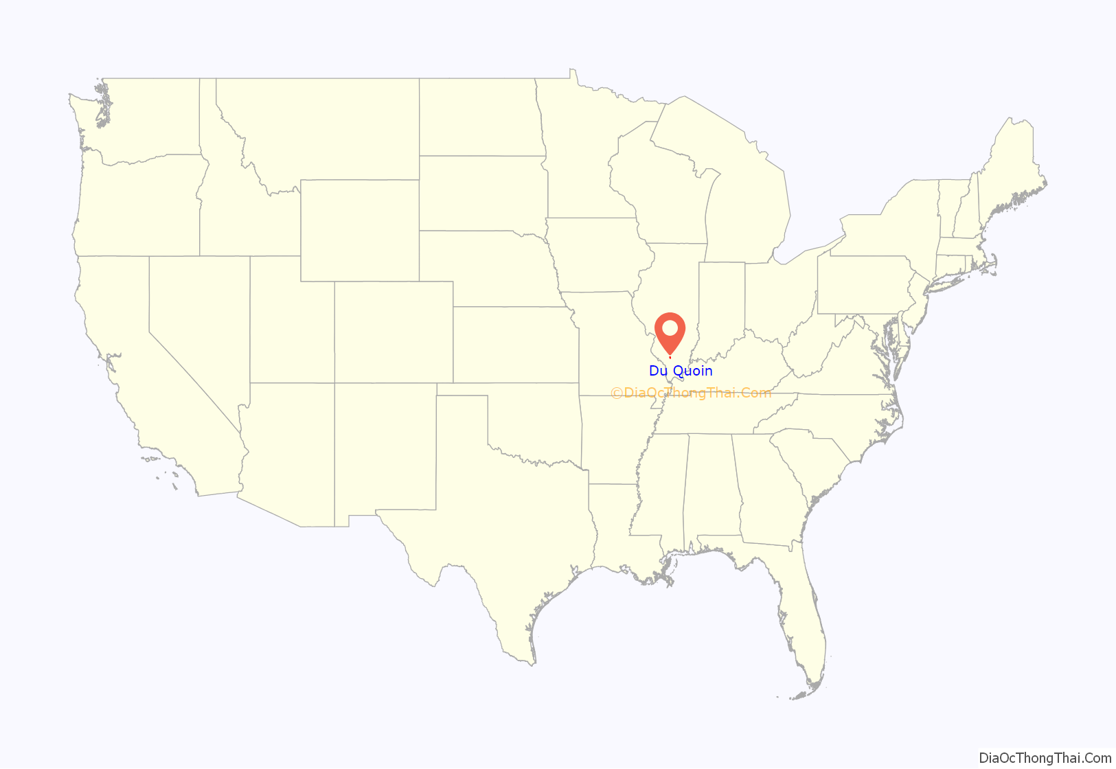
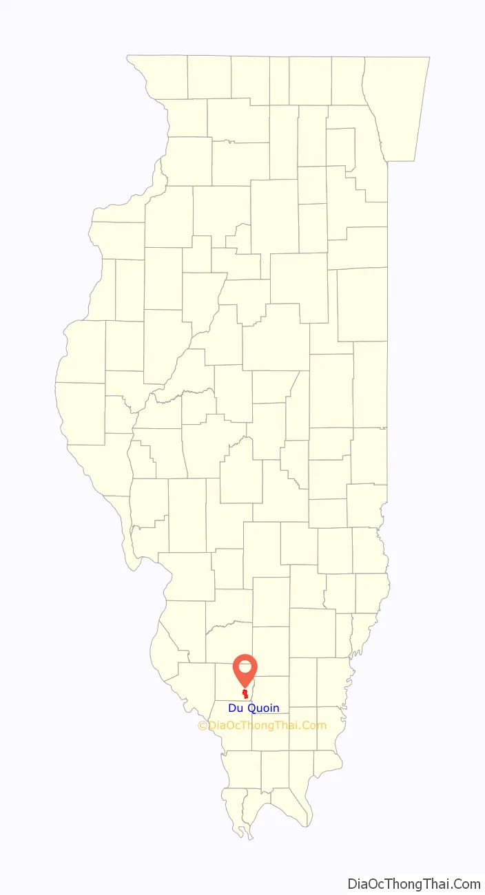
Du Quoin location map. Where is Du Quoin city?
History
The area east of Du Quoin is known as Old Du Quoin. In the early 19th century, Du Quoin was near the Lusk’s Ferry Road, an important early road that connected Kaskaskia with Lusk’s Ferry on the Ohio River. The road ran easterly out of Steeleville to a point southwest of Du Quoin. There it turned to the southeast to cross the Big Muddy River and head for Lusk’s Ferry.
Du Quoin had its start at its present location in 1853 when the railroad was extended to that point. The city was named after Chief Jean Baptiste Ducoigne of the Kaskaskia, an Illiniwek people, who were defeated by the Shawnee near here in 1802.
The first mayor of Du Quoin was George Spencer Smith.
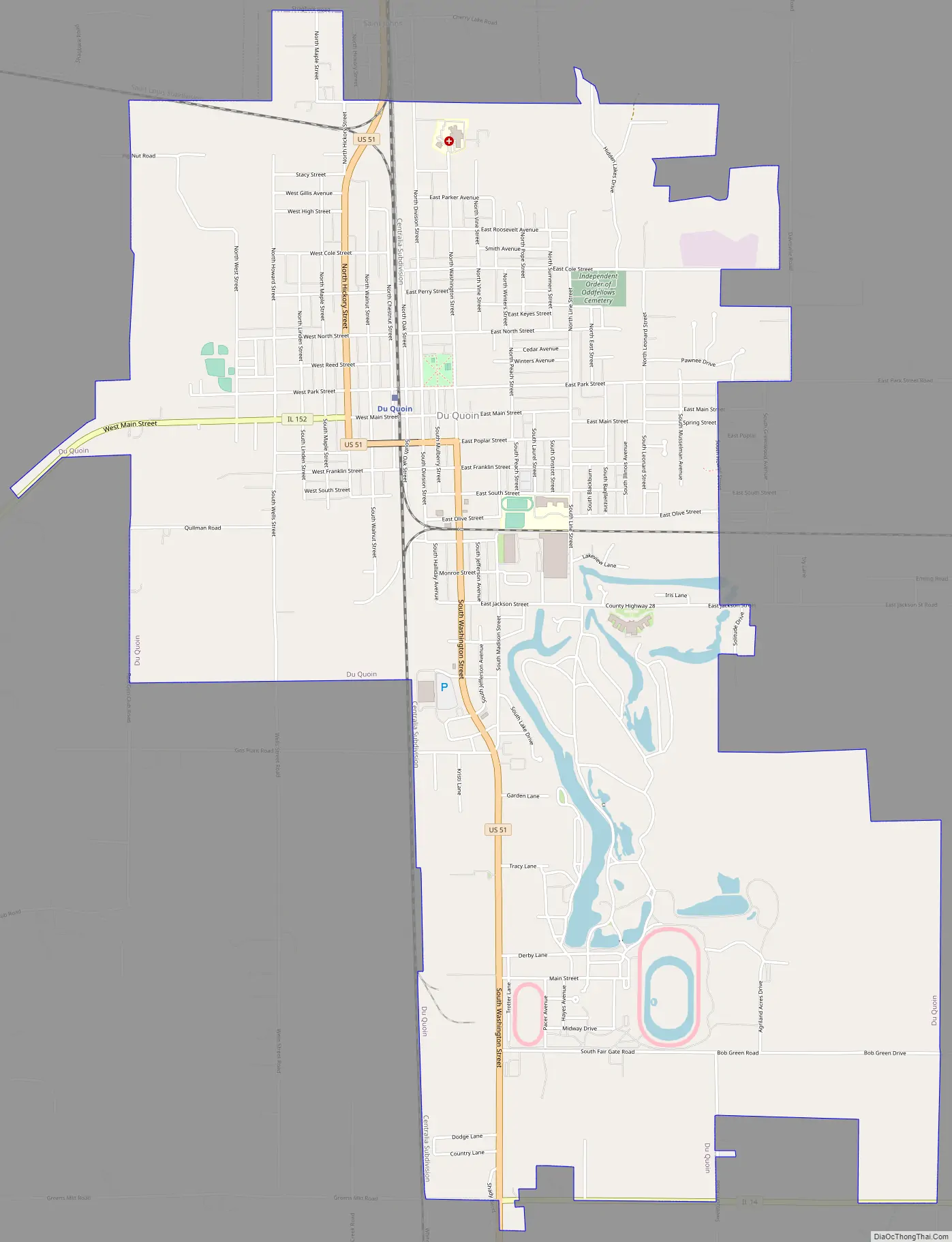
Du Quoin Road Map
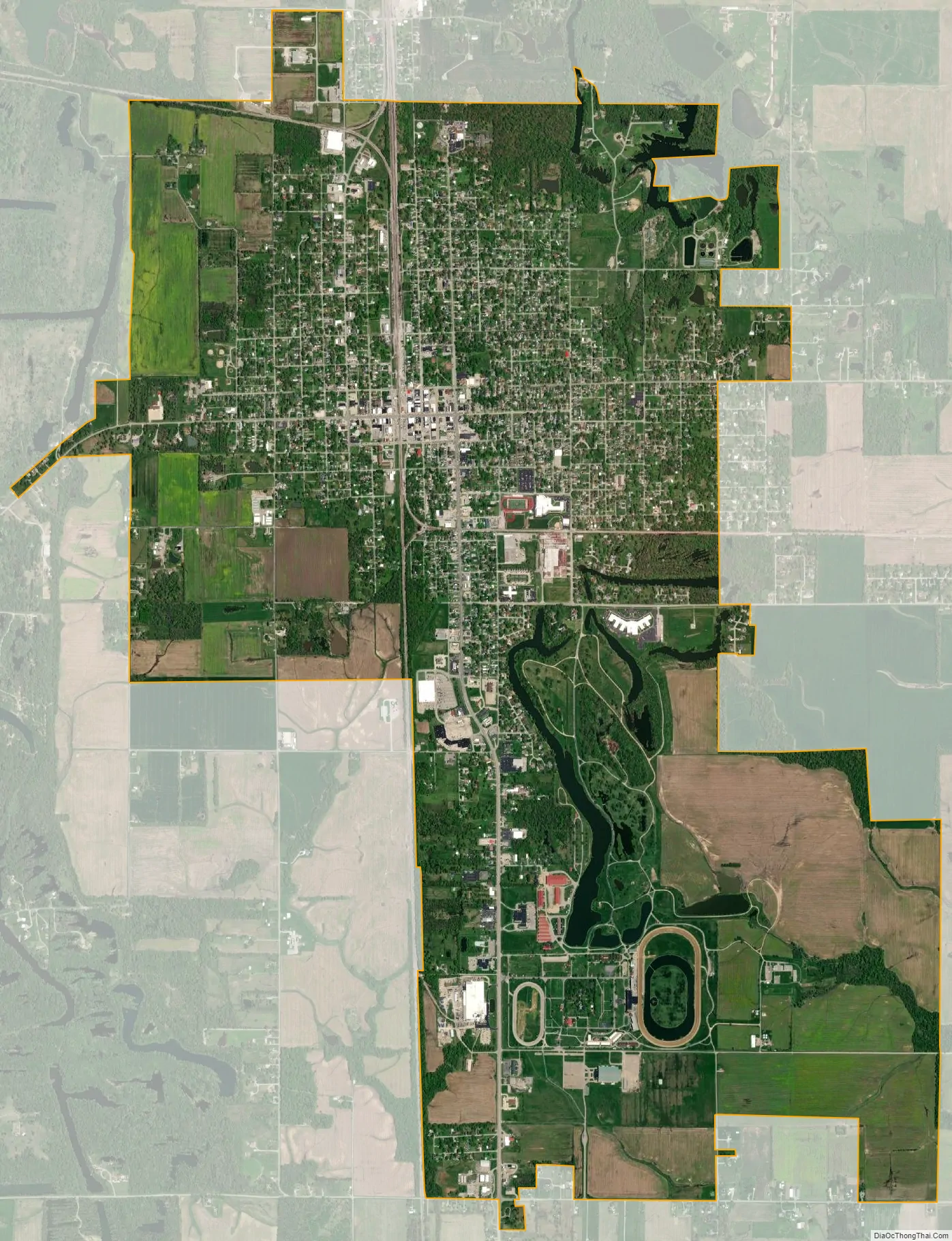
Du Quoin city Satellite Map
Geography
The city of Du Quoin is located in the southeastern portion of Perry County, Illinois.
According to the 2010 census, Du Quoin has a total area of 7.061 square miles (18.29 km), of which 6.98 square miles (18.08 km) (or 98.85%) is land and 0.081 square miles (0.21 km) (or 1.15%) is water.
Climate
See also
Map of Illinois State and its subdivision:- Adams
- Alexander
- Bond
- Boone
- Brown
- Bureau
- Calhoun
- Carroll
- Cass
- Champaign
- Christian
- Clark
- Clay
- Clinton
- Coles
- Cook
- Crawford
- Cumberland
- De Kalb
- De Witt
- Douglas
- Dupage
- Edgar
- Edwards
- Effingham
- Fayette
- Ford
- Franklin
- Fulton
- Gallatin
- Greene
- Grundy
- Hamilton
- Hancock
- Hardin
- Henderson
- Henry
- Iroquois
- Jackson
- Jasper
- Jefferson
- Jersey
- Jo Daviess
- Johnson
- Kane
- Kankakee
- Kendall
- Knox
- La Salle
- Lake
- Lake Michigan
- Lawrence
- Lee
- Livingston
- Logan
- Macon
- Macoupin
- Madison
- Marion
- Marshall
- Mason
- Massac
- McDonough
- McHenry
- McLean
- Menard
- Mercer
- Monroe
- Montgomery
- Morgan
- Moultrie
- Ogle
- Peoria
- Perry
- Piatt
- Pike
- Pope
- Pulaski
- Putnam
- Randolph
- Richland
- Rock Island
- Saint Clair
- Saline
- Sangamon
- Schuyler
- Scott
- Shelby
- Stark
- Stephenson
- Tazewell
- Union
- Vermilion
- Wabash
- Warren
- Washington
- Wayne
- White
- Whiteside
- Will
- Williamson
- Winnebago
- Woodford
- Alabama
- Alaska
- Arizona
- Arkansas
- California
- Colorado
- Connecticut
- Delaware
- District of Columbia
- Florida
- Georgia
- Hawaii
- Idaho
- Illinois
- Indiana
- Iowa
- Kansas
- Kentucky
- Louisiana
- Maine
- Maryland
- Massachusetts
- Michigan
- Minnesota
- Mississippi
- Missouri
- Montana
- Nebraska
- Nevada
- New Hampshire
- New Jersey
- New Mexico
- New York
- North Carolina
- North Dakota
- Ohio
- Oklahoma
- Oregon
- Pennsylvania
- Rhode Island
- South Carolina
- South Dakota
- Tennessee
- Texas
- Utah
- Vermont
- Virginia
- Washington
- West Virginia
- Wisconsin
- Wyoming