Red Bud is a city in Randolph County, Illinois, in the United States. The population was 3,804 at the 2020 census.
It is the home of the Red Bud campus of Southwestern Illinois College.
| Name: | Red Bud city |
|---|---|
| LSAD Code: | 25 |
| LSAD Description: | city (suffix) |
| State: | Illinois |
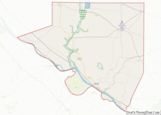
| County: | Randolph County |
| Elevation: | 453 ft (138 m) |
| Total Area: | 2.65 sq mi (6.85 km²) |
| Land Area: | 2.62 sq mi (6.79 km²) |
| Water Area: | 0.02 sq mi (0.06 km²) |
| Total Population: | 3,804 |
| Population Density: | 1,450.25/sq mi (559.92/km²) |
| FIPS code: | 1763043 |
| GNISfeature ID: | 2396334 |
| Website: | www.cityofredbud.org |
Online Interactive Map
Click on ![]() to view map in "full screen" mode.
to view map in "full screen" mode.
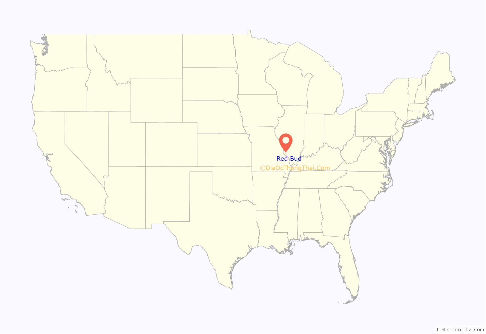
Red Bud location map. Where is Red Bud city?

History
The city receives its name from the redbud tree, a species of flora that grows in the area. The first development by a European settler within what is now the city limits was made by Preston Brickey in 1820. He constructed a log cabin near the current intersection of Main and Power streets, and there cultivated a farm. In 1839, James Pollock placed a small stock of goods in the log cabin built by Henry Simmons, where he did business for about a year. This was located where Lutheran cemetery now exists. The next year he moved his stock of goods into a log building erected by John C. Crozier. He continued the business there about three years, when he moved to Preston. In 1840, R.D. Dufree became the first permanent merchant in Red Bud. Two years later he built a frame store house on the southeast corner of Main and Market streets. The first brick school house was erected in 1854, in the east part of town.
Incorporation and charter
The village of Red Bud was organized on April 19, 1866, with officers as follows: John Brickey – president of board, Gerhard Boekhoff, William Schuck, Gerhard Ortgeisen, and John Brunner. B.C.F. Janssen was appointed clerk, John Washbaugh constable, and Boekhoff treasurer.
Red Bud was chartered as a city on February 28, 1867. In April the city officer elections were held and came out as follows: Mayor- Jacob Miller; Aldermen- Alexander Green, Henry Fohrell, John Gerner, Peter Kardell, Benedict Rau, and Frederick Roepke. City Treasurer was George Carl, City Attorney was Joseph Simpson, Police Magistrate was John Stoehr, Clerk was Fred Guker, and City Marshal was J. Matt Smith.
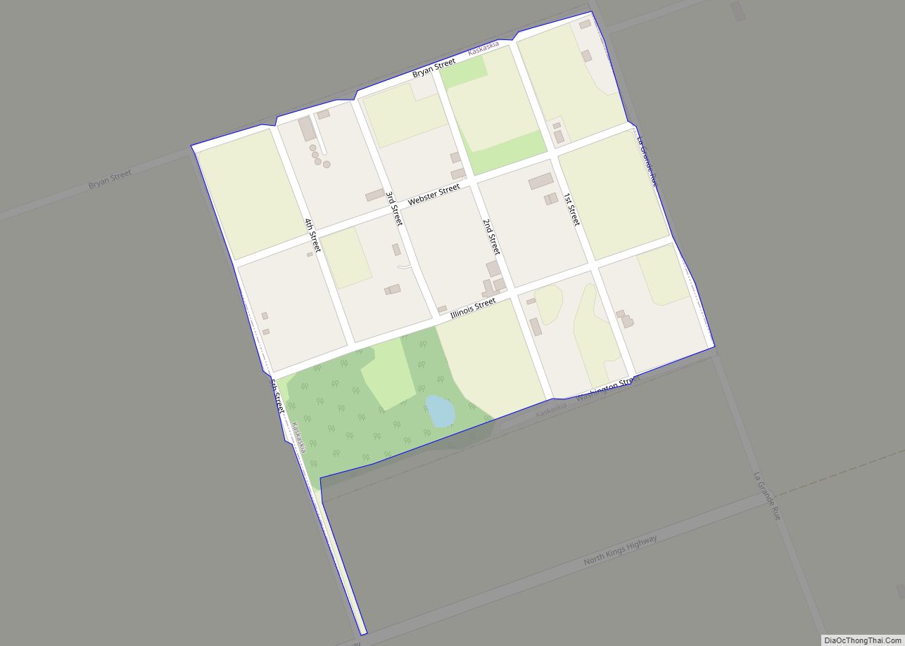
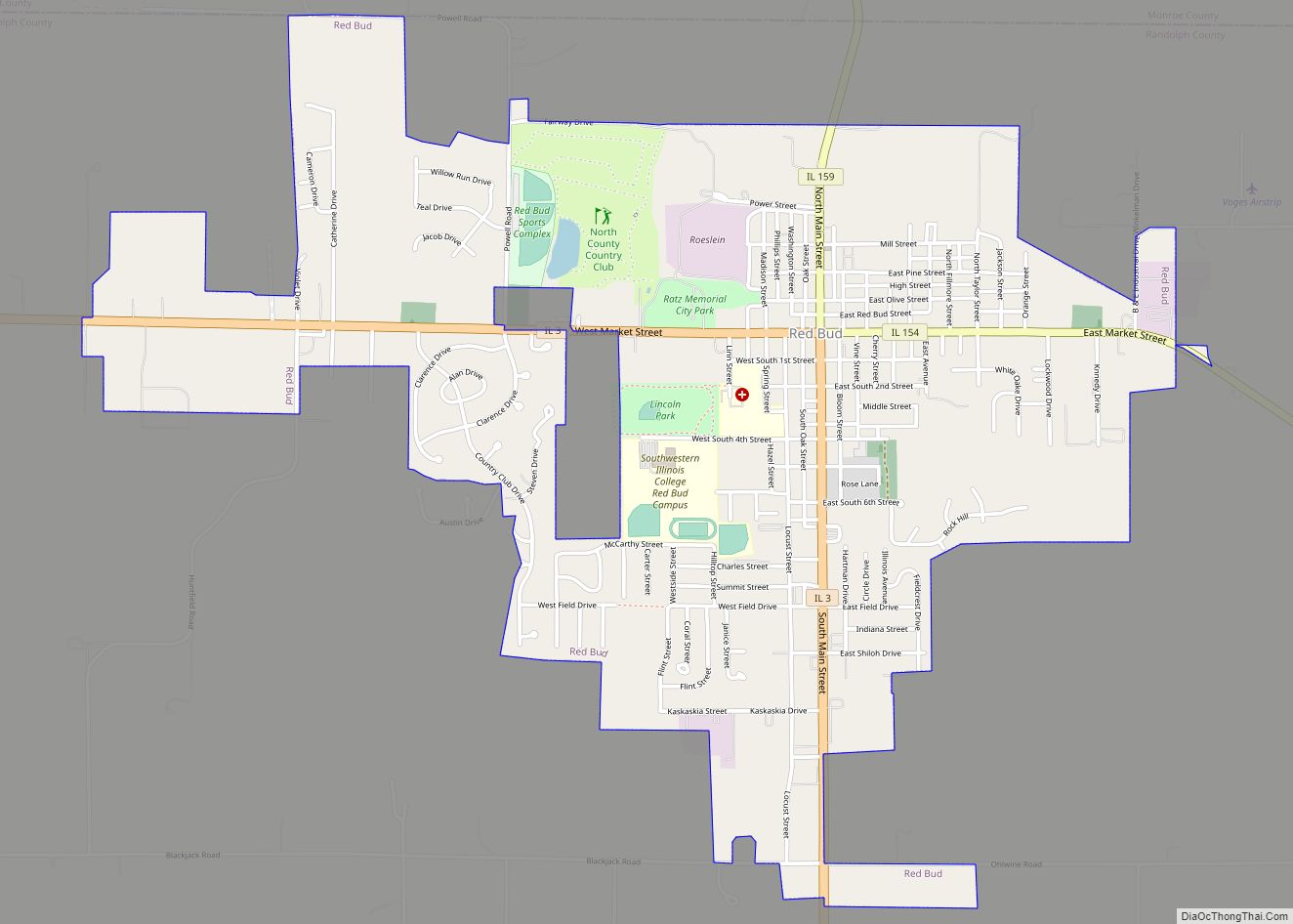
Red Bud Road Map

Red Bud city Satellite Map

Geography
Red Bud is located at 38°12′37″N 89°59′47″W / 38.210205°N 89.996494°W / 38.210205; -89.996494.
According to the 2010 census, Red Bud has a total area of 2.453 square miles (6.35 km), of which 2.43 square miles (6.29 km) (or 99.06%) is land and 0.023 square miles (0.06 km) (or 0.94%) is water.
Red Bud lies in the northwestern part of Randolph County and is bounded on the north and west by Monroe County, on the east by the Kaskaskia River, and on the south by Ruma and Horse creeks. Originally it was two-thirds rich rolling prairie, with good timber bordering the Kaskaskia.
See also
Map of Illinois State and its subdivision:- Adams
- Alexander
- Bond
- Boone
- Brown
- Bureau
- Calhoun
- Carroll
- Cass
- Champaign
- Christian
- Clark
- Clay
- Clinton
- Coles
- Cook
- Crawford
- Cumberland
- De Kalb
- De Witt
- Douglas
- Dupage
- Edgar
- Edwards
- Effingham
- Fayette
- Ford
- Franklin
- Fulton
- Gallatin
- Greene
- Grundy
- Hamilton
- Hancock
- Hardin
- Henderson
- Henry
- Iroquois
- Jackson
- Jasper
- Jefferson
- Jersey
- Jo Daviess
- Johnson
- Kane
- Kankakee
- Kendall
- Knox
- La Salle
- Lake
- Lake Michigan
- Lawrence
- Lee
- Livingston
- Logan
- Macon
- Macoupin
- Madison
- Marion
- Marshall
- Mason
- Massac
- McDonough
- McHenry
- McLean
- Menard
- Mercer
- Monroe
- Montgomery
- Morgan
- Moultrie
- Ogle
- Peoria
- Perry
- Piatt
- Pike
- Pope
- Pulaski
- Putnam
- Randolph
- Richland
- Rock Island
- Saint Clair
- Saline
- Sangamon
- Schuyler
- Scott
- Shelby
- Stark
- Stephenson
- Tazewell
- Union
- Vermilion
- Wabash
- Warren
- Washington
- Wayne
- White
- Whiteside
- Will
- Williamson
- Winnebago
- Woodford
- Alabama
- Alaska
- Arizona
- Arkansas
- California
- Colorado
- Connecticut
- Delaware
- District of Columbia
- Florida
- Georgia
- Hawaii
- Idaho
- Illinois
- Indiana
- Iowa
- Kansas
- Kentucky
- Louisiana
- Maine
- Maryland
- Massachusetts
- Michigan
- Minnesota
- Mississippi
- Missouri
- Montana
- Nebraska
- Nevada
- New Hampshire
- New Jersey
- New Mexico
- New York
- North Carolina
- North Dakota
- Ohio
- Oklahoma
- Oregon
- Pennsylvania
- Rhode Island
- South Carolina
- South Dakota
- Tennessee
- Texas
- Utah
- Vermont
- Virginia
- Washington
- West Virginia
- Wisconsin
- Wyoming