Ringwood is a northwest suburban village in McHenry County, Illinois, United States. It is a commuter village, part of the Chicago metropolitan area. The population was 844 at the 2020 census.
| Name: | Ringwood village |
|---|---|
| LSAD Code: | 47 |
| LSAD Description: | village (suffix) |
| State: | Illinois |
| County: | McHenry County |
| Founded: | 1994 |
| Elevation: | 858 ft (262 m) |
| Total Area: | 3.86 sq mi (10.01 km²) |
| Land Area: | 3.86 sq mi (10.01 km²) |
| Water Area: | 0.00 sq mi (0.00 km²) |
| Total Population: | 844 |
| Population Density: | 218.43/sq mi (84.34/km²) |
| ZIP code: | 60072 |
| Area code: | 815 |
| FIPS code: | 1764135 |
| Website: | ringwood-il.us |
Online Interactive Map
Click on ![]() to view map in "full screen" mode.
to view map in "full screen" mode.
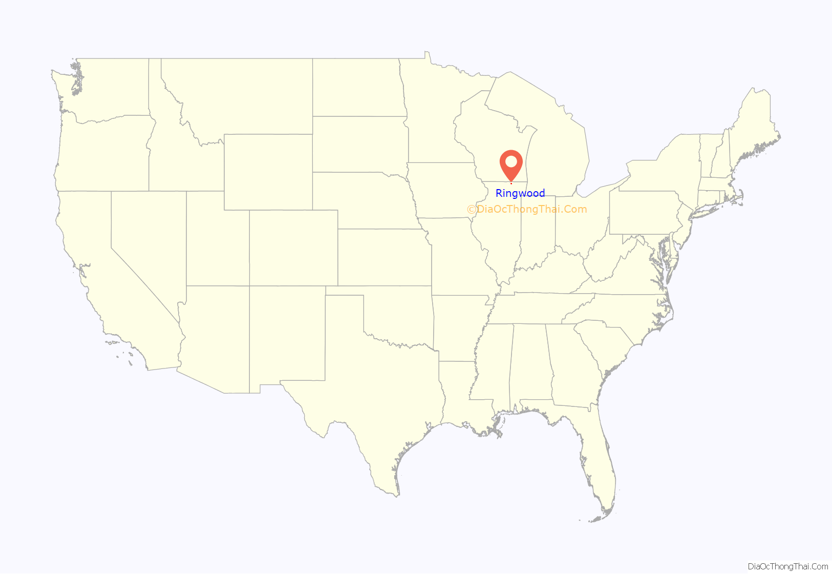
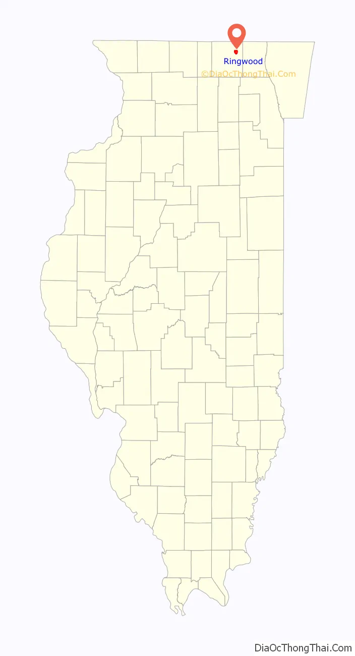
Ringwood location map. Where is Ringwood village?
History
Settlement
Ringwood was settled in 1837 by Dr. Luke Hale and Wm. H. Beach, both native to Vermont. The original settlement was supposedly surrounded by a ring of trees, hence the name “Ringwood”.
Development
The Ringwood post office was established in 1845 to provide post office boxes for local industrial firms and residents located on the far northern edge of McHenry. The small village was platted in 1854, allowing the installation of roads, infrastructure, public amenities and allowing residents to legally own plots of land for agricultural use, and the construction of homes and businesses. In an attempt to maintain its small-town environment, Ringwood was incorporated as a Village on November 15, 1994. By 2018, the Village of Ringwood had two paid staff, plus contracted services including building inspection, and an unsalaried Board of Trustees.
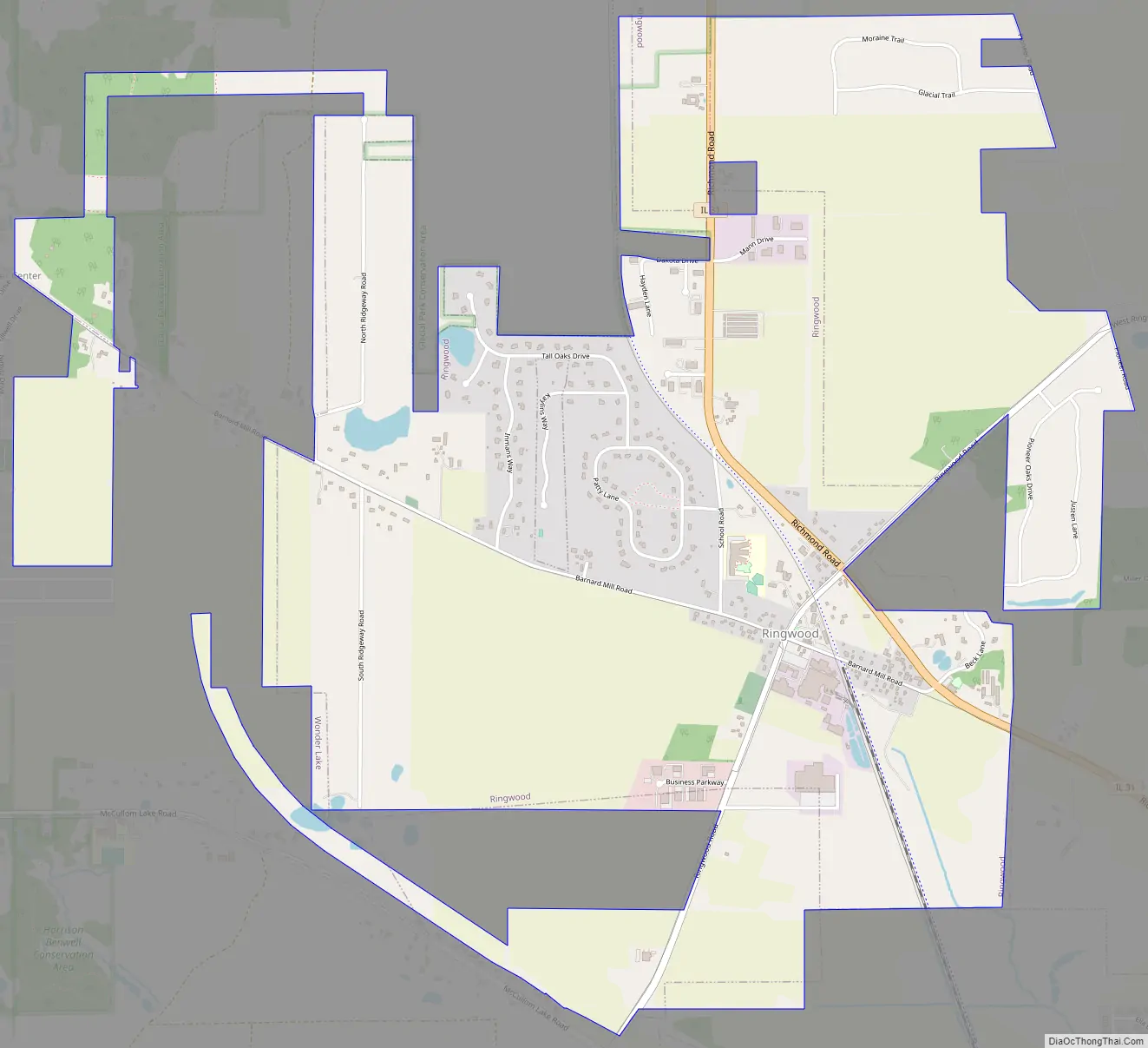
Ringwood Road Map
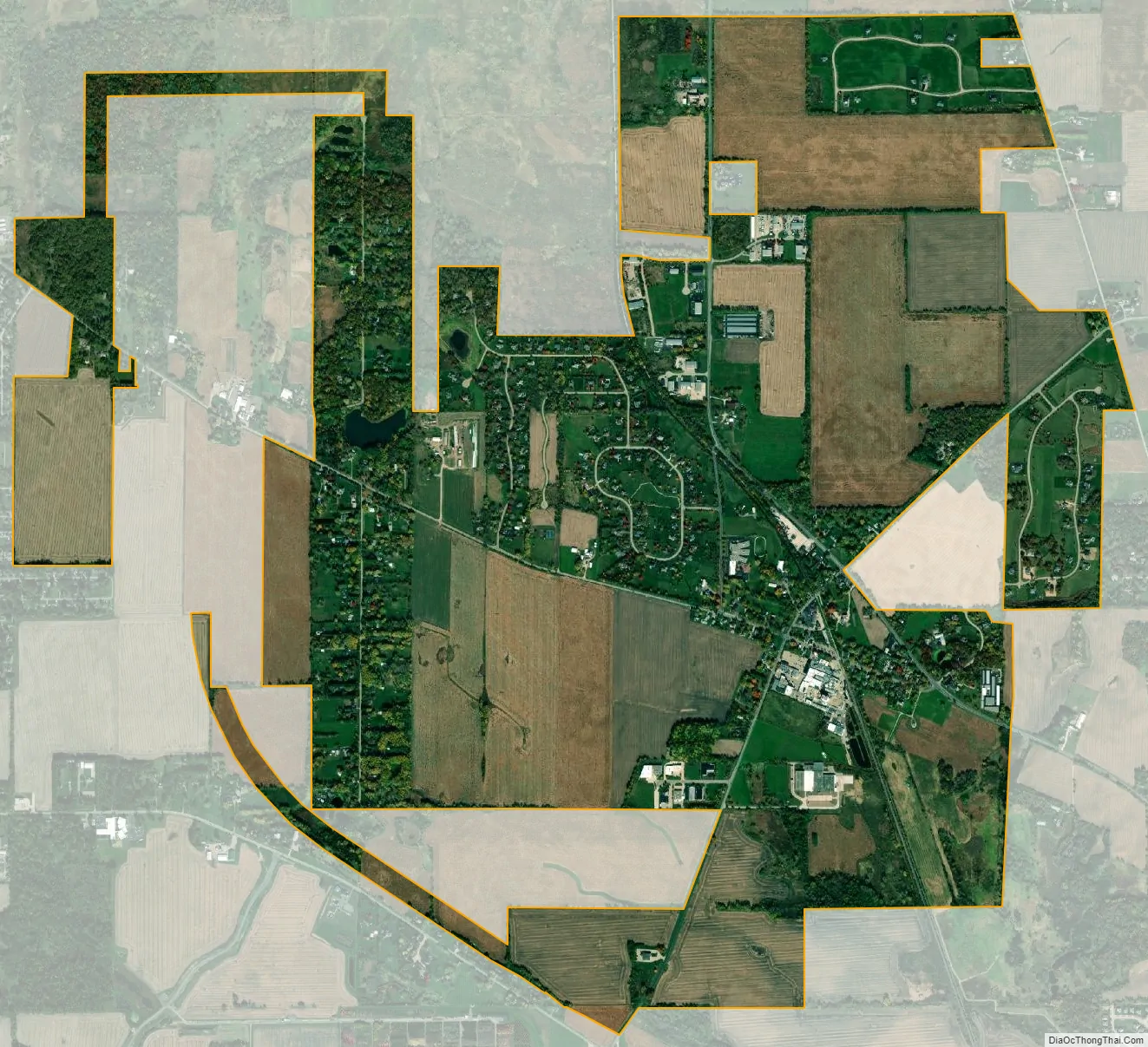
Ringwood city Satellite Map
Geography
Ringwood is located in northeastern McHenry County at 42°23′42″N 88°18′11″W / 42.39500°N 88.30306°W / 42.39500; -88.30306 (42.395084, -88.303030). It is bordered by the larger village of Johnsburg to the southeast. The village of Wonder Lake is to the southwest.
According to the U.S. Census Bureau, Ringwood has a total area of 3.86 square miles (10.00 km), all land.
Major streets
- Richmond Road passes just northeast of the center of Ringwood, leading north 6 miles (10 km) to Richmond and southeast 4 miles (6 km) to McHenry.
- Barnard Mill Road runs northwest-southeast through the center of Ringwood.
- Ringwood Road, running southwest-northeast, crosses Barnard Mill Road in the village center.
Public and rail transportation
As of October 2018, the closest public transportation to Ringwood is a Pace bus route that runs through Johnsburg, between the nearby municipalities of Crystal Lake, McHenry, and Fox Lake. The closest rail transit is the McHenry commuter rail station, one of the termini of Metra’s Union Pacific/Northwest Line. Until 1980, the commuter rail service also served a Ringwood station and continued north to the Village of Richmond, Illinois. A remaining freight track exists between Ringwood’s Dow Chemical plant at Barnard Mill Road and McHenry station.
See also
Map of Illinois State and its subdivision:- Adams
- Alexander
- Bond
- Boone
- Brown
- Bureau
- Calhoun
- Carroll
- Cass
- Champaign
- Christian
- Clark
- Clay
- Clinton
- Coles
- Cook
- Crawford
- Cumberland
- De Kalb
- De Witt
- Douglas
- Dupage
- Edgar
- Edwards
- Effingham
- Fayette
- Ford
- Franklin
- Fulton
- Gallatin
- Greene
- Grundy
- Hamilton
- Hancock
- Hardin
- Henderson
- Henry
- Iroquois
- Jackson
- Jasper
- Jefferson
- Jersey
- Jo Daviess
- Johnson
- Kane
- Kankakee
- Kendall
- Knox
- La Salle
- Lake
- Lake Michigan
- Lawrence
- Lee
- Livingston
- Logan
- Macon
- Macoupin
- Madison
- Marion
- Marshall
- Mason
- Massac
- McDonough
- McHenry
- McLean
- Menard
- Mercer
- Monroe
- Montgomery
- Morgan
- Moultrie
- Ogle
- Peoria
- Perry
- Piatt
- Pike
- Pope
- Pulaski
- Putnam
- Randolph
- Richland
- Rock Island
- Saint Clair
- Saline
- Sangamon
- Schuyler
- Scott
- Shelby
- Stark
- Stephenson
- Tazewell
- Union
- Vermilion
- Wabash
- Warren
- Washington
- Wayne
- White
- Whiteside
- Will
- Williamson
- Winnebago
- Woodford
- Alabama
- Alaska
- Arizona
- Arkansas
- California
- Colorado
- Connecticut
- Delaware
- District of Columbia
- Florida
- Georgia
- Hawaii
- Idaho
- Illinois
- Indiana
- Iowa
- Kansas
- Kentucky
- Louisiana
- Maine
- Maryland
- Massachusetts
- Michigan
- Minnesota
- Mississippi
- Missouri
- Montana
- Nebraska
- Nevada
- New Hampshire
- New Jersey
- New Mexico
- New York
- North Carolina
- North Dakota
- Ohio
- Oklahoma
- Oregon
- Pennsylvania
- Rhode Island
- South Carolina
- South Dakota
- Tennessee
- Texas
- Utah
- Vermont
- Virginia
- Washington
- West Virginia
- Wisconsin
- Wyoming