River Grove is a village in Cook County, Illinois, United States. The population was 10,612 at the 2020 census.
| Name: | River Grove village |
|---|---|
| LSAD Code: | 47 |
| LSAD Description: | village (suffix) |
| State: | Illinois |
| County: | Cook County |
| Total Area: | 2.39 sq mi (6.19 km²) |
| Land Area: | 2.39 sq mi (6.19 km²) |
| Water Area: | 0.00 sq mi (0.00 km²) |
| Total Population: | 10,612 |
| Population Density: | 4,438.31/sq mi (1,713.61/km²) |
| Area code: | 708 |
| FIPS code: | 1764343 |
| Website: | rivergroveil.gov |
Online Interactive Map
Click on ![]() to view map in "full screen" mode.
to view map in "full screen" mode.
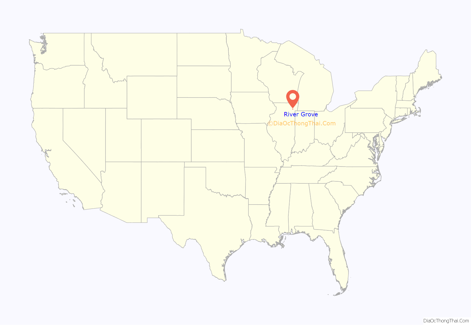
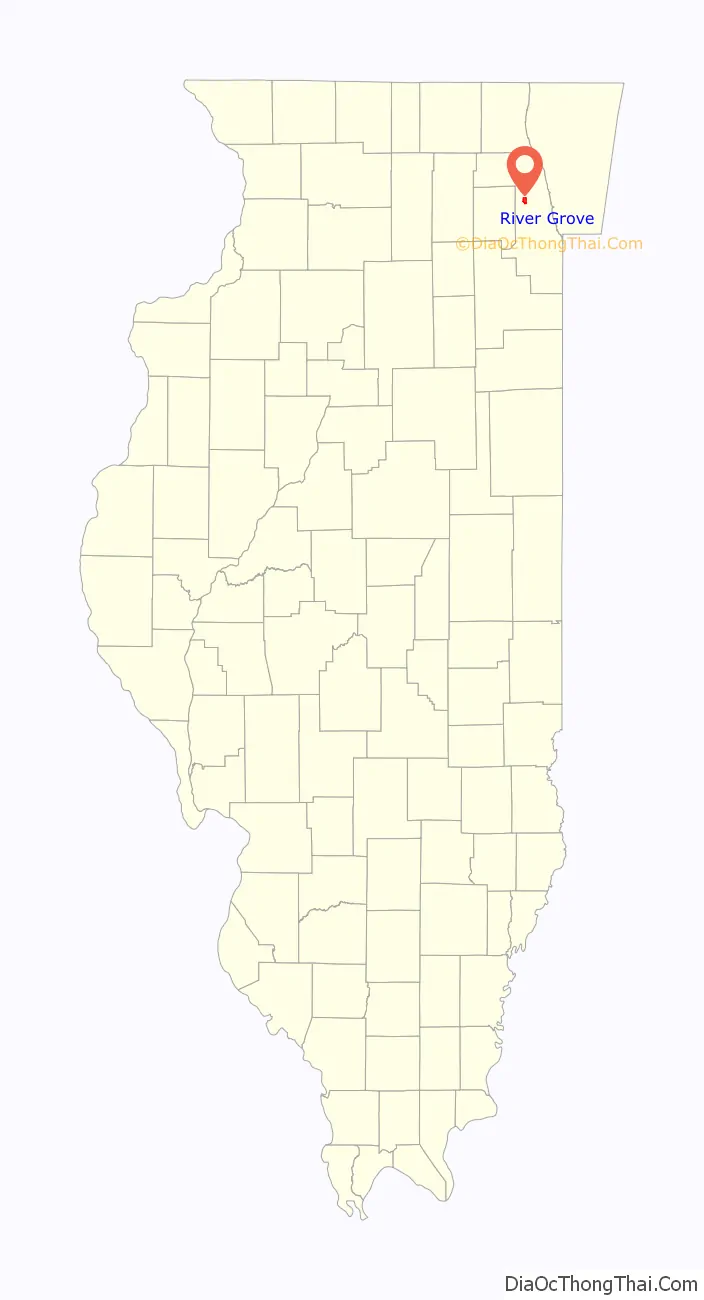
River Grove location map. Where is River Grove village?
History
Just as nearby Elmwood Park and Oak Park are named after their historic elm and oak trees, River Grove gets its two-part name first from the community’s shallow, muddy Des Plaines River, and second from the majestic groves of American ash trees lining shore of the river’s “bottomland.” Credit goes to the village’s early German and Nordic settlers who, already holding a great reverence for the “mystic ash” through old world traditions, felt that they were home again among the familiar groves of ash trees, “just like the ones they left behind.” Up until the modern day extinction event of the American ash tree species 2006–2018, River Grove was the home to Cook County’s second-oldest green ash with an estimated age of 240 in the “old growth” Lafrombose Woods, along with several other living examples of locally evolved white, green, black and blue ash types 110–160 years of age scattered around the village. Because the invasive Asian emerald ash borer kills off young trees long before they reach seeding age of 10, scientists theorize that the “Fraxinus/ash” species will no longer be able to germinate continued generations by 2018 within the local woods, or only 12 years after EAB was first discovered in River Grove.
James Kirie (1911-2000), businessman and Illinois state representative, was born in River Grove.
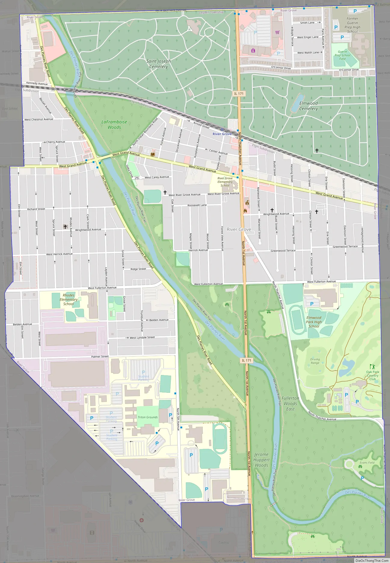
River Grove Road Map
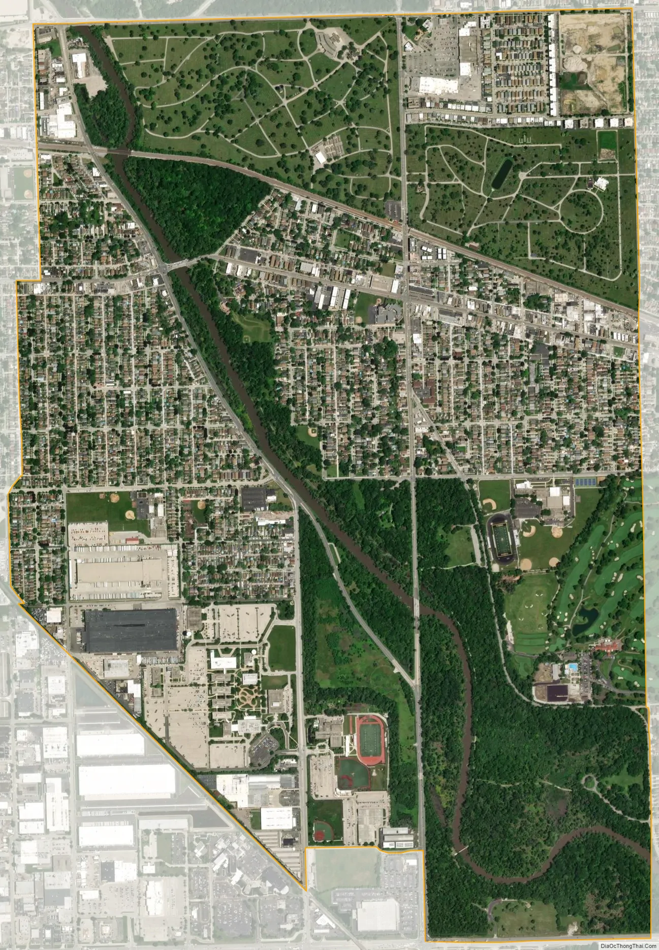
River Grove city Satellite Map
Geography
River Grove is located at 41°55′33″N 87°50′24″W / 41.92583°N 87.84000°W / 41.92583; -87.84000 (41.925830, -87.840135). According to the 2010 census, River Grove has a total area of 2.39 square miles (6.19 km), all land.
See also
Map of Illinois State and its subdivision:- Adams
- Alexander
- Bond
- Boone
- Brown
- Bureau
- Calhoun
- Carroll
- Cass
- Champaign
- Christian
- Clark
- Clay
- Clinton
- Coles
- Cook
- Crawford
- Cumberland
- De Kalb
- De Witt
- Douglas
- Dupage
- Edgar
- Edwards
- Effingham
- Fayette
- Ford
- Franklin
- Fulton
- Gallatin
- Greene
- Grundy
- Hamilton
- Hancock
- Hardin
- Henderson
- Henry
- Iroquois
- Jackson
- Jasper
- Jefferson
- Jersey
- Jo Daviess
- Johnson
- Kane
- Kankakee
- Kendall
- Knox
- La Salle
- Lake
- Lake Michigan
- Lawrence
- Lee
- Livingston
- Logan
- Macon
- Macoupin
- Madison
- Marion
- Marshall
- Mason
- Massac
- McDonough
- McHenry
- McLean
- Menard
- Mercer
- Monroe
- Montgomery
- Morgan
- Moultrie
- Ogle
- Peoria
- Perry
- Piatt
- Pike
- Pope
- Pulaski
- Putnam
- Randolph
- Richland
- Rock Island
- Saint Clair
- Saline
- Sangamon
- Schuyler
- Scott
- Shelby
- Stark
- Stephenson
- Tazewell
- Union
- Vermilion
- Wabash
- Warren
- Washington
- Wayne
- White
- Whiteside
- Will
- Williamson
- Winnebago
- Woodford
- Alabama
- Alaska
- Arizona
- Arkansas
- California
- Colorado
- Connecticut
- Delaware
- District of Columbia
- Florida
- Georgia
- Hawaii
- Idaho
- Illinois
- Indiana
- Iowa
- Kansas
- Kentucky
- Louisiana
- Maine
- Maryland
- Massachusetts
- Michigan
- Minnesota
- Mississippi
- Missouri
- Montana
- Nebraska
- Nevada
- New Hampshire
- New Jersey
- New Mexico
- New York
- North Carolina
- North Dakota
- Ohio
- Oklahoma
- Oregon
- Pennsylvania
- Rhode Island
- South Carolina
- South Dakota
- Tennessee
- Texas
- Utah
- Vermont
- Virginia
- Washington
- West Virginia
- Wisconsin
- Wyoming


